
In Brief:
Warm dry weather returns with small chances of afternoon storms.
Sunday update:
We received cool stable air down I-25 to around Denver. That prevented severe weather around north Denver to the Wyoming border. We did received about 1/4th inch of rain overnight (Figure 2 update). Boulder received a bit more rain. Figure 3 update is the severe weather reports for the nation yesterday. The red dots are tornado reports, there are 10 tornado reports in as of Sunday 10am. There were 6 reports of large hail and 2 reports of damaging winds. It was an active day, but not near Longmont.
It will be warm and dry today behind the dry line, but northeast Colorado has an even better chance of severe weather today. Keep an eye on the eastern horizon for those big storms later today.
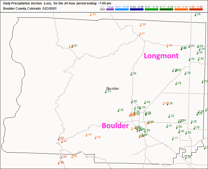 Figure 2 update: CoCoRaHS rainfall reports as of 7am Sunday.
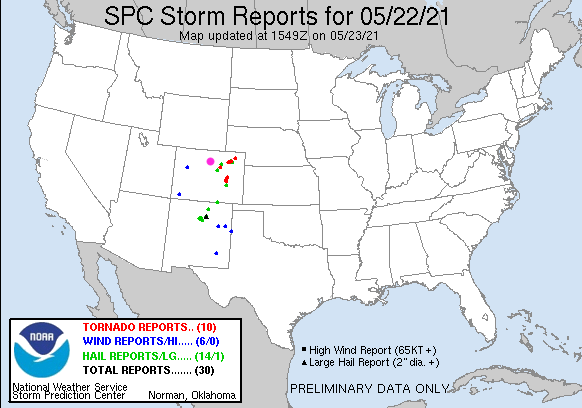 Figure 3 update: the SPC storm reports for Saturday and Saturday night.
End Sunday update.
Saturday AM Update:
All the elements are coming into place for a number of rounds of thunderstorms starting in the early afternoon and continuing into the early evening. The SPC now has predicted a 2% chance of a tornado within 25 miles of a given spot all along I-25 and eastward. There is a 5% chance of a tornado within 25 miles of a spot further out on the eastern Colorado plains (similar to the yellow region/Slight Risk in Figure 1 update). Large hail and high winds are possible everywhere east of the Divide in the mountains and on the plains. Keep your weather apps up and refreshing!
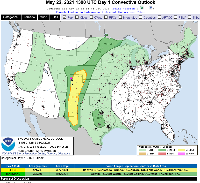 Figure 1 update: the SPC forecast for the chance of severe weather and convection for Day 1 / Saturday.
End Saturday AM update.
Forecast Discussion:
The biggest news is our chance of severe weather and some locally healthy rainfall amounts Saturday afternoon (Figure 1 - see thunderstorm weather map symbol). Most areas will receive little rain to maybe a 1/10th of an inch except where thunderstorm cores pass.
The big cutoff low out west is finally starting to move to the northeast over the stout eastern U.S. ridge (Figure 2). The flow around this low to the west and the high to the east is pulling in a good amount of tropical moisture (green arrows in Figure 2 and in the atmospheric moisture anomaly map Figure 3).
The cool air and lift aloft with the low, plus daytime heating and that moisture will result in pretty good thunderstorm coverage Saturday afternoon and severe weather. There is an elevated chance of hail and damaging winds in the dark green (Marginal risk) zone (Figure 4) and a few tornadoes in the yellow (Slight Risk) zone.
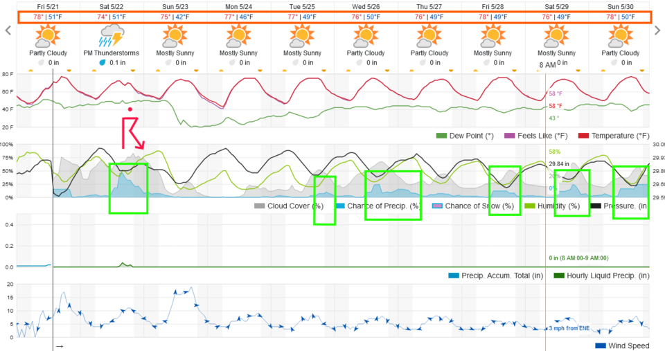 Figure 1: the 10 day graphical forecast for Longmont from weatherunderground.com
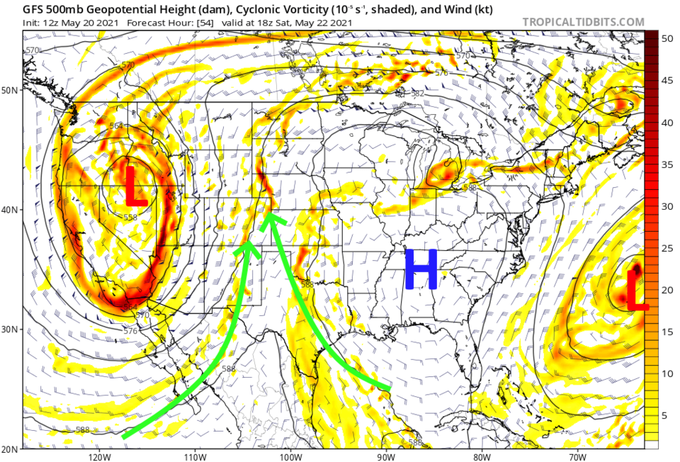 Figure 2: the 500mb upper air map for Saturday from the GFS and tropicaltidbits.com.
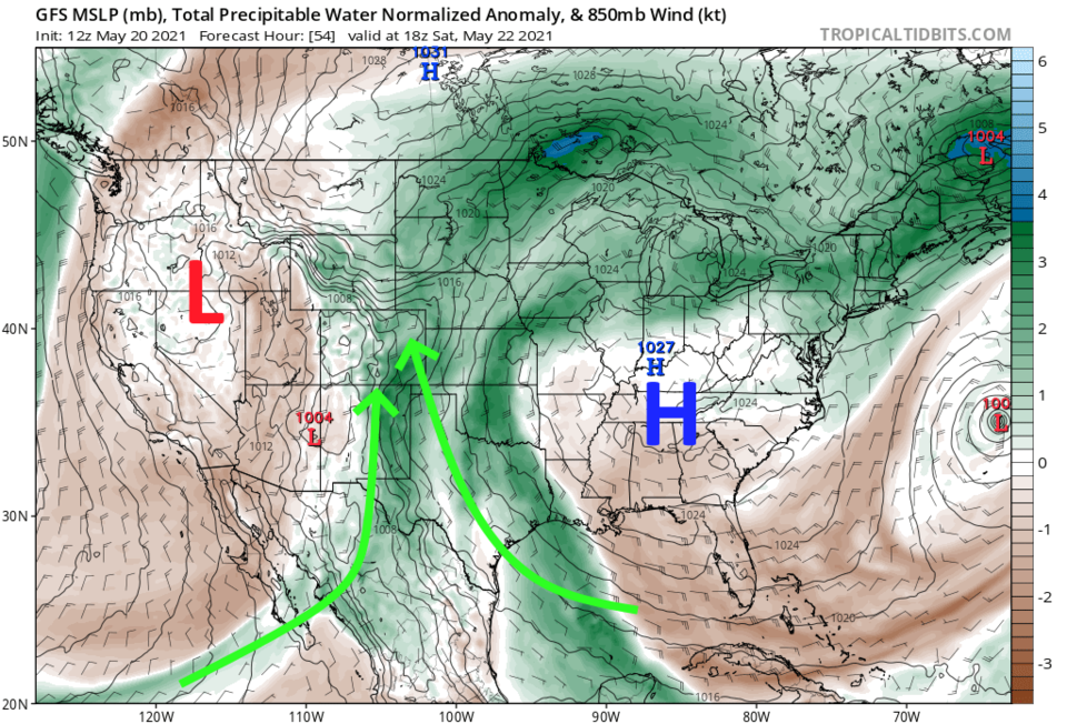 Figure 3: the precipitatable water departure from normal map for noon Saturday from tropicaltidbits.com
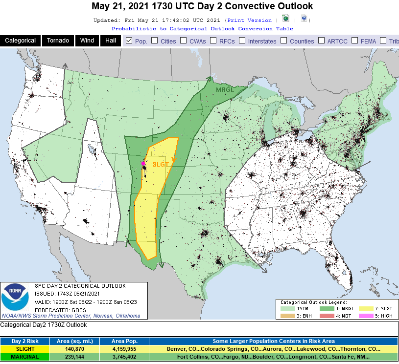 Figure 4: the SPC Day 2 severe weather forecast map for Saturday.
The Longer-Range Forecast:
The risk of severe weather shifts out onto the Colorado plains on Sunday as things dry out along I-25. The rest of the week becomes the pattern of warm days with a chance of afternoon thunderstorms (Figure 1 green boxes). Over the next 10 days, the GFS does say we get around 1/2 to 3/4th inch of water. That would be nice.
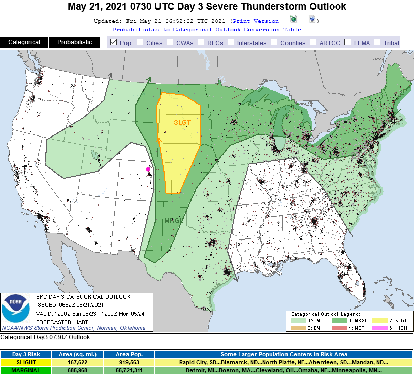 Figure 5: the SPC Day 3 severe weather forecast map for Sunday.
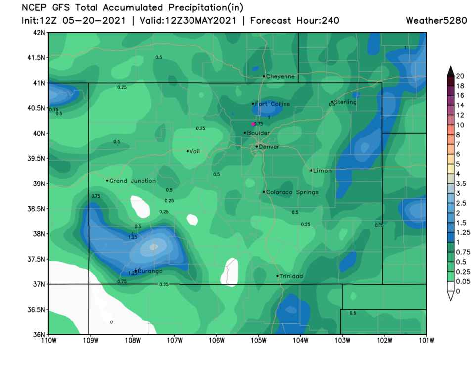 Figure 6: the 10 day precipitation total map from the GFS and weather5280.com


