In Brief:
As we climb slowly out of the deep freeze, there are midweek and weekend snow chances.
Update Wednesday PM:
The snow has started and will continue through the pre-dawn hours Thursday (Figure 2 update). That model gives us about 2 inches of snow. The GFS has a bulls-eye over Larimer and Boulder county with 3-4 inches (Figure 3 update). The HRRR (Figure 4 update) keeps the better snow up in the foothills giving Longmont 1/2 -1 inch. I'm happy with an accumulation of 1-2 inches. Stay warm!
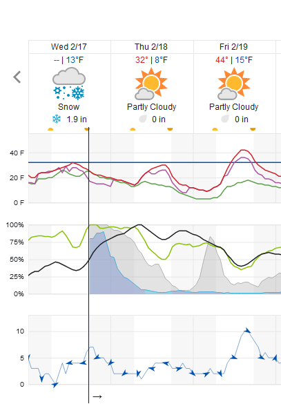 Figure 2 update: snippet of the 10 day graphical forecast for Longmont from weatherunderground.com
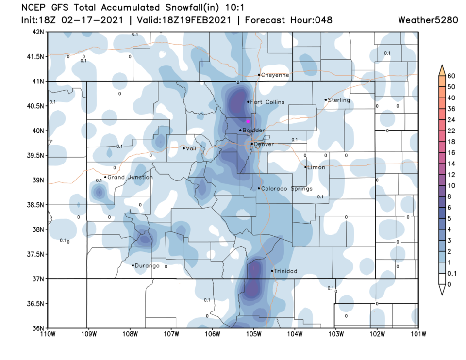 Figure 3 update: the 48 hour 10:1 snowfall forecast from the GFS and weather5280.com
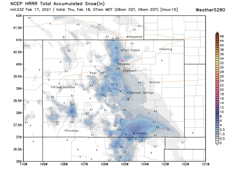 Figure 4 update: the 15 hour HRRR snowfall forecast through 7am from weather5280.com
End Wednesday PM update.
Update Tuesday PM:
The next up slope storm system should produce snow from around 3pm to 1am Wednesday into Thursday AM. About 1-3 inches is likely (Figure 1 update below). Another 1/2 to 1 inch of snow is expected Saturday into Sunday.
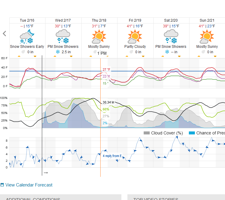 Figure1 update: snippet of the 10 day graphical forecast from weatheunderground.com
End Tuesday PM update.
Forecast Discussion:
The "polar vortex" is exiting 'stage right' north of New England but significant cold air is still plunging southward and eastward across the nation (Figure 1 below). The cold air has modified enough in the U.S. that it is not showing up as pink based on its extreme cold (as it still is up in Canada - Figure 2) in the water vapor satellite image. We are on the extreme western edge of this shallow departing cold air. By Wednesday, we will be close to normal temperatures again while the Great Plains keep shivering (Figure 3).
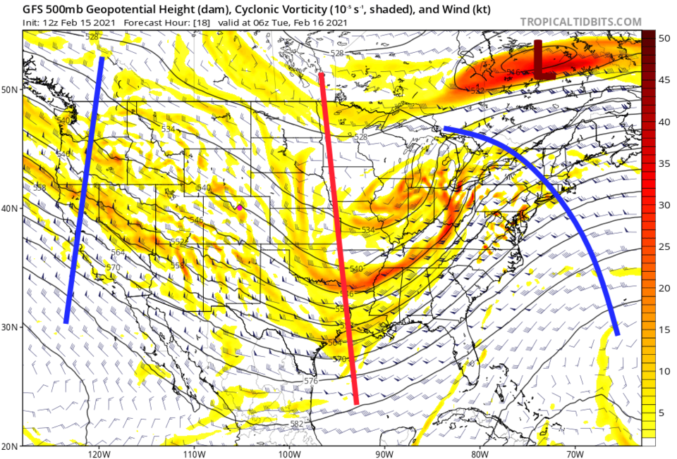 Figure 1: the 500mb upper air forecast map for Tuesday AM from the GFS and tropicaltidbits.com
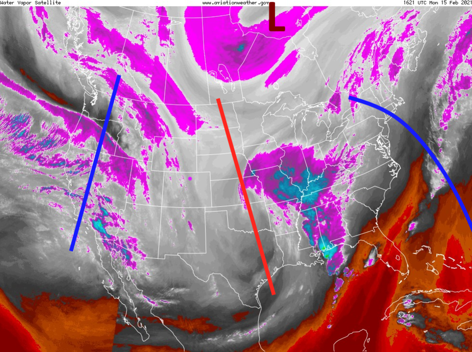 Figure 2: the water vapor satellite image from NOAA from Monday PM. White/purple is moist air, red/brown is very dry air.
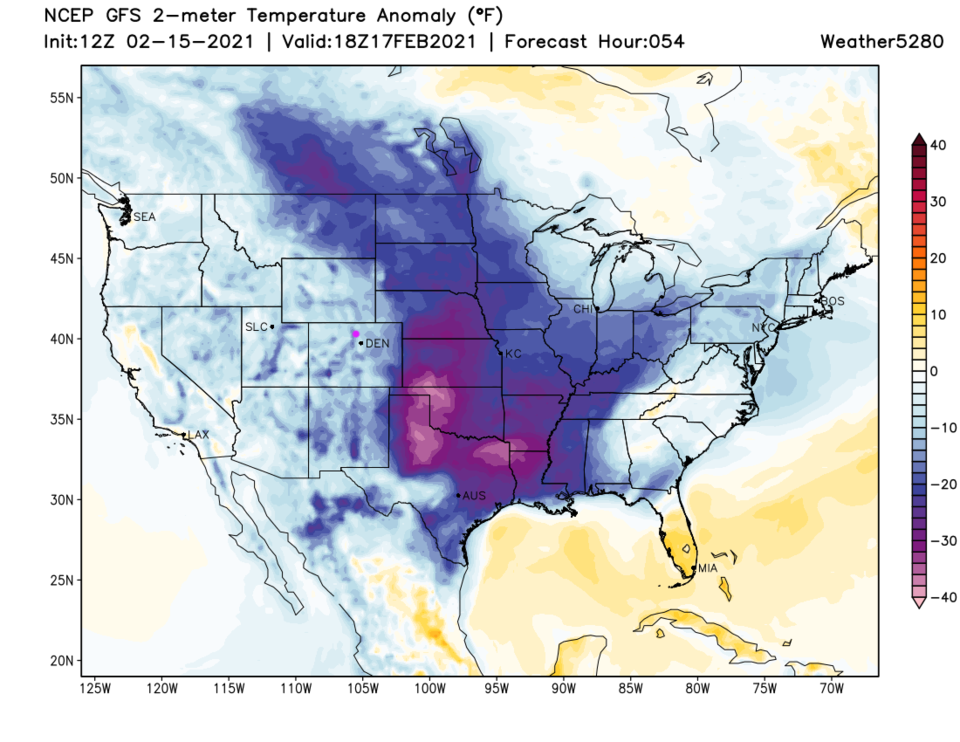 Figure 3: the temperature anomaly (departure from normal) for Wednesday noon from tropicaltidbits.com
By Tuesday, the next storm system is spending most of its energy east of the Continental Divide (Figure 4) but some snow showers may drift east of the Rockies at times. It is not until Wednesday that we see up slope flow and a larger regional snow again.
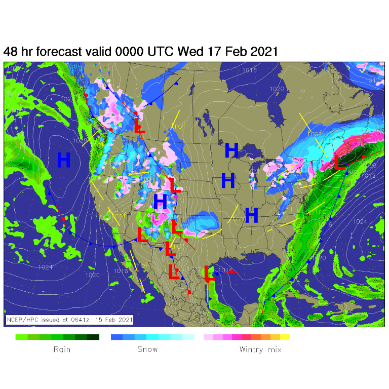 Figure 4: the forecast surface analysis for Tuesday PM from NCEP.
The Longer Range Forecast:
Once the next upper air trough and surface low begins to pass, we'll have about 12 hours of healthy snow fall again (Figure 5) from around 3 p.m. Wednesday to 3 a.m. Thursday. The weatherunderground model give us 3-4 inches of snow. The GFS, over the next four days, gives Longmont about 2-3 inches of snow (Figure 6).
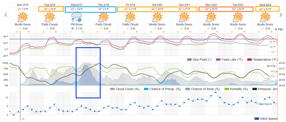 Figure 5: the 10 day graphical forecast from weatherunderground.com for Longmont, CO.
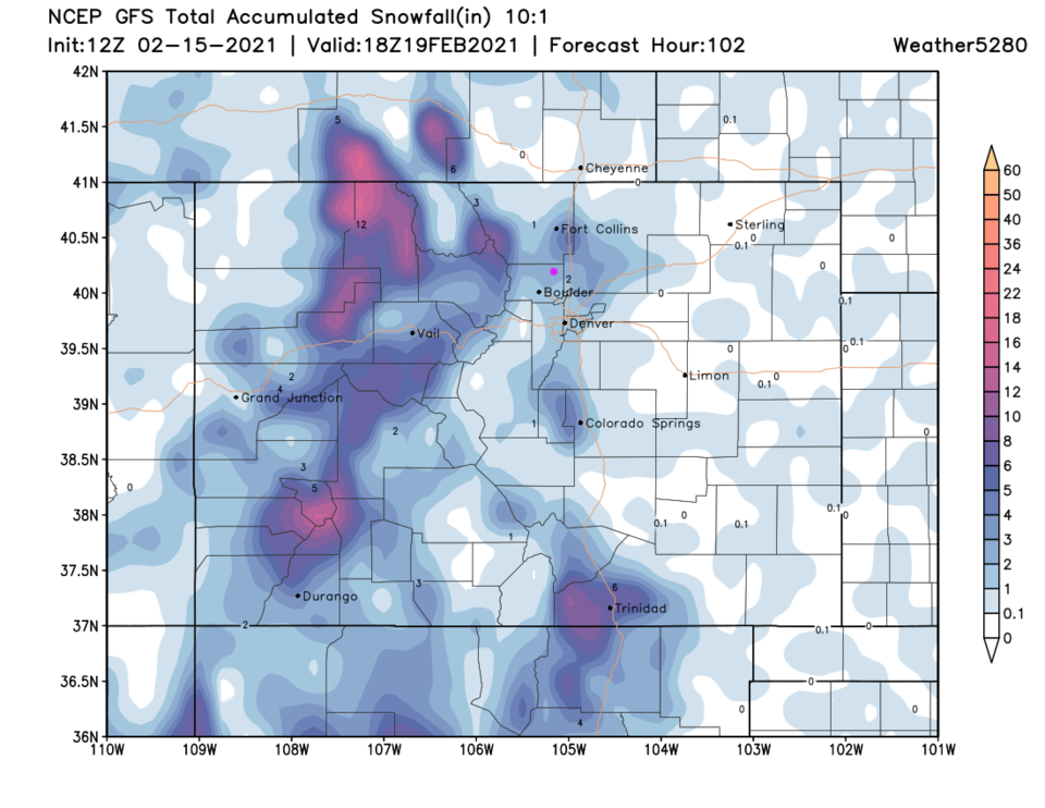 Figure 6: the 4 day (10:1 ratio) total snowfall forecast from the GFS and weather5280.com
A minor system is expected to effect the state Saturday/Sunday. Most of it snowfall will be in the mountains again, but a half inch is not impossible down along u.S. 25 (Figure 7). Next week, the entire nation starts the week at near normal or above normal temperatures (Figure 8). Normal temperatures are also beginning to rise a couple of degrees a week. Spring is on its way.
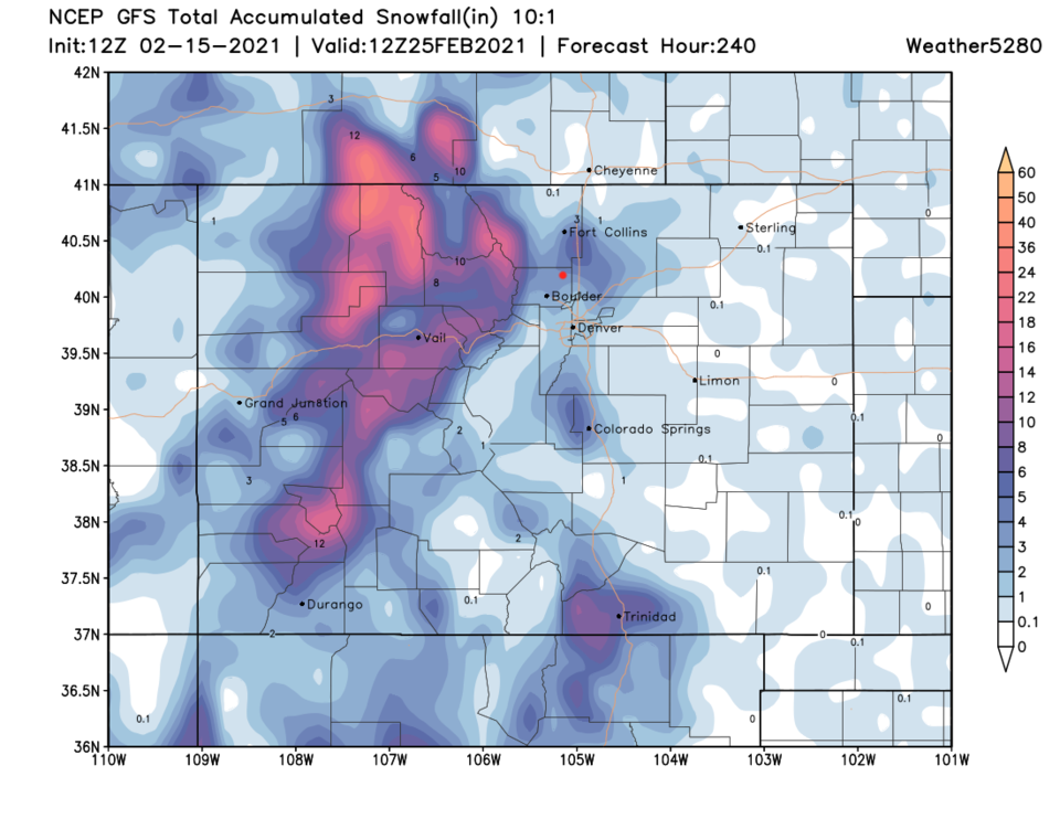 Figure 7: the 10 day (10:1 ratio) total snowfall forecast from the GFS and weather5280.com
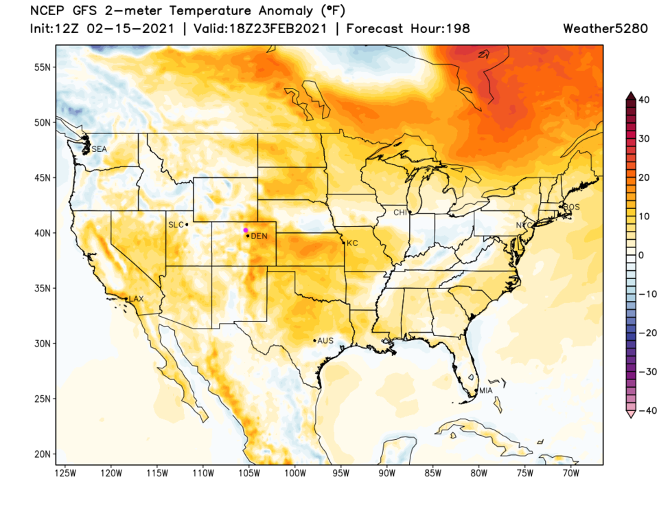 Figure 8: the temperature anomaly (departure from normal) for next Tuesday from tropicaltidbits.com


