
The Video Forecast for this Week
In Brief:
A stretch of smoky, hot, rainless summer returns this week.
Wednesday Update:
Smoke hangs on for a while longer - small rain chances return Friday, then Sunday and beyond. Summer is hanging on in August! (Figure 3 update).
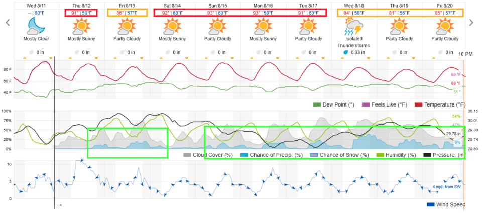 Figure 3 update: the 10 day graphical forecast for Longmont from weatherunderground.com
End Wednesday update.
Monday Update:
There isn't much to add, but the heat will climb to near 100F and smoke will come and go in extreme thickness. We'll keep watching for a return of some rain Friday. Not much to see here folks.
End Sunday update.
Saturday Update:
The ridge will help high temperatures to climb slowly each day approaching 100F Monday and Wednesday. The upper air flow will allow smoke to thin a bit for Sunday (Figure 1 update) - but not that much. Figure 2 shows a return of very thick smoke on Monday. It will be hard to see the Perseid meteor shower this week (even though the moon is cooperating by being in a New phase).
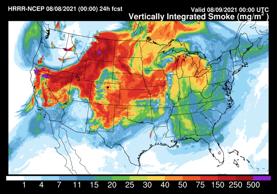 Figure 1: the HRRR smoke at all levels forecast for Sunday PM.
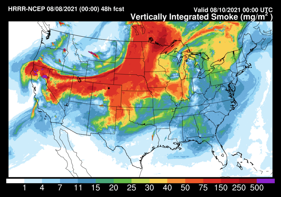 Figure 2: the HRRR smoke at all levels forecast for Monday PM.
End Saturday Update.
Forecast Discussion:
The cool beautiful weather is slipping into the rear view window. The ridge is back (Figure 4) shunting the moisture to the east and blocking it from coming in from the southwest. We will have high temperature at near normal (orange boxes) to about 5 degrees above normal (red boxes) for the next 10 days (Figure 1). We'll see a break in the smoke on Friday (Figure 2) but it roars back as bad as ever on the weekend (Figure 3). You might smell it on Saturday.
In Figure 4, you can see a small short wave (red line) passing to our north in the upper airflow. This is responsible for the small, but slightly better, chance of storms Friday in Figure 1. It isn't much, but someone will see a shower or hear a clap of thunder.
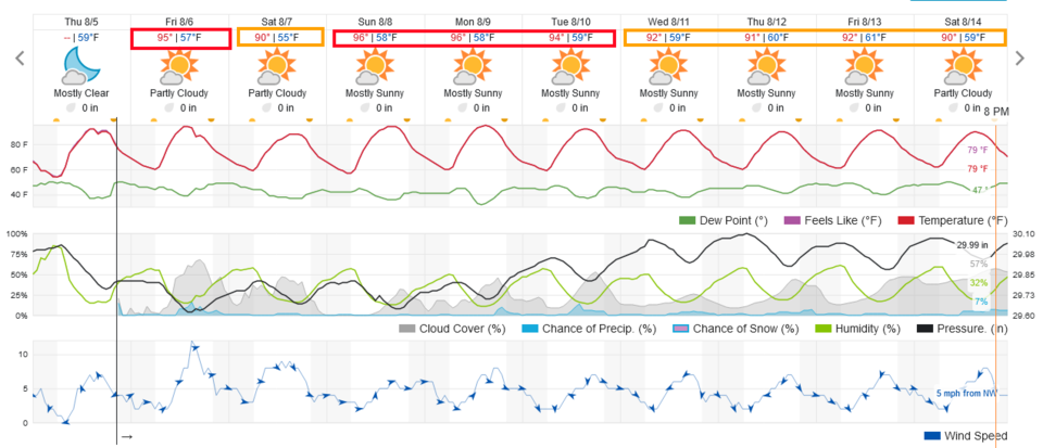 Figure 1: the 10 day graphical forecast from weatherunderground.com for Longmont, CO.
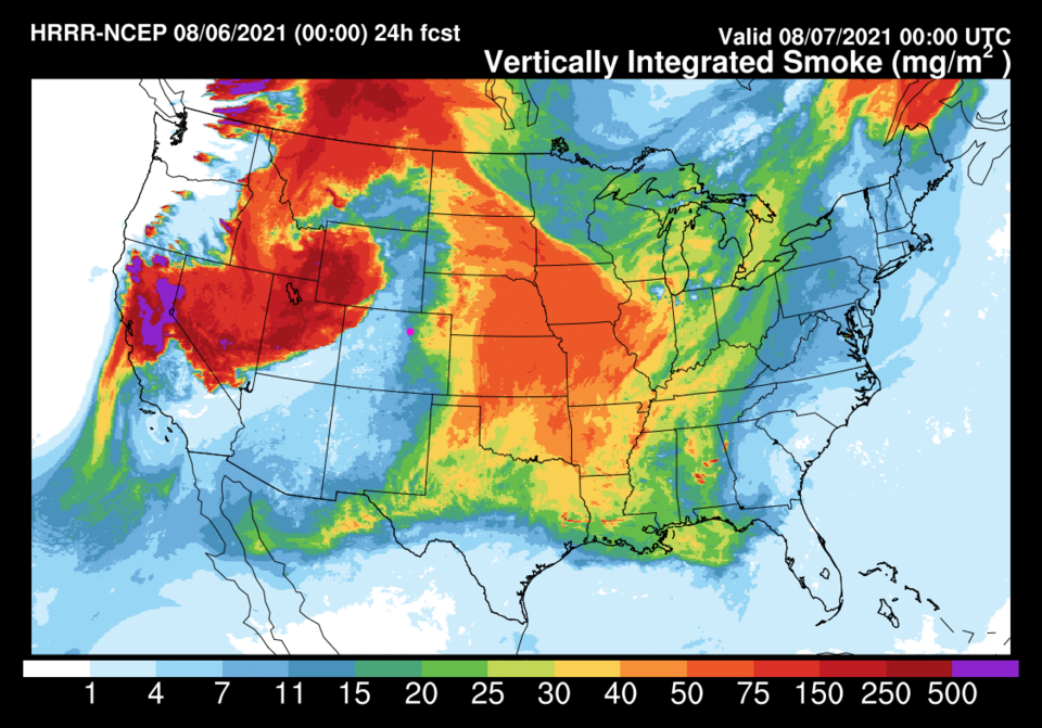 Figure 2: the HRRR Smoke at all levels Friday PM from weather5280.com
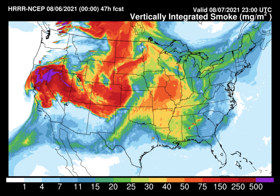 Figure 3: the HRRR Smoke at all levels Saturday afternoon from weather5280.com
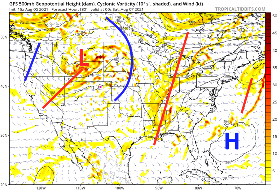 Figure 4: the 500mb upper air forecast map for Friday PM from the GFS and tropicaltidbits.com
The Longer-Range Forecast:
After that trough passes, the ridge slowly takes over the West again (Figure 5) We have the heat from the ridge but northerly airflow that will keep us from extreme temperatures. Rainfall over the next 10 days is pretty light and spotty around here (Figure 6). We had to get a bit of summer in summer, I guess.
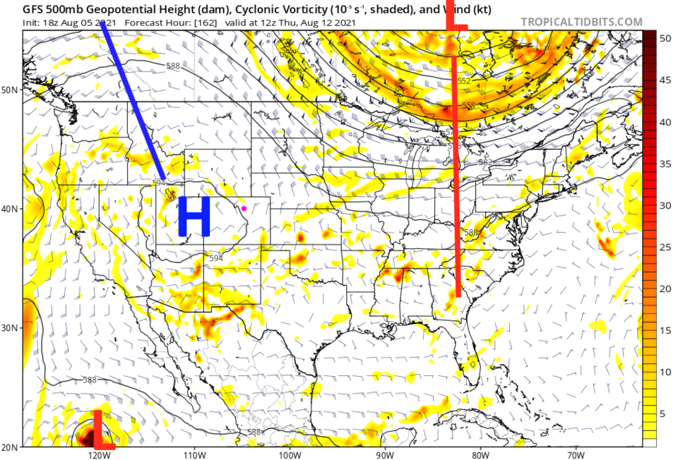 Figure 5: the 500mb upper air forecast map for Thursday AM from the GFS and tropicaltidbits.com
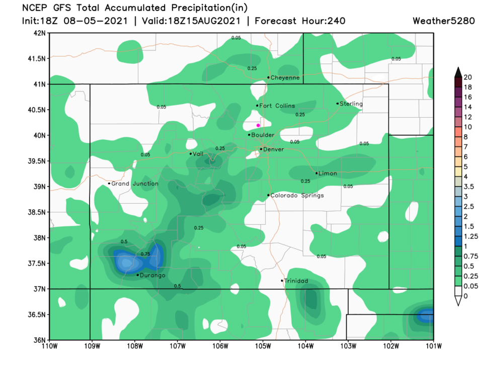 Figure 6: the 10 day precipitation total from the GFS and weather5280.com


