In Brief:
Except for a Monday afternoon cold front, and a cool damp Tuesday, spring and dry weather is here for the week.
Monday AM Update:
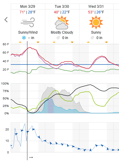
It seems like the TV stations are excited about an inch to a few inches of snow from the Monday PM to Tuesday AM storm (maybe southwest of central Denver and up in the foothills). I think we should only see 0.05 to 0.10 inch of liquid and maybe a coating to 1/2 inch of snow buildup on grassy surfaces along I-25 north of the big city. This is a quick moving small system (Figure 1 update). That update figure shows precipitation starting between 10pm and 11pm tonight tapering off mid morning, for the most part.
It WILL be quite chilly tomorrow and very windy before the front hits. We bounce back to mid-upper 50's on Wednesday and head for upper 70's for the weekend. Blink, and you'll miss this storm!
 Figure 1 update: snippet of the 10 day graphical forecast for Longmont from weatherunderground.com
End Monday AM update.
Sunday PM Update:
There are high wind warnings in the mountains and foothills to our west and out on the Plains to the east (as described below). For now, the atmospheric profile should shelter the communities along I-25 from the highest winds (but expect it to be gusty Monday). Just to be safe, tie down loose patio furniture!
End Sunday PM Update.
Forecast Discussion:
The Friday rain showers came and went pretty quickly. It was nice to see rain for a change. In Longmont, we received only a few hundredths of an inch of rain. Areas nearby got up to a quarter of an inch (Figure 1).
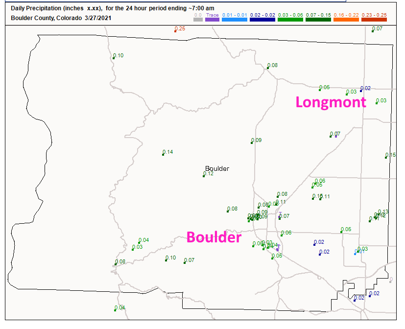 Figure 1: the CoCoRaHS snowfall reports as of Saturday AM.
 High pressure is in place at the surface (Figure 2) and high temperatures will get very close to 70 degrees (Figure 3) through the start of the week.
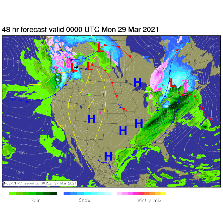 Figure 2: the forecast surface analysis for Sunday evening from NCEP.
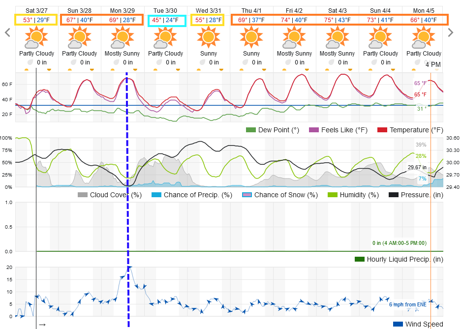 Figure 3: the 10 day graphical forecast from weatherunderground.com for Longmont, CO.
The Longer Range Forecast:
A fairly strong, but dry, cold front arrives Monday afternoon. This will drop temperatures about 15 degrees and bring in some stiff winds for a while (Figure 3). Not much precipitation is expected. Over the next 10 days, the GFS does not give us any snow or rain and shows little falling anywhere in the state (Figure 4 and Figure 5). Enjoy the spring!
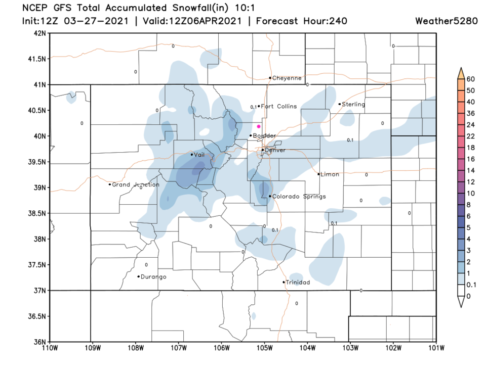 Figure 4: the 10 day snowfall total from the GFS and weather5280.com
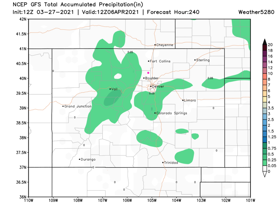 Figure 5: the 10 day precipitation total from the GFS and weather5280.com


