Longmont Public Media Weekly Weather Forecast Video
In Brief:
Normal summer heat returns along with both afternoon storm chances (a few severe Wednesday) and smoke from western fires.
Thursday update:
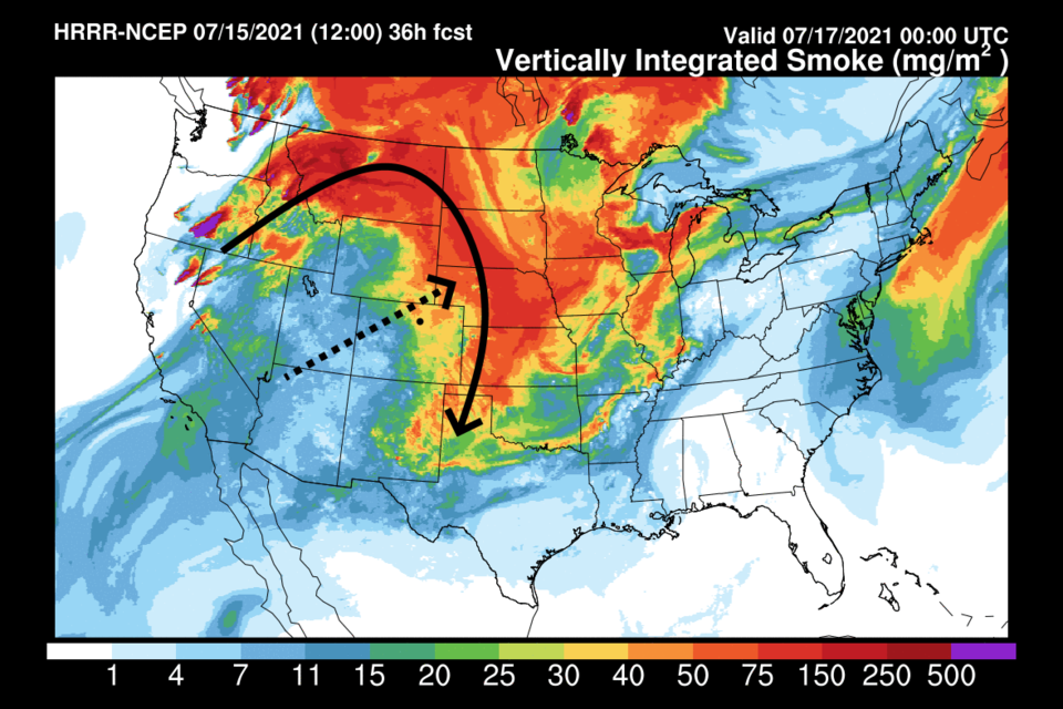
We remain east of the big western ridge. Highs will sit around a degree or two above normal (Figure 3 update) and moisture will decrease a bit lowering storm chances a bit each day. Smoke will keep circulating around the western high pressure center (black arrow) but the overall pattern will slowly carry the worst of the smoke off to the northeast (dashed line - Figure 4 update).
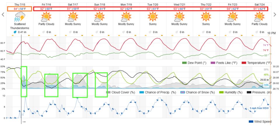 Figure 3 update: the 10 day graphical forecast for Longmont from weatherunderground.com
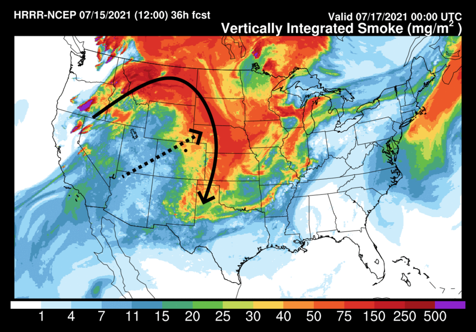 Figure 4 update: the HRRR smoke at all levels forecast for Friday PM fromNOAA.
End Thursday update.
Wednesday Update:
A front is entering the state today increasing moisture and upslope flow. An upper level short wave is drifting in from the west on northwest flow. These elements will combine to create a Marginal Risk of severe weather (1 on a scale of 1 -5 in severity) for a chance of damaging hail and damaging straight line winds.
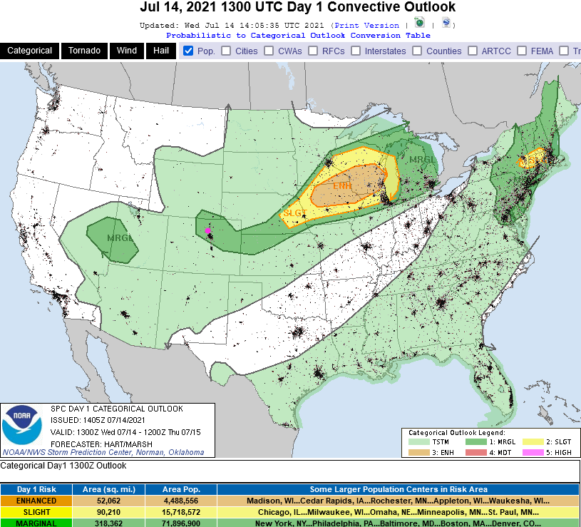 Figure 2 update: severe weather forecast for Day 1 - Wednesday - from the SPC.
End Wednesday update:
Monday Update:
Just a quick check-in on the smoke situation. The smoke forecast in the original post is smoke at all levels. Thankfully, most of the smoke is remaining in the mid to upper levels of the atmosphere. Figure 1 update shows just the forecast for the low level smoke. It is not as bad down here where we are breathing as the earlier maps may have implied. The forecast remains on track!
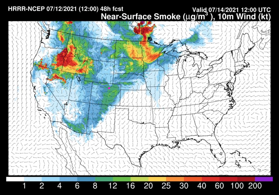 Figure 1 update: the low level smoke forecast from the HRRR for Wednesday morning.
End Monday update.
Forecast Discussion:
Figure 1 says it all, we hover around the upper 80's and mid 90's for the next week. This is very close to normal high temperatures for this time of year. Moisture returns on Tuesday adding a chance of a thunderstorm wandering off the mountains each afternoon. The western states are really baking - still- as the high pressure center moves from the Las Vegas area (Figure 2) into southern California (Figure 4). This continues northerly flow aloft over Colorado (Figure 2) which (unfortunately) is bringing in smoke (Figure 3) from fires that are getting established in the West as the drought stretches on (see the Longmont Public Media forecast videos).
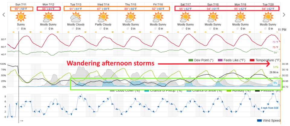 Figure 1: the 10 day graphical forecast from weatherunderground.com for Longmont, CO.
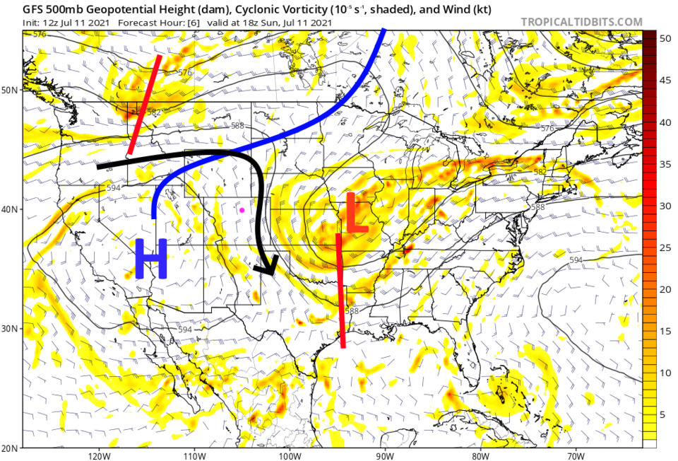 Figure 2: the 500mb upper air forecast map for Sunday noon from the GFS and tropicaltidbits.com
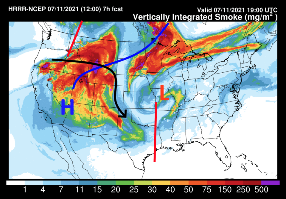 Figure 3: the HRRR smoke at all levels forecast map for Saturday afternoon from NOAA.
The Longer Range Forecast:
By Tuesday, the high has retreated a bit further to the west (Figure 4). Smoke continues to fill the ridge and the states downstream (Figure 5). As the ridge nudges westward, it will remove some of the storm-suppressing sinking air and allow moisture to return in the lower and mid levels (Figure 6). Watch for wandering storms each afternoon (Figure 1). Rainfall totals will remain light and spotty over the next five days (Figure 7).
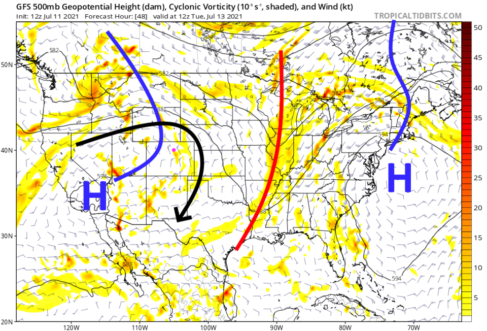 Figure 4: the 500mb upper air forecast map for Tuesday morning from the GFS and tropicaltidbits.com
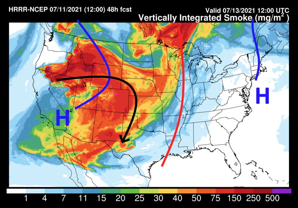 Figure 5: the HRRR smoke at all levels forecast map for Tuesday morning from NOAA.
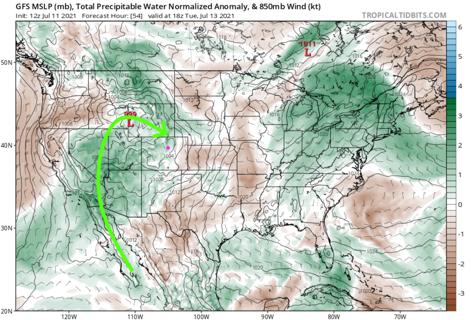 Figure 6: The precipitatable water anomaly (departure from normal) for Tuesday noon from tropicaltidbits.com
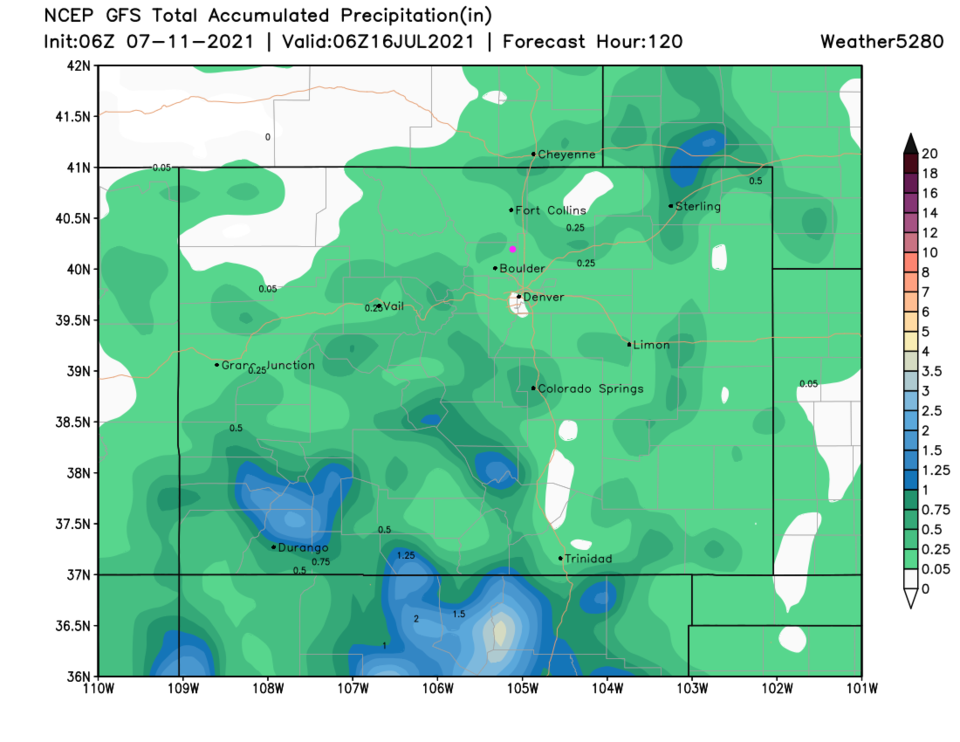 Figure 7: the 5 day precipitation total from the GFS and weather5280.com


