
In Brief:
The week ends cold with another shortwave snow event Friday. The start of next week is warmer and dry.
Friday AM Update:
Snow is beginning to fall across the state Friday morning. Cold north winds are making it unpleasant to stand outside. The HRRR is showing very little accumulation though. The atmosphere is dry and the storm system is pretty weak.
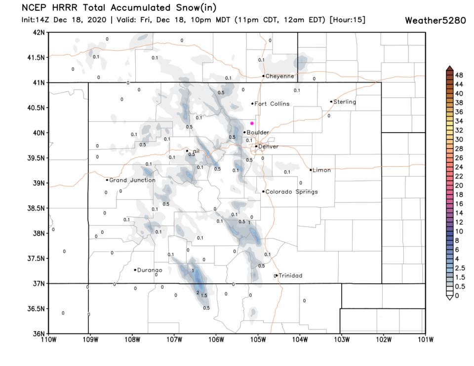 Figure 1 update: the HRRR snowfall forecast through 10pm Friday from weather5280.com
End Friday AM Update.
The Forecast Discussion:
Our Monday storm dropped less than an inch of snow across Longmont (but it made roads tricky Tuesday morning). Boulder got closer to an inch, but not much more than Longmont (Figure 1 below).
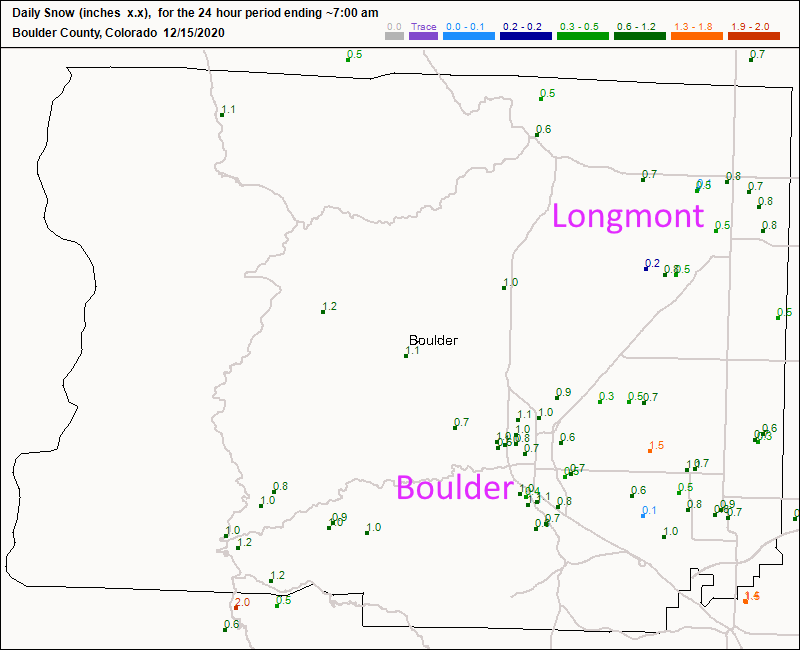 Figure 1: the CoCoRaHS snowfall reports as of 7am Tuesday- new snow depth.
 For the short term, we have northwest flow aloft and dry conditions until a bit of a front hits Thursday evening. Temperatures don't drop but the wind switches to a northeast in direction and snow chances return (Figure 2).
 Figure 2: the 10 day (10:1 ratio) total snowfall forecast from the GFS and weather5280.com
The Long Range Forecast:
The Friday storm is driven by the trough visible over the state in Figure 3.
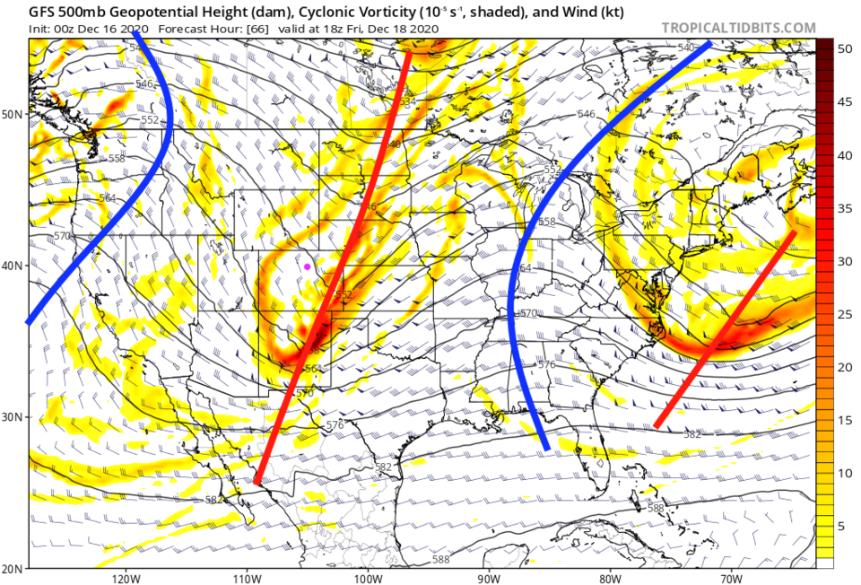 Figure 3: the 500mb upper air forecast map for Friday noon from the GFS and tropicaltidbits.com
Over the next 10 days, the I-25 corridor only gets a dusting or a coating, if lucky, (Figure 4) and no measurable precipitation (Figure 5). The mountain wins with "some" snow. Sorry, things are pretty quiet. A glance at Christmas still shows a very minor dusting of snow possible Christmas Eve. More on that next time.
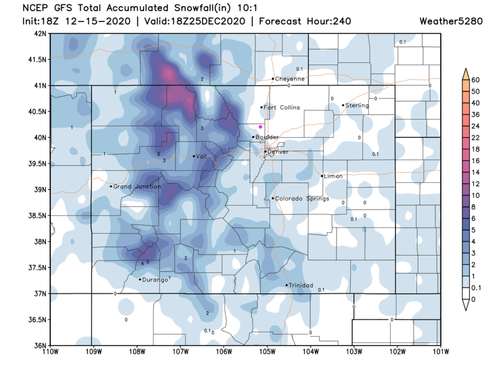 Figure 4: the 10 day (10:1 ratio) total snowfall forecast from the GFS and weather5280.com
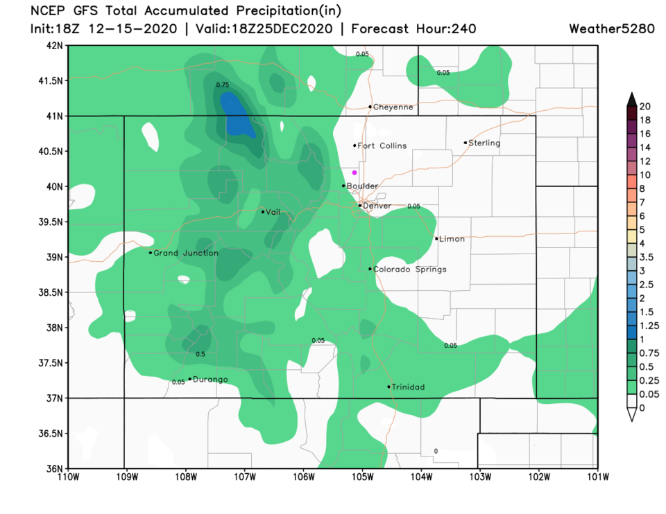 Figure 5: the precipitation total forecast from the GFS and weather5280.com


