
In Brief:
Severe weather leaves, warm and dry weather returns, with less smoke.
Thursday update:
We did have severe weather nearby - there were 2 tornadoes, over 25 hail reports, and a few reports of strong damaging winds (Figure 1 update). We quiet down and start to warm up again now.
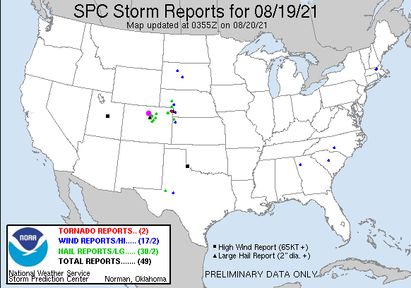 Figure 1 update: the storm reports from Thursday afternoon up to 9pm.
End Thursday update.
Forecast Discussion:
The weather is changing. Say goodbye (for a bit) to the peak heat! We have temperatures almost 10-15F lower than we saw on Wednesday arriving Thursday (Figure 1). This is due to a cold front and a return of healthy moisture levels that may drop up to 1/4 inch of rain over many locations along I-25.
An abnormally deep and cool trough is approaching the state (Figure 2). It will also create a chance of severe weather with the northern half of the state at a Marginal Risk of severe weather Thursday (1 on a scale of 1-5). Areas from northern Denver to Estes Park and to the northeast will be in a Slight risk zone (2 on a scale of 1-5; Figure 3). The primary risk is severe hail and strong damaging straight-line winds.
Storms will be more widespread over western Colorado Thursday (Figure 4) but areas east of the Divide may see some healthy local rainfall amounts (Figure 4). This new southwestern flow aloft will scour out much of the smoke. This will give us back our view of the mountains and a return to blue skies (Figure 5). The best rainfall totals should be seen in western Colorado (Figure 6).
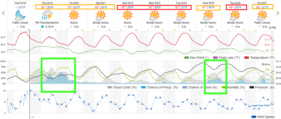 Figure 1: the 10 day graphical forecast from weatherunderground.com for Longmont, CO.
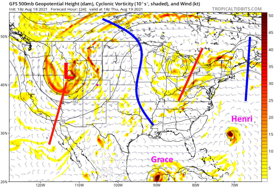 Figure 2: the 500mb upper air forecast map for Thursday noon from the GFS and tropicaltidbits.com
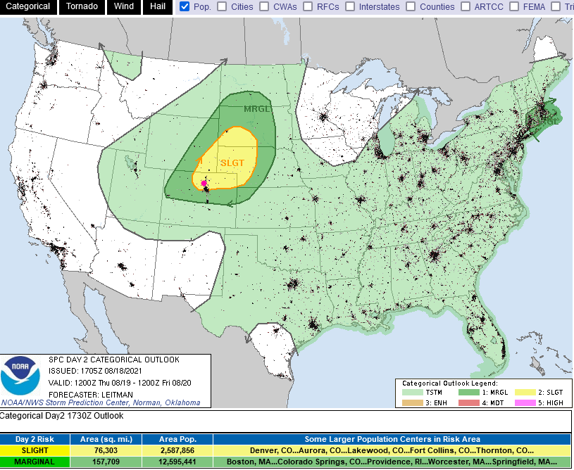 Figure 3: the risk of severe weather from the Storm Prediction Center, Norman OK for Day 2, Thursday.
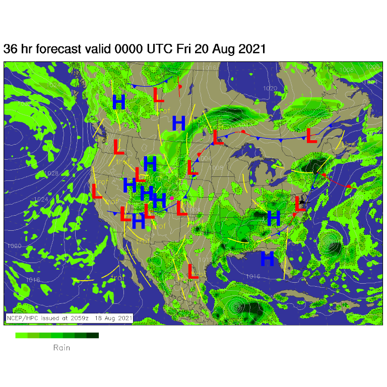 Figure 4: the surface forecast analysis for Thursday PM from NCEP.
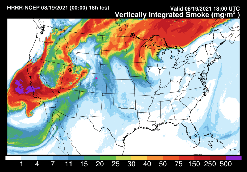 Figure 5: the HRRR smoke total to Thursday noon from weather5280.com
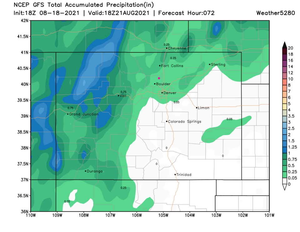 Figure 6: the 3 day precipitation total from the GFS and weather5280.com
The Longer-Range Forecast:
After this storm moves off to the east, we'll warm to just below and just above 90 on the weekend with another small system predicted around Wednesday next week (Figure 1). Keep an eye on the western sky Thursday!


