In Brief:
The high pressure retreats west allowing a cool down and a return of afternoon storms at the end of the weekend. Western fires add smoke.
Saturday update:
The current dry, "coolish" forecast is on track, but the over heated and baked western states have fires ongoing and the smoke is arriving in Colorado. These are not Colorado fires for the most part. Sorry, it is hard to hold on to perfect forecasts long.
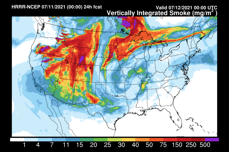
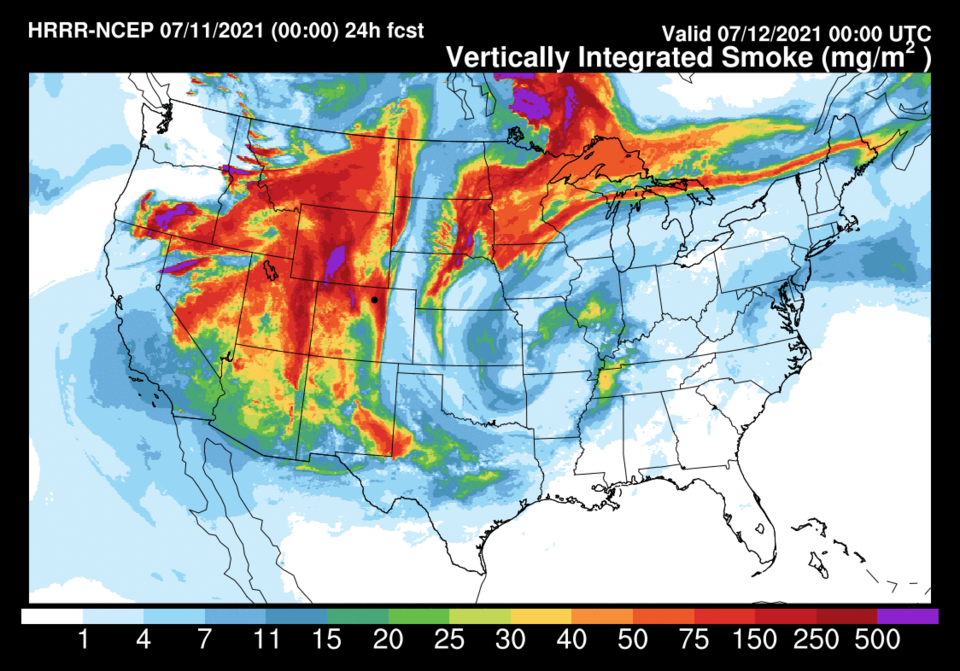 Figure 2 update: the HRRR smoke forecast for Sunday PM from NOAA.
End Saturday update:
Friday update:
A dry cold front chases record heat (again) away. By Monday, enough moisture will return to allow better chances of afternoon storms (Figure 1 update). The high pressure center in the West will retreat to southern California. We see healthy north winds again (and a cold front). After flirting with 100F on Friday, we see VERY nice daytime highs.
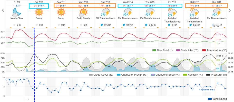 Figure 1 update: the 10 day graphical forecast for Longmont from weatherunderground.com
End Friday Update.
Forecast Discussion:
The last half of this week begins to feel the effects of the western ridge return. This ridge has been baking the western states with near all-time heat. Figure 1 shows that we return to the 90s into the start of the weekend. The high-pressure center is sitting over the Grand Canyon at the start of the forecast window giving us northerly winds (Figure 2). If it wasn't for that, we'd be in the 100s instead of the lower to mid-90s.
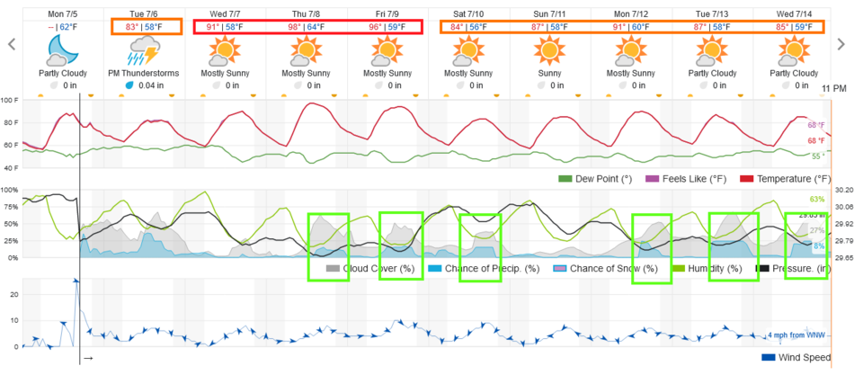 Figure 1: the 10 day graphical forecast from weatherunderground.com for Longmont, CO.
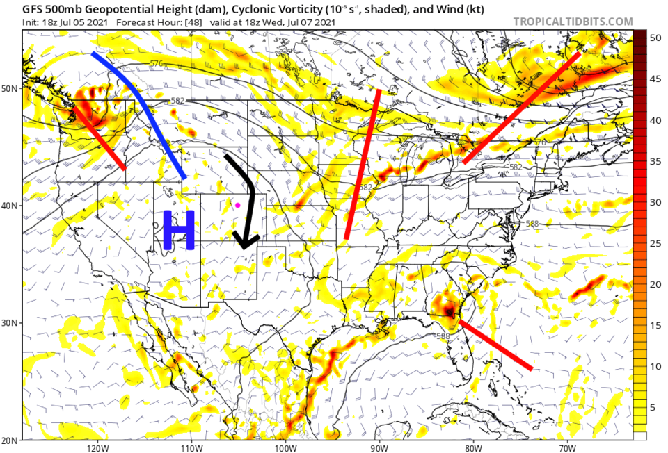 Figure 2: the 500mb upper air forecast map for Wednesday noon from the GFS and tropicaltidbits.com
The Longer-Range Forecast:
By Sunday, the high shifts a bit to the west allowing us to cool down (Figure 3). We still have a lot of local moisture in place and a fetch of tropical moisture not far away (Figure 4). Spotty rain will be the rule over the next 5 (Figure 5) and 10 days (Figure 6). This is your typical summer pattern in Colorado!
Tropical Check-In:
Tropical storm Elsa is heading for Florida then a probable trip overland up the eastern coast (Figure 7). There is a small chance it could make it to the ocean after crossing Georgia. That would allow it to strengthen. The most likely path is given in this figure created by the National Hurricane Center. Something to keep an eye on if you have relatives out east.
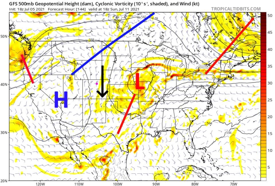 Figure 3: the 500mb upper air forecast map for Sunday noon from the GFS and tropicaltidbits.com
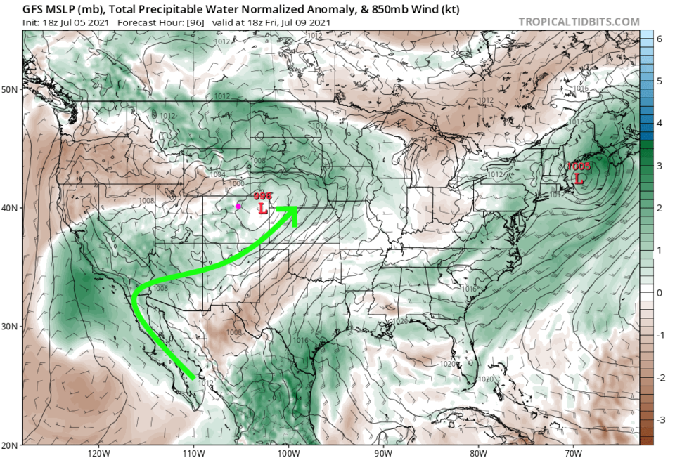 Figure 4: the precipitatable water anomaly (departure from normal) for Friday PM from tropicaltidbits.com
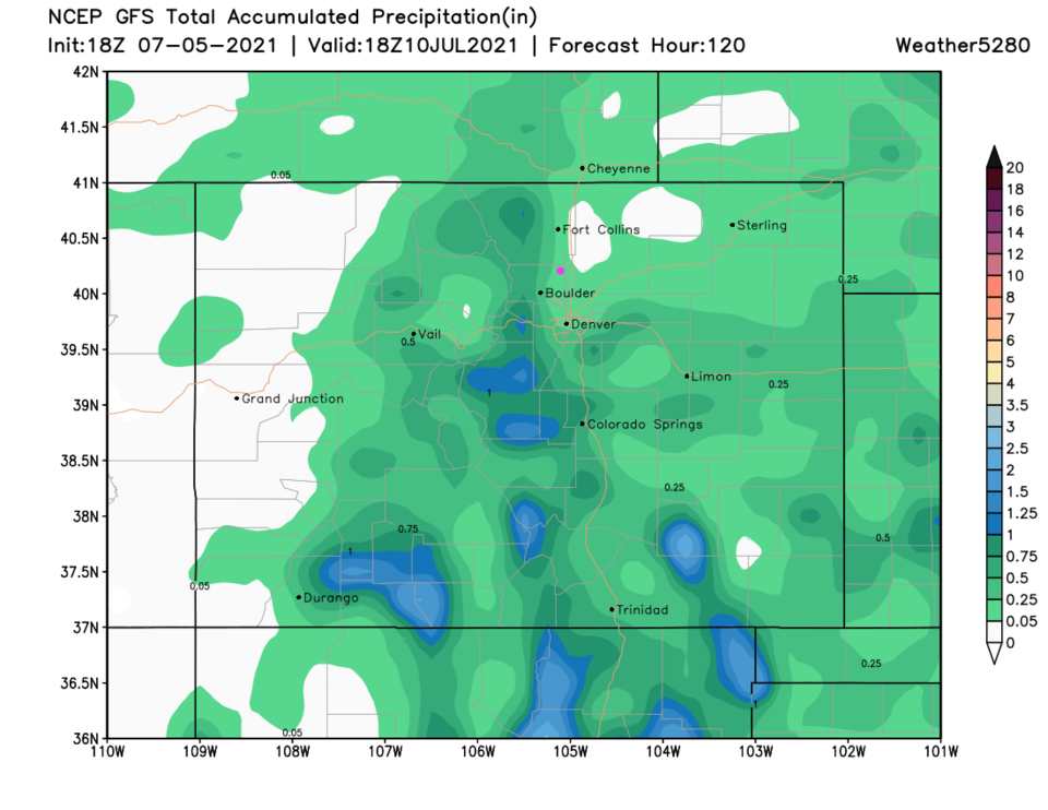 Figure 5: the 5 day precipitation total from the GFS and weather5280.com
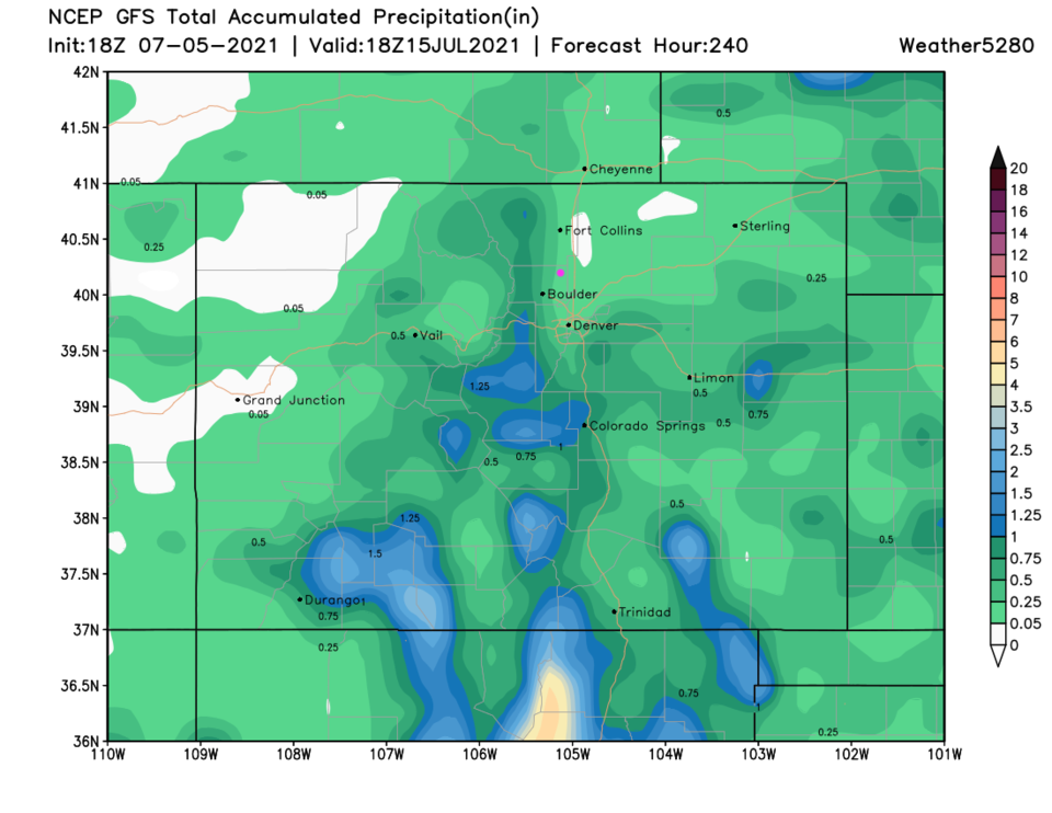 Figure 6: the 10 day precipitation total from the GFS and weather5280.com
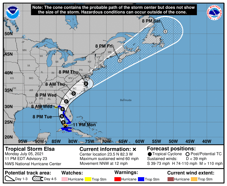 Figure 7: the 5 day forecast for Elsa from the National Hurricane Center.


