In Brief:
Finally, the march of cold fronts begins again (a progressive pattern); we bounce between warm and cool with smoke and dry conditions.
Forecast Discussion:
The high pressure to our west is keeping us abnormally hot Saturday with plenty of local smoke across northeast Colorado (Figure 1). This won't change until the next cold front has passed. There is an indication it will be strong enough to bring in clean Canadian air early in the week.
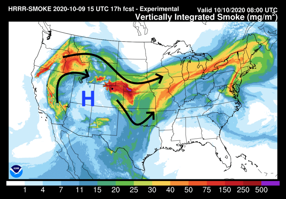 Figure 1: the HRRR smoke at all levels forecast map for Saturday morning from NOAA.
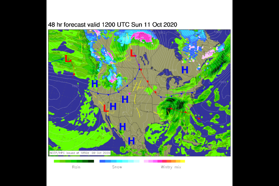
By Sunday, the next front is sweeping our way from the northern Rockies and Pacific northwest (Figure 2). There is precipitation behind it, but that won't make it to Colorado.
 Figure 2: the Sunday morning forecast surface map from NCEP.
The first front arrives around 11 a.m. Sunday and will cool us about 10 degrees (Figure 3). Moisture is lacking, only a very small chance of showers shows up as a blip on the model.
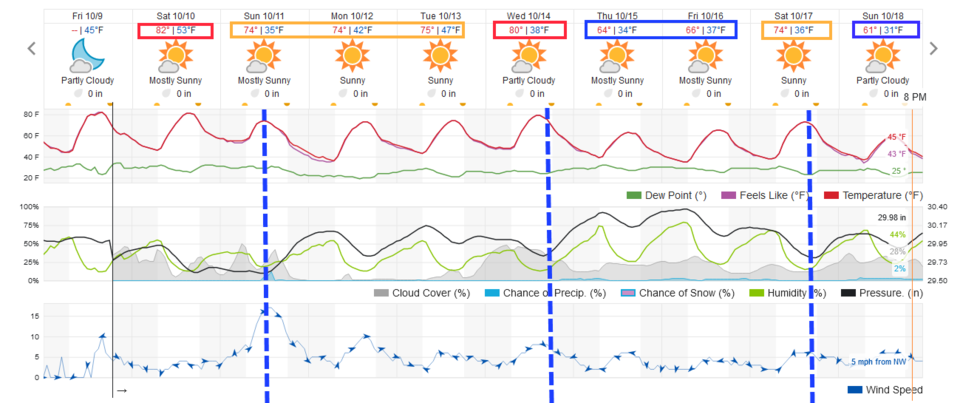 Figure 3: the 10 day graphical forecast from weather5280.com for Longmont, CO.
The Longer Range Forecast:
Over the next 10 days, there may be a bit of moisture along the northern Colorado border and northern Colorado Rockies. Totals are still pretty light (Figure 4). We warm up to 80 F by Wednesday when our next cold front hits, cooling us 15 degrees. Then another cold front next Saturday steps us down another 10 degrees.
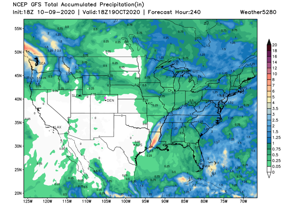 Figure 4: the 10 day precipitation total from the GFS and tropicaltidbits.com
Fantasy Snowfall Returns!
The GFS has a stout trough sweep through the state Tuesday after this Tuesday (Figure 5). It thinks this will create enough upslope flow in cold enough air that we get our second snow for the season (Figure 6). We'll keep an eye on it, but the last storm this far out vanished from the model. Still, one can dream.
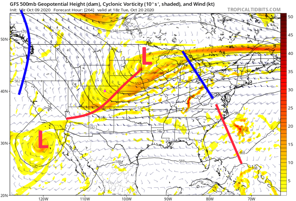 Figure 5: the 500mb upper air forecast map for NEXT Tuesday noon from the GFS and tropicaltidbits.com
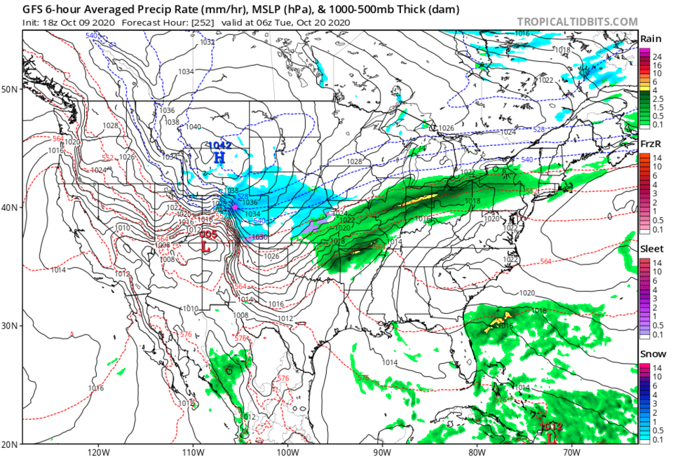 Figure 6: the 6 hour precipitation forecast map for NEXT Tuesday noon from the GFS and tropicaltidbits.com


