In Brief:
The front arrives, winds shift and slowly the snow begins to fall for about 36 hours with bitter cold.
There is a Winter Storm Warning for 5-10" of snow along I-25 and for 10-20" in the mountains through Monday morning.
Forecast Discussion:
Today is the day, with terrible fires still blowing through mountain communities and Rocky Mountain National Park, a vigorous trough is swinging into place to bring snow and amazing cold (Figure 1 below).
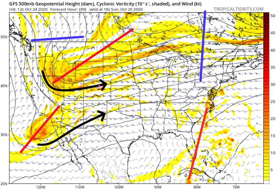 Figure 1: forecast 500mb upper air map for Sunday noon from the GFS and tropicaltidbits.com
The northern jet and southern tropical jets are beginning to pull together to bring in mid and upper level moisture (Figure 2). Easterly surface winds behind the front will push a lot of moisture from the Great Plains up the eastern Colorado Plains and into the mountains.
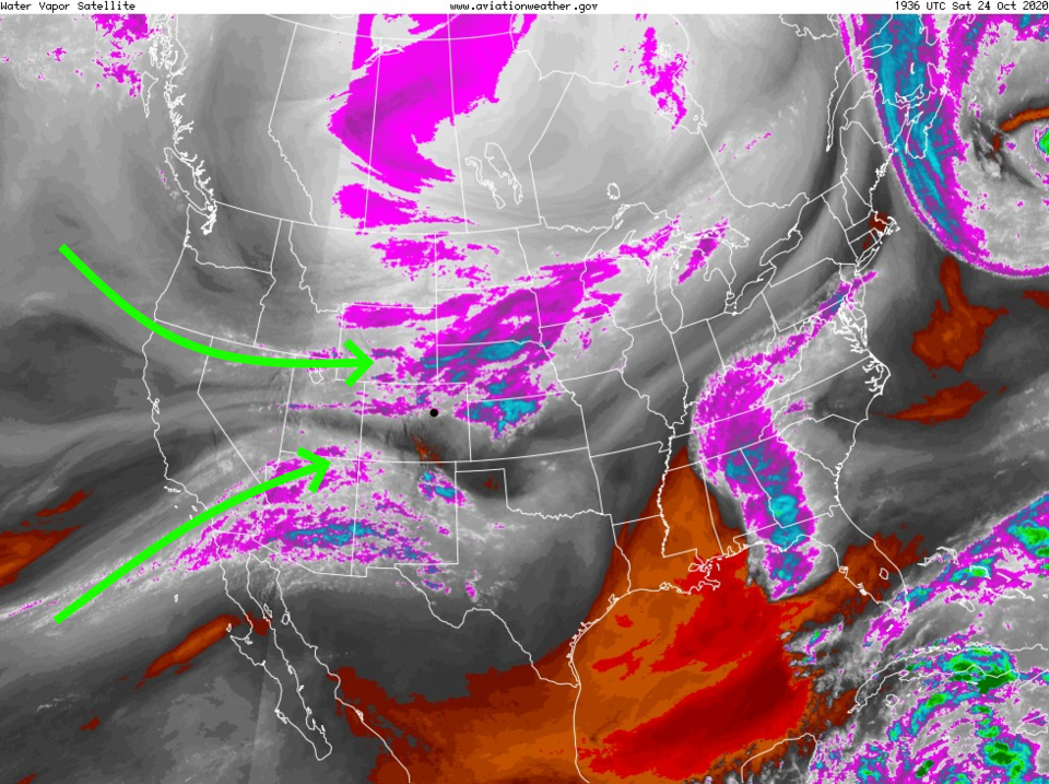 Figure 2: the water vapor satellite image from NOAA from Saturday AM. White/purple is moist air, red/brown is very dry air.
 The front blasts down the plains passing Longmont between 5-6 p.m. Saturday. Clouds will increase with snow falling beginning between 9-10 p.m.. Figure 3 shows the snow across the northern half of the state by Sunday noon. The entire states is getting blanketed with snow as the low deepens at the Four Corners Sunday night (Figure 4). Snow picks up more Monday morning statewide (Figure 5).
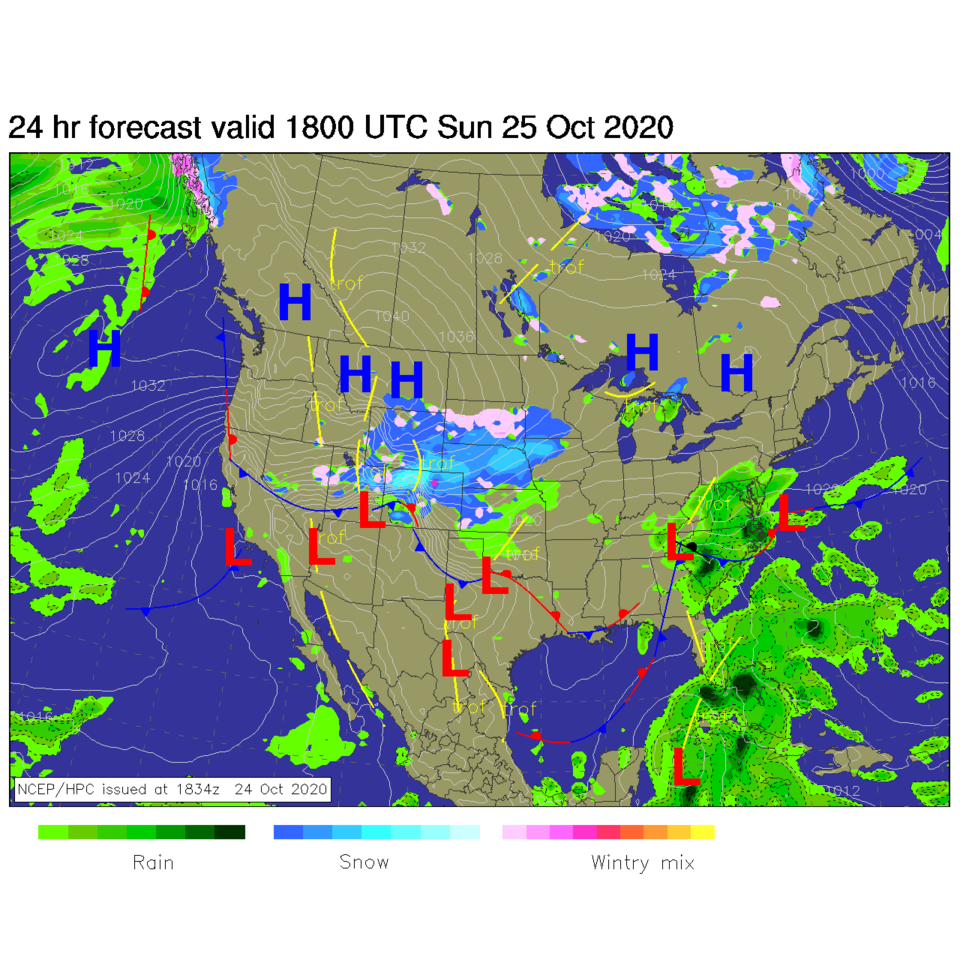 Figure 3: the forecast surface analysis for Sunday noon from NCEP.
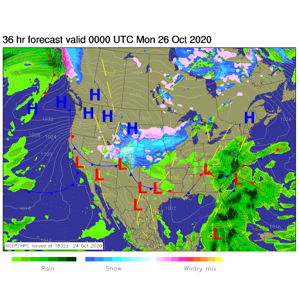 Figure 4: the forecast surface analysis for Sunday night from NCEP.
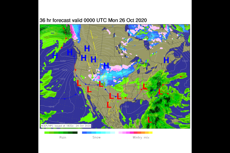
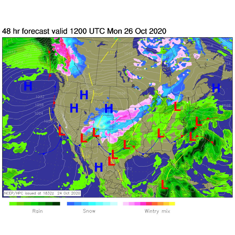 Figure 5: the forecast surface analysis for Monday morning from NCEP.
Figure 6 shows the almost 36 hours of likely snow hitting. Note that temperatures are down in the lower single digits Monday and Tuesday morning.
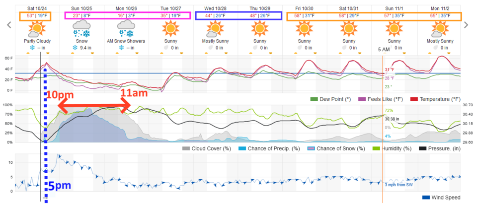 Figure 6: the 10 day graphical forecast from weather5280.com for Longmont, CO.
Snowfall Round-Up:
The GFS (Figure 7) gives Longmont 4-8 inches (more on the west side of town).
The NAM (Figure 8) gives Longmont 8-12 inches.
The GEM (Figure 9) gives Longmont 3-5 inches.
The NWS warning text gives Longmont 5-10 inches.
The Weatherunderground model gives us 8-10 inches.
I'm giving Longmont 6-9 inches.
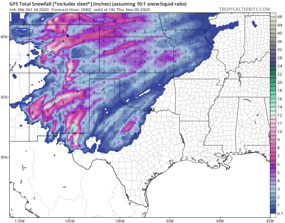 Figure 7: the forecast total snowfall through Thursday noon (10:1 ratio) from the GFS and tropicaltidbits.com
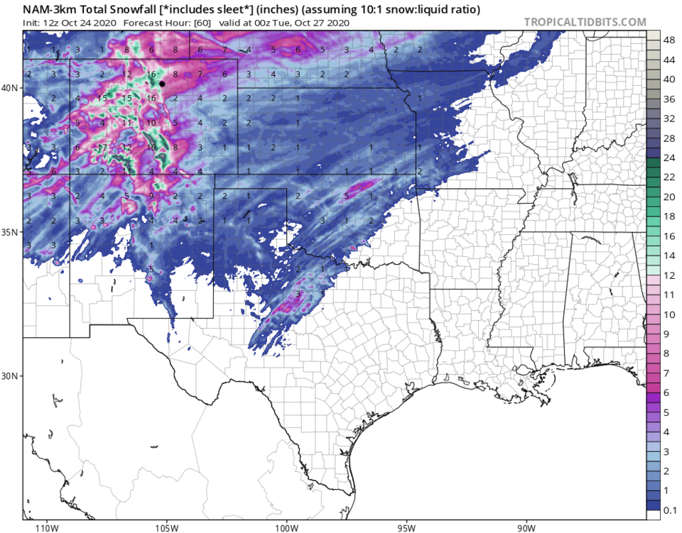 Figure 8: the forecast total snowfall through Wednesday night (10:1 ratio) from the Canadian GEM and tropicaltidbits.com
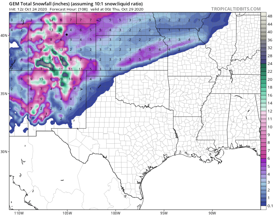 Figure 9: the forecast total snowfall through Thursday noon (10:1 ratio) from the NAM and tropicaltidbits.com
The Longer Range Forecast:
We remain very cold through Tuesday (Figure 6). It is mostly dry and slowly warming over the next week.


