
The video forecast for this week.
In Brief:
Hot, quiet, mostly smoke free weather sets in. Two cool fronts bring storm chances.
Thursday update:
Our local forecast is on track, but all eyes are turning to the Gulf of Mexico where a, potentially, major hurricane might threaten the areas around New Orleans. It looks like landfall will occur over the weekend.
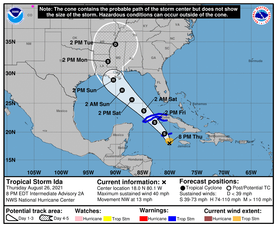 Figure 2 update: Ida forecasted path by the NHC and NOAA.
End Thursday Update.
Wednesday update:
Not much will change over the next week. We still have high temperatures above normal. Approaching short waves will kick a couple of weak cold fronts down the Front Range; one Thursday and the next Saturday. There is a slightly better chance of storms with those fronts (Figure 1 update). There is a Marginal Risk of severe weather just 20-30 miles east of I-25 Wednesday and Thursday. Storms will be very isolated.
There may be a big tropical system hitting Texas middle next week. That moisture might feed rain/storms next weekend (Green question mark). We'll keep an eye on it, the moisture could easily miss Colorado entirely.
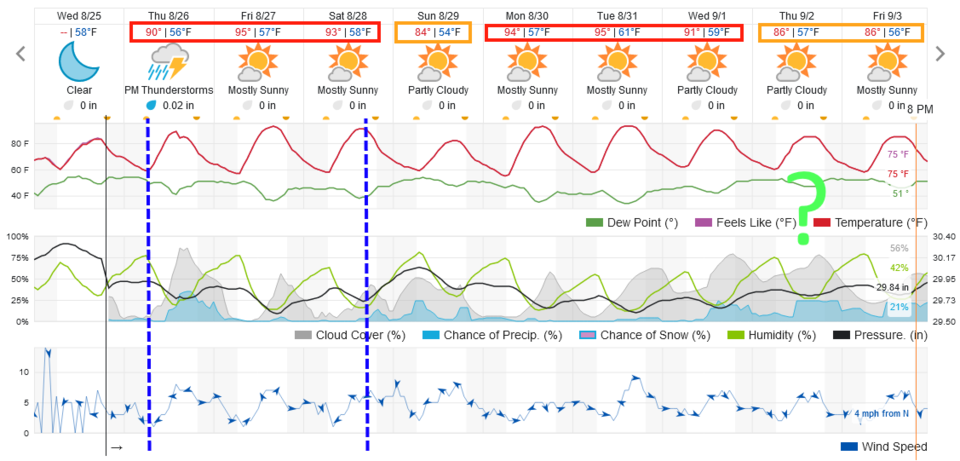 Figure 1 update: the 10 day graphical forecast for Longmont from weatherunderground.com
End Wednesday update.
Forecast Discussion:
We enter a stretch of quiet summer weather. Figure 1 shows a stretch of somewhat above normal temperatures through the weekend and only a small mid-week chance of storms when a short wave zips by. The overall pattern will look like that in Figure 2 for most of the next 10 days. The ridge to our east and southwest flow aloft (Figure 2) will keep warm dry weather going. This flow is diverting smoke away from Colorado - for the most part- for at least the next few days (Figure 3).
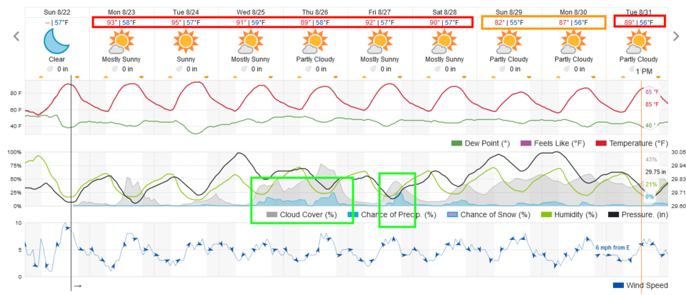 Figure 1: the 10 day graphical forecast from weatherunderground.com for Longmont, CO.
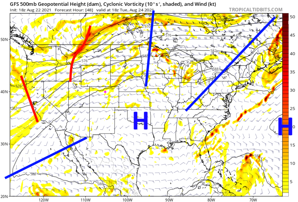 Figure 2: the 500mb upper air forecast map for Tuesday noon from the GFS and tropicaltidbits.com
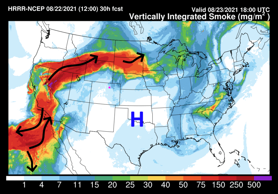 Figure 3: the HRRR smoke at all levels forecast map for Monday noon from NOAA.
The Longer-Range Forecast:
This will be a very dry pattern, at least for the first five days of the forecast window, as seen in Figure 4, the 5 day GFS preciptation totals. Enjoy the warmth. Winter is coming!
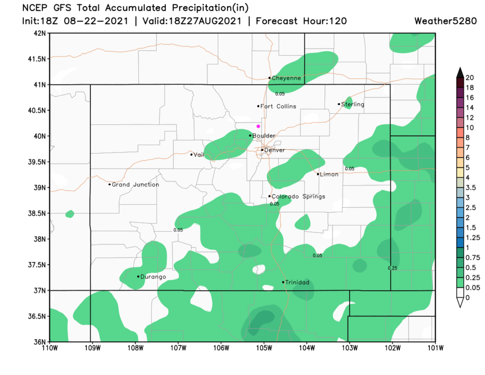 Figure 4: the 10 day precipitation total from the GFS and weather5280.com


