
In Brief:
Moving ridges and troughs mean bouncing, but primarily warm weather; except for a chance of snow on Wednesday.
Forecast Discussion:
The 500mb upper air pattern is really on the move with troughs zipping across the nation every few days. This means that moisture is having a hard time making it into the middle of the continent (Colorado). Figure 1 shows a big ridge to our west and a northwest flow aloft. This ridge is also keeping temperatures mild.
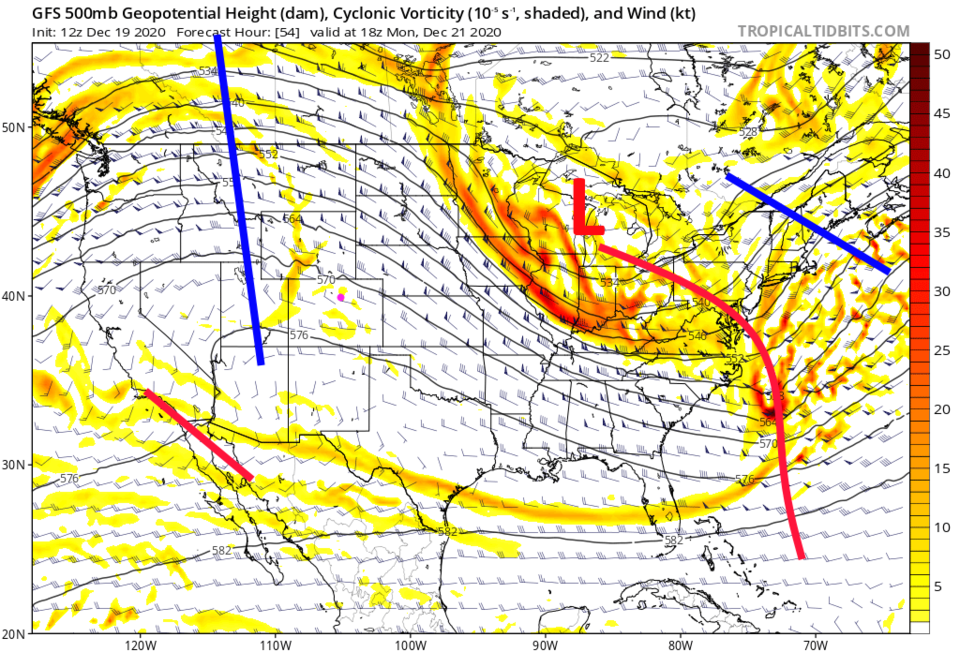 Figure 1: the 500mb upper air forecast map for Monday noon from the GFS and tropicaltidbits.com
The Longer Range Forecast:
By Tuesday, a trough will sweep over the state (red line in Figure 2). But moisture will be very limited. Figure 3 shows the amount of water in the atmosphere that could precipitate out. The green colors are above normal amounts of moisture, the brown coloration is below normal. The moisture is expected to pull out of Colorado by the time the precipitation begins.
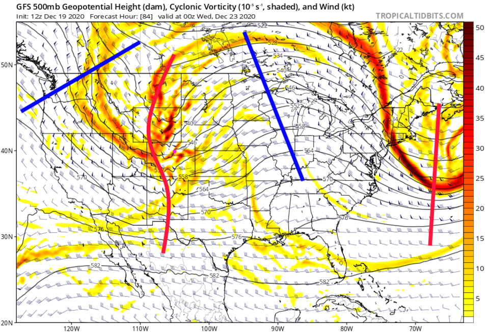 Figure 2: the 500mb upper air forecast map for Tuesday PM from the GFS and tropicaltidbits.com
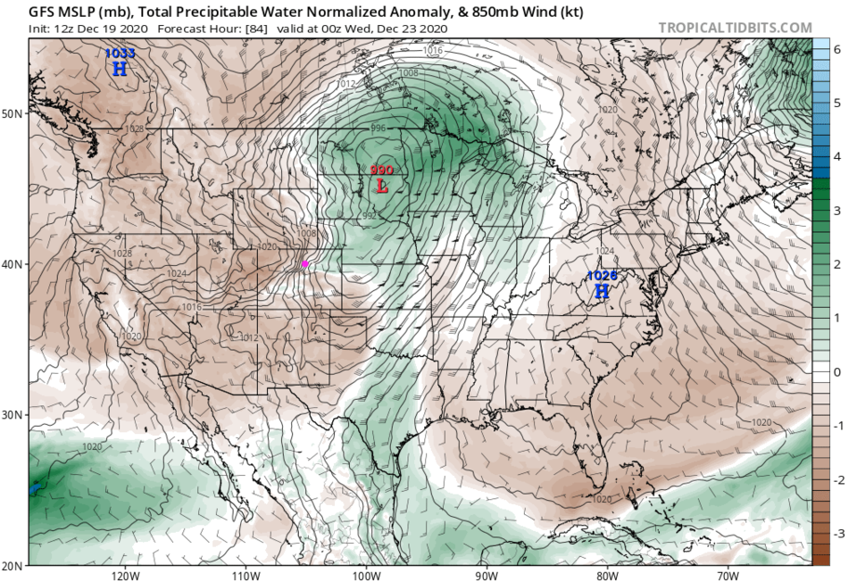 Figure 3: the precipitatable water anomaly (departure from normal) for Tuesday PM from tropicaltidbits.com
The future precipitation map for early Wednesday morning shows a spotty shield of snow mainly in the mountains of Colorado. This is expected to come in behind the low that is already in Iowa (Figure 4).
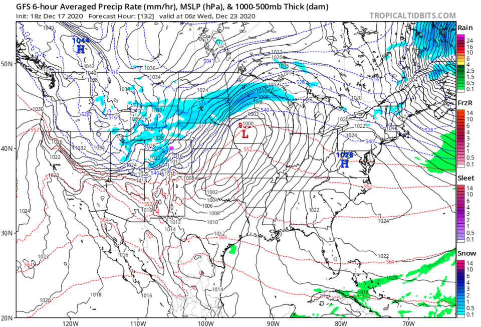 Figure 4: the 6 hour averaged precipitation around Wednesday morning from the GFS and tropicaltidbits.com
The big picture of the week shows us steadily warming up until the cold fronts arrival Tuesday evening (the left side of the blue box Figure 5). We do have a small chance of snow now and then Wednesday with cold gusty north winds. We may see a coating to a lucky inch of snow falling along I-25 on Wednesday. The mountains will get up to a foot at higher elevations (Figure 6).
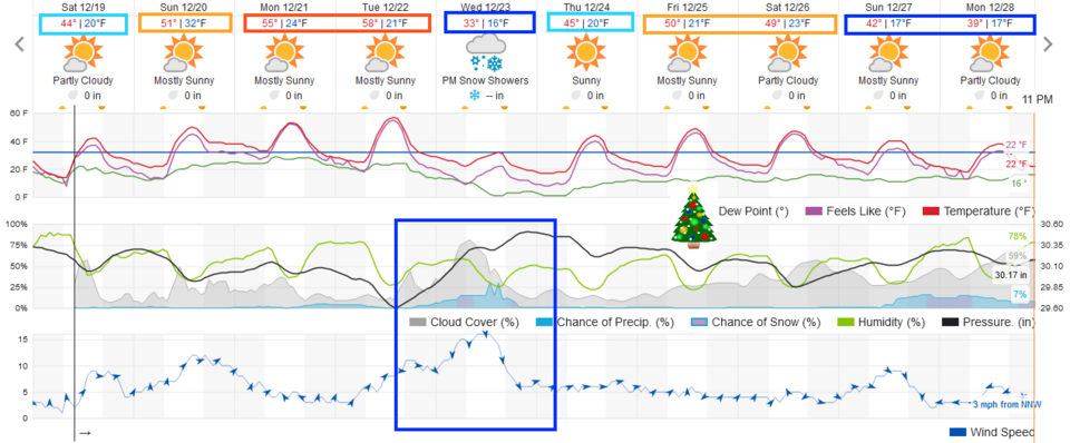 Figure 5: the 10 day graphical forecast from weather5280.com for Longmont, CO.
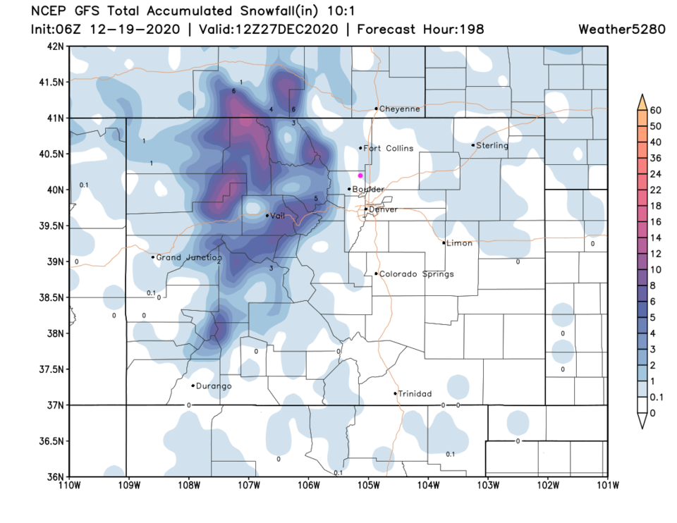 Figure 6: the 10 day (10:1 ratio) total snowfall forecast from the GFS and weather5280.com
Christmas Day Forecast:
It will be dry and very mild on Christmas Day. We have a trough dipping down into Arizona, but we are under a ridge axis again (Figure 7). You can take that new bicycle out for a ride right away this year!
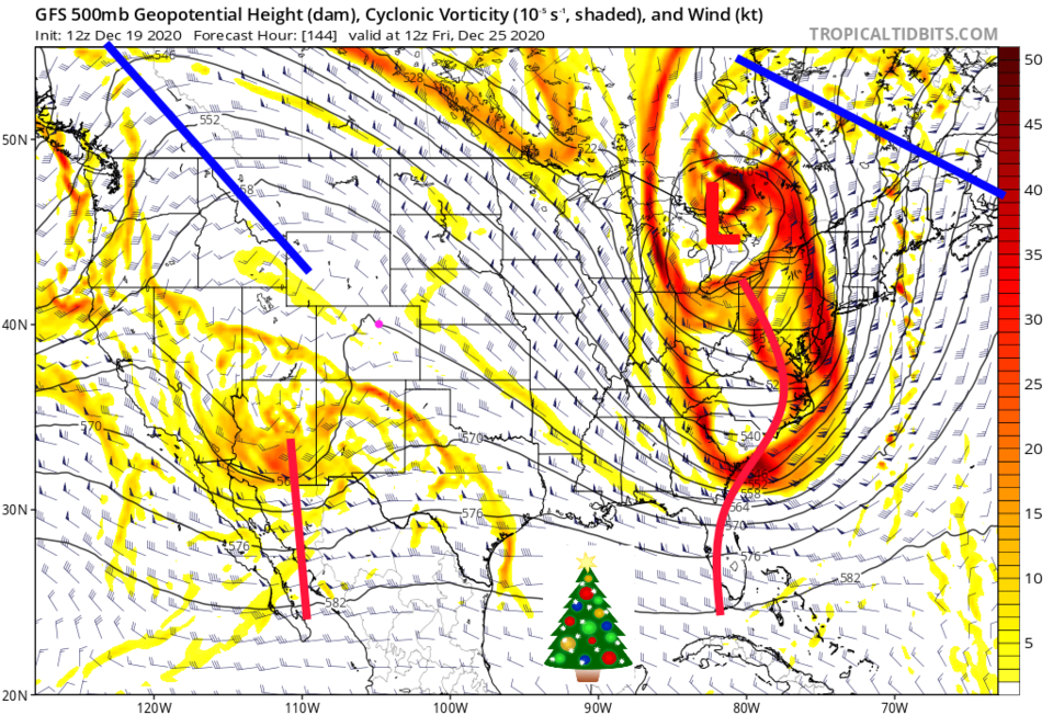 Figure 7: the 500mb upper air forecast map for Christmas Day from the GFS and tropicaltidbits.com


