Skip to content
Join our Newsletter

Friday Update: Longmont Weather Forecast: Very warm again, then a chance of snow

Figure2u3_11192021
Figure 2 update: the 10 day graphical forecast for Longmont from weatherunderground.com

In Brief:

Mild weather continues with tiny chances of precipitation.

Friday update:

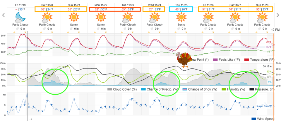
Things remain very quiet and mild (for this point in Fall).  The chilliest day in the future will be Thanksgiving day itself, when temperatures return to normal briefly (Figure 2 update). There are very small chances of showers this weekend, the night before Thanksgiving and the following weekend.  We will probably set the record for the latest measurable snow after all.  When those small chances occur, the northern mountains will pick up some nice snow.  Enjoy the pleasant weather unless there are showers on Saturday!

Figure2u3_11192021
Figure 2 update: the 10 day graphical forecast for Longmont from weatherunderground.com

End Friday update:

Tuesday Update:

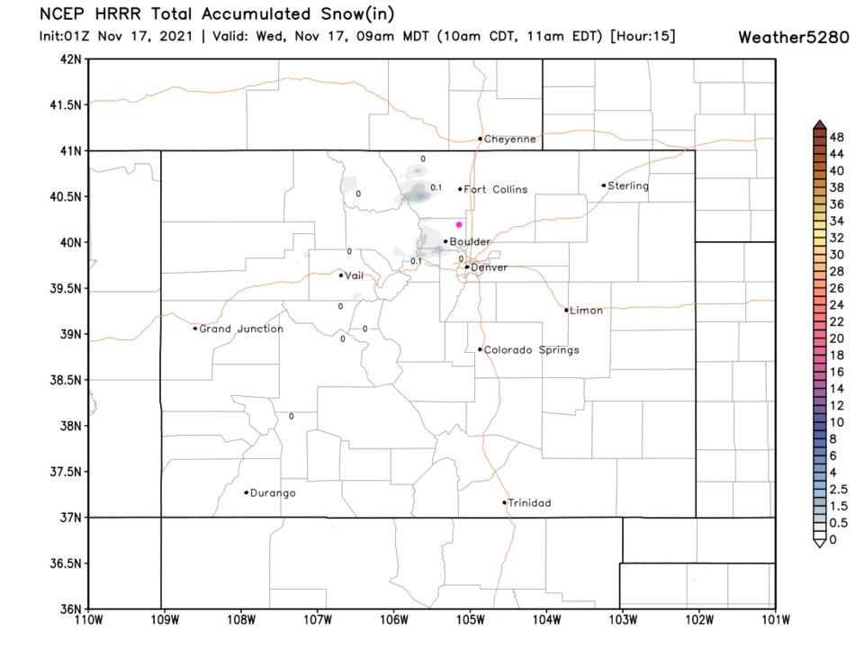
The front is blasting down the Front Range currently and a bit of moisture and uplift will occur in the mountains. Figure 1 update shows the expected snow overnight. Look close, it is hard to see. We "may" have a coating or dusting in the morning, but probably not.  We are still in the running for a record late snow and record period of snow-less weather in Denver. It WILL be pretty chilly for the next.

Figure1u_11162021
Figure 1 update: the HRRR total snowfall forecast through 9am Wednesday from weather5280.com

End Tuesday update.


Forecast Discussion:

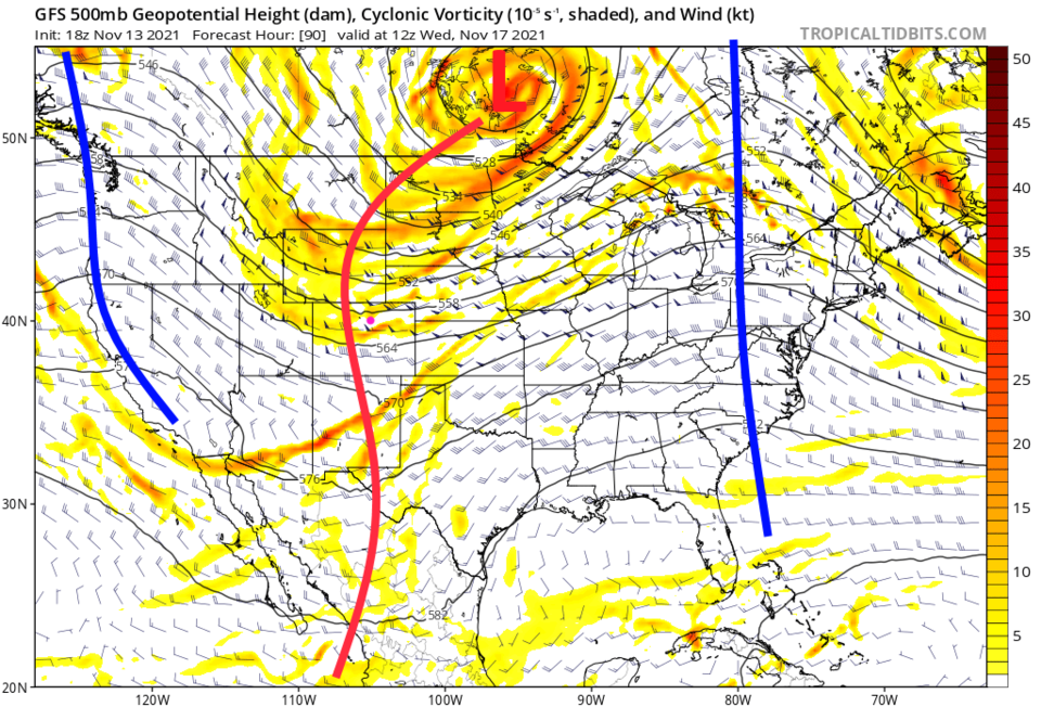
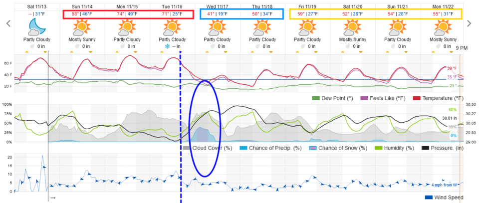
A giant ridge over the west keeps us very warm through Tuesday (Figure 1).  A strong cold front arrives Tuesday around sunset, temperatures plummet and precipitation chances rise (see the Longer Range Forecast below).

Figure1_11132021
Figure 1: the 10 day graphical forecast from weatherunderground.com for Longmont, CO.

The Longer Range Forecast:

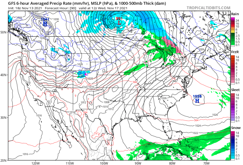
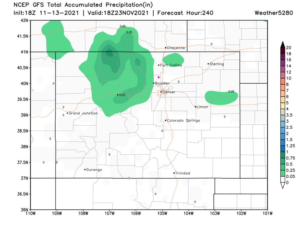
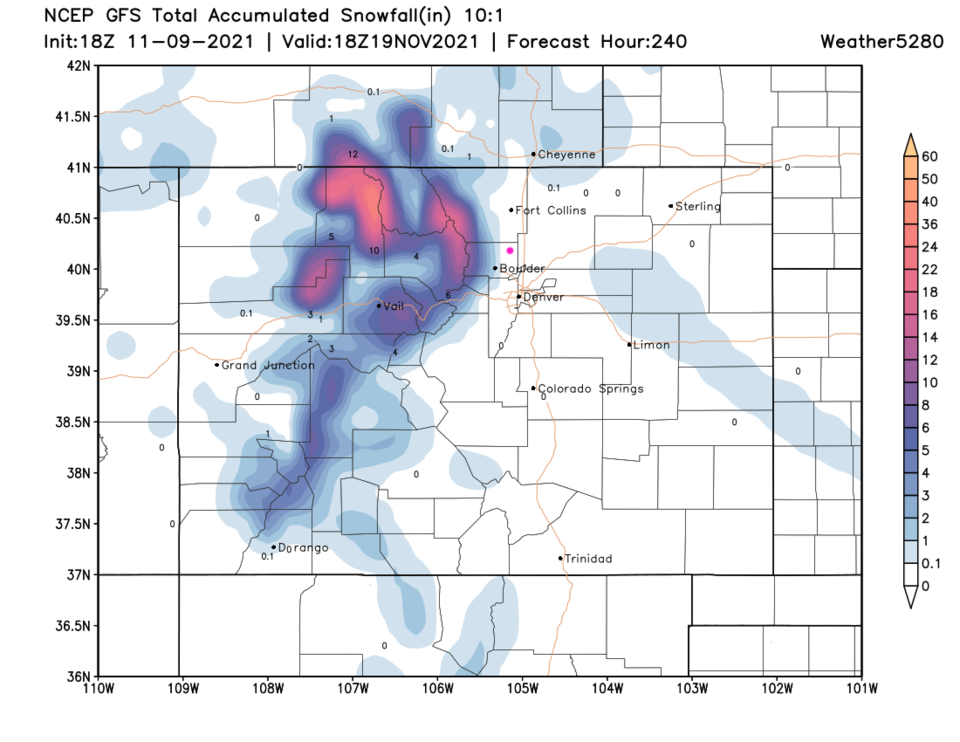
A pretty strong trough sweeps the nation and brings down some cold Canadian air on Wednesday (Figure 2). At present, the area of snow this storm will kick up is very limited in coverage (Figure 3).  The precipitation will be confined to the northern Colorado mountains and a few spots on the Plains (Figure 4). The snow in the mountains might be pretty impressive but with only a dusting apparent at lower elevations (Figure 5).  The latest recorded measurable snow in Denver is November 21 which occurred in 1934. Looking further out, we might just break this record if this storm does not hit the airport.


Figure2_11132021
Figure 2: the 500mb upper air forecast map for Wednesday morning from the GFS and tropicaltidbits.com
Figure3_11132021
Figure 3: the 6 hour averaged precipitation around Wednesday morning from the GFS and tropicaltidbits.com
Figure4_11132021
Figure 4: the 10 day precipitation total from the GFS and weather5280.com
Figure5_11132021
Figure 5: the 10 day (10:1 ratio) total snowfall forecast from the GFS and weather5280.com


About the Author: John Ensworth

John Ensworth used to work from Longmont as the PI for the NASA through the IGES (The Institute for Global Environmental Strategies). He now teaches technology, algebra, astronomy, meteorology, film school, and Lego robotics to middle/high school.
Read more


Comments


Current Weather

Sunny

Sunny

90°F

UV Index
11 Extreme
Pressure
30.13 Steady
Visibility
8 miles
Dewpoint
56 °F
Humidity
31%
Wind
ESE 2.9 mph
Gust
5.6 mph
Wind Chill
90 °F

Hourly Forecast

Today
1 PM
90°F
Mostly cloudy w/ showers
Today
2 PM
92°F
Mostly cloudy
Today
3 PM
93°F
Mostly cloudy
Today
4 PM
91°F
Mostly cloudy
Today
5 PM
87°F
Mostly cloudy
Today
6 PM
83°F
Thunderstorms
Today
7 PM
80°F
Mostly cloudy
Today
8 PM
77°F
Partly sunny
Today
9 PM
73°F
Partly cloudy
Today
10 PM
71°F
Partly cloudy w/ t-storms
Today
11 PM
68°F
Partly cloudy
Tomorrow
12 AM
67°F
Partly cloudy

7 Day Forecast

Mostly cloudy w/ t-storms

Monday

93 °F

A shower in spots late this morning, then a thunderstorm in spots late this afternoon; thunderstorms can bring hail and damaging winds


Partly cloudy w/ t-storms

Monday Night

60 °F

A thunderstorm in spots this evening; otherwise, clear to partly cloudy; thunderstorms can bring hail and damaging winds


Intermittent clouds

Tuesday

96 °F

Intervals of clouds and sunshine


Partly cloudy

Tuesday Night

61 °F

Partly cloudy


Partly sunny w/ t-storms

Wednesday

82 °F

Clouds and sun with a thunderstorm in the afternoon; thunderstorms can bring hail and damaging winds


Partly cloudy w/ t-storms

Wednesday Night

58 °F

An evening thunderstorm; otherwise, partly cloudy


Mostly cloudy

Thursday

86 °F

Mostly cloudy with a thunderstorm in spots in the afternoon


Partly cloudy

Thursday Night

58 °F

Partly cloudy


Mostly cloudy

Friday

89 °F

Variable cloudiness


Mostly clear

Friday Night

61 °F

Mainly clear


Sunrise and Sunset

Sunrise
5:43 AM
Sunset
8:29 PM

Based on AccuWeather data