In Brief:
Slow warm-up to a mostly dry pre-Christmas week.
Thursday Update:
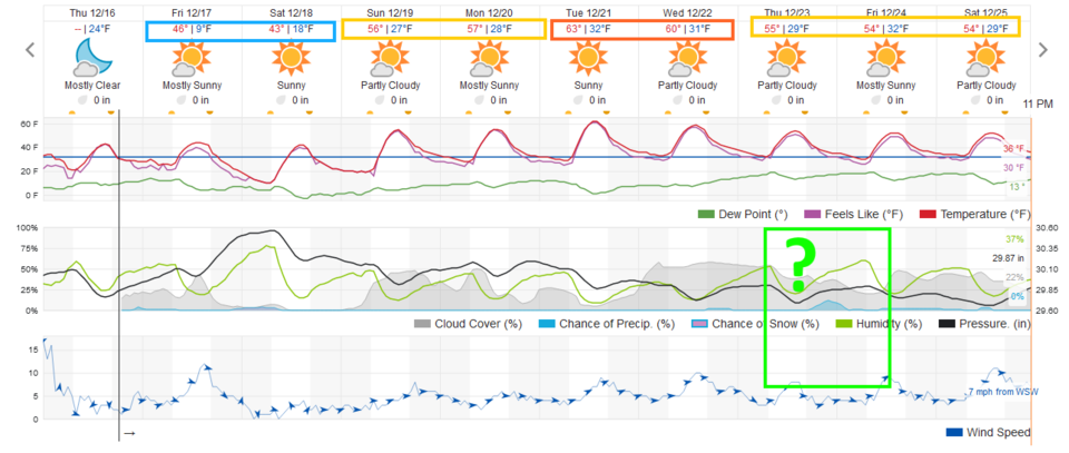
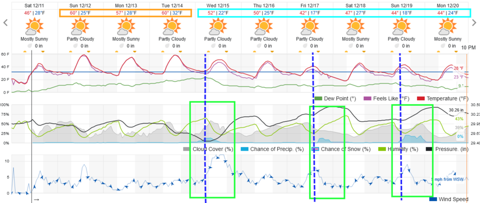
After winds topping 100mph in the mountains and reaching 76mph in Longmont Wednesday, things quiet down and slowly warm towards Christmas (Figure 2 update). There is a storm that will drop snow in the mountains Thursday. There is a hint that showers may make it to the lower elevations around here (green question mark). We'll see!
End Thursday update.
Tuesday Update:
First off - from the National Weather Service:
High Wind Warning
Issued: 3:50 PM Dec. 14, 2021 – National Weather Service
...HIGH WIND WARNING REMAINS IN EFFECT FROM 8 AM TO 5 PM MST
WEDNESDAY...
* WHAT...West winds 30 to 50 mph with gusts reaching 60 to 80 mph.
Wind prone areas in and near the foothills may see gusts near 100
mph.
* WHERE...Central and Southeast Park County, Jefferson and West
Douglas Counties Above 6000 Feet/Gilpin/Clear Creek/Northeast Park
Counties Below 9000 Feet, Larimer County Below 6000 Feet/Northwest
Weld County, Larimer and Boulder Counties Between 6000 and 9000
Feet and Boulder and Jefferson Counties Below 6000 Feet/West
Broomfield County Counties.
* WHEN...From 8 AM to 5 PM MST Wednesday.
* IMPACTS...Damaging winds will blow down trees and power lines.
Widespread power outages are expected. Travel will be difficult,
especially for high profile vehicles. Gusty winds will blow around
unsecured objects and a few power outages may result. Blowing dust
will reduce visibility to less than a quarter mile in places.
* ADDITIONAL DETAILS...Strong winds and low humidity will create
critical fire weather conditions on the plains.
PRECAUTIONARY/PREPAREDNESS ACTIONS...
Remain in the lower levels of your home during the windstorm, and
avoid windows. Watch for falling debris and tree limbs. Use caution
if you must drive.
Persons with respiratory problems should make preparations to stay
indoors until the storm passes. Be ready for a sudden drop in
visibility to near zero. If you encounter blowing dust or blowing
sand on the roadway or see it approaching, pull off the road as far
as possible and put your vehicle in park. Turn the lights all the
way off and keep foot off the brake pedal. Remember, 'Pull Aside,
Stay Alive'.
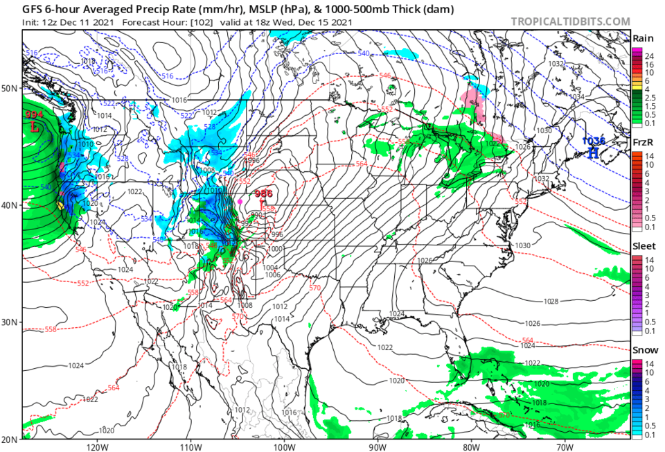
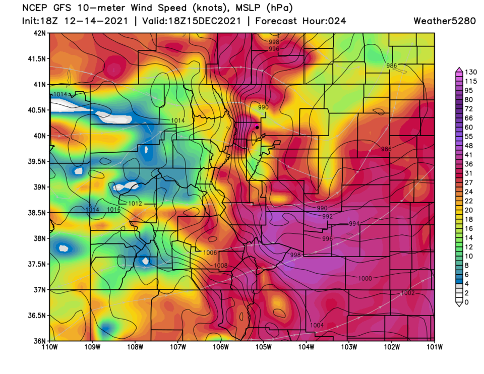
There is also, with the current drought conditions, a red flag fire warning as well. Please pray that NOTHING gets ignited in the mountains or on the Plains as this wind blasts the area. Figure 1 update shows the sustained wind average around noon Wednesday. Longmont and surrounding areas will see 30-50mph winds blow continually. Wow. There will be some snow in the morning hours in the mountains (Figure 2 update).
Please be safe out there. You should see lots of blowing dust and reduced visibilities.

End Tuesday update.
Monday Update:
As our first front arrives Wednesday, you can see that winds were expected to really pick up (Figure 1). Now the NWS has issued a High Wind Watch 48 hours in advance. Tie those Christmas decorations down!
High Wind Watch
Issued: 2:31 PM Dec. 13, 2021 – National Weather Service
...HIGH WIND WATCH REMAINS IN EFFECT FROM WEDNESDAY MORNING THROUGH
WEDNESDAY AFTERNOON...
* WHAT...West winds 30 to 40 mph with gusts over 60 mph on the
plains, and in the foothills 40 to 50 mph with gusts over 75 mph.
* WHERE...Portions of central, east central, north central, and
northeast Colorado.
* WHEN...From Wednesday morning through Wednesday afternoon.
* IMPACTS...Damaging winds could blow down trees and power lines.
Widespread power outages are possible. Travel could be difficult,
especially for high profile vehicles. Blowing dust will reduce
visibility to less than a quarter mile in places on the plains.
* ADDITIONAL DETAILS...Strong winds and low humidity will create
critical fire weather conditions on the plains.
PRECAUTIONARY/PREPAREDNESS ACTIONS...
Monitor the latest forecasts and warnings for updates.
Fasten loose objects or shelter objects in a safe location prior to
the onset of winds.
Winds this strong can make driving difficult, especially for high
profile vehicles. Use extra caution.
End Monday update.
Forecast Discussion:
The airport received 0.3 inch of snow Friday (tying the record set in the 1800's, they reported) the longest snow-less streak for Denver. A big ridge is back in the West (Figure 2) and we will experience temperatures well above normal again (Figure 1).
The Longer Range Forecast:
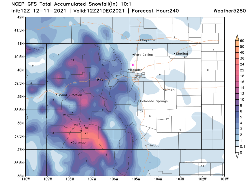
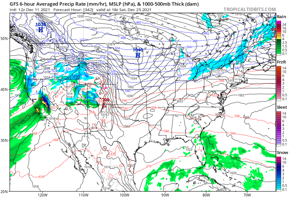
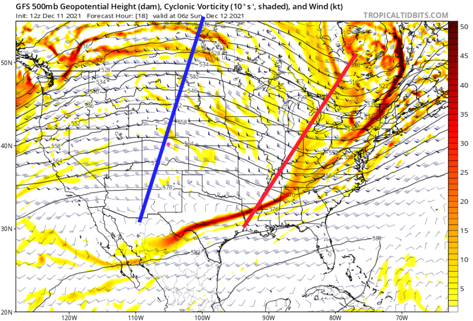
The next cold front arrives Wednesday dumping healthy snows for the mountains (Figure 3). Unfortunately, precipitation is unlikely east of the mountains (along I-25 and on the plains). With another front arriving Friday and a third on Sunday - this story is repeated each time with almost no precipitation making it over the mountains (Figure 4). That could change, but it looks like very dry conditions will remain.
Crystal Ball Christmas Glance:
It does not look like we'll see snow along I-25 by Christmas, but there is a hint that a storm will be effecting the state on Christmas morning (Figure 5). People in the mountain communities may have a winter wonderland outside!