
In Brief:
Above normal warmth until a couple of cold fronts hit this weekend brining in three to four days of rain.
Saturday update:
The forecast, below, is on track. The front is expected to sweep down across Denver before severe weather begins this afternoon. The Marginal Risk of severe weather is confined to areas southeast of Denver. The Saturday through Tuesday rainfall total forecasts are still quite different, model to model. The Weatherudnerground model has about 1.5 inches falling. The GFS is still over 2 to even 2.5 inches. The European is more around 1 inch. The Canadian model has dropped to more like 1.25 inches of rain. Garden-variety storms will move through this afternoon and showers will occur off and on through Sunday morning. The better, and more continuous, rain begins Sunday afternoon after 2pm.
End Saturday update.
Friday update:
Moisture is increasing and the trough/ cut-off low is approaching Colorado. This means that thunderstorm chances are increasing. There is a chance of normal thunderstorm activity along I-25 today (Figure 1) and Saturday (Figure 2). Just to the east of the major cities there IS a Marginal Risk of severe weather for mainly large hail and damaging straight line winds. I would not be surprised if areas around Denver to Ft. Collins get included in the Marginal Risk zone on Saturday. I'll update here if it does.
After thunderstorms come and go Saturday - a more steady rain will set in overnight with better chances for steady rain arriving midday Sunday and extending on through Tuesday. The GFS (not shown) gives us almost 2 inches of rain (but it has been over predicting rain on the last 3 storms). The Canadian model, though, also gives us about 2 inches of water over this period of time from Saturday through Tuesday afternoon. Weatherunderground's model gives us 1.25" of rain (it has been quite accurate with these cut-off-low based storms). We'll watch that here too!
My grass is already growing rapidly and is very green. Great news for the region!
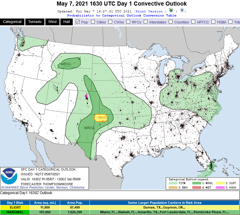 Figure 1 update: the Storm Prediction Center Day 1 (Friday) convection and severe weather forecast.
 Figure 2 update: the Storm Prediction Center Day 2 (Saturday) convection and severe weather forecast.
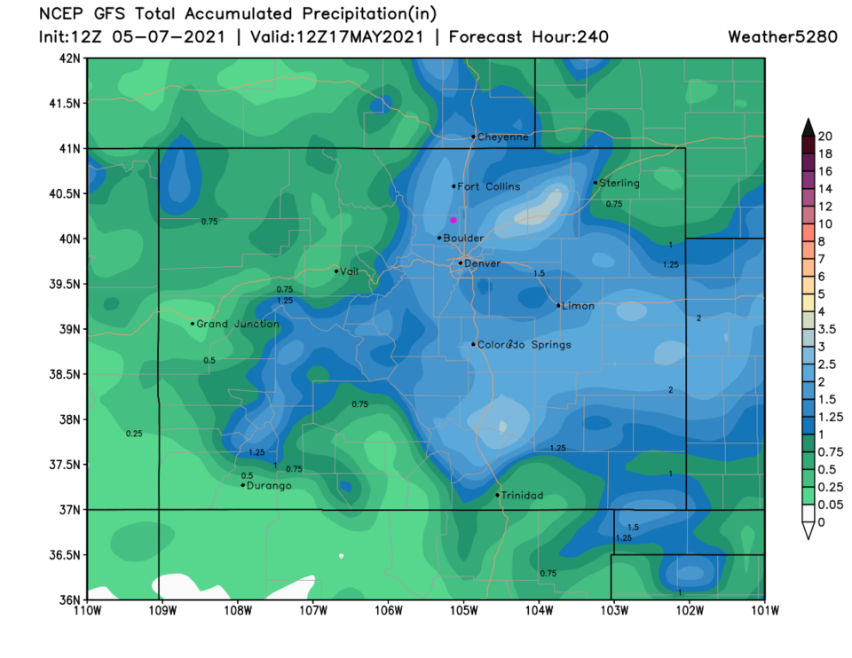 Figure 3 update: the 10 day precipitation total from the GFS and weather5280.com
End Friday update.
The Forecast Discussion:
In the short term, the western U.S. ridge moves in making temperatures soar back to the 70s then the 80s (Figure 1). A couple of cold fronts hit Friday evening, then again Saturday late morning. That story belongs to the Longer-Range Forecast below...
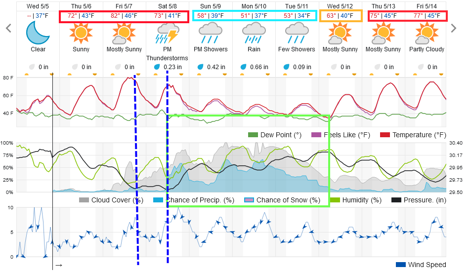 Figure 1: the 10 day graphical forecast from weatherunderground.com for Longmont, CO.
The Longer-Range Forecast:
Figure 1 shows thunderstorms ushering in the wet weather the way they have the last couple of times.
Note: the storm before last arrived on a Monday. The last storm arrived on a Sunday and this one moves on with storms on Saturday.
The fronts are kicked down by a cutoff low moving in from the west Friday or Saturday (Figure 2). Then the trough digs to our west and keeps the moisture and lift in place for another long-term rain (Figure 3).
We will have to handle this with updates as the weekend approaches, but the weatherunderground.com model (Figure 1) cools us to the 50s in the day and 30s at night. It keeps the precipitation as rain and gives us just under 1.5 inches of liquid (Figure 1). (My backyard received about 0.88 inch of rain last time.)
The GFS is colder, at present, and gives Longmont 10-12 inches of snow (Figure 4) and 2.5 inches of rainfall (Figure 5). It has overestimated precipitation in our recent storms while weatherunderground has been more accurate. Stay tuned to see how things trend!
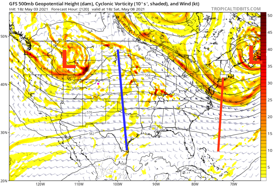 Figure 2: the 500mb upper air forecast map for Saturday noon from the GFS and tropicaltidbits.com
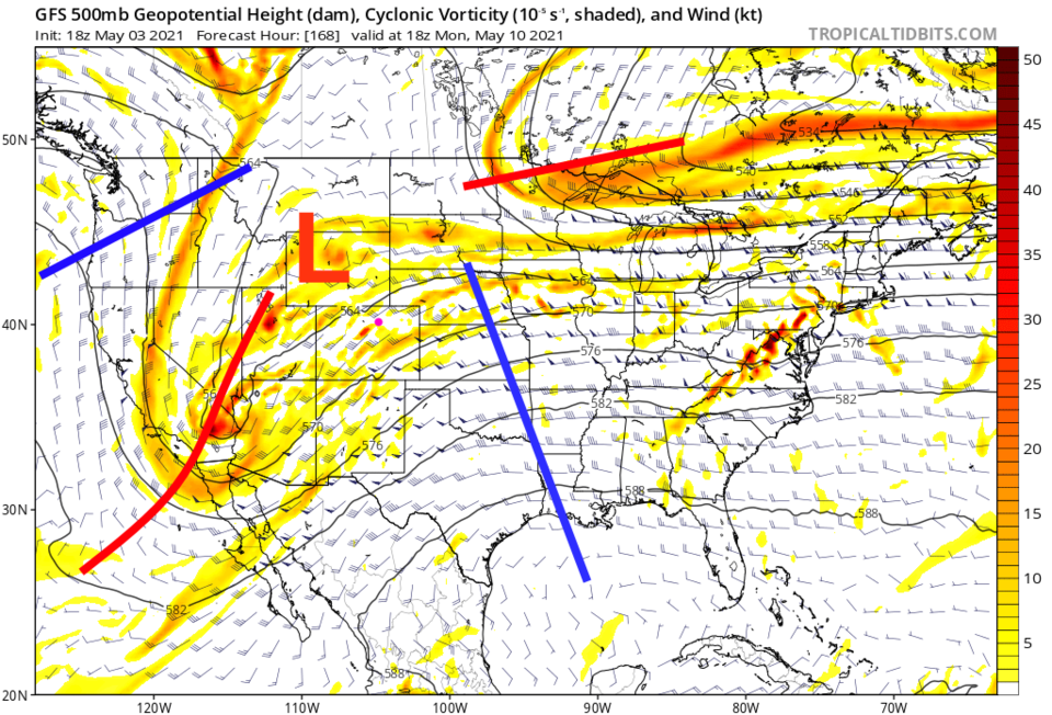 Figure 3: the 500mb upper air forecast map for Monday noon from the GFS and tropicaltidbits.com
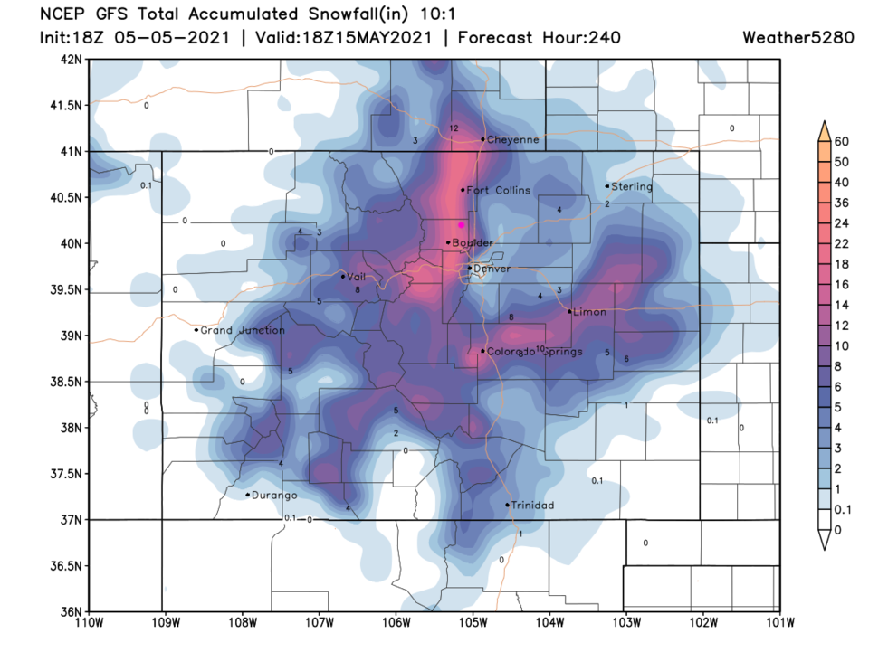 Figure 4: the 10 day (10:1 ratio) total snowfall forecast from the GFS and weather5280.com
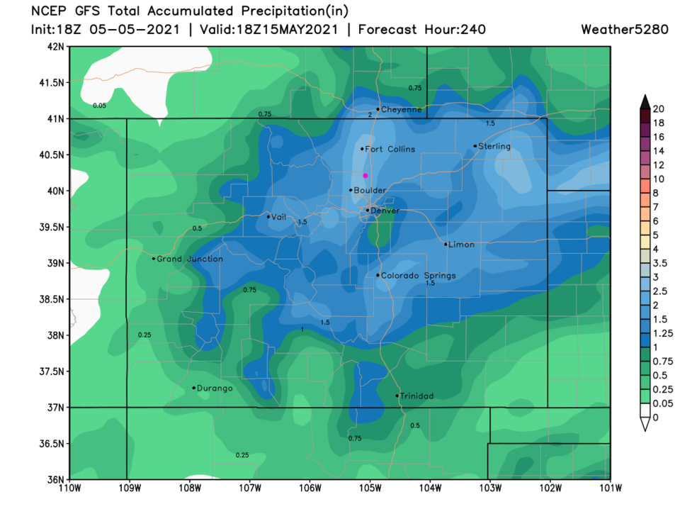 Figure 5: the 10 day precipitation total from the GFS and weather5280.com


