
The weekly forecast discussion video
In brief:
Abnormally/record warm weather changes to cool and damp weather, with a windy weekend in between.
Saturday 11/7 4pm update:
The front arrives tonight around 2am (Sunday) with some showers and snow mixed in. Temperatures cool from here forward through the week. Snowfall looks significant for the mountains over the next 10 days (Figure 1 udpate) but snowfall along I-25 and rainfall will remain light at these lower elevations due to the drying effect of down slope flow.
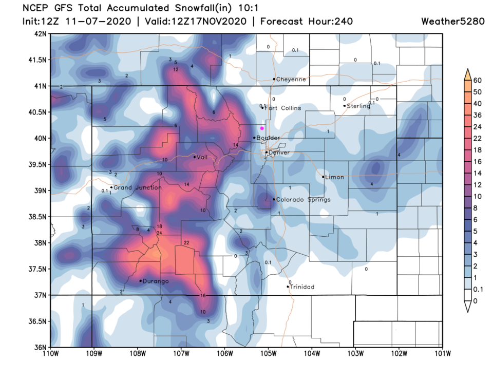 Figure 1 update: the GFS 10 day snowfall forecast map for Colorado from weather5280.com
End 11/7 4pm update.
Forecast discussion:
We still have a couple of warm dry days ahead as a giant ridge begins to move off to the east bringing warm southwest airflow over the state (Figure 1 below).
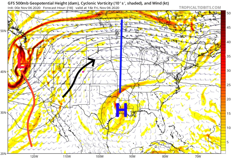 Figure 1: the 500mb upper air forecast map for Friday noon from the GFS and tropicaltidbits.com
There is not much fire activity in the west currently (hurray) so we are nearly smoke-free except for maybe some low-level drainage smoke from smoldering local fires not picked up by the model (Figure 2).
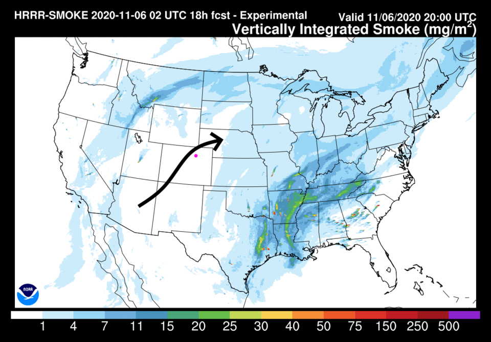 Figure 2: the HRRR smoke at all levels forecast map for Friday afternoon from NOAA.
For Friday and Saturday, we enjoy mid-70s for highs and some clouds now and then (Figure 3).
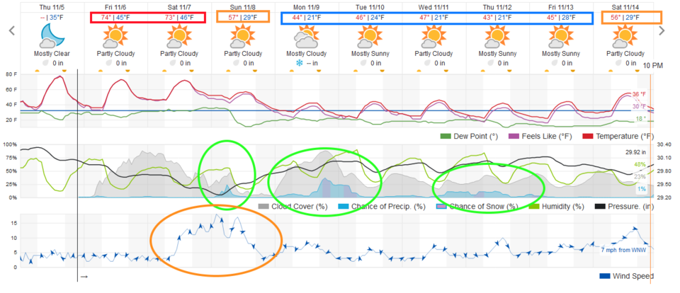 Figure 3: the 10 day graphical forecast from weather5280.com for Longmont, CO.
The longer-range forecast:
As the trough in the west approaches, cold fronts begin to invade beginning late night Saturday/Sunday morning. Winds really pick up from the south (orange circle in Figure 3). The next trough is very large but somewhat disorganized. We'll see the influence of lobes of lower heights now and then kicking off slightly better chances of showers along Interstate 25 (Figure 4) and green circles in Figure 3.
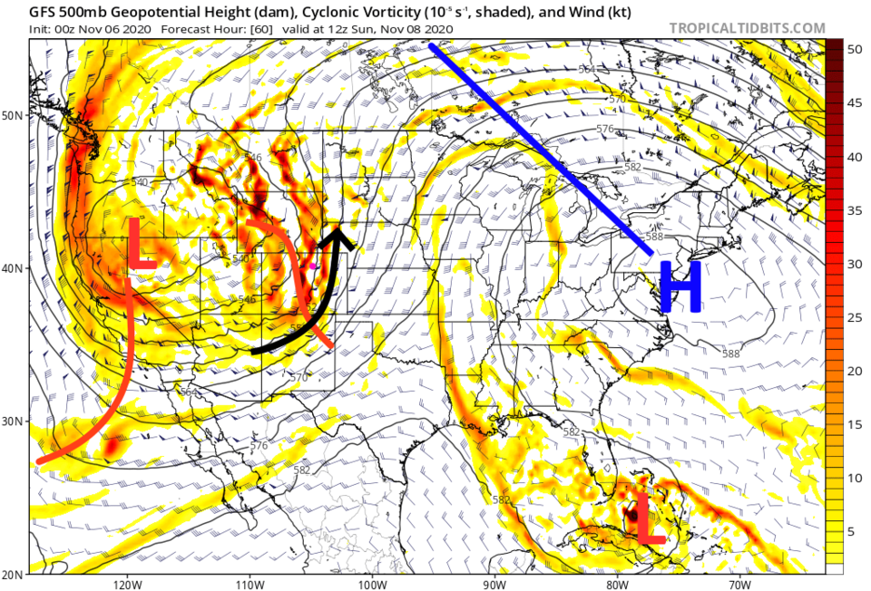 Figure 4: the 500mb upper air forecast map for Sunday AM from the GFS and tropicaltidbits.com
The best precipitation coverage in the state forms Sunday morning, but it is mainly over the Western Slope and higher mountains (Figure 5). Areas east of the Rockies will see warming/dry downslope winds.
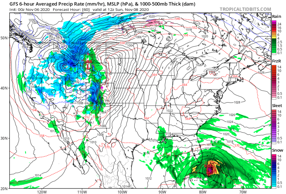 Figure 5: the 6 hour averaged precipitation around Sunday morning from the GFS and tropicaltidbits.com
The precipitation totals reflect that this will mainly be a winter storm for the mountains over the next 10 days with widespread 2-foot and greater snow totals (Figure 6). The southwest mountains of Colorado might see 4 to 6 inches of water from this storm — that is very impressive if it happens (Figure 7).
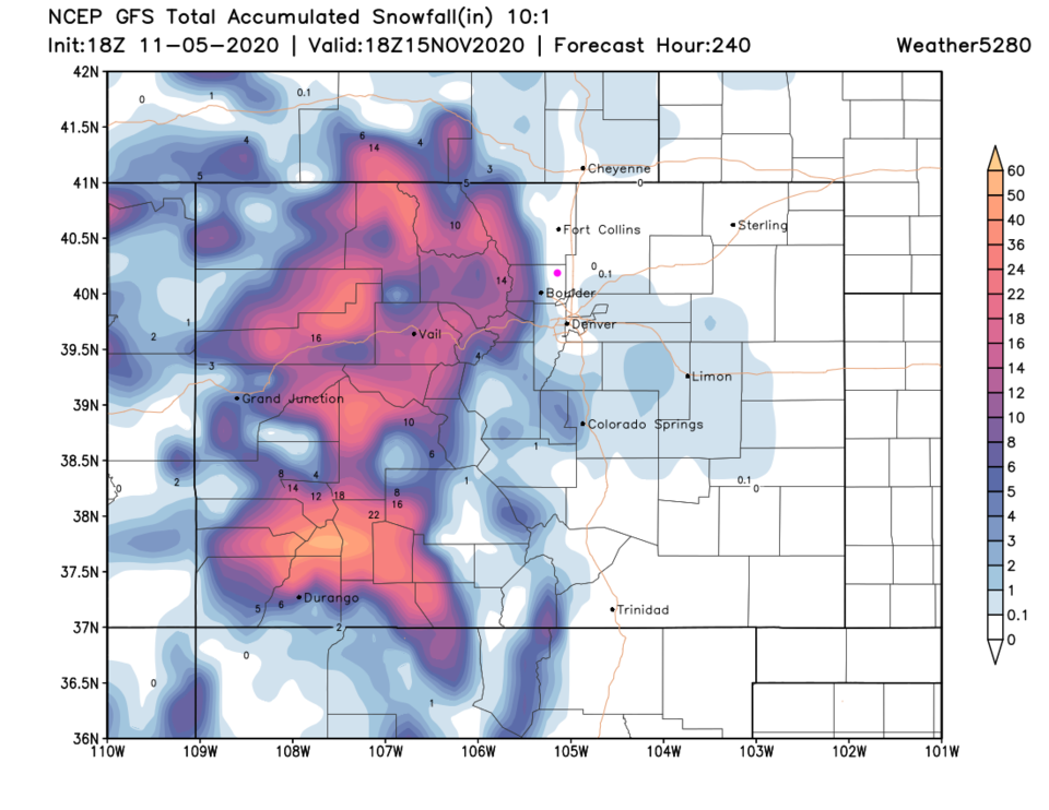 Figure 6: the 10-day 10-to-1 ratio snowfall total from the GFS and weather5280.com
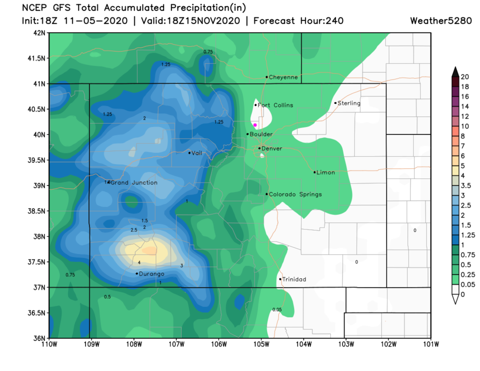 Figure 7: the 10-day precipitation total from the GFS and weather5280.com
Tropical check-in:
Tropical Depression Eta is expected to strengthen to a tropical storm and wander around Florida into next week (Figure 8). We'll need to watch this next week to see how it strengthens and where it finally will make landfall in the U.S.
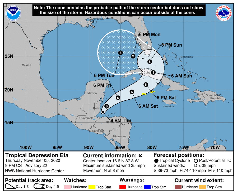 Figure 8: the 5 day forecast from the NHC probability cone for Eta.


