The Weekly Weather Video
In brief:
The down slope northwest flow keeps Longmont warm until the trough widens making the week colder and colder, with snow!
Thursday night update:
The arctic front begins to overtake the entire state Thursday night. Some snow chances begin immediately. A strong snow signal is showing up in the models beginning Saturday night into Sunday. More snow arrives Tuesday into Wednesday. Remarkably low temperatures are expected through the period. Bundle up! More on exact snow totals Friday!
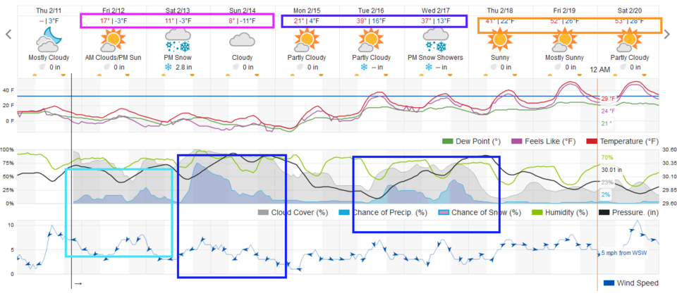 Figure 3 update: the 10 day graphical forecast from wunderground.com
End Thursday night update.
Tuesday night update:
We are still looking at a powerful cold front Thursday evening. Temperatures drop from a cold mid-30s high to the teens by the weekend (Figure 1 update). There is an extended period of light and moderate, snow from Thursday evening to Thursday next week (with maybe a break on Monday). The weatherunderground model doesn't give a significant amount of snow, but the GFS (Figure 2 update) gives a prediction of four to six inches with many mountain locations receiving two to three feet of snow. More on this later! Get ready for serious cold weather for Valentine's Day weekend.
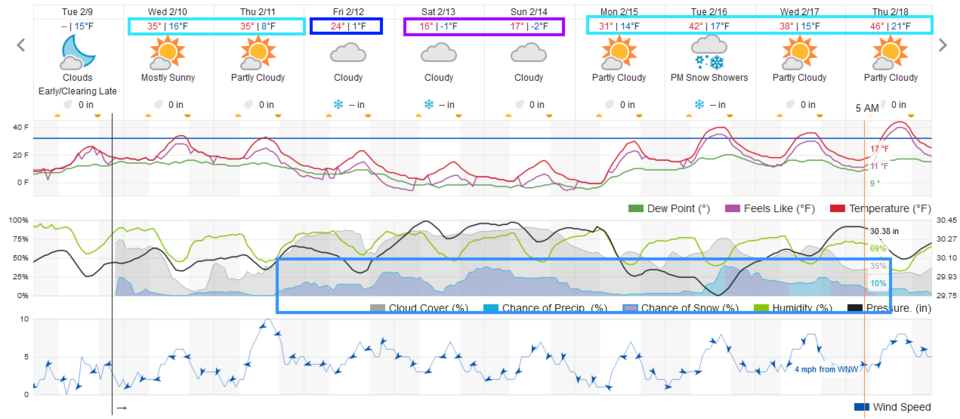 Figure 1 update: the 10 day graphical forecast for Longmont from weatherunderground.com
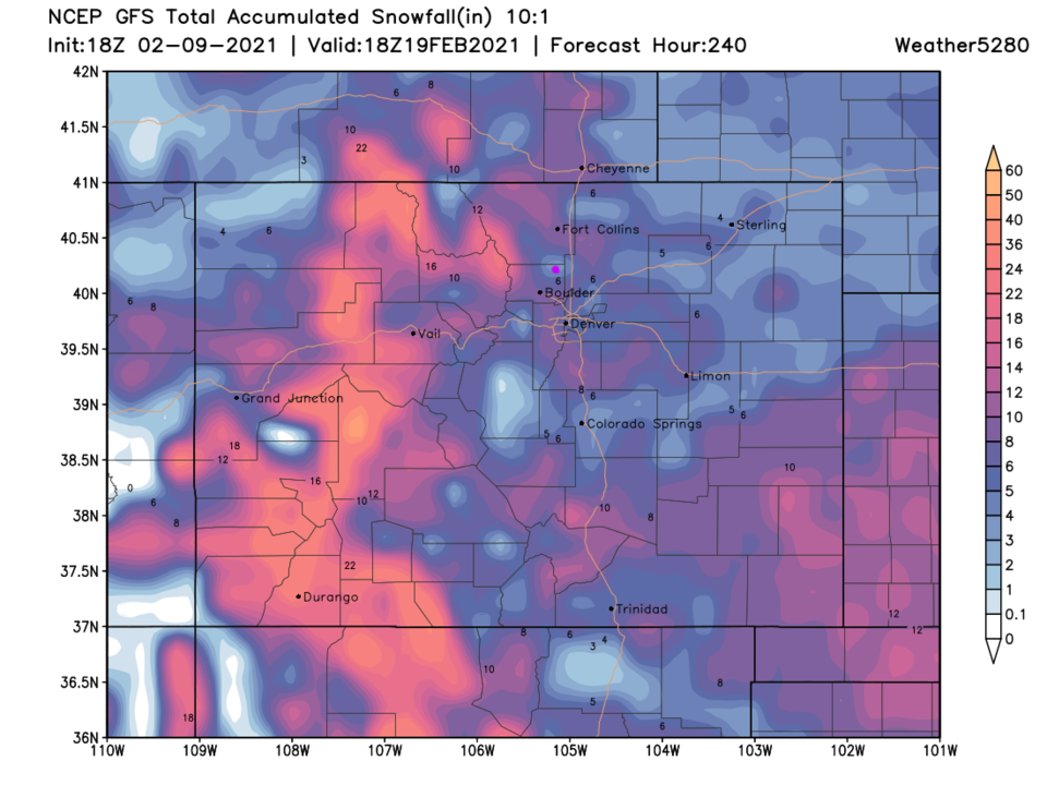 Figure 2 update: the 10 day 10:1 snowfall forecast from the GFS and weather5280.com
Forecast discussion:
Let us start with the big picture. The 10-day graphical forecast shows us enjoying warm (for February) weather through Monday. Things chill a bit Tuesday/Wednesday, then we crater into really cold temperatures with daily snow chances for a while (Figure 1 below). For this weekend, the front is draped right through northeast Colorado (Figure 2). The snow is remaining far to the northeast of Colorado. The cold air that might have chilled us (from the forecast earlier in the week) is maybe 20 to 40 miles east of Longmont. You could drive out east for less than an hour and feel really cold temperatures (if you wanted to — Figure 3). As I type, it is 42 degrees in Denver and 22 degrees in Cheyenne.
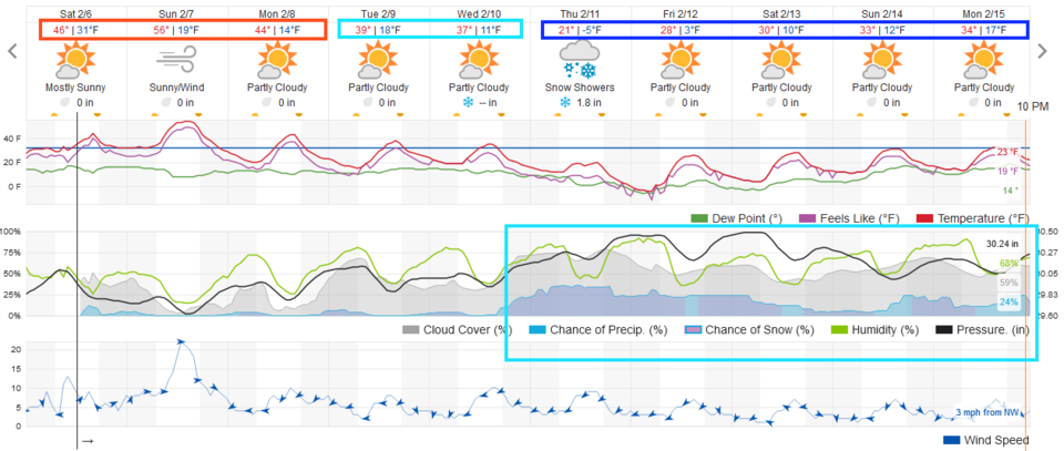 Figure 1: The 10-day graphical forecast from weatherunderground.com for Longmont.
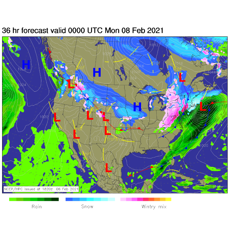 Figure 2: The forecast surface analysis for Sunday PM from NCEP.
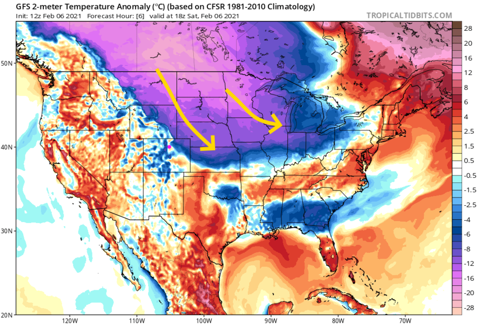 Figure 3: The temperature anomaly (departure from normal) for Saturday noon from tropicaltidbits.com
The longer-range Forecast:
We have northwest flow aloft through early week, then the trough in the eastern U.S. will broaden and expand to the west. Short wave troughs will begin to roll down into the larger trough (Figure 4) kicking off periods of snow. The most notable event hits Thursday with a large region of upslope flow and snow (Figure 5). This wider trough really pours abnormally cold air into most of the nation by the end of the week (Figure 6). Brrrrr!
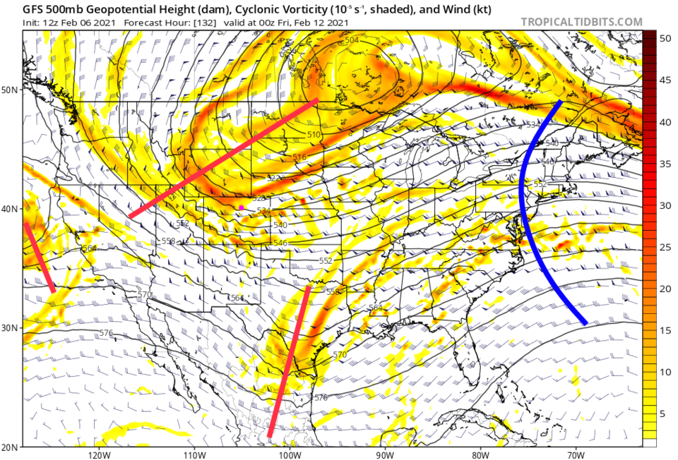 Figure 4: The 500mb upper air forecast map for Thursday PM from the GFS and tropicaltidbits.com
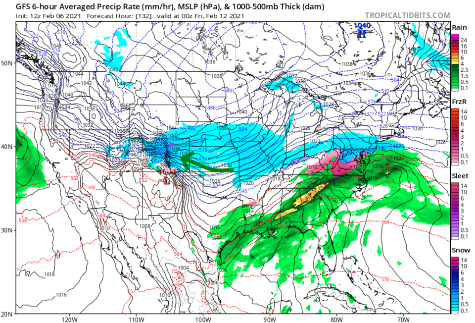 Figure 5: The six-hour averaged precipitation around Thursday evening/sunset from the GFS and tropicaltidbits.com
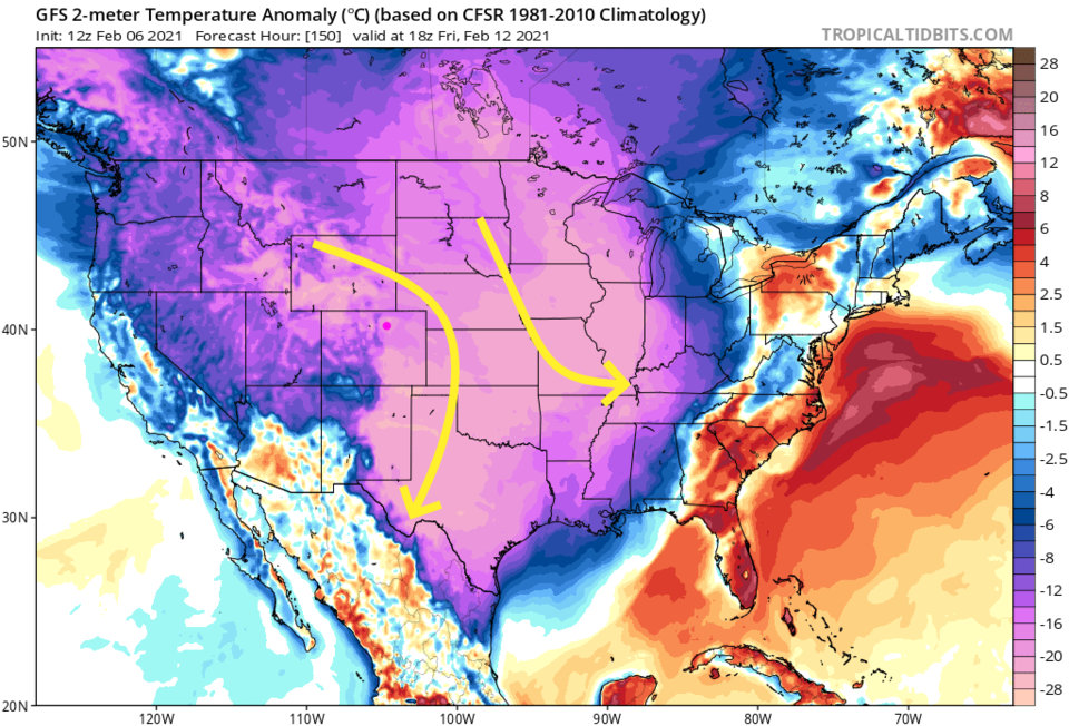 Figure 6: The temperature anomaly (departure from normal) for Friday noon from tropicaltidbits.com


