The video forecast for this week.
In Brief:
Incredibly nice, warm, dry weather settles in for most of the next ten days. Spring!
Friday PM update:
The incredible warm weather continues through Monday. There are hints of showers Tuesday.
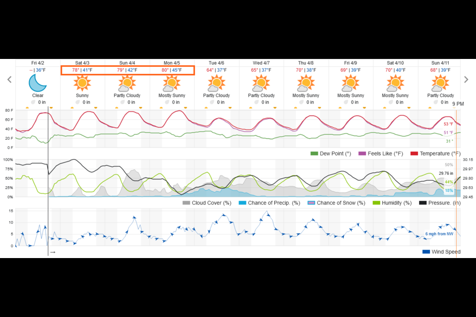
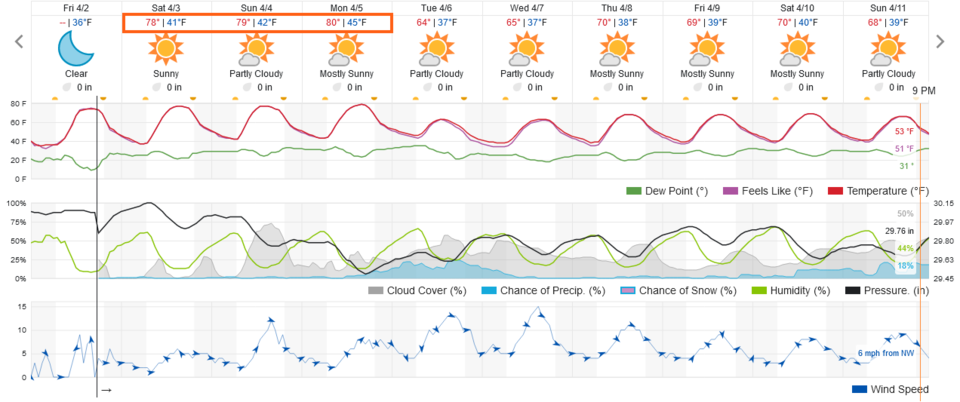 Figure 1 update: the 10 day graphical forecast from weatherunderground.com for Longmont, CO.
End Friday PM update.
Forecast Discussion:
High pressure is here! (Figure 1). Each day, temperatures rise to record and above record levels (Figure 2) with very little chance of precipitation. Figure 3 shows the big ridge over the area by the end of the week. There is some concern of fire danger as these "hot" dry conditions persist for the next week and beyond. But it will feel great!
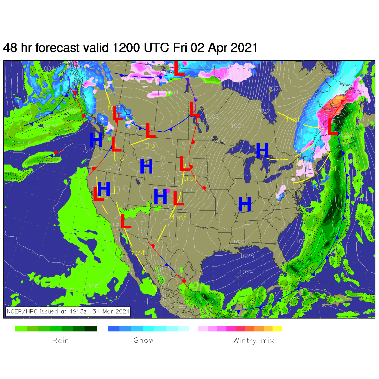 Figure 1: the surface forecast analysis for Friday AM from NCEP.
 Figure 2: the 10 day graphical forecast from weatherunderground.com for Longmont, CO.
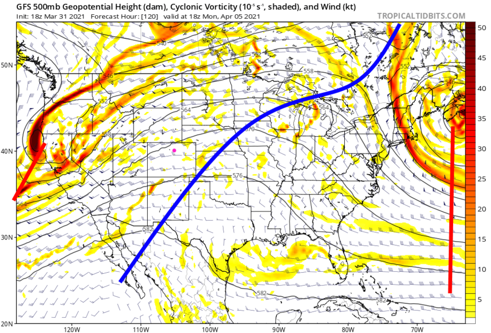 Figure 3: the 500mb upper air forecast map for Monday noon from the GFS and tropicaltidbits.com
The Longer-Range Forecast:
We could set an all-time Easter high-temperature record and do the same on Monday (Figure 4) with temperatures over 20 degrees above normal. We should expect nearly nothing in the way of snow (Figure 5) or rain (Figure 6). Get out and enjoy this beautifulness.
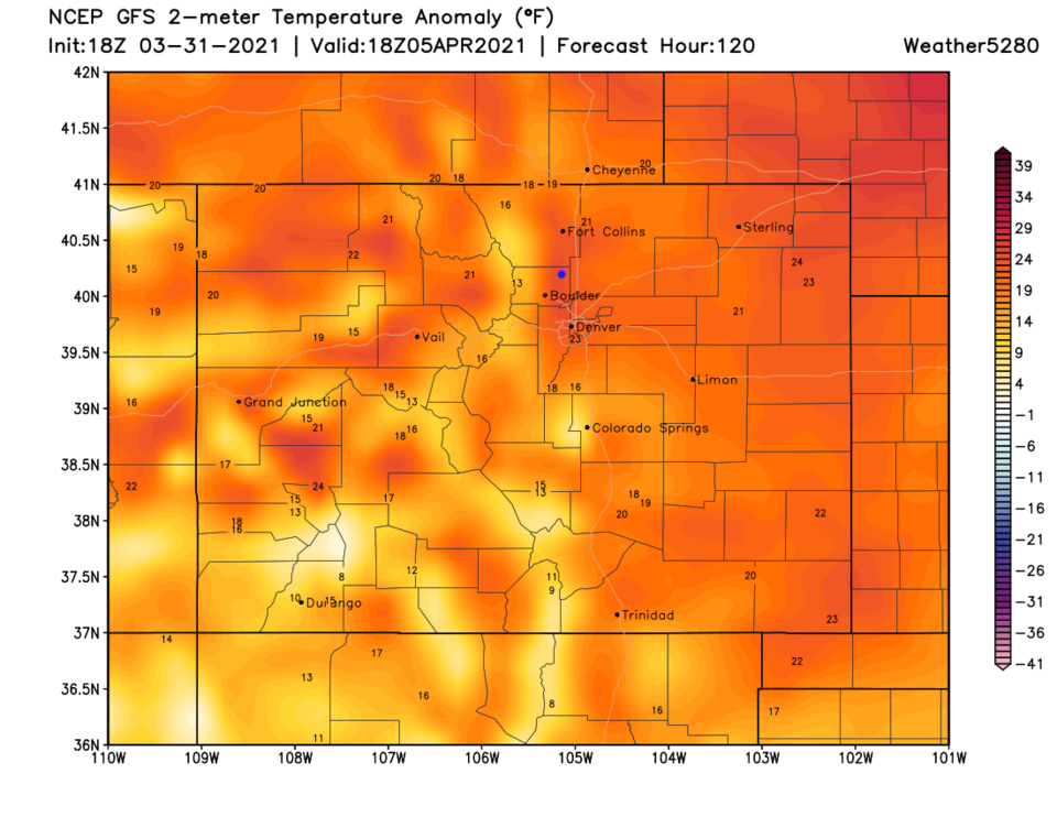 Figure 4: the temperature anomaly (departure from normal) for Monday noon from tropicaltidbits.com
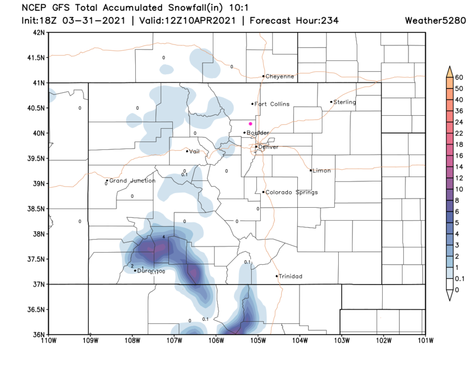 Figure 5: the 10 day (10:1 ratio) total snowfall forecast from the GFS and weather5280.com
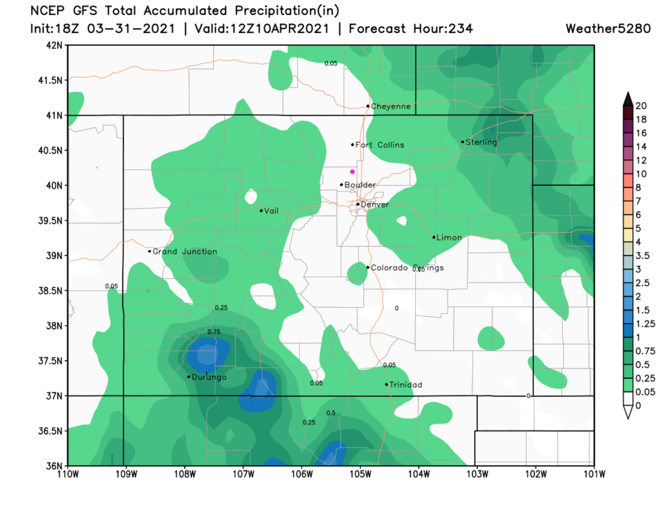 Figure 6: the 10 day total precipitation forecast from the GFS and weather5280.com


