
In Brief:
Remarkable warmth gets cut down to normal cold December weather at the end of the week with snow returning.
Update 12/10 10pm:
We have periods of snow Thursday Night to Friday morning and afternoon, then again Saturday afternoon and night, then again Monday night. In all, the GFS gives us 4-6 inches of snow (too high I think- Figure 1 update). The forecasters at the excellent site weather5280.com give us 1-4 inches of snow (which I think is more reasonable - Figure 2 update). Be careful on your morning commute!
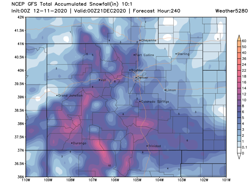 Figure 1 update: the 10 day precipitation total from the GFS and weather5280.com
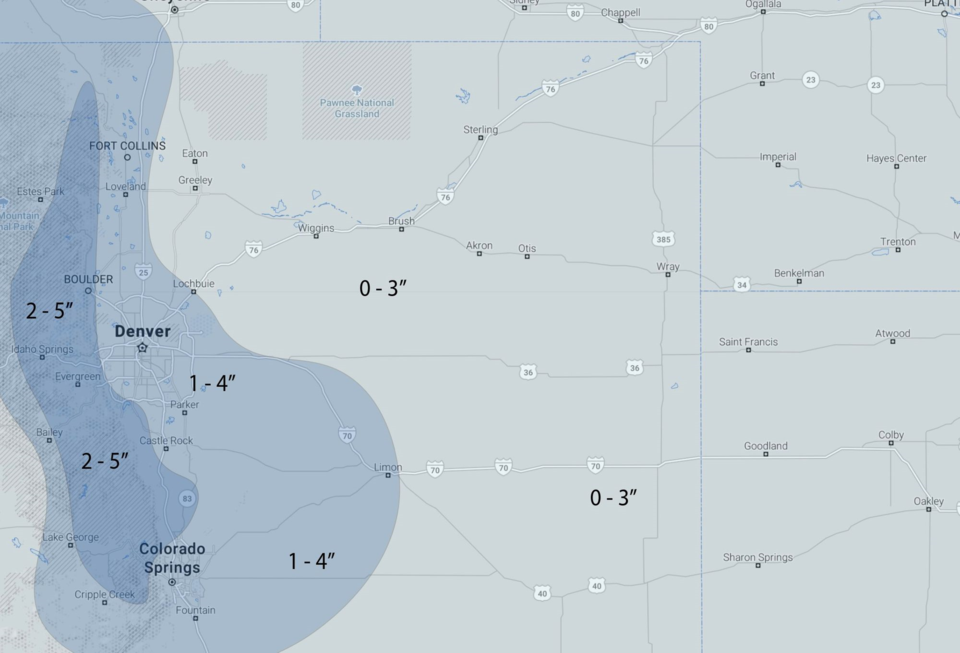 Figure 2 update: the weather5280 forecasters snowfall prediction for this storm.
End update 12/10 10pm.
Forecast Discussion:
A cut-off low that has sunk into southern California is picking up a bit of tropical moisture before it comes our way (Figure 1 below).
 Figure 1: the 500mb upper air forecast map for Monday noon from the GFS and tropicaltidbits.com
You can see the low and the moisture (gray/white coloration to the east of that low) in Figure 2.
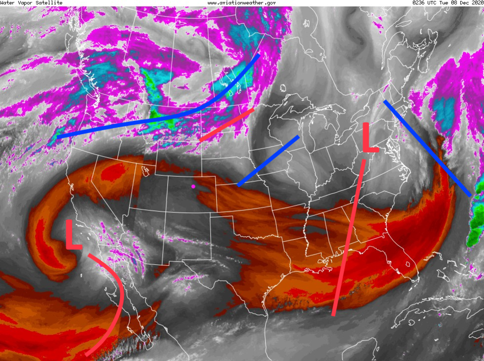 Figure 2: the water vapor satellite image from NOAA from Friday PM. White/purple is moist air, red/brown is very dry air.
 We enjoy amazing 60 degree highs through Wednesday. The cold front arrives later in the afternoon Wednesday and temperatures begin to settle to values closer to normal this time of year (Figure 3).
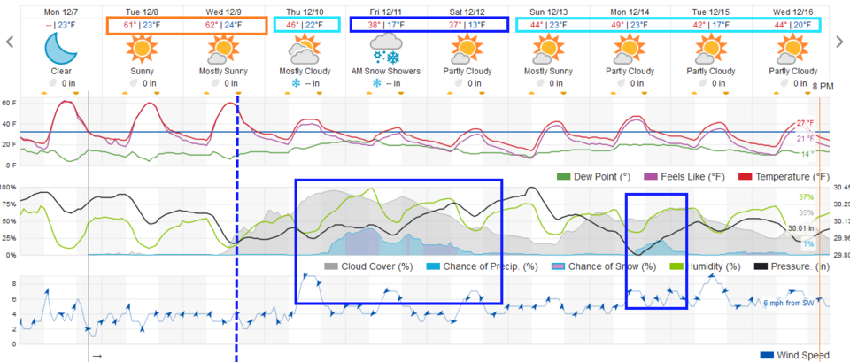 Figure 3: the 10 day graphical forecast from weather5280.com for Longmont, CO.
The Longer Range Forecast:
That low arrives Thursday pulling cool air down and pushing some moisture up slope into Colorado (Figure 4). You can see clouds (gray shading) increase soon after frontal passage Wednesday but the snow will hold off for about a day (Figure 3).
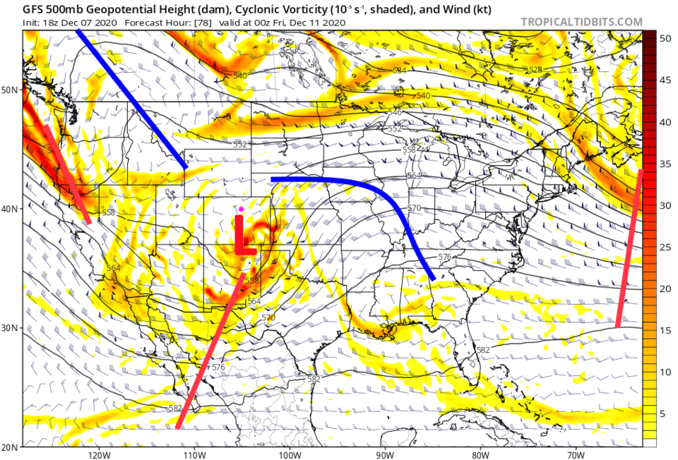 Figure 4: the 500mb upper air forecast map for Thursday night from the GFS and tropicaltidbits.com
The GFS only gives Longmont about 1-2 inches of snow (Figure 5) and under a quarter inch of liquid over the next 10 days (Figure 6). The mountains see up to a foot of snow, or a bit more, over large regions.
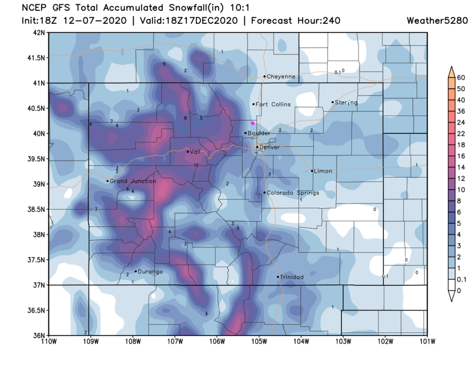 Figure 5: the 10:1 snowfall forecast total from the GFS and weather5280.com
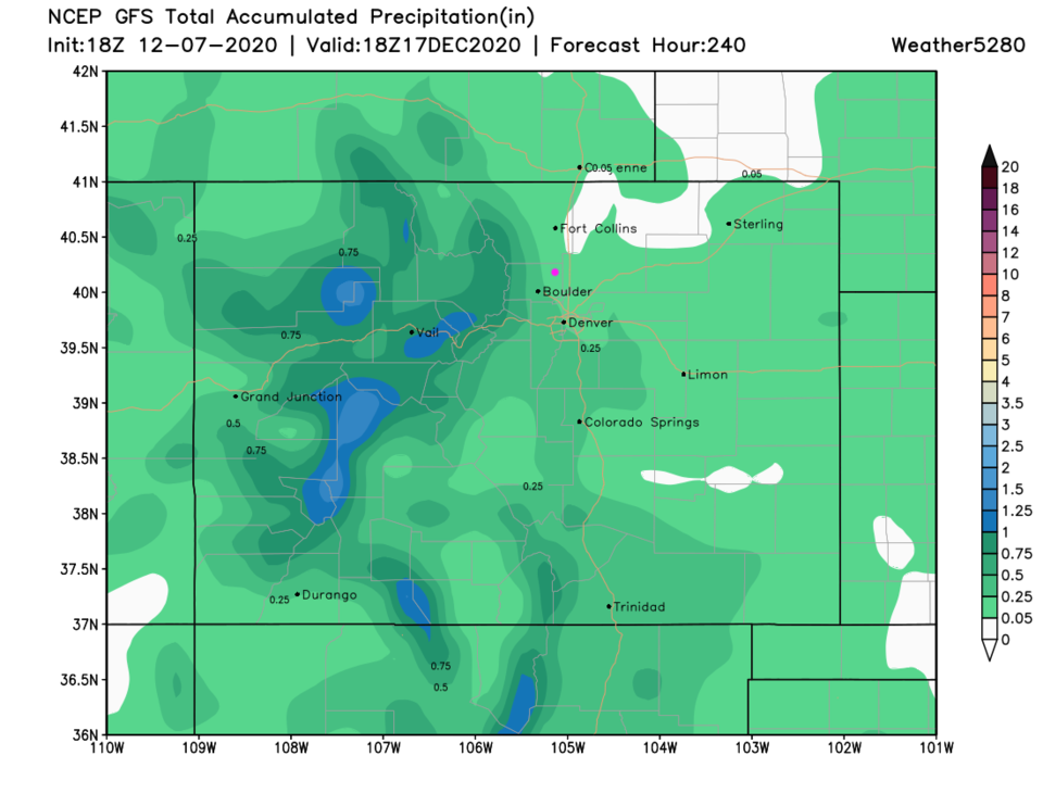 Figure 6: the 10 day precipitation total from the GFS and weather5280.com


