In brief:
We make it into the weekend warm and dry with a change to cold and wet weather coming Sunday into next week.
Forecast discussion:
There is a lot of frontal and low pressure action gathering off the west coast of Canada and the Pacific Northwest. This is an early sign of things to come. We sit high and dry under high pressure (with, thankfully, little wind — see Figure 1 below).
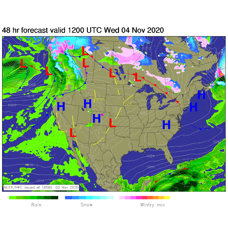 Figure 1: the forecast surface analysis for Wednesday noon from NCEP.
Other than a little ripple passing on Wednesday, the flow over the U.S. is nearly straight west to east (also called zonal flow — Figure 2).
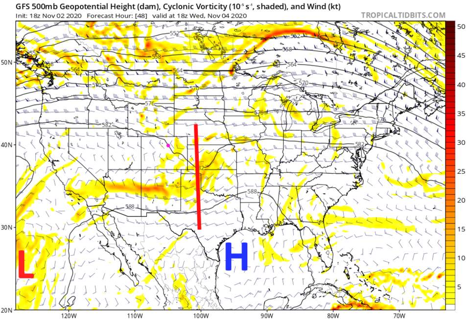 Figure 2: the 500mb upper air forecast map for Wednesday noon from the GFS and tropicaltidbits.com
We'll see above-normal temperatures until a cold front arrives Saturday afternoon. That front will bring in a half-day of gusty winds (Figure 3).
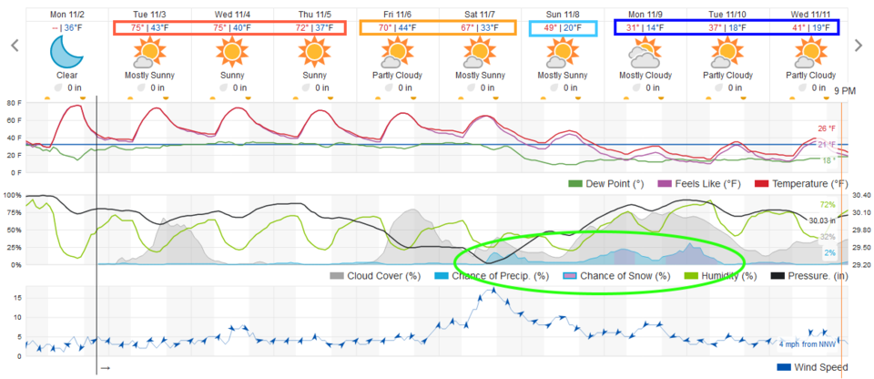 Figure 3: the 10 day graphical forecast from weather5280.com for Longmont, CO.
The Longer Range Forecast:
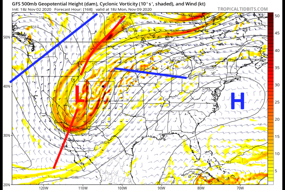
What is arriving this weekend is a deep, closed, low sliding in over the Four Corners area. This will bring in cold air and create upslope flow over the state (Figure 4).
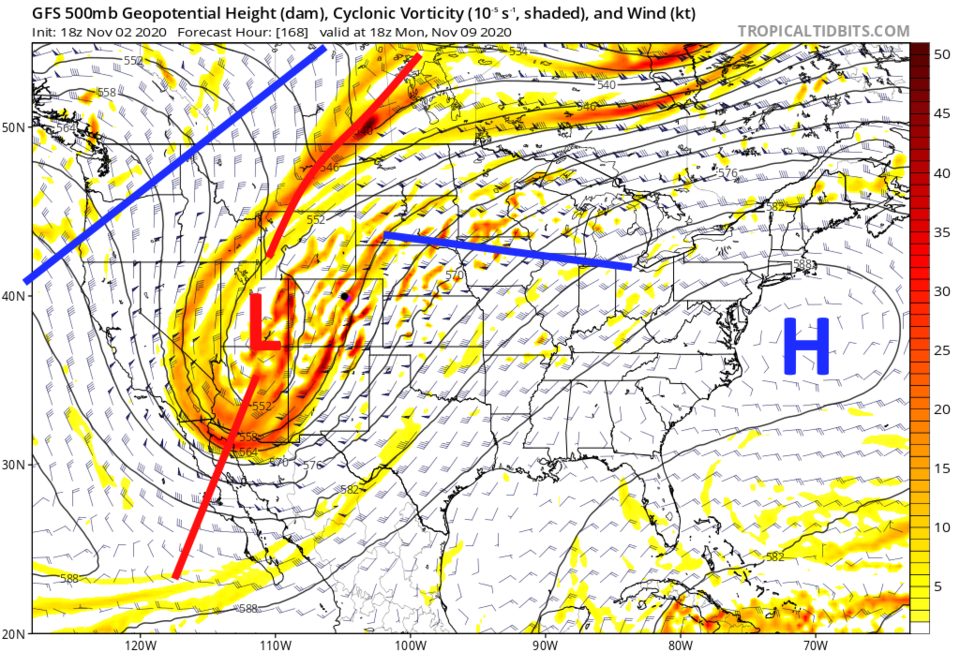 Figure 4: the 500mb upper air forecast map for Monday noon from the GFS and tropicaltidbits.com
It is still a long way out, so don't trust the model precipitation totals much. The GFS seems to think temperatures will be an issue with lower elevations not getting much snow while the higher elevations pick up 1 to 1.5 feet (Figure 5).
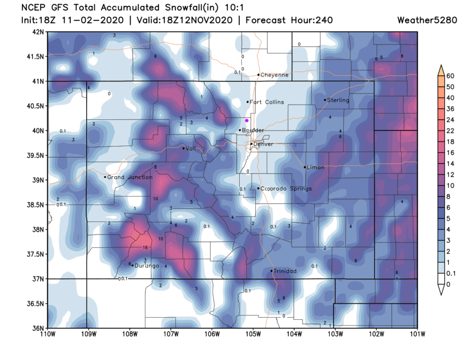 Figure 5: the forecast total snowfall through the next 10 days (10:1 ratio) from the GFS and tropicaltidbits.com
 As rainfall goes, it looks pretty light at this time. Longmont only gets 0.05 to 0.25 an inch of water if this is correct (Figure 6). The mountains get a better wetting — and they need it. More later.
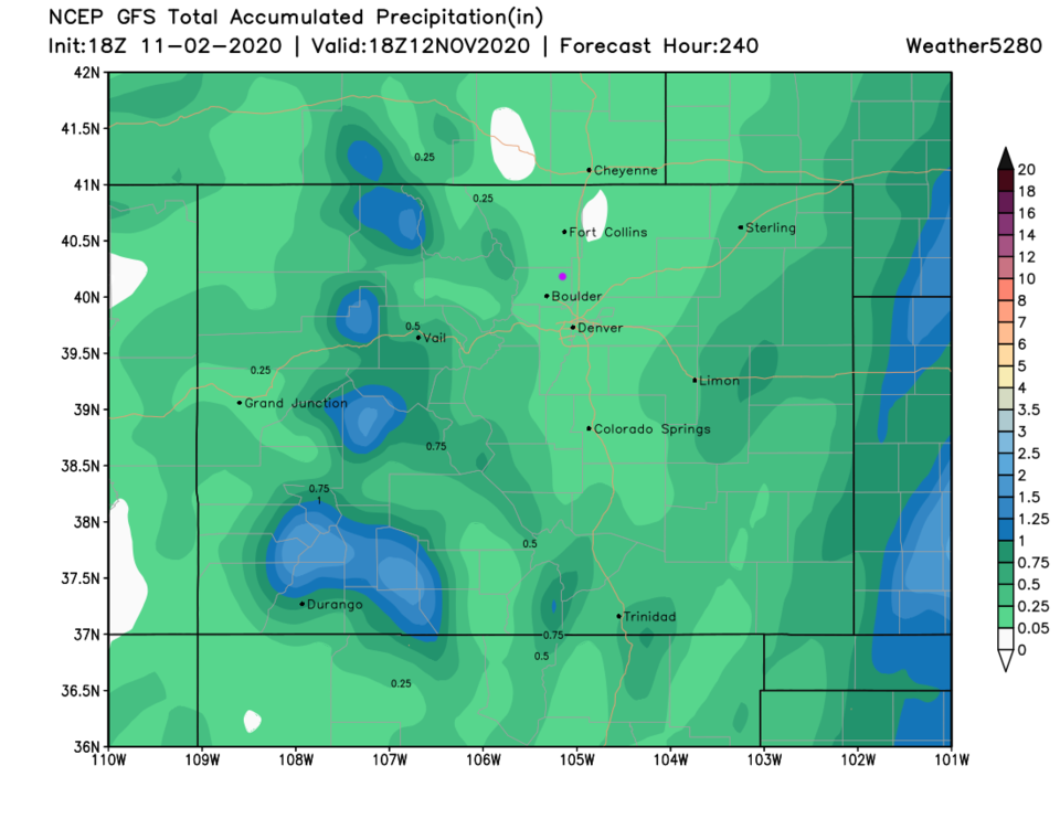 Figure 6: the 10 day precipitation total from the GFS and weather5280.com


