In Brief:
Other than a weekend chilly cold front, we warm to nearly 70 degrees next week before big storms return.
Forecast discussion:
At the end of the week, a weak ridge will pass giving us a warm end of the week (Figure 1 below).
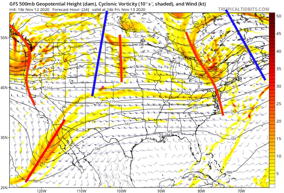 Figure 1: the 500mb upper air forecast map for Friday noon from the GFS and tropicaltidbits.com
On Saturday, a fast moving trough will blast a dry cold front across the state. We cool almost 15 degrees for the start of the weekend (Figure 2).
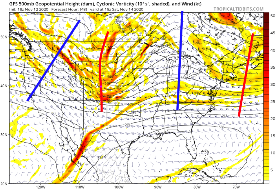 Figure 2: the 500mb upper air forecast map for Saturday noon from the GFS and tropicaltidbits.com
Winds will be stiff for about 12 to 18 hours as temperatures remain flat Saturday. We begin another warm-up on Sunday (Figure 3).
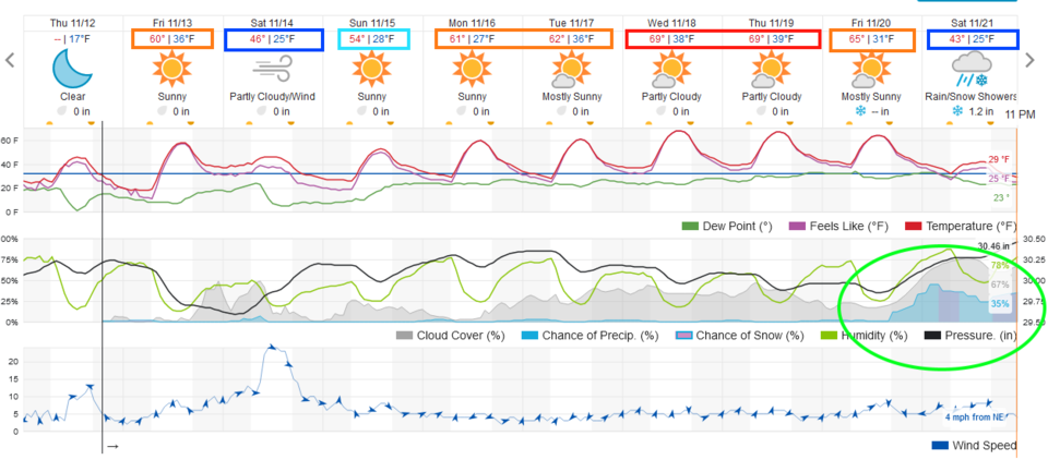 Figure 3: the 10 day graphical forecast from weather5280.com for Longmont, CO.
The Longer Range Forecast:
Over the next five days we'll still see the westerly moisture flow give the mountains fire-quenching snow and healthy snow/moisture. The low lands miss out (Figure 4).
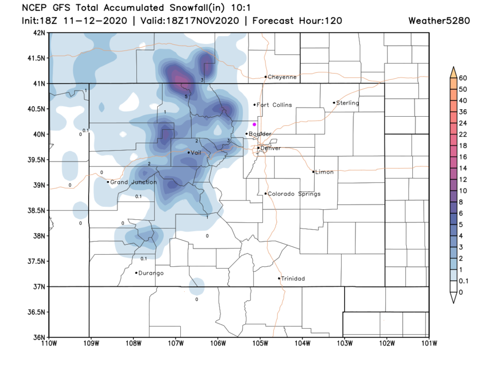 Figure 4: the forecast total snowfall through the next 5 days noon (10:1 ratio) from the GFS and tropicaltidbits.com
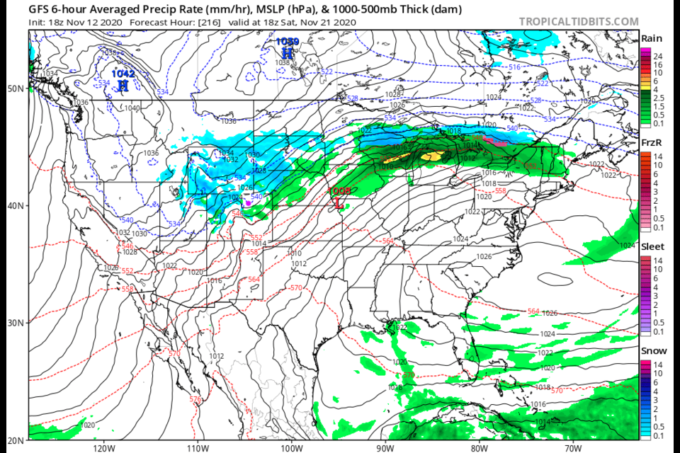
 On Saturday Nov. 21,, there are signs of our next storm shaping up (but that is a long way out). The surface precipitation map shows snow and rain across the state that day (Figure 5).
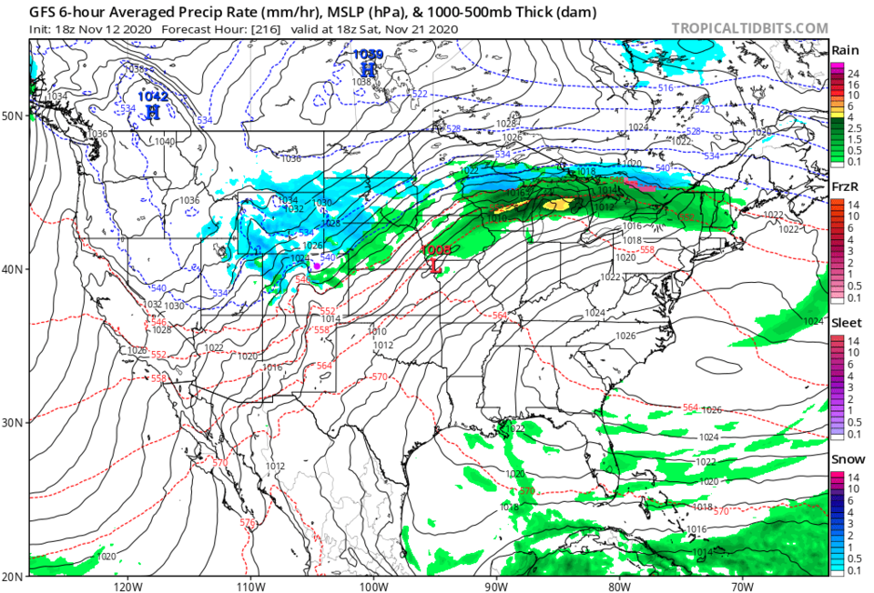 Figure 5: the 6 hour averaged precipitation around Saturday Nov 21 noon from the GFS and tropicaltidbits.com
Over the next 10 days, good mountain snows should pile up, but only a small bit of snow along I-25 (Figure 6). We may see about a quarter inch of water over the next 10 days (Figure 7).
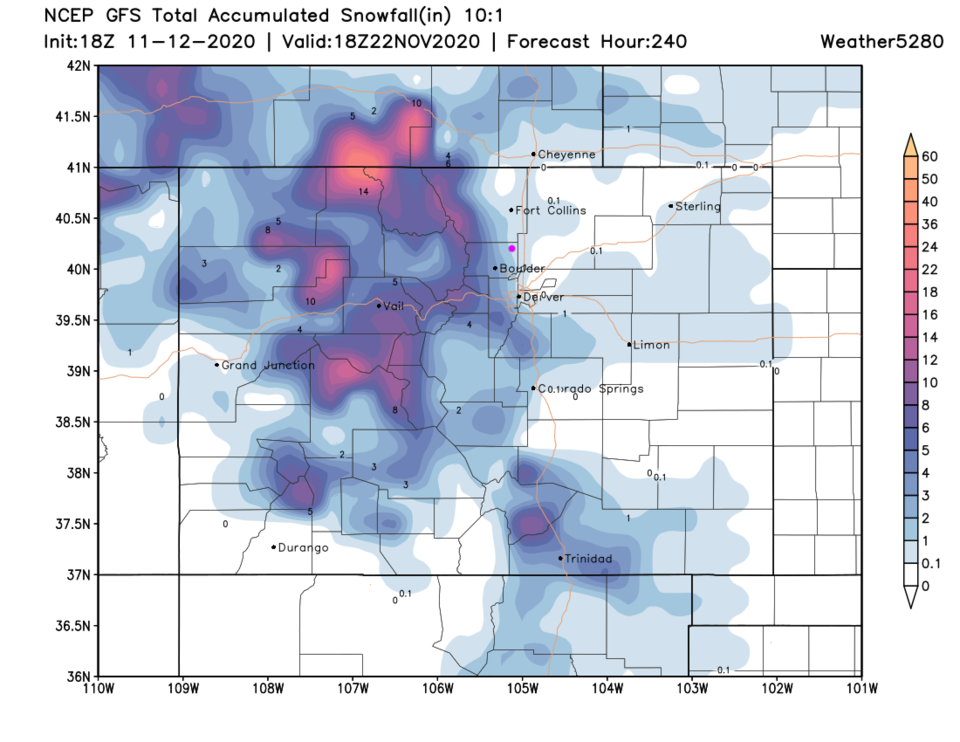 Figure 6: the forecast total snowfall through the next 10 days (10:1 ratio) from the GFS and tropicaltidbits.com
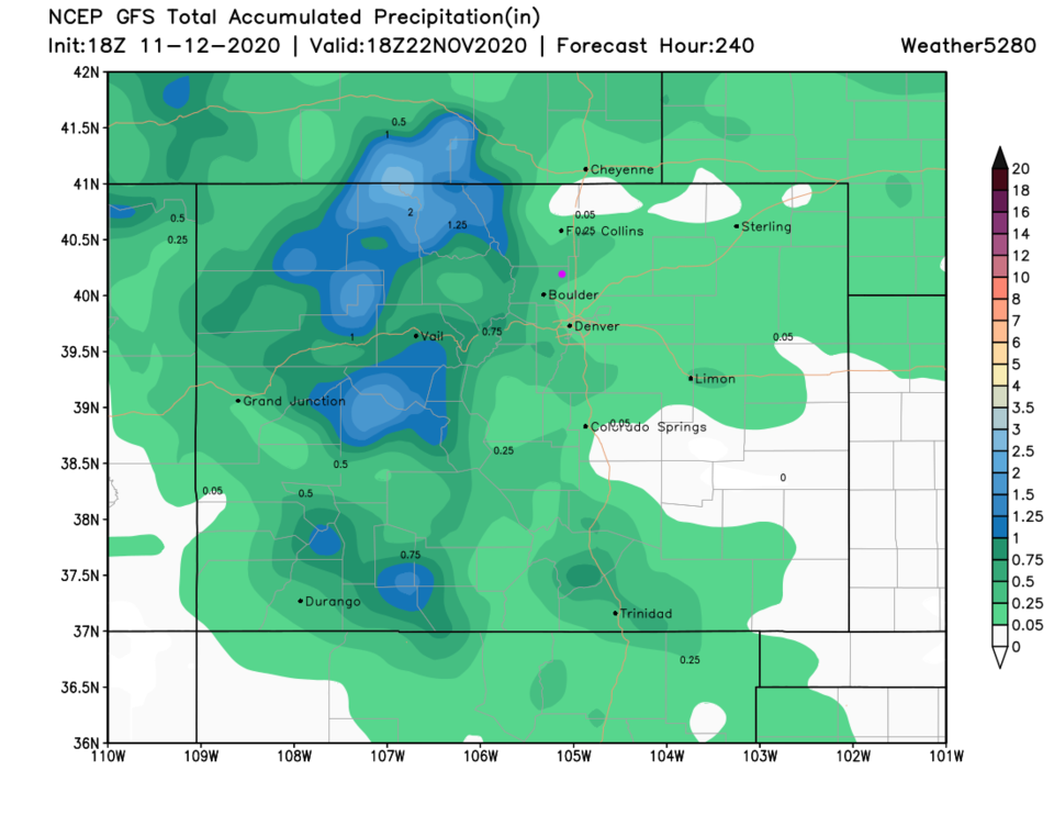 Figure 7: the forecast total precipitation through next 10 days from the GFS and tropicaltidbits.com
 Looking into the "crystal ball;" there is an indication of a big storm that may hit around Thanksgiving eve. We'll keep an eye on it (Figure 8).
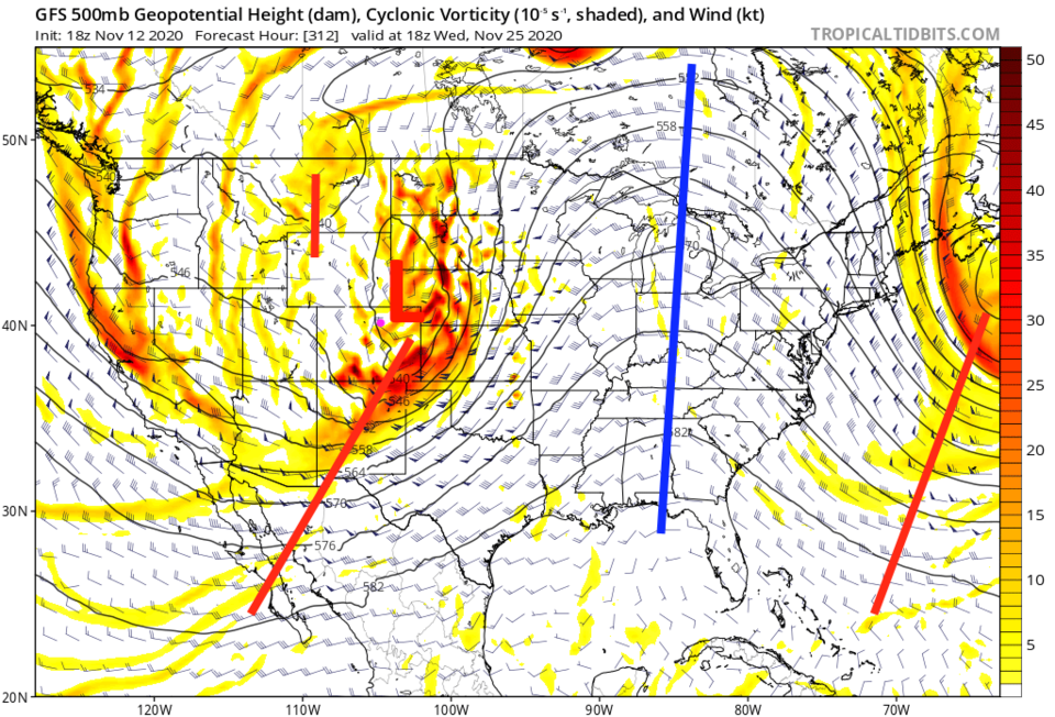 Figure 8: the 500mb upper air forecast map for Thanksgiving Eve from the GFS and tropicaltidbits.com


