In Brief:
Cold fronts begin to arrive cooling us to normal (chilly) weather but precipitation around I-25 will be scarce.
Forecast Discussion:
A giant ridge spans the nation this week (Figure 1 below).
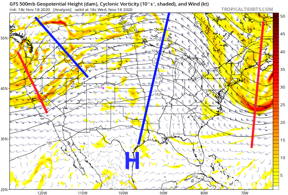 Figure 1: the 500mb upper air forecast map for Thursday noon from the GFS and tropicaltidbits.com
There is some high level moisture (purples/blues) streaming across the state keeping temperatures down a bit and giving us great sunrises and sunsets (Figure 2).
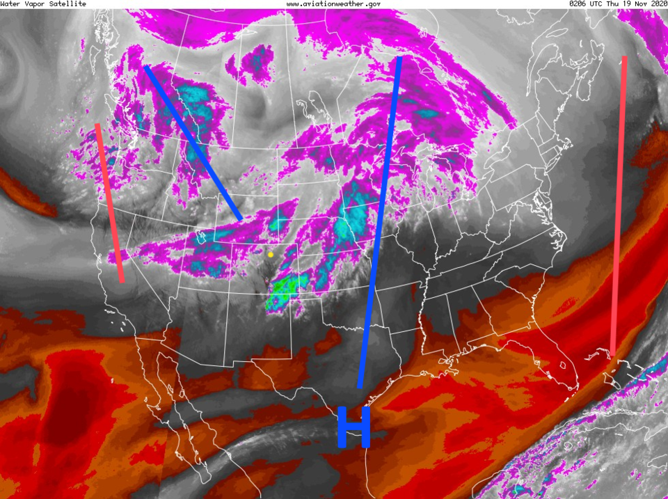 Figure 2: the water vapor satellite image from NOAA from Friday PM. White/purple is moist air, red/brown is very dry air.
 Still, that ridge is keeping us about 10 to 20 degrees warmer than normal (just like the summer and fall to date - Figure 3).
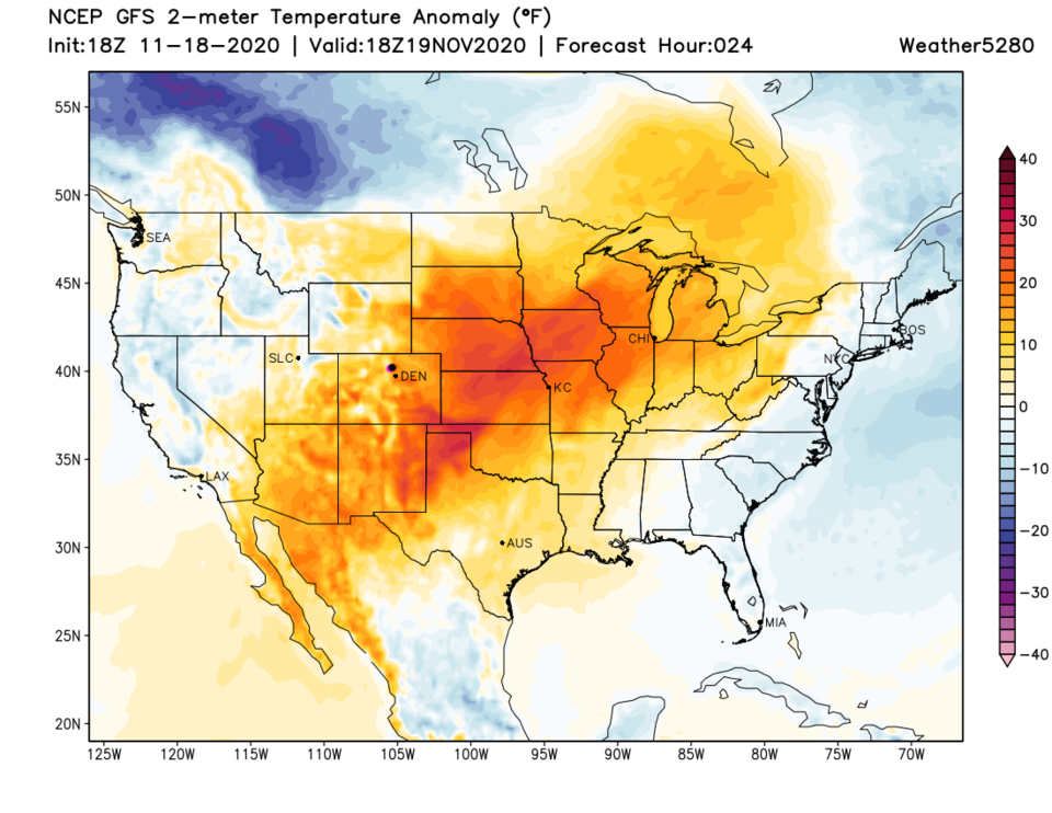 Figure 3: the temperature anomaly (departure from normal) for Thursday from tropicaltidbits.com
A cold front arrives Thursday afternoon (dashed line in Figure 4). Low level moisture is almost nonexistent. We may see a sprinkle or two. We begin to cool down to normal (around 50 degrees for a high this time of year).
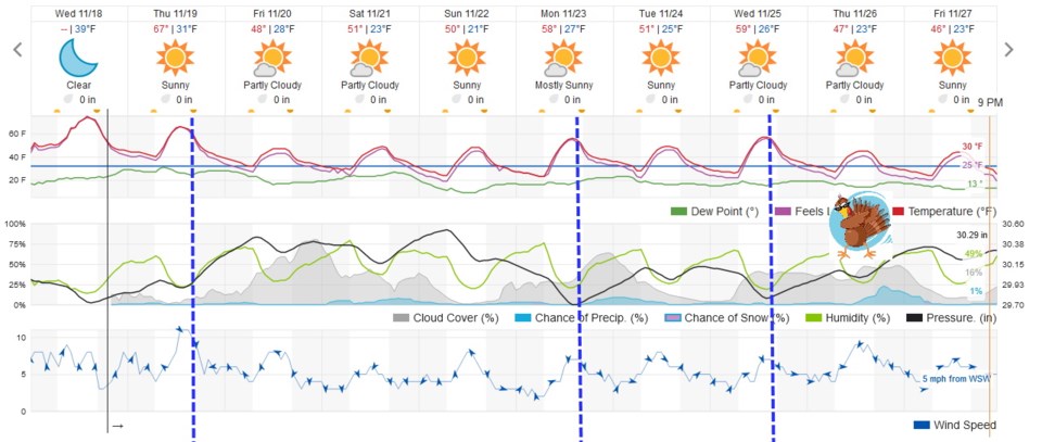 Figure 4: the 10 day graphical forecast from weather5280.com for Longmont, CO.
The Longer Range Forecast:
Not much changes over the next 10 days except that temperatures keep getting knocked down to near normal by a couple of additional cold fronts next week (Figure 4). On Saturday, we have a trough passing but it will only cool us a degree or two (Figure 5).
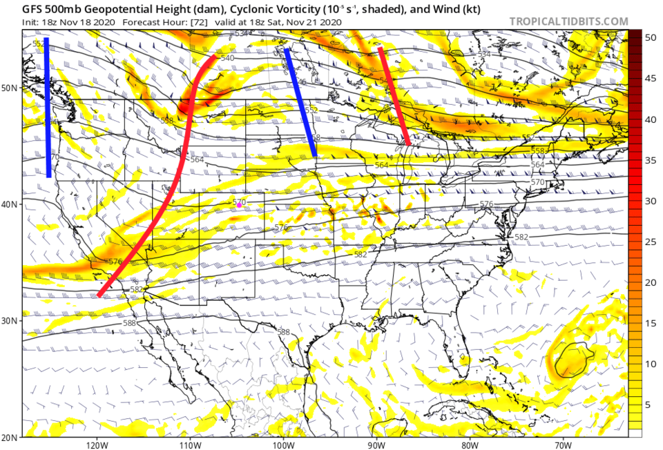 Figure 5: the 500mb upper air forecast map for Saturday noon from the GFS and tropicaltidbits.com
Thanksgiving Forecast:
Our big weekend storm and Thanksgiving storms are evaporating like the water we need to get snow and rain in the first place. A vigorous trough is again passing on Thanksgiving Day (with a ridge rebuilding on the West Coast - Figure 6).
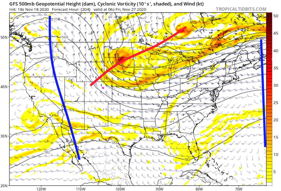 Figure 6: the 500mb upper air forecast map for late Thanksgiving night from the GFS and tropicaltidbits.com
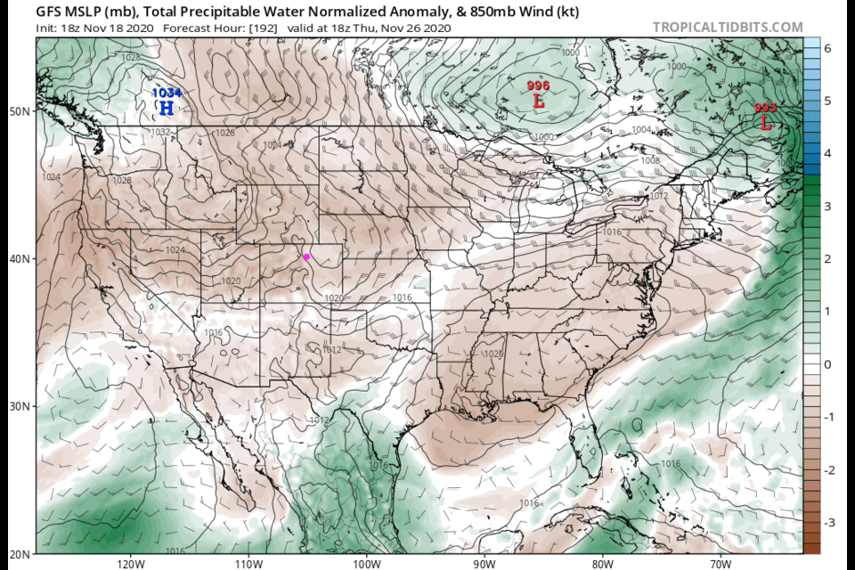
The forecast precipitatable water anomaly map (showing how much water could be squeezed out of the atmosphere ideally compared to normal) shows almost the entire nation remains abnormally dry. There just isn't anything to make snow or rain, in any large way, on the plains of Colorado (Figure 7).
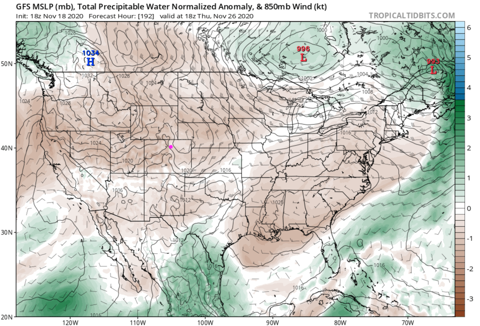 Figure 7: the precipitatable water anomaly (departure from normal) for Thanksgiving from tropicaltidbits.com
Even temperatures on Thanksgiving Day are just a bit below normal to the east of the Rockies and a bit above normal to the west (Figure 8).
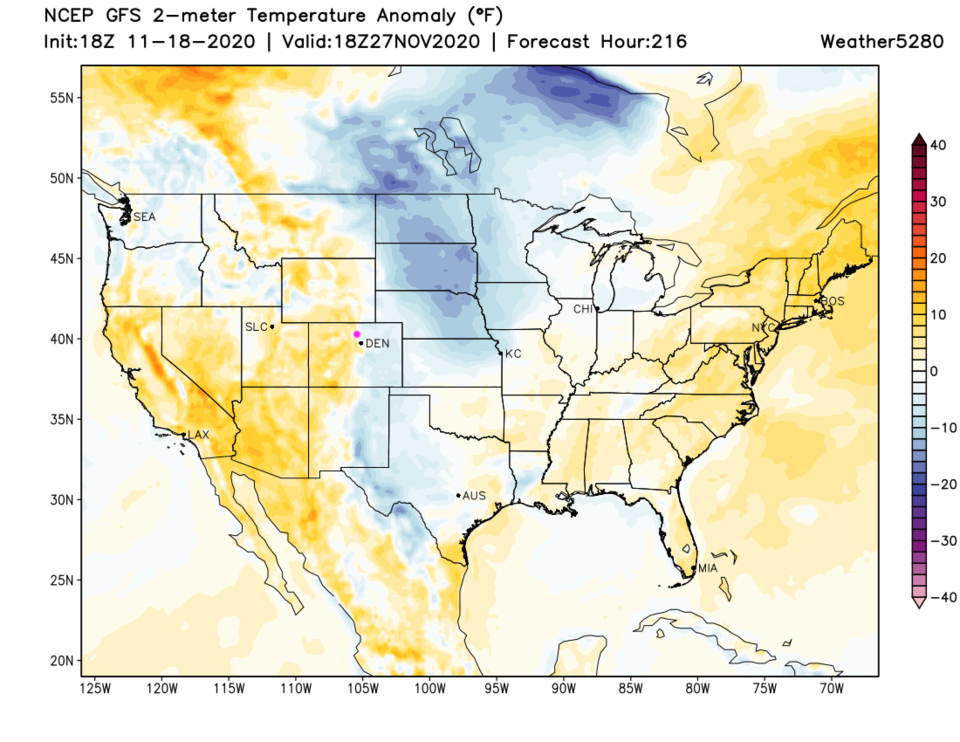 Figure 8: the temperature anomaly (departure from normal) for Thanksgiving from tropicaltidbits.com
The GFS gives the mountains an okay amount of snow (Figure 9) and total precipitation (Figure 10). Areas from Denver to the north hardly get enough precipitation to measure.
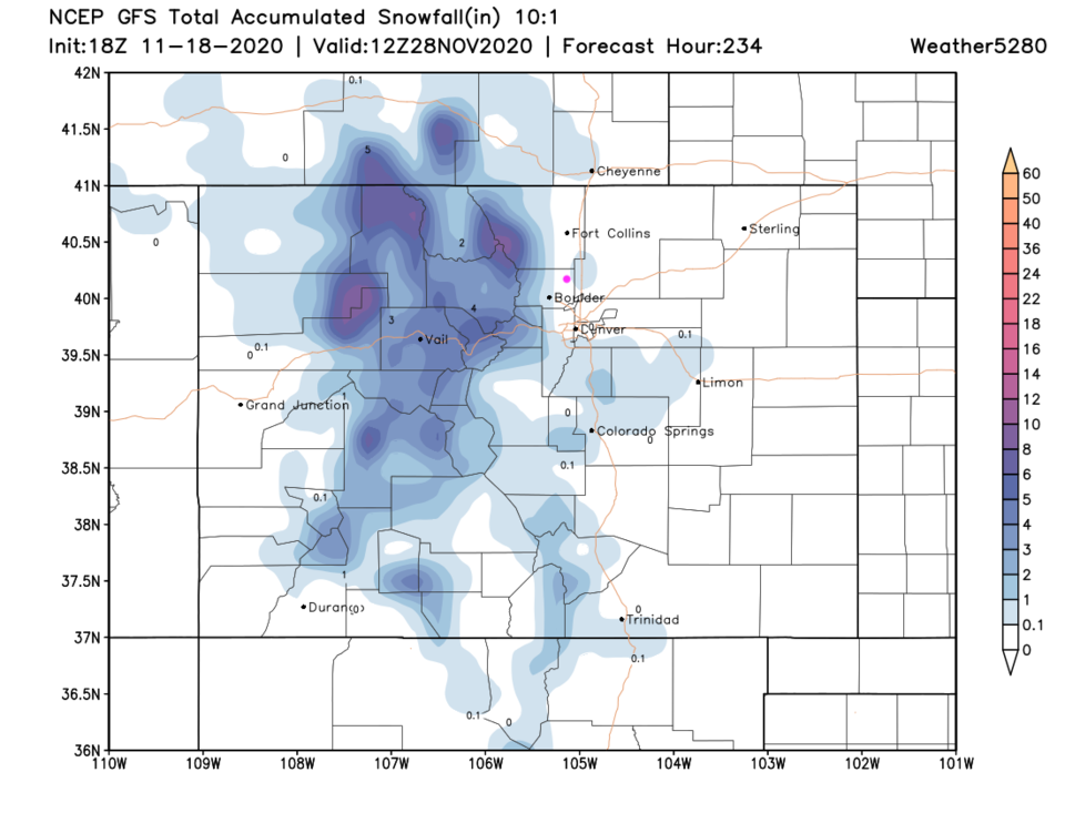 Figure 9: the 10 day snowfall total from the GFS and weather5280.com
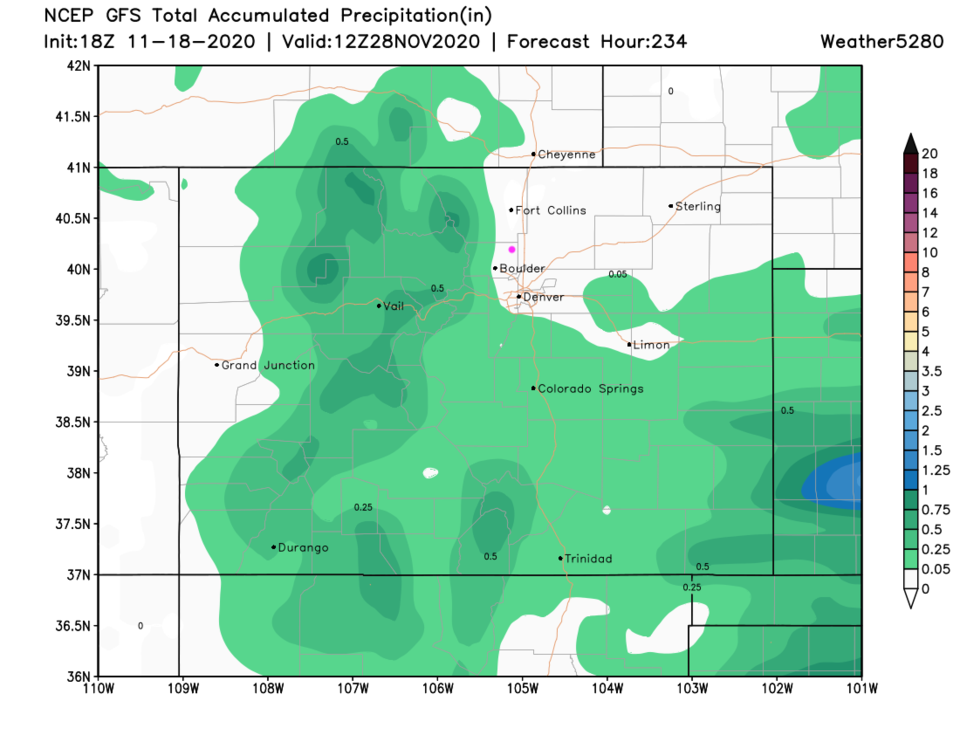 Figure 10: the 10 day precipitation total from the GFS and weather5280.com


