Skip to content

The Next Storm/Next Snow Forecast Discussion from the Cherrywood Observatory – December 11, 2017

This content was originally published by the Longmont Observer and is licensed under a Creative Commons license.

Forecast Discussion:

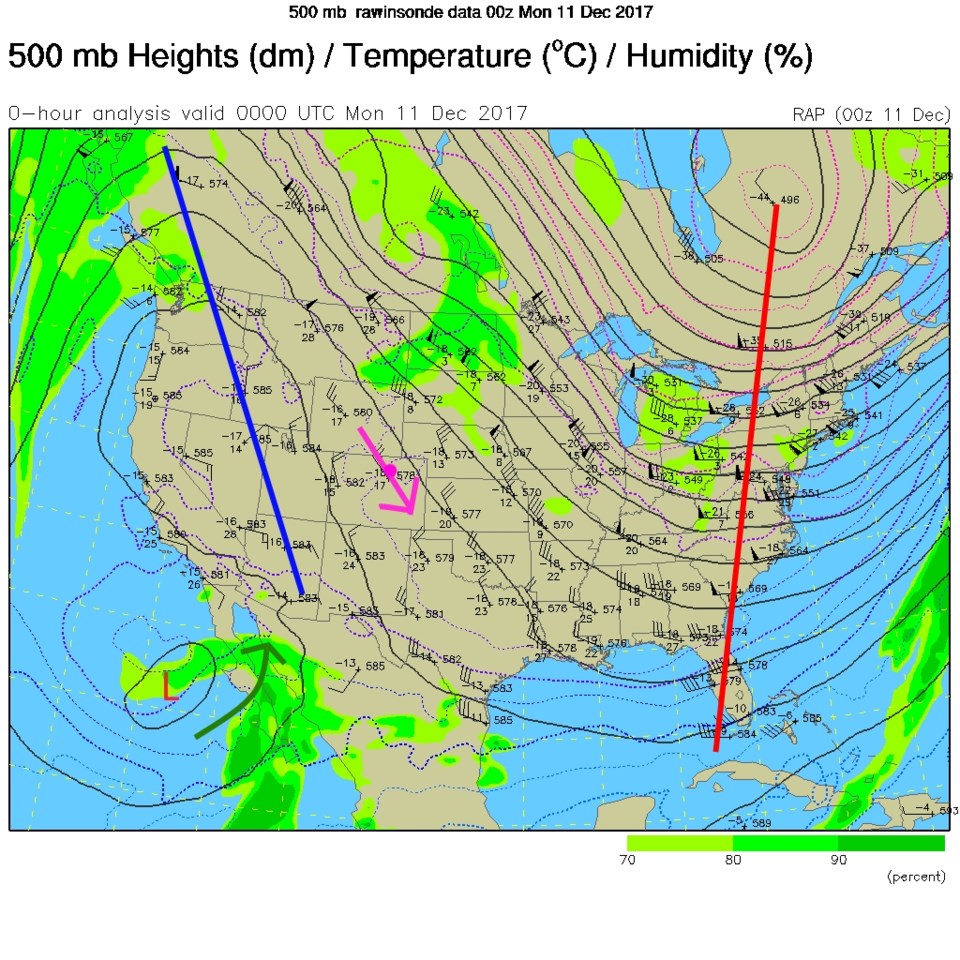
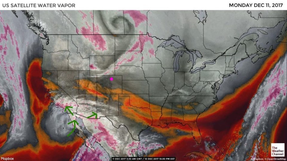
It is shorts and t-shirt weather again (at least for December). The upper air map from last night shows the big west coast ridge that we are on the downhill side of (Figure 1). Note the interesting low under the ridge down in the Pacific ocean off of Mexico and the Baja Peninsula. It is pumping moisture northward (Figure 1 and 2) at the mid- and upper levels.  Nothing for our weather, but it sort of looks like the summer monsoon pattern!

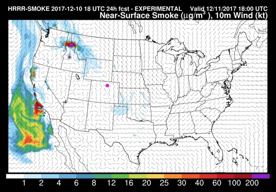
I did check (Figure 3) on the southern California smoke to see if any of that smoke is headed here. For now, that smoke is all going out to sea by the same east to west flow that creates the Santa Anna winds causing the fire problems in the first place. Any smoke you smell or see will be local fields (hopefully planned agricultural burning).

Figure 1: Current 500mb upper air map from Sunday PM.

Figure 2: The current water vapor satellite image from Sunday PM ( white and purple= moist air, reds/brows = dry air).

Figure 3: The HRRR experimental forecast smoke map for all levels of the atmosphere with surface winds.

The longer range forecast:

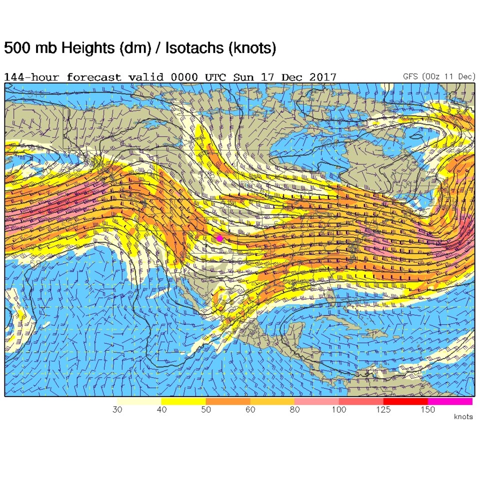
Figure 4 is the upper air map for next Saturday night when a hint of a trough seems to be possible. This might give us a break from the near continuous near-60F highs of the week. More later!

Figure 4: The 500mb upper air forecast map for Saturday PM next week.

Current Weather

Sunny

Sunny

49°F

UV Index
0 Low
Pressure
29.68 Steady
Visibility
9 miles
Dewpoint
24 °F
Humidity
38%
Wind
W 5.8 mph
Gust
16.5 mph
Wind Chill
46 °F

Hourly Forecast

Today
9 PM
46°F
Mostly cloudy w/ showers
Today
10 PM
45°F
Partly cloudy
Today
11 PM
43°F
Partly cloudy
Tomorrow
12 AM
42°F
Mostly clear
Tomorrow
1 AM
41°F
Mostly clear
Tomorrow
2 AM
39°F
Mostly clear
Tomorrow
3 AM
38°F
Mostly clear
Tomorrow
4 AM
37°F
Mostly clear
Tomorrow
5 AM
36°F
Partly cloudy
Tomorrow
6 AM
35°F
Partly sunny
Tomorrow
7 AM
37°F
Intermittent clouds
Tomorrow
8 AM
41°F
Intermittent clouds

7 Day Forecast

Partly sunny w/ showers

Tuesday

60 °F

Times of clouds and sun with a couple of brief showers beginning at midday; windy


Partly cloudy

Tuesday Night

35 °F

A shower in spots this evening; otherwise, partly cloudy and colder; there can be frost in the normally colder spots


Intermittent clouds

Wednesday

58 °F

Cool with times of clouds and sun


Mostly cloudy w/ showers

Wednesday Night

39 °F

Increasing clouds with a shower in spots late


Partly sunny w/ showers

Thursday

56 °F

Times of clouds and sun with a couple of showers; cool


Partly cloudy

Thursday Night

40 °F

Partly cloudy


Mostly cloudy

Friday

63 °F

Mostly cloudy and warmer


Clear

Friday Night

42 °F

Clear


Mostly sunny

Saturday

68 °F

Mostly sunny


Mostly clear

Saturday Night

43 °F

Mainly clear


Sunrise and Sunset

Sunrise
5:52 AM
Sunset
8:02 PM

Based on AccuWeather data