Skip to content

The Next Storm/Next Snow Forecast Discussion from the Cherrywood Observatory – February 13 , 2018

This content was originally published by the Longmont Observer and is licensed under a Creative Commons license.

Forecast discussion:

We were spared freezing drizzle and freezing fog for most locations around Longmont on Monday. Instead a very very light snow fell most of the morning and early afternoon.  It was not enough to coat the ground in most locations.

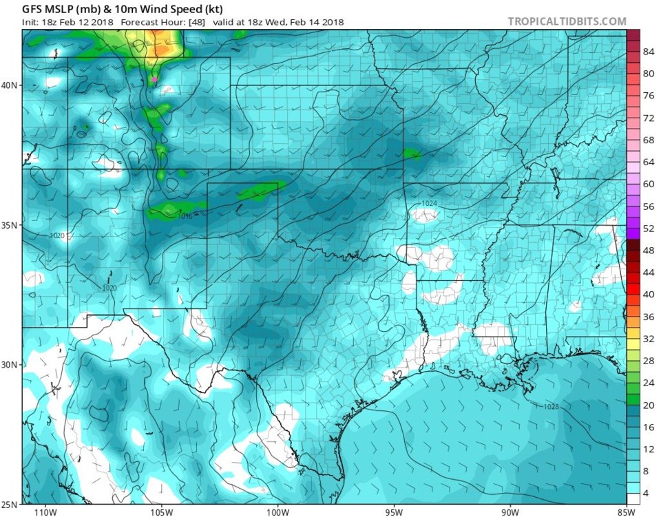
Now the winds switch to a westerly direction and down slope warms us up quickly.  Today's high will be around 50F and Wednesday's temperature will be 60F with much stronger winds. Figure 1 shows those down slope winds at their maximum tomorrow.  Wind speeds may hover around 20mph.  Good thing it is not trash day (well, for my neighborhood).  The mountains will see continued snow.  Estes Park will get 2-4" + of snow Tuesday and Wednesday, for example.

Figure 1: The surface wind speeds midday Wednesday from the GFS and tropicaltidbits.com

The longer range forecast:

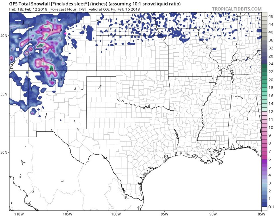
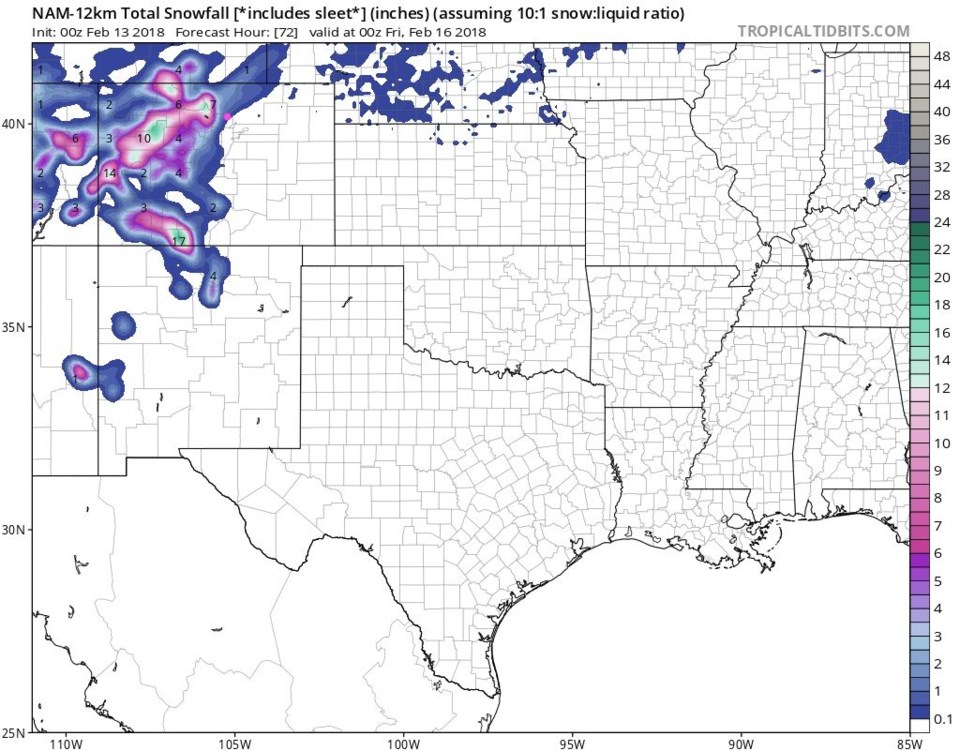
Looking off to Friday, small snow chances return on Thursday night in Longmont.  Snow totals look like a coating to an inch will build up in the Thursday 'storm.' We are on the edge of the no-snow zone (the GFS Figure 2).  The NAM looks similar (Figure 3).  Both put a foot or more snow in the higher elevations.  Bring it on!

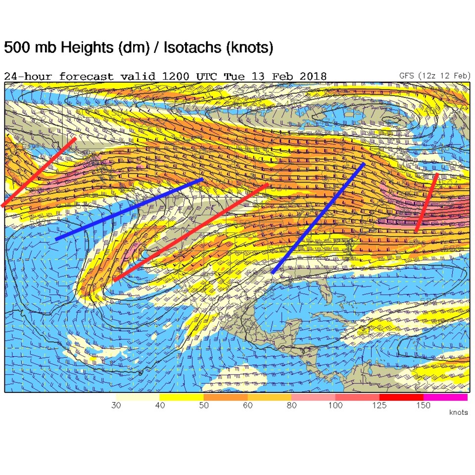
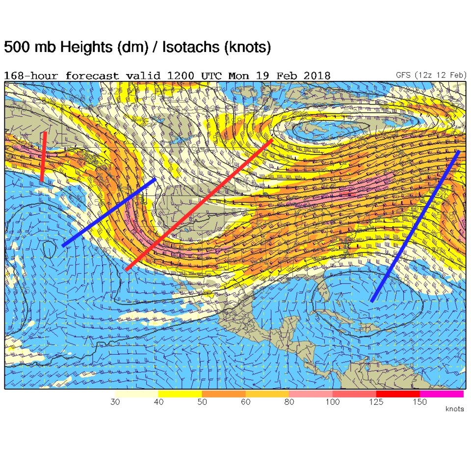
What is interesting is the upper air pattern - for today (Figure 4) there is a trough over the western US and a ridge in the east.  Figure 5 is the pattern for next Monday - and it is very similar!  Having a trough to our west does mean more western Colorado and mountain snows.

Figure 2: The total snowfall between Monday PM and Thursday PM from the GFS and tropicaltidbits.com

Figure 3: The total snowfall between Monday PM and Thursday PM from the NAM and tropicaltidbits.com

Figure 4: The 500mb upper air forecast map for Tuesday morning from the GFS.

Figure 5: The 500mb upper air forecast map for Monday morning from the GFS.

Current Weather

Mostly cloudy

Mostly cloudy

47°F

UV Index
0 Low
Pressure
29.96 Rising
Visibility
8 miles
Dewpoint
41 °F
Humidity
79%
Wind
ENE 2 mph
Gust
4.3 mph
Wind Chill
47 °F

Hourly Forecast

Today
11 PM
46°F
Mostly cloudy w/ showers
Tomorrow
12 AM
44°F
Partly cloudy
Tomorrow
1 AM
43°F
Partly cloudy
Tomorrow
2 AM
42°F
Partly cloudy
Tomorrow
3 AM
41°F
Partly cloudy
Tomorrow
4 AM
39°F
Partly cloudy
Tomorrow
5 AM
38°F
Partly cloudy
Tomorrow
6 AM
37°F
Partly cloudy
Tomorrow
7 AM
40°F
Partly sunny
Tomorrow
8 AM
44°F
Mostly sunny
Tomorrow
9 AM
50°F
Mostly sunny
Tomorrow
10 AM
56°F
Partly sunny

7 Day Forecast

Intermittent clouds

Sunday

64 °F

Warmer with times of clouds and sun


Partly cloudy w/ showers

Sunday Night

37 °F

A brief evening shower or two; otherwise, partly cloudy


Partly sunny

Monday

70 °F

Partly sunny and pleasant


Intermittent clouds

Monday Night

43 °F

Partly cloudy


Mostly sunny

Tuesday

73 °F

Mostly sunny and pleasant


Intermittent clouds

Tuesday Night

41 °F

Clearing


Intermittent clouds

Wednesday

65 °F

Times of sun and clouds


Intermittent clouds

Wednesday Night

39 °F

A thundershower in spots in the evening; otherwise, partly cloudy


Rain

Thursday

53 °F

Cooler with occasional rain and drizzle; breezy in the morning


Partly cloudy

Thursday Night

32 °F

Partly cloudy


Sunrise and Sunset

Sunrise
6:03 AM
Sunset
7:53 PM

Based on AccuWeather data