Skip to content

The Next Storm/Next Snow Forecast Discussion from the Cherrywood Observatory – February 15 , 2018

This content was originally published by the Longmont Observer and is licensed under a Creative Commons license.

Forecast Discussion:

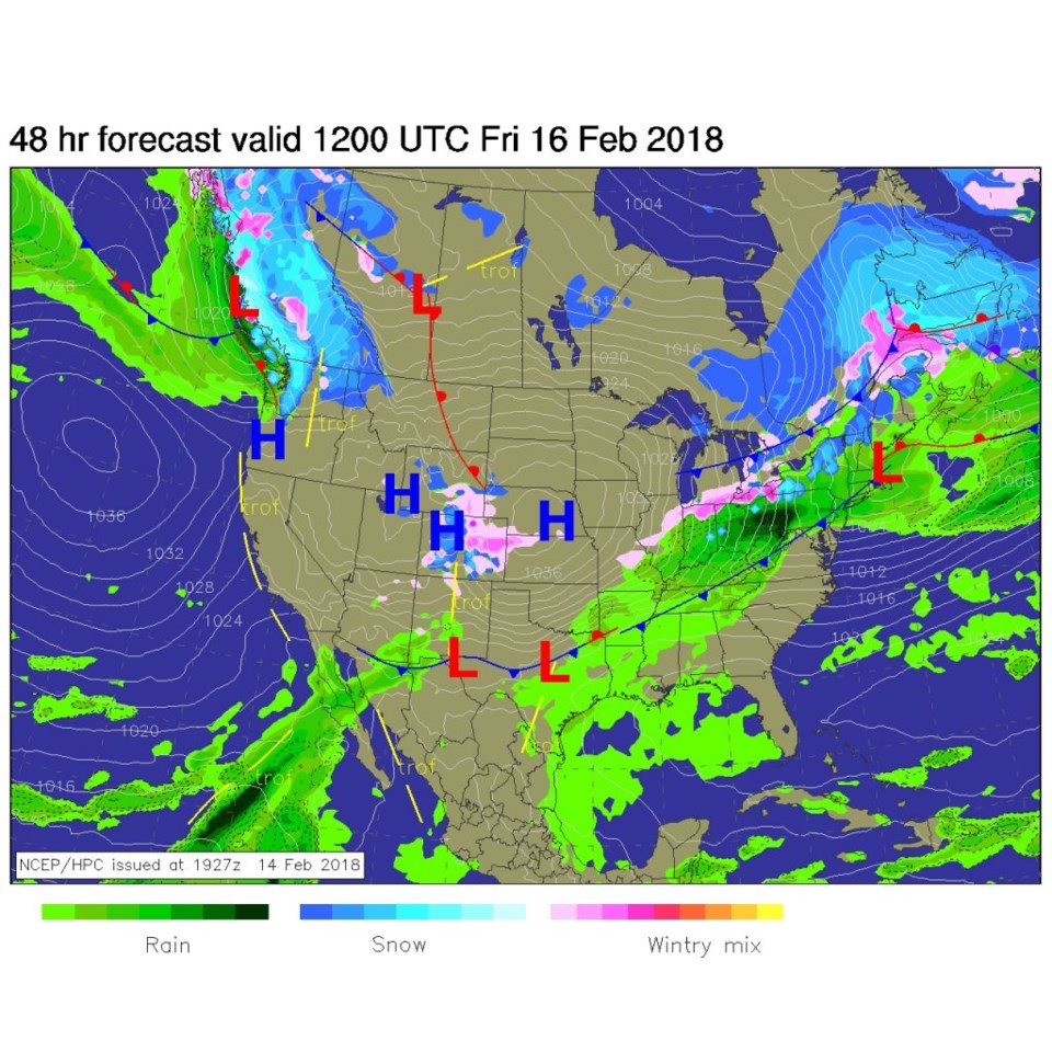
The winds blew and temperatures climbed Wednesday to 61F (by the time I wrote this). But here comes our cold front Thursday morning. Even though the front comes through this morning, it won't be until later tonight that flurries may fall around Colorado (Figure 1).

Figure 1: z7! model sky conditions and precipitation type (Snow pre-midnight Thursday.

The longer range forecast:

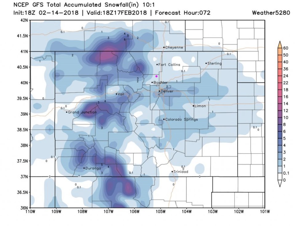
Tomorrow morning, there will be clouds, freezing temperatures and some amounts of snow falling out on the Plains (Figure 2). The mountains continue to have periods of snow almost every day.

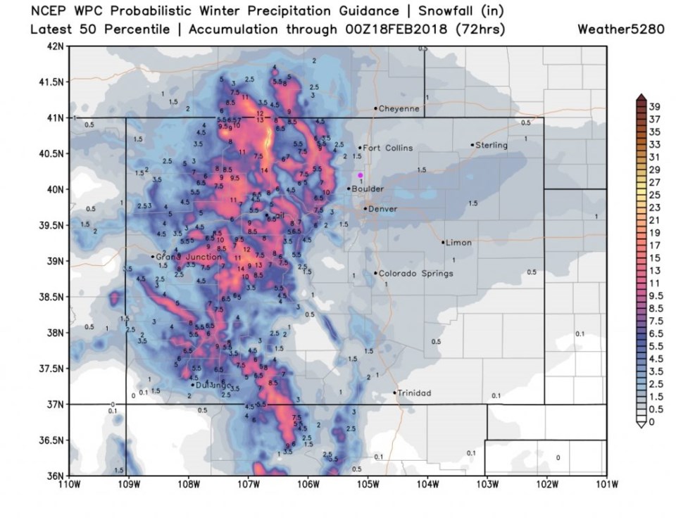
The GFS paints Longmont in the 0.1 to 1 inch snow area by Saturday AM (though it ends Friday AM) [Figure 3].

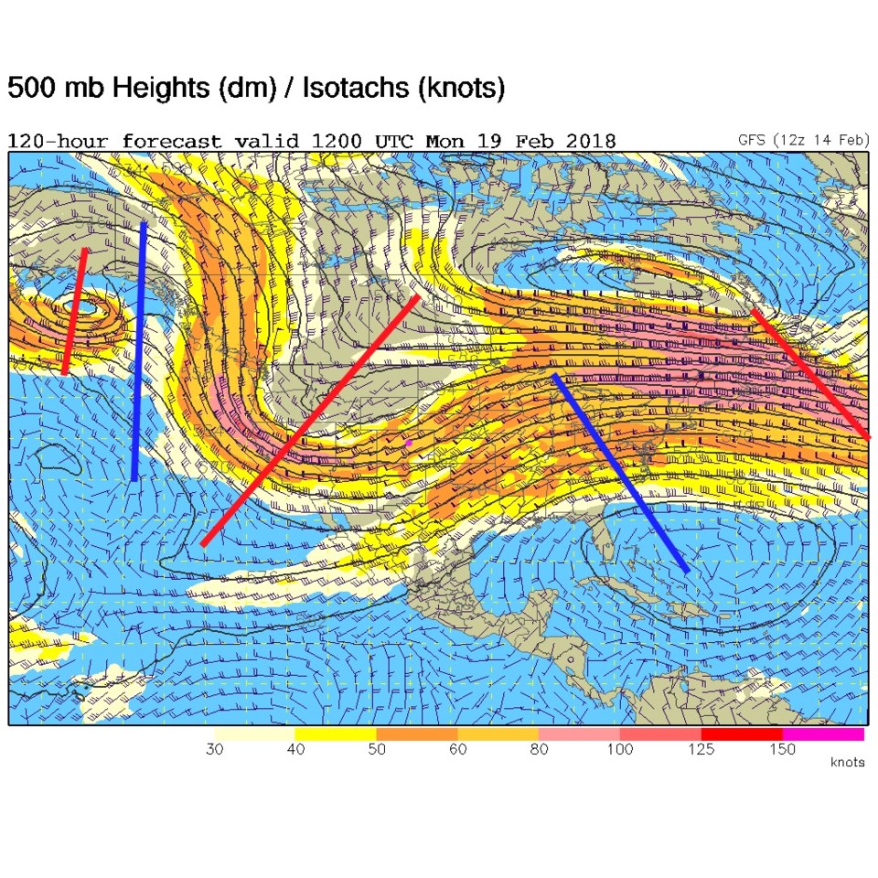
Figure 4 is the WPC 50th percentile take, and it gives us about 1 inch of snow.

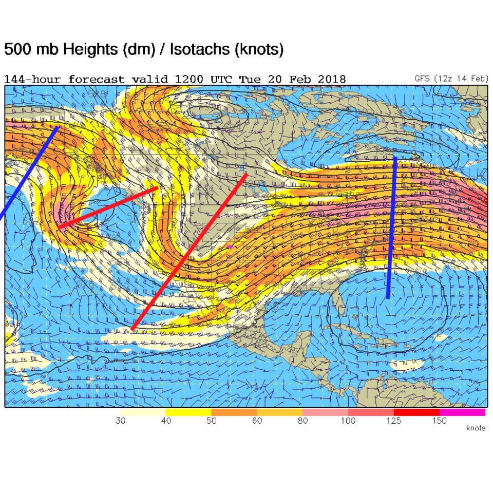
Figures 5 and 6 are the upper air pattern for Monday and Tuesday next week. A big trough dominates the West bringing in cold Arctic air and and increasing snow chances.  One model has 3-5" of snow for Longmont.  We'll see!

Figure 2: Forecast surface map for Friday AM from NCEP.

Figure 3: Total snowfall between Wed. PM and Saturday midday from the GFS and weather5280.com

Figure 4: Total snowfall between Wed. PM and Saturday midday from the WPC probabilistic 50% level and weather5280.com

Figure 5: The 500mb upper air forecast map for Monday from the GFS.

Figure 6: The 500mb upper air forecast map for Tuesday from the GFS.

Current Weather

Sunny

Sunny

54°F

UV Index
7 High
Pressure
29.75 Steady
Visibility
8 miles
Dewpoint
18 °F
Humidity
24%
Wind
WNW 6.4 mph
Gust
14.6 mph
Wind Chill
54 °F

Hourly Forecast

Today
11 AM
56°F
Partly sunny
Today
12 PM
57°F
Intermittent clouds
Today
1 PM
59°F
Intermittent clouds
Today
2 PM
59°F
Intermittent clouds
Today
3 PM
60°F
Intermittent clouds
Today
4 PM
59°F
Intermittent clouds
Today
5 PM
59°F
Intermittent clouds
Today
6 PM
57°F
Intermittent clouds
Today
7 PM
56°F
Intermittent clouds
Today
8 PM
53°F
Intermittent clouds
Today
9 PM
50°F
Intermittent clouds
Today
10 PM
48°F
Intermittent clouds

7 Day Forecast

Intermittent clouds

Wednesday

60 °F

Cool with times of clouds and sun


Mostly cloudy

Wednesday Night

40 °F

Increasing clouds


Partly sunny w/ showers

Thursday

53 °F

Times of clouds and sun with a couple of showers; cooler


Partly cloudy

Thursday Night

41 °F

Partly cloudy


Mostly cloudy

Friday

57 °F

Mostly cloudy


Partly cloudy

Friday Night

39 °F

Partly cloudy


Mostly sunny

Saturday

66 °F

Mostly sunny and warmer


Mostly cloudy w/ t-storms

Saturday Night

43 °F

Mostly cloudy with showers and thunderstorms late


Mostly cloudy

Sunday

64 °F

Mostly cloudy with a thunderstorm in spots in the afternoon


Intermittent clouds

Sunday Night

44 °F

A thunderstorm in the evening; otherwise, becoming clear


Sunrise and Sunset

Sunrise
5:51 AM
Sunset
8:03 PM

Based on AccuWeather data