Skip to content

The Next Storm/Next Snow Forecast Discussion from the Cherrywood Observatory – February 19 , 2018

This content was originally published by the Longmont Observer and is licensed under a Creative Commons license.

Forecast Discussion:

Here we go. It is storm time.

But first, Sunday (as has been so common with these storms) - we had a ridge and strong down slope winds.  Longmont hit 66F while areas around Denver reached 70F.

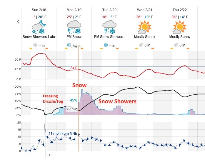
Figure 1 shows that the front rolled in around midnight this morning.  Temperatures keep dropping, overall, all day today and into Tuesday. The initially shallow cold air may create some pre-dawn freezing drizzle or freezing fog before jet dynamics and more moist & cold air flows in getting steady snow going around noon to 2pm today.  Healthy snow rates continue until after midnight Tuesday AM then drier air flows in.  Snow flurries are still possible on into Wednesday AM.

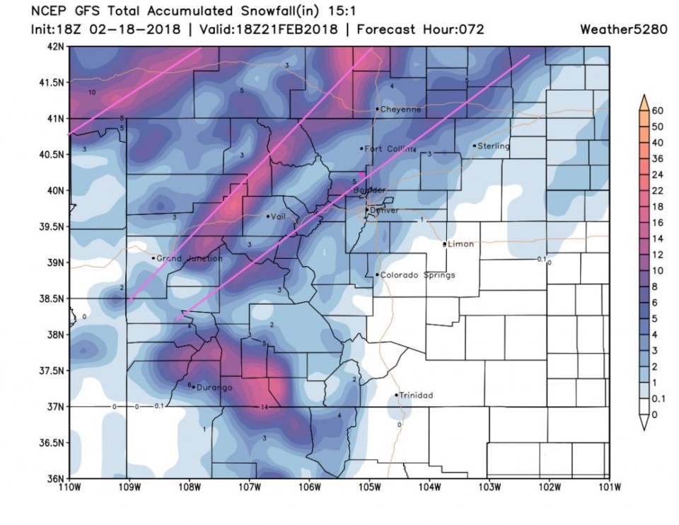
Figure 2 gives you a snapshot of the storm Monday evening.  As discussed yesterday, the storm will feature banded snowfall features.  My call is that everyone from central Denver up to Fort Collins will see 2-4 inches of snow.  Southern Denver is more like 1-3 inches of snow.  Estes Park should see 3-7 inches of snow.  BUT where these banded features form (and that may not be easy to nail down until things get started- but Boulder, southern Larimer, and part of Weld County has been 'under the gun' in a number of model runs recently) one could see double those snow amounts; 4-8"+.

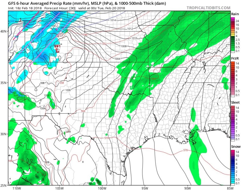
Figure 3 is the GFS take and the banded features are visible.  We are under one of those bands and are getting 4-5" of snow in this run.

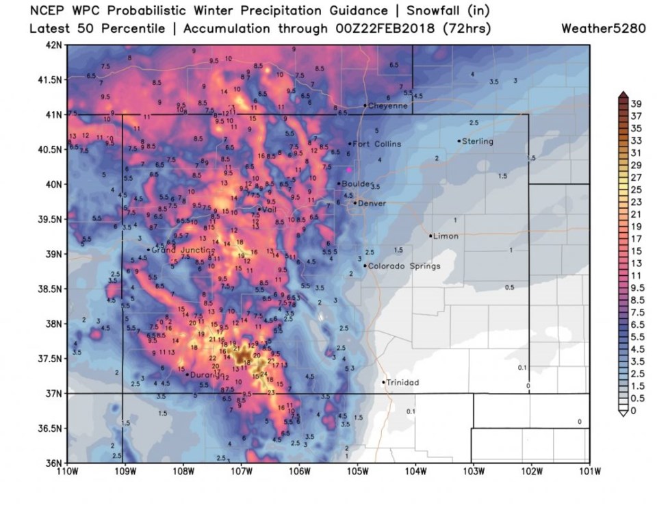
Figure 4 is the WPC 50th percentile accumulation idea and we are around 4-5" here.

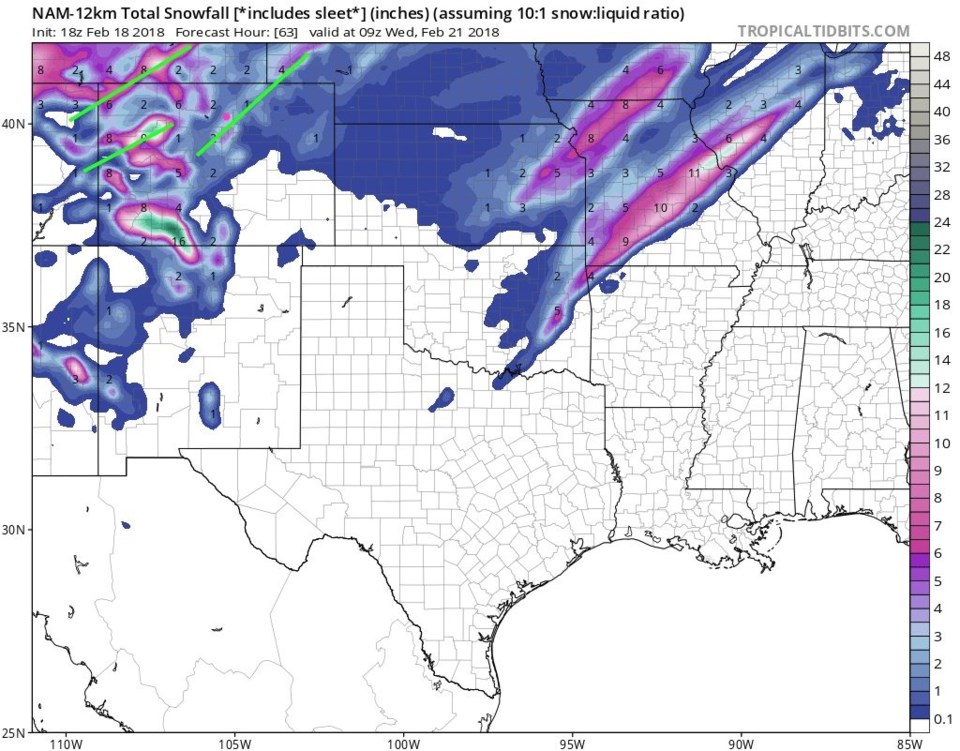
Figure 5 is the NAM - and we are on the north side of a band here, and in the 3-4" area.

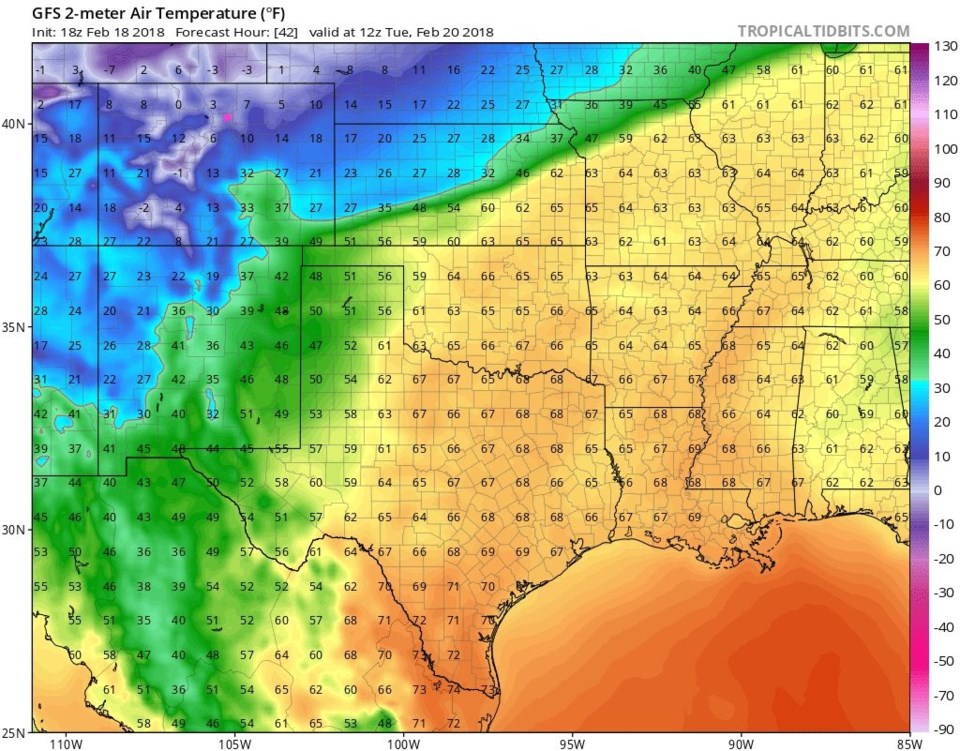
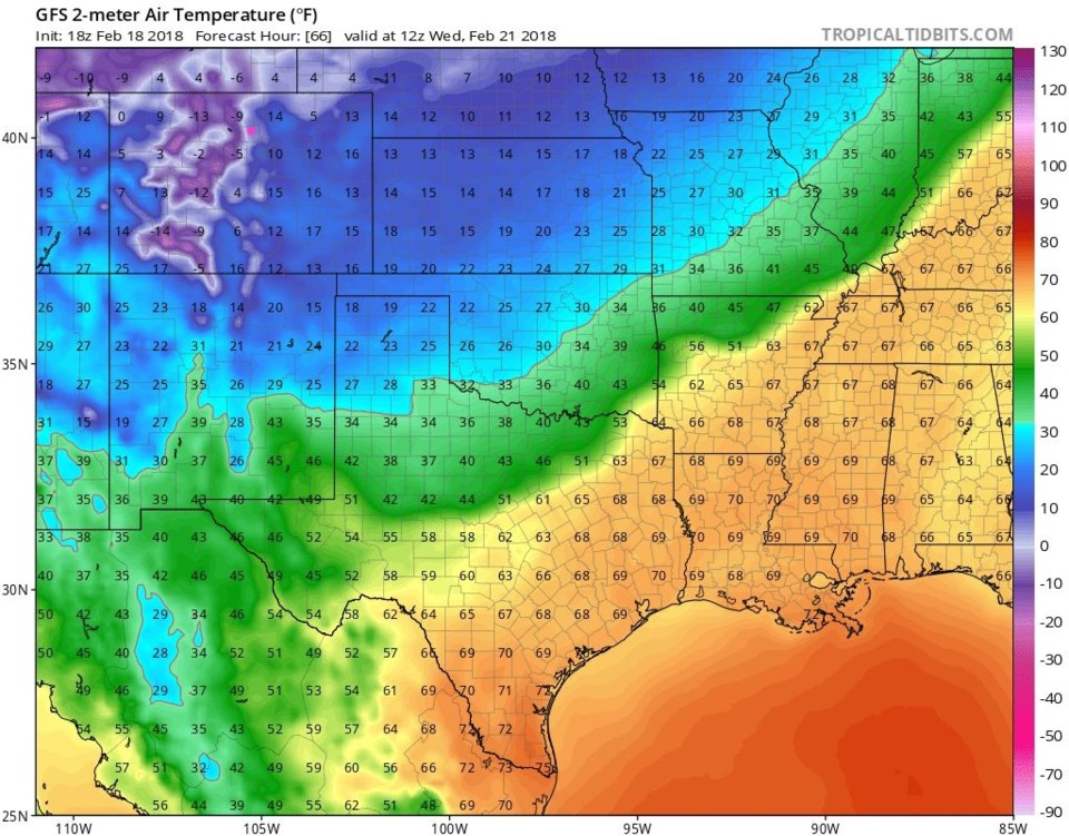
Temperatures will be shockingly cold (especially after our pleasant, if windy, weekend).  Figure 6 are the temperatures Tuesday AM and Longmont is in the single digits (also in Figure 1).  Figure 7 are the temperatures Wednesday AM and we are in the upper single digits (also in Figure 1).  Get ready for COLD!

Figure 1: The first part of the 10 day graphical forecast from weatherunderground.com for Longmont.

Figure 2: The current surface weather forecast for Monday evening from the GFS and tropicaltidbits.com

Figure 3: The total snowfall forecast from Sunday PM to Wednesday AM from the GFS and weather5280.com

Figure 4: The total snowfall forecast from Sunday PM to Wednesday PM from the WPC 50th percentile confidence and weather5280.com

Figure 5: The total snowfall forecast from Sunday PM to Wednesday AM from the NAM and tropicaltidbits.com

Figure 6: The surface temperature forecast for Tuesday AM from the GFS and tropicaltidbits.com

Figure 7: The surface temperature forecast for Wednesday AM from the GFS and tropicaltidbits.com

The longer range forecast:

There are hints of a storm at the end of the week, but it doesn't look very big.  Temperatures this week will remain largely below normal. More after this storm clears!

Current Weather

Light rain

Light rain

42°F

UV Index
2 Low
Pressure
29.92 Steady
Visibility
3 miles
Dewpoint
38 °F
Humidity
87%
Wind
N 4.4 mph
Gust
9.4 mph
Wind Chill
40 °F

Hourly Forecast

Today
2 PM
42°F
Rain
Today
3 PM
42°F
Rain
Today
4 PM
42°F
Cloudy
Today
5 PM
42°F
Cloudy
Today
6 PM
42°F
Rain and snow
Today
7 PM
41°F
Rain and snow
Today
8 PM
41°F
Rain
Today
9 PM
41°F
Cloudy
Today
10 PM
40°F
Rain
Today
11 PM
40°F
Rain
Tomorrow
12 AM
40°F
Rain
Tomorrow
1 AM
39°F
Rain

7 Day Forecast

Rain and snow

Saturday

42 °F

Chilly with a mix of snow and rain; travel in the foothills and mountains will be slippery due to snow


Rain and snow

Saturday Night

36 °F

Cloudy with rain, mixed with a little snow late; travel in the foothills and mountains will be slippery due to snow


Thunderstorms

Sunday

60 °F

Mostly cloudy and warmer; a thundershower in spots in the afternoon


Partly cloudy w/ t-storms

Sunday Night

37 °F

A thunderstorm in spots in the evening; otherwise, partly cloudy


Partly sunny

Monday

71 °F

Partly sunny, pleasant and warmer


Intermittent clouds

Monday Night

42 °F

Partly cloudy


Mostly sunny

Tuesday

73 °F

Mostly sunny; pleasant in the afternoon


Mostly cloudy

Tuesday Night

40 °F

Mostly cloudy


Intermittent clouds

Wednesday

65 °F

Times of sun and clouds with a passing shower in the afternoon


Rain

Wednesday Night

35 °F

Mainly clear


Sunrise and Sunset

Sunrise
6:04 AM
Sunset
7:52 PM

Based on AccuWeather data