Skip to content

The Next Storm/Next Snow Forecast Discussion from the Cherrywood Observatory – February 5, 2018

This content was originally published by the Longmont Observer and is licensed under a Creative Commons license.

Forecast discussion:

Update Monday noon:

The cold front should push through Longmont around 3pm with temperatures dropping to freezing around 5pm.  Rain chances pick up as the front moves in changing to snow shortly after that.  We could see a coating to an 1/2 inch of snow by morning (locally 1 inch). This will move out around 5am Tuesday with flurries possible throughout the day and into Tuesday night.

Prior discussion:

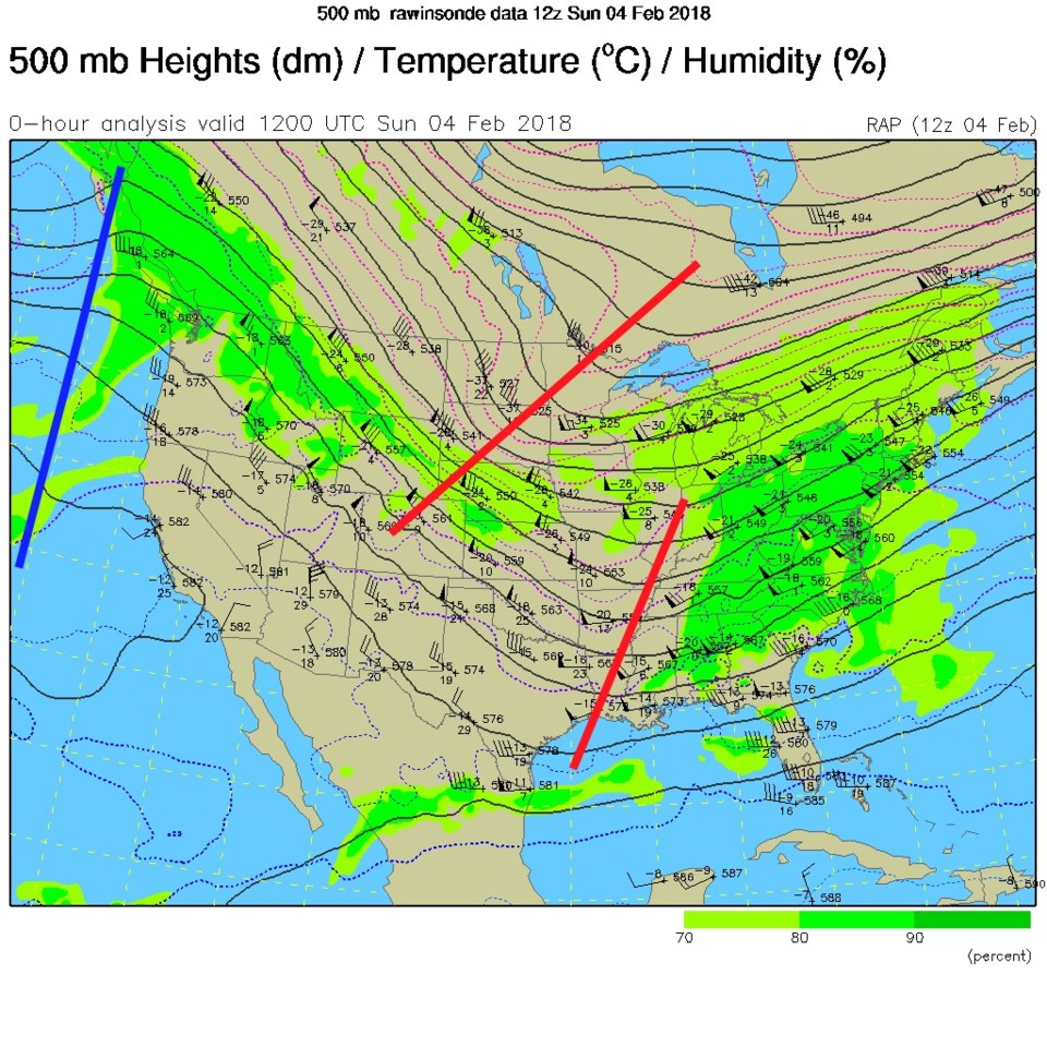
Things are on track for a Mon/Tue, a Fri/Sat, and a then a Sun/Mon storm to be carried in on the northwest flow this week (Figure 1). In Figure 1 we see that flow from the northwest that will dominate all week.  There is a ridge off the West coast and ripples (troughs in red) traveling down the stream may kick a cold front down to cool us and create a period of up slope snow (like the dusting of snow and kiss of ice we received Sunday AM).

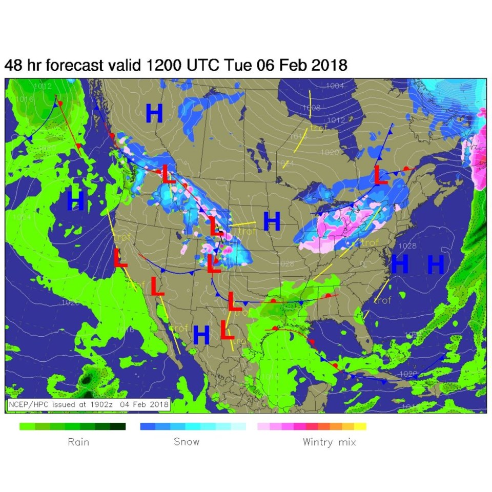
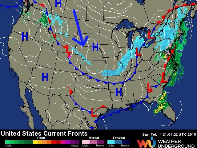
Figure 2 shows the location of the cold front and real snow (out on the Nebraska border).  The main drive is into the south central part of the nation, just glancing us. It is hard to get a good winter storm this year.  At least so far.

Figure 1: The current (Sunday PM) 500mb upper air map from the RAP model.

Figure 2: The current surface analysis map from weatherunderground.com from Sunday PM.

The longer range forecast:

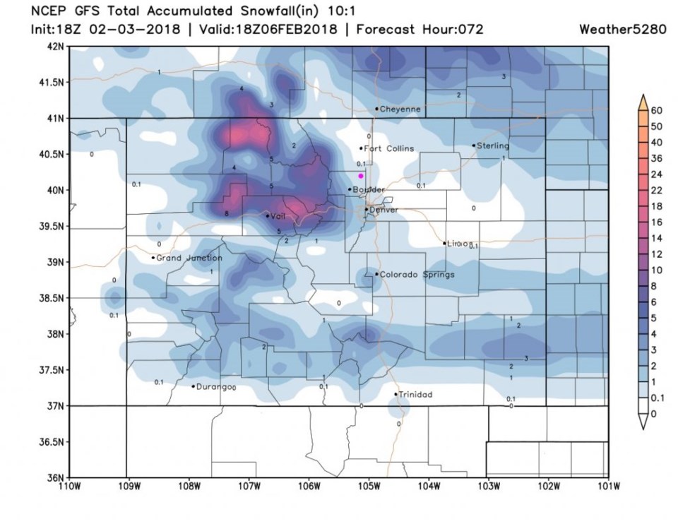
By later tonight (Monday PM) into Tuesday AM, we'll have a low form in the southern parts of the state and some up slope flow create snow over the Pains with snow and ice back in town here (Figure 3).

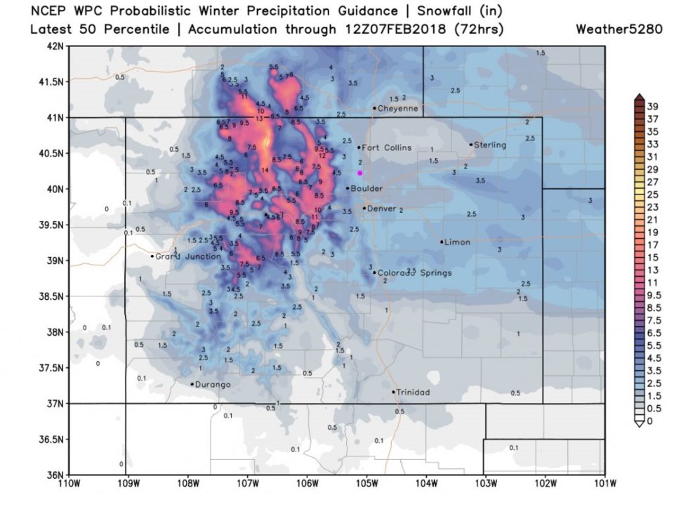
How much snow this time? Figure 4 shows it as a coating to maybe an inch for lucky folks. The 50th percentile from the WPC puts us in the range of 'maybe' seeing up to 2 inches of snow- if we are very very lucky (Figure 5).

Figure 3: The forecast surface map from Tuesday early morning from NCEP.

Figure 4: The GFS total snowfall forecast between Sunday PM and Tuesday AM from Weather5280.com and the GFS.

Figure 5: The the WPC 50th percentile confidence total snowfall forecast between Sunday PM and Tuesday AM from Weather5280.com.

Current Weather

Sunny

Sunny

59°F

UV Index
6 High
Pressure
29.9 Rising
Visibility
5 miles
Dewpoint
34 °F
Humidity
39%
Wind
W 8 mph
Gust
18.8 mph
Wind Chill
59 °F

Hourly Forecast

Today
11 AM
64°F
Sunny
Today
12 PM
66°F
Mostly sunny
Today
1 PM
68°F
Mostly sunny
Today
2 PM
70°F
Mostly sunny
Today
3 PM
72°F
Mostly sunny
Today
4 PM
74°F
Mostly sunny
Today
5 PM
72°F
Mostly sunny
Today
6 PM
70°F
Mostly sunny
Today
7 PM
69°F
Mostly sunny
Today
8 PM
63°F
Mostly cloudy
Today
9 PM
58°F
Mostly cloudy
Today
10 PM
55°F
Mostly cloudy

7 Day Forecast

Mostly sunny

Tuesday

74 °F

Windy this morning; mostly sunny


Intermittent clouds

Tuesday Night

41 °F

Clearing


Partly sunny w/ t-storms

Wednesday

65 °F

Periods of clouds and sun, becoming breezy with a thunderstorm in the afternoon


Thunderstorms

Wednesday Night

37 °F

A thunderstorm in the evening; otherwise, mostly cloudy


Intermittent clouds

Thursday

64 °F

Windy with intervals of clouds and sun


Mostly cloudy

Thursday Night

36 °F

Mostly cloudy


Partly sunny

Friday

68 °F

Some sun; breezy in the afternoon


Mostly clear

Friday Night

36 °F

Mainly clear


Partly sunny

Saturday

69 °F

Partly sunny


Partly cloudy

Saturday Night

41 °F

Patchy clouds


Sunrise and Sunset

Sunrise
6:00 AM
Sunset
7:55 PM

Based on AccuWeather data