Skip to content

The Next Storm/Next Snow Forecast Discussion from the Cherrywood Observatory – February 7 , 2018

This content was originally published by the Longmont Observer and is licensed under a Creative Commons license.

Forecast Discussion:

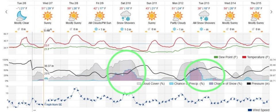
As my update pointed out this morning, we did not get any precipitation from this latest storm, though the mountains and even Boulder received some snow.  Figure 1 is the

next 10 day graphical forecast for our fair city.  The Saturday storm looms large, but with only 1-3" predicted, most storms this size have faded out before we get to that time. There is another storm Monday/Tuesday after that that is a bit less impressive in the models.

Figure 1: The 10 day graphical forecast for Longmont from weatherunderground.com

The longer range forecast:

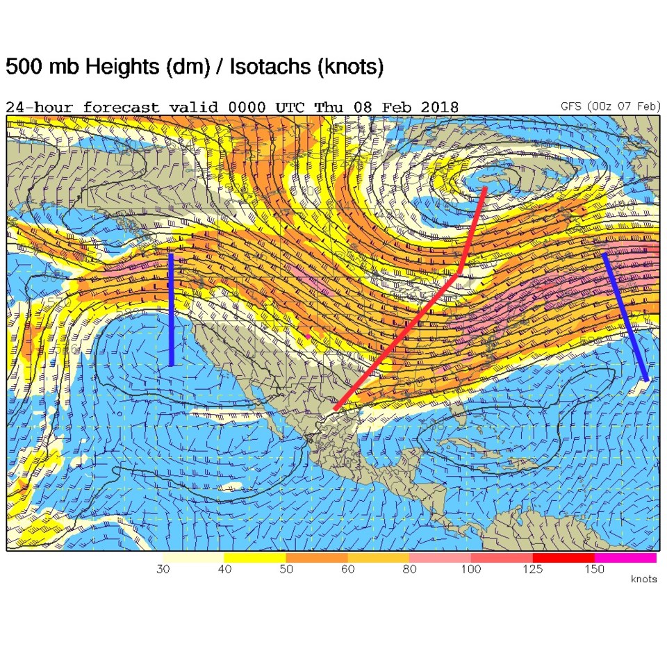
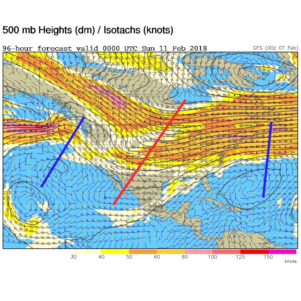
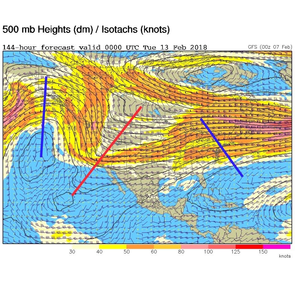
Figure 2 is the first of the upper air maps where we are tracking the troughs (red lines) that help kick up storms around here. Later today, we can see the trough for yesterday's storm moving off to the east. Figure 3 is the same map for Saturday PM, that is a fairly deep trough passing overhead.  Figure 4 is the approaching storm next Monday - this is another good looking trough.

All of these are storm systems are on the move. They are not digging a big cut-off low that may sit in the southern parts of the state and pump moisture into the cold air dammed up against the mountains.  This is just not the right pattern for the big Plains storms we like now and then. The mountains keep getting brush after brush of snow - which is great for them.

Figure 2: The 500mb upper air forecast map from the GFS for Wednesday PM.

Figure 3: The 500mb upper air forecast map from the GFS for Saturday PM.

Figure 4: The 500mb upper air forecast map from the GFS for Monday PM.

Current Weather

Clear

Clear

61°F

UV Index
0 Low
Pressure
29.45 Falling
Visibility
8 miles
Dewpoint
33 °F
Humidity
34%
Wind
S 3.8 mph
Gust
9.2 mph
Wind Chill
61 °F

Hourly Forecast

Today
2 AM
55°F
Mostly cloudy
Today
3 AM
54°F
Cloudy
Today
4 AM
52°F
Cloudy
Today
5 AM
50°F
Cloudy
Today
6 AM
49°F
Cloudy
Today
7 AM
47°F
Cloudy
Today
8 AM
48°F
Cloudy
Today
9 AM
50°F
Cloudy
Today
10 AM
51°F
Cloudy
Today
11 AM
52°F
Cloudy
Today
12 PM
52°F
Cloudy
Today
1 PM
53°F
Cloudy

7 Day Forecast

Intermittent clouds

Sunday

76 °F

Warmer with intervals of clouds and sunshine


Mostly cloudy

Sunday Night

47 °F

Winds becoming strong; thickening clouds


Windy

Monday

56 °F

Winds gusting past 40 mph; cloudy and cooler


Intermittent clouds

Monday Night

42 °F

Partly cloudy


Partly sunny w/ showers

Tuesday

59 °F

A couple of showers in the morning; otherwise, windy and cool with times of clouds and sun


Partly cloudy

Tuesday Night

32 °F

Partly cloudy


Intermittent clouds

Wednesday

58 °F

Cool with times of clouds and sun


Intermittent clouds

Wednesday Night

38 °F

Partly cloudy


Intermittent clouds

Thursday

56 °F

Breezy and cool with sun and clouds


Intermittent clouds

Thursday Night

39 °F

Partly cloudy


Sunrise and Sunset

Sunrise
5:54 AM
Sunset
8:00 PM

Based on AccuWeather data