Skip to content

The Next Storm/Next Snow Forecast Discussion from the Cherrywood Observatory – November 18, 2017

This content was originally published by the Longmont Observer and is licensed under a Creative Commons license.

Forecast Discussion:

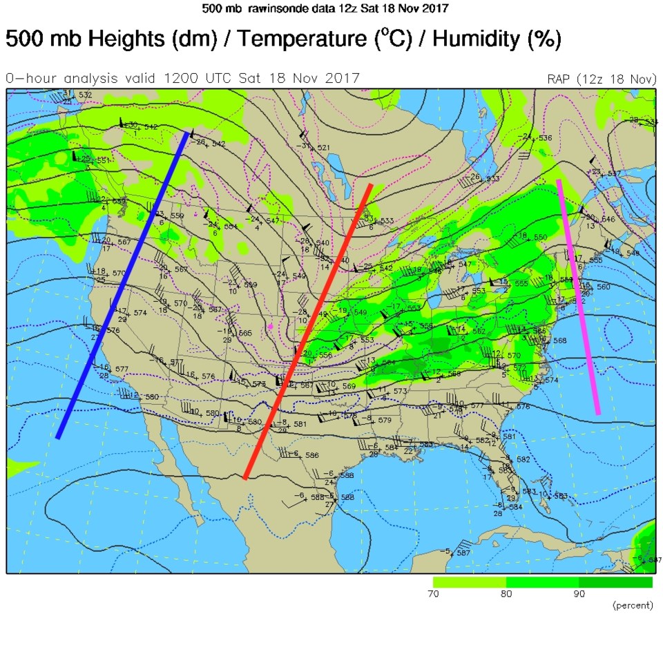
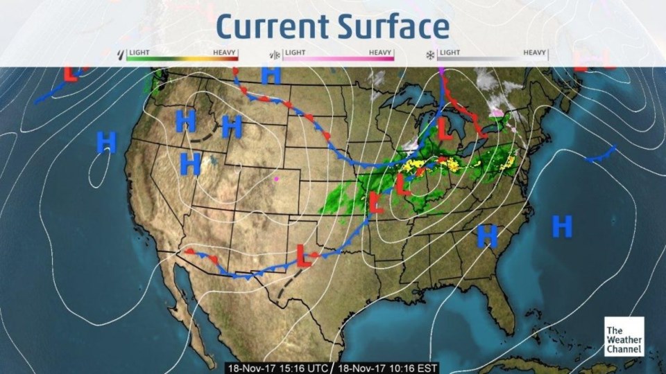
It is a bright, but chilly, Saturday - great for putting up Christmas Lights. In Figure 1, the front has swept back down to Mexico and the rain is in middle Kansas and east (Longmont is the pink dot again). The trough that is responsible for this storm is already into middle Kansas as well (red line, the pink dot is Longmont, and the pink line should be blue... bad software! - Figure 5).

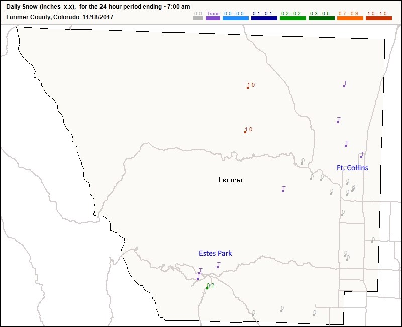
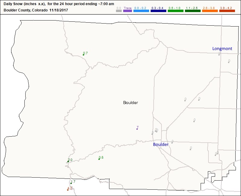
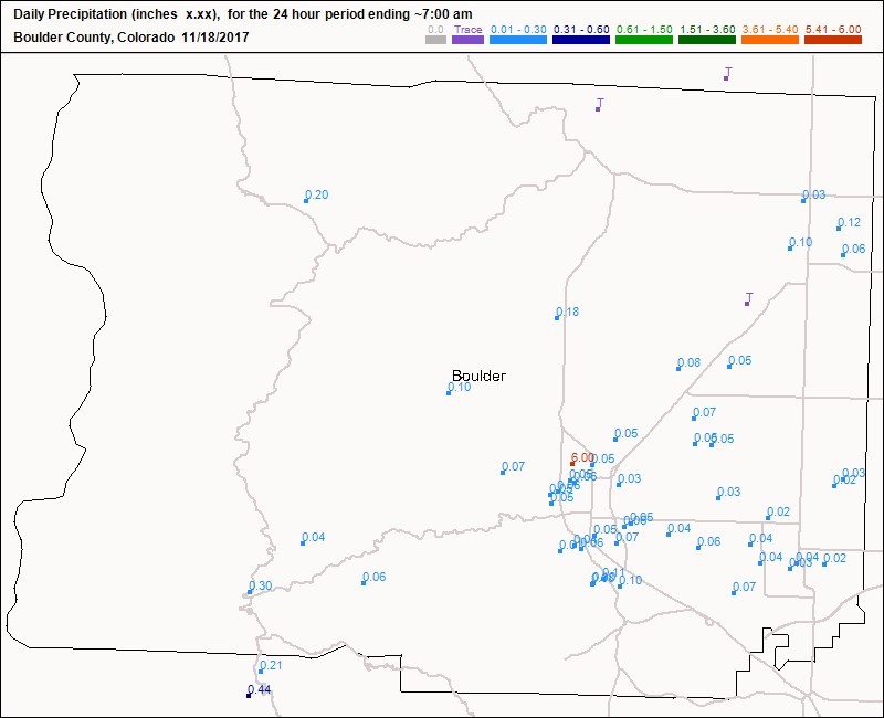
From the cooperative observers at CoCoRaHS - there was a trace to a coating of snow in Estes Park, an inch in the northern mountains above Ft. Collins and a trace on the north side of Ft. Collins:  Figure 2.  Figure 3 has the closest snow being just a trace in the mountains above Boulder. But we did get about a 1/10th of an inch of rain (Figure 4).  The models two days ago nailed it well!

Figure 1: Current surface analysis map for Saturday AM from the weatherchannel.com

Figure 2: 24 hour snow reports as of 7am Saturday from CoCoRaHS Larimer County.

Figure 3: 24 hour snow reports as of 7am Saturday from CoCoRaHS Boulder County.

Figure 2: 24 hour precipitation reports as of 7am Saturday from CoCoRaHS Boulder County.

The Longer Range Forecast:

The current upper air map (previously mentioned Figure 5) shows a ridge on the two coasts and a trough in the middle.  When the ridge to ridge distance is about equal to the width of the U.S., the pattern doesn't move much (troughs and ridges stop really moving west to east).

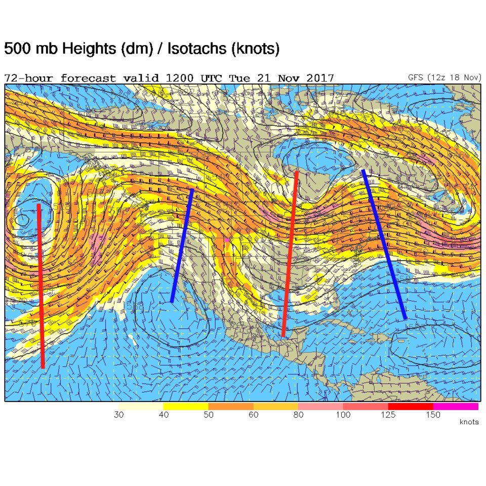
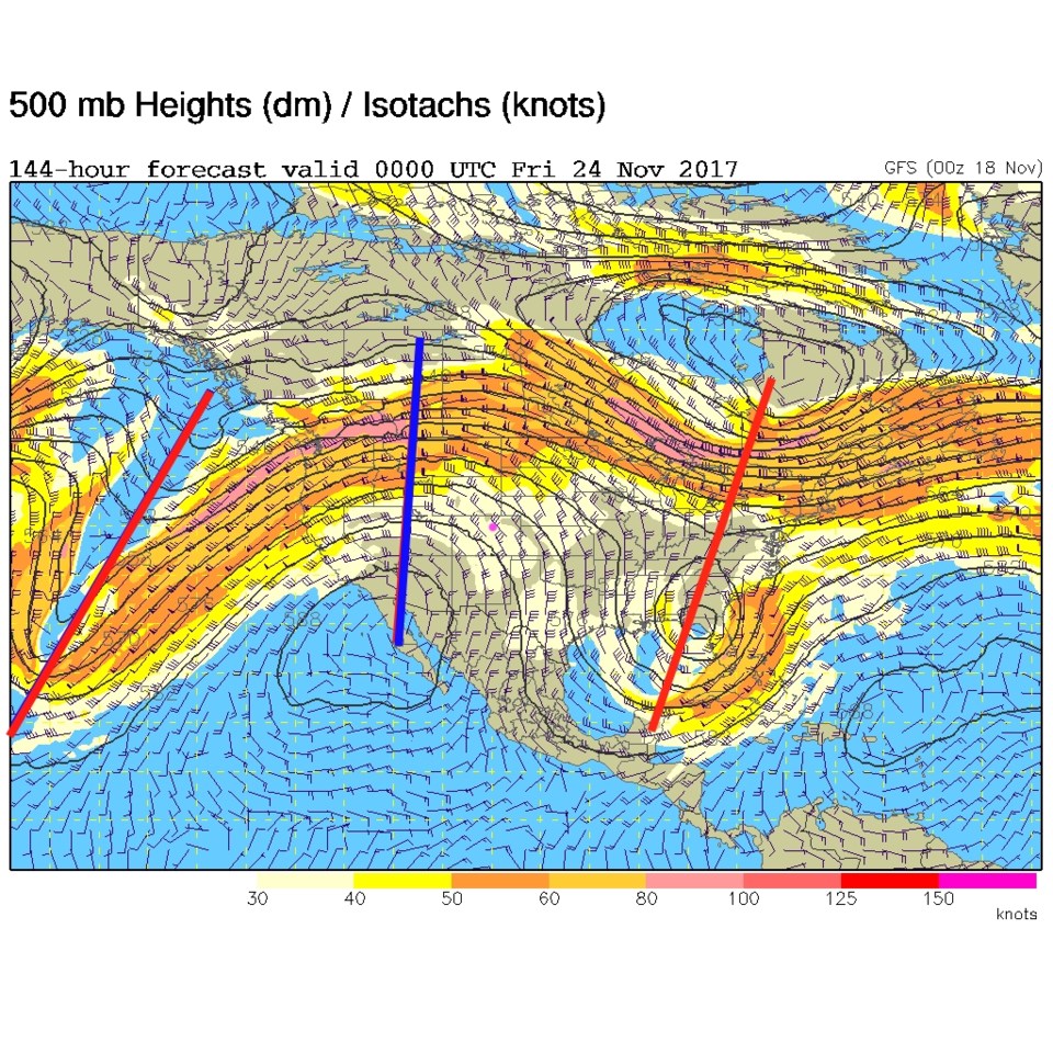
In figure 6, our northwest flow aloft is still in place (Longmont is the pink dot) and the two ridges have just inched eastward a bit.  But by Thursday night (Thanksgiving!) the ridge is just 10's of miles closer -  meaning continued seasonal weather for our fair city.

Thanksgiving Forecast: A high of 68F, a low of 44F. We'll see light westerly winds and mostly clear skies.  Give thanks!

Figure 5: 500mb upper air map, actual, from Saturday AM.

Figure 6: 500mb upper air map, forecast for Tuesday AM from the GFS.

Figure 7: 500mb upper air map, forecast for Thursday PM from the GFS.

Current Weather

Mostly cloudy

Mostly cloudy

75°F

UV Index
2 Low
Pressure
29.53 Falling
Visibility
8 miles
Dewpoint
44 °F
Humidity
33%
Wind
E 4.9 mph
Gust
12.6 mph
Wind Chill
75 °F

Hourly Forecast

Today
6 PM
73°F
Cloudy
Today
7 PM
72°F
Cloudy
Today
8 PM
68°F
Cloudy
Today
9 PM
66°F
Cloudy
Today
10 PM
62°F
Mostly cloudy
Today
11 PM
60°F
Intermittent clouds
Tomorrow
12 AM
58°F
Intermittent clouds
Tomorrow
1 AM
56°F
Intermittent clouds
Tomorrow
2 AM
55°F
Mostly cloudy
Tomorrow
3 AM
54°F
Cloudy
Tomorrow
4 AM
52°F
Cloudy
Tomorrow
5 AM
50°F
Cloudy

7 Day Forecast

Intermittent clouds

Sunday

75 °F

Warmer with intervals of clouds and sunshine


Windy

Sunday Night

47 °F

Winds becoming strong; cloudy most of the time


Windy

Monday

56 °F

Winds gusting past 40 mph; cloudy and cooler


Intermittent clouds

Monday Night

42 °F

Partly cloudy


Partly sunny w/ showers

Tuesday

59 °F

A couple of showers in the morning; otherwise, windy and cool with times of clouds and sun


Partly cloudy

Tuesday Night

32 °F

Partly cloudy


Intermittent clouds

Wednesday

58 °F

Cool with times of clouds and sun


Intermittent clouds

Wednesday Night

38 °F

Partly cloudy


Intermittent clouds

Thursday

56 °F

Breezy and cool with sun and clouds


Intermittent clouds

Thursday Night

39 °F

Partly cloudy


Sunrise and Sunset

Sunrise
5:54 AM
Sunset
8:00 PM

Based on AccuWeather data