Skip to content

Next Storm/Next Snow Forecast Discussion from the Cherrywood Observatory – April 11, 2019

This content was originally published by the Longmont Observer and is licensed under a Creative Commons license.

Forecast Discussion:

This is a part 2 post to the very active April 10th discussion. The winter storm is just getting underway and warnings (winter storm and blizzard) are just now in effect as this posts. Be safe out there! I'm in St. Louis (missing all the fun) and have no internet connection after my evening meetings. (I know!)

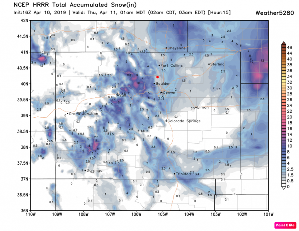
The next 15 hours after noon Wednesday from the HRRR (Figure 1) have about an inch over Longmont with heavier amounts east and west of us.

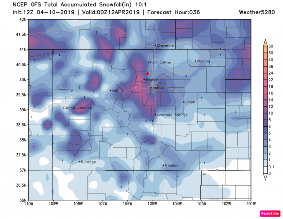
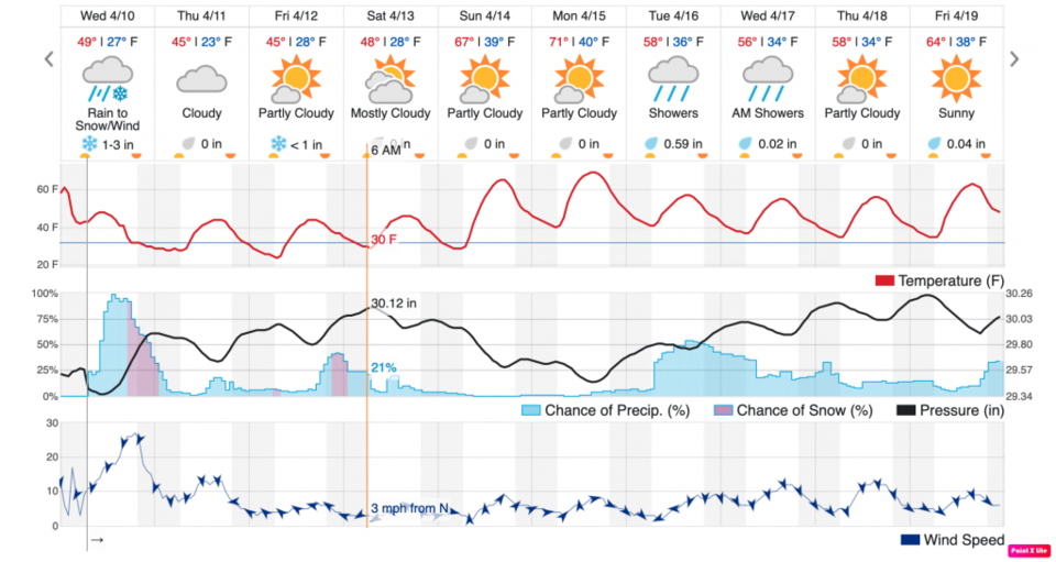
The GFS, over the next 2 days, ends up giving Longmont 3-4 inches of snow. Add wind and you have a travel mess shaping up Wednesday night into Thursday AM (Figure 2). In Figure 3, this storm largely wraps up in the early morning hours Thursday with some snow flurry chances later in the day.

The longer range forecast:

A big deep south low forms on the heals of this storm and moves up to dump rain on me in St. Louis, then a third storm rolls out of the U.S. Northwest to bring some rain/snow chances back (Figure 3) Friday night into Saturday AM. More on that AFTER the Wed/Thur storm actually wraps up.

Figure 1: the forecast accumulated snowfall map from the HRRR and weather5280.com for Colorado, over the next 15 hours.
Figure 2: the forecast accumulated snowfall map from the GFS and weather5280.com for Colorado, over the next 2 days.
Figure 3: the graphical forecast for the next 10 days for Longmont, CO from weatherunderground.com


Current Weather

Mostly cloudy

Mostly cloudy

38°F

UV Index
0 Low
Pressure
29.96 Steady
Visibility
8 miles
Dewpoint
35 °F
Humidity
88%
Wind
NW 1.8 mph
Gust
3.5 mph
Wind Chill
38 °F

Hourly Forecast

Today
6 AM
37°F
Partly cloudy
Today
7 AM
40°F
Partly sunny
Today
8 AM
48°F
Partly sunny
Today
9 AM
54°F
Partly sunny
Today
10 AM
58°F
Partly sunny
Today
11 AM
62°F
Partly sunny
Today
12 PM
65°F
Partly sunny
Today
1 PM
67°F
Partly sunny
Today
2 PM
68°F
Partly sunny
Today
3 PM
69°F
Partly sunny
Today
4 PM
70°F
Partly sunny
Today
5 PM
69°F
Partly sunny

7 Day Forecast

Partly sunny

Monday

70 °F

Partly sunny and pleasant


Intermittent clouds

Monday Night

43 °F

Partly cloudy


Mostly sunny

Tuesday

73 °F

Mostly sunny; windy in the morning, then pleasant in the afternoon


Intermittent clouds

Tuesday Night

43 °F

Clearing


Intermittent clouds

Wednesday

65 °F

Periods of clouds and sun; breezy in the afternoon


Intermittent clouds

Wednesday Night

39 °F

An evening thundershower in spots; otherwise, partly cloudy


Intermittent clouds

Thursday

57 °F

Clouds and sun, becoming windier and cooler with a shower in spots


Mostly clear

Thursday Night

32 °F

Mainly clear


Mostly sunny

Friday

71 °F

Mostly sunny, pleasant and warmer


Partly cloudy

Friday Night

36 °F

Partly cloudy


Sunrise and Sunset

Sunrise
6:02 AM
Sunset
7:54 PM

Based on AccuWeather data