Skip to content

Next Storm/Next Snow Forecast Discussion from the Cherrywood Observatory – April 17, 2019

This content was originally published by the Longmont Observer and is licensed under a Creative Commons license.

Forecast Discussion:

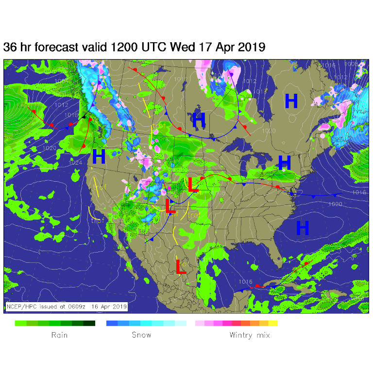
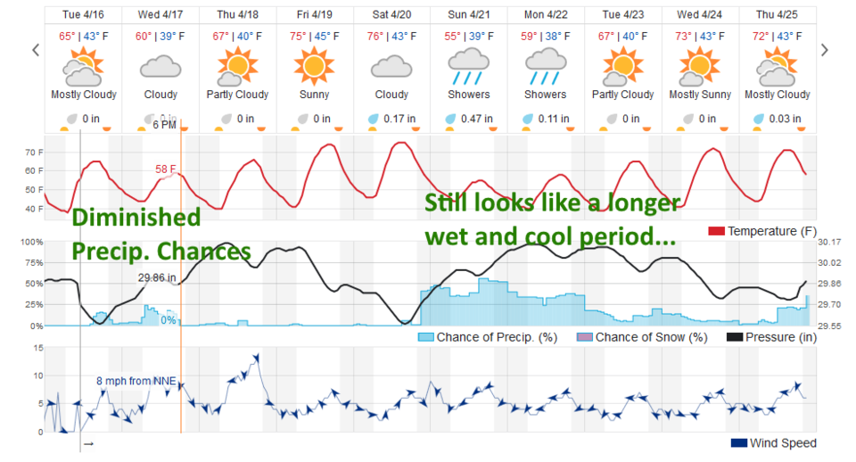
Our front has pushed through around 5 pm and by tomorrow morning is draped just a bit further south of us, but is still in Colorado (Figure 1). This is being powered by a (positively tilted) trough sliding by over the next day and a half. After the front and up to 11 pm Tuesday, rain showers will be very widely scattered (Figure 3- the HRRR). The weatherunderground.com model has a fairly low chance of precipitation through 6 pm Wednesday with temperatures probably too warm for snow (Figure 4).

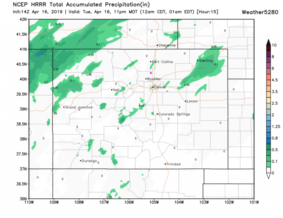
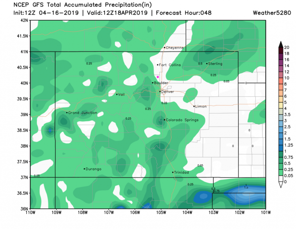
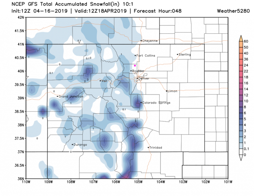
The GFS give us a bit of rain (nearby) - Figure 5. The small amounts of snow are as close as Lyons and Boulder - but still it isn't much (Figure 6).

The longer range forecast:

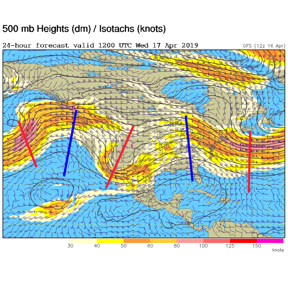
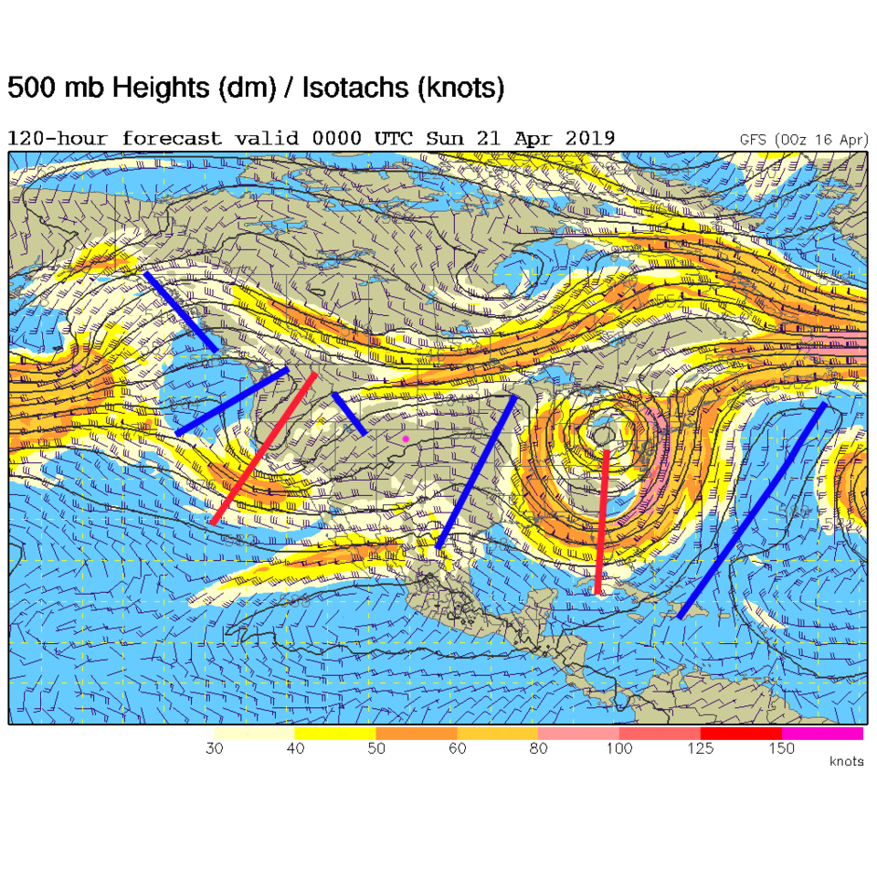
From Figure 4, we climb to the mid 70's F at the end of the week before the next trough moves in (Figure 7 - the red line to our west again). It won't be moving quickly and another trough lurks out in the Pacific - so we cool down and have pretty good rain chances Saturday pm through Tuesday and beyond.

Figure 1: The forecast surface map for Wednesday AM from NCEP.
Figure 2: The 500mb forecast upper air analysis for Wednesday morning. Pink dot is Longmont. Red lines are troughs, blue lines are ridges.
Figure 3: the HRRR precipitation prediction up to 11pm Tuesday from weather5280.com
Figure 4: the graphical forecast for the next 10 days for Longmont, CO from weatherunderground.com
Figure 5: the forecast accumulated precipitation map from the GFS and weather5280.com for Colorado, over the next 2 days.
Figure 6: the forecast accumulated snowfall map from the GFS and weather5280.com for Colorado, over the next 2 days.
Figure 7: The 500mb forecast upper air analysis for Saturday evening. Pink dot is Longmont. Red lines are troughs, blue lines are ridges.

Current Weather

Mostly cloudy

Mostly cloudy

47°F

UV Index
0 Low
Pressure
29.99 Steady
Visibility
7 miles
Dewpoint
33 °F
Humidity
59%
Wind
S 1.7 mph
Gust
4 mph
Wind Chill
47 °F

Hourly Forecast

Today
11 PM
47°F
Mostly cloudy
Tomorrow
12 AM
45°F
Cloudy
Tomorrow
1 AM
44°F
Cloudy
Tomorrow
2 AM
42°F
Cloudy
Tomorrow
3 AM
41°F
Cloudy
Tomorrow
4 AM
39°F
Mostly cloudy
Tomorrow
5 AM
38°F
Intermittent clouds
Tomorrow
6 AM
36°F
Partly sunny
Tomorrow
7 AM
35°F
Partly sunny
Tomorrow
8 AM
41°F
Partly sunny
Tomorrow
9 AM
49°F
Partly sunny
Tomorrow
10 AM
58°F
Partly sunny

7 Day Forecast

Mostly cloudy

Thursday

65 °F

Becoming cloudy


Mostly cloudy

Thursday Night

35 °F

Mostly cloudy


Partly sunny

Friday

71 °F

Pleasant with partial sunshine


Partly cloudy

Friday Night

38 °F

Partly cloudy


Partly sunny

Saturday

66 °F

Partial sunshine


Mostly clear

Saturday Night

41 °F

Clear to partly cloudy


Mostly cloudy

Sunday

76 °F

Rather cloudy; breezy in the afternoon


Intermittent clouds

Sunday Night

46 °F

Partly cloudy


Cloudy

Monday

60 °F

Cloudy and cooler with a shower in spots; windy in the afternoon


Mostly cloudy

Monday Night

41 °F

Breezy in the evening; otherwise, mostly cloudy


Sunrise and Sunset

Sunrise
5:58 AM
Sunset
7:57 PM

Based on AccuWeather data