Skip to content

Next Storm/Next Snow Forecast Discussion from the Cherrywood Observatory – April 20, 2019

This content was originally published by the Longmont Observer and is licensed under a Creative Commons license.

Forecast Discussion:

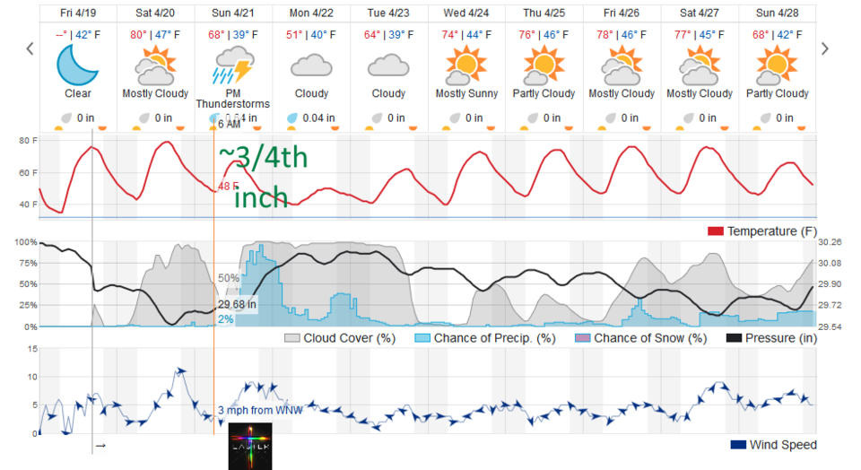
Today will be one of the warmest days in the last 5 months - even if breezy at times (Figure 1). We should break 80F - but the record for today seems to be 88F. That record should be safe.

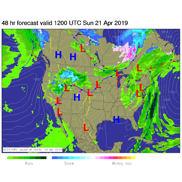
Easter Forecast: The storm system is still moving towards us in the morning Sunday for sunrise services (Figure 2). The temperatures at sunrise (about 6:14am) should be 48F with skies at about 50% cloud cover. Winds will be about 3-5mph from the NW. (Figure 1)

The rain should form quite quickly around 12pm to 1pm. We are down to about 3/4th of an inch of rain Sunday through Tuesday AM.

The longer range forecast:

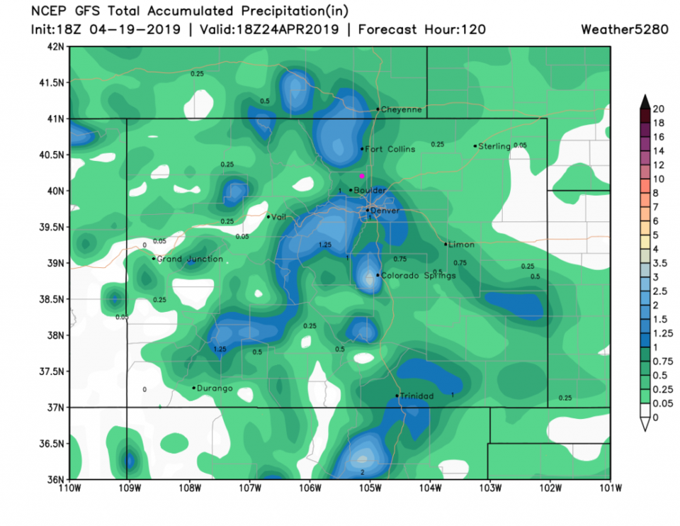
The GFS has dropped the rainfall total to about 3/4th of an inch as well (Figure 3). The rainfall should have more breaks in it at times.

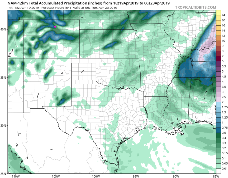
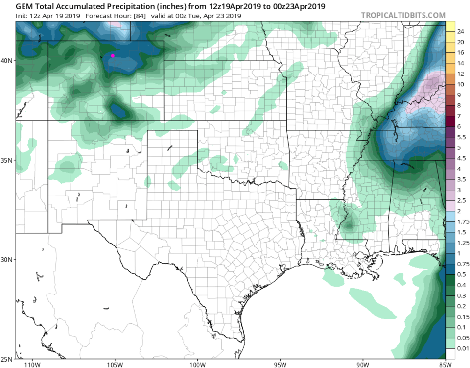
Figure 4 - the NAM gives us about 1/2 or a bit less (up to Monday evening only). The GEM (Figure 5) up through Monday PM is more generous at about 3/4th of an inch again.

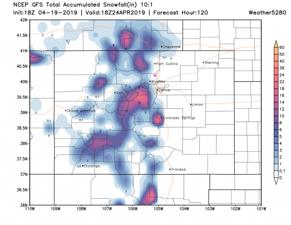
For snowfall (Figure 6 - the GFS) - it remains up in the mountains except near Cheyenne, the western suburbs of Denver and Boulder and the Palmer Divide.

Further out - we warm to the 60'sF and 70'sF on into the new week. More later! Happy Easter everyone.

Figure 1: the graphical forecast for the next 10 days for Longmont, CO from weatherunderground.com
Figure 2: The forecast surface map for Saturday PM from NCEP.
Figure 3: the forecast accumulated precipitation map from the GFS and weather5280.com for Colorado, through Wednesday night.
Figure 4: the forecast accumulated precipitation map from the NAM and tropicaltidbits.com for Colorado and areas east and south, through the next 3.5 days.
Figure 5: the forecast accumulated precipitation map from the GEM and tropicaltidbits.com for Colorado and areas east and south, through the next 3.5 days.
Figure 6: the forecast accumulated snowfall map from the GFS and weather5280.com for Colorado, through Wednesday night.

Current Weather

Mostly cloudy

Mostly cloudy

47°F

UV Index
0 Low
Pressure
29.9 Rising
Visibility
8 miles
Dewpoint
36 °F
Humidity
64%
Wind
NE 3.8 mph
Gust
8.4 mph
Wind Chill
45 °F

Hourly Forecast

Today
1 AM
45°F
Cloudy
Today
2 AM
42°F
Mostly cloudy
Today
3 AM
40°F
Mostly cloudy
Today
4 AM
38°F
Mostly cloudy
Today
5 AM
37°F
Mostly cloudy
Today
6 AM
35°F
Mostly cloudy
Today
7 AM
38°F
Mostly cloudy
Today
8 AM
42°F
Mostly sunny
Today
9 AM
46°F
Partly sunny
Today
10 AM
50°F
Partly sunny
Today
11 AM
53°F
Intermittent clouds
Today
12 PM
56°F
Intermittent clouds

7 Day Forecast

Mostly cloudy

Wednesday

68 °F

A morning shower in spots; otherwise, clouds and breaks of sun


Thunderstorms

Wednesday Night

35 °F

A thunderstorm in spots late this evening; otherwise, mostly cloudy


Intermittent clouds

Thursday

63 °F

A blend of sun and clouds


Mostly cloudy

Thursday Night

39 °F

Mostly cloudy


Partly sunny

Friday

64 °F

Some sun; breezy in the afternoon


Partly cloudy

Friday Night

36 °F

Partly cloudy


Partly sunny

Saturday

66 °F

Partial sunshine


Mostly clear

Saturday Night

41 °F

Clear to partly cloudy


Mostly cloudy

Sunday

78 °F

Rather cloudy and warmer; breezy in the afternoon


Mostly cloudy

Sunday Night

43 °F

Rather cloudy


Sunrise and Sunset

Sunrise
5:59 AM
Sunset
7:56 PM

Based on AccuWeather data