Skip to content

Update 8am: Next Storm/Next Snow Forecast Discussion from the Cherrywood Observatory – April 22, 2019

This content was originally published by the Longmont Observer and is licensed under a Creative Commons license.

In Brief:

Today (Monday) is mostly cloudy, cool, with showers at time. We warm slowly with dry weather to the end of the week when we reach 80F again.

Forecast Discussion:

8am Update:

All the models and the NWS forecast are trending toward only a sprinkle or two today under cool stable cloudy skies with a bit of fog possible. The GEM model is the only one that still brings in about 1/10th of an inch. It is an outlier - we won't see much more water from this system. I received just over 2/10th of an inch of water here in NE Longmont.

End 8am Update.

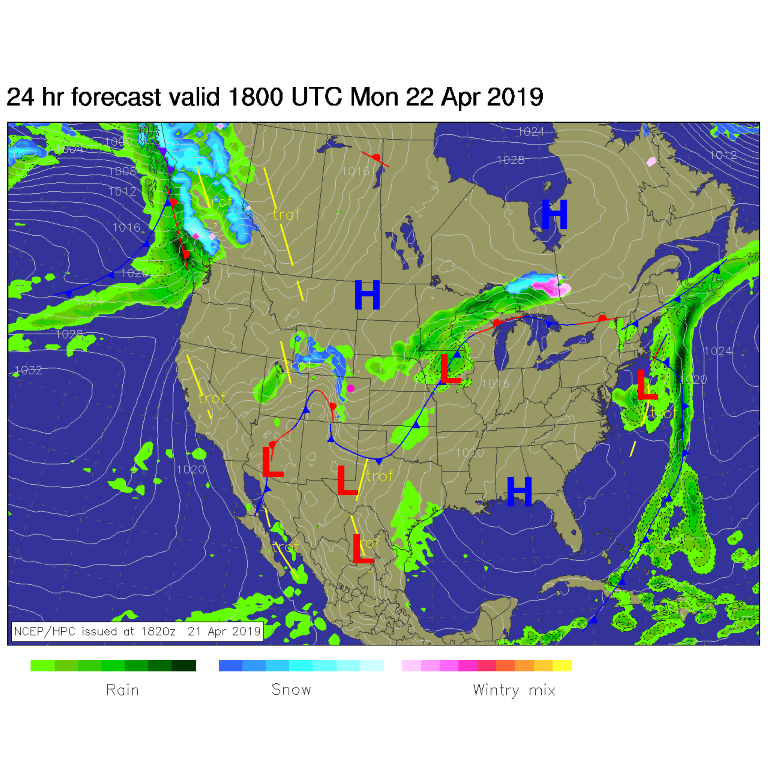
The weather situation over the next 24 hours is fairly complex. There is cool air in place (diminishing shower chances), some cool air aloft (but not much - aiding in showers a little bit), some up slope flow (aiding in showers), and a front draped nearby (aiding in showers). (Figure 1)

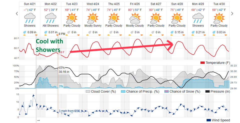
The models are quite confused as well. The weatherudnerground.com model have showers possible most of the day Monday - but it doesn't give us much precipitation (an under-done 0.01" - Figure 2).

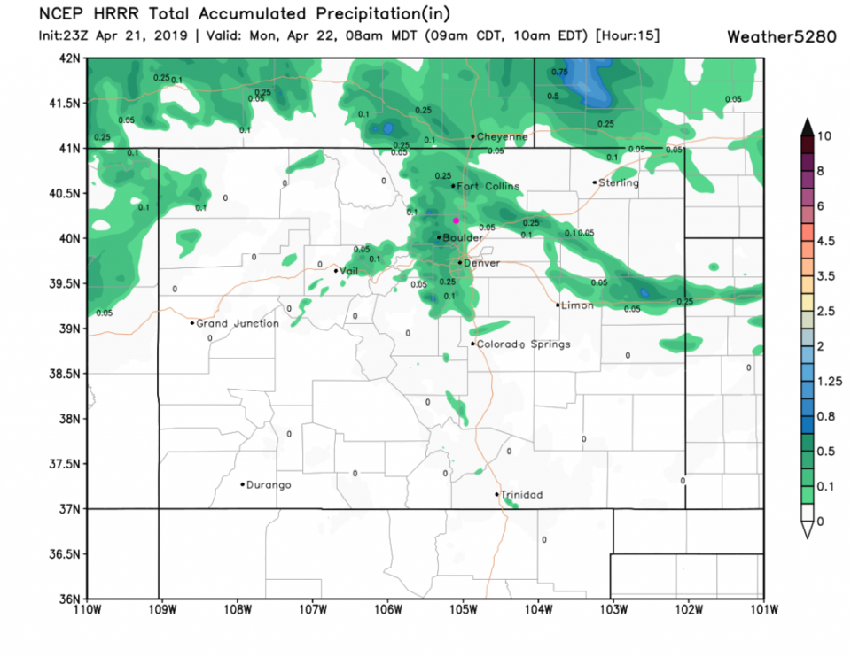
The HRRR, in contrast- just through 8am - gives us about 0.10" (Figure 3).

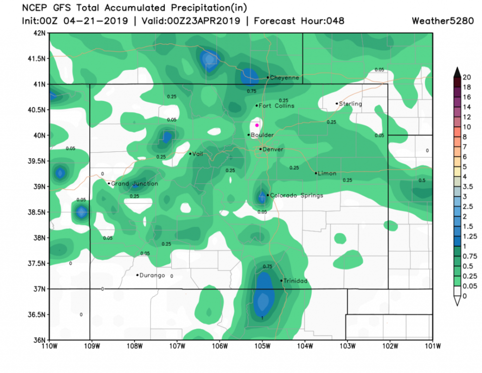
The old reliable GFS, for the next 48 hours - has us in a dry (Figure 4) hole as it did 24 hours ago- but we've had almost a quarter inch in the thunderstorms that came through Sunday afternoon (we got our egg hunt done just in time!)

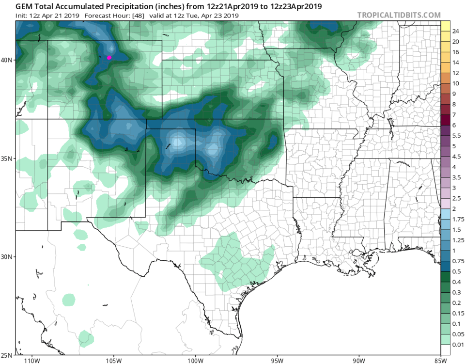
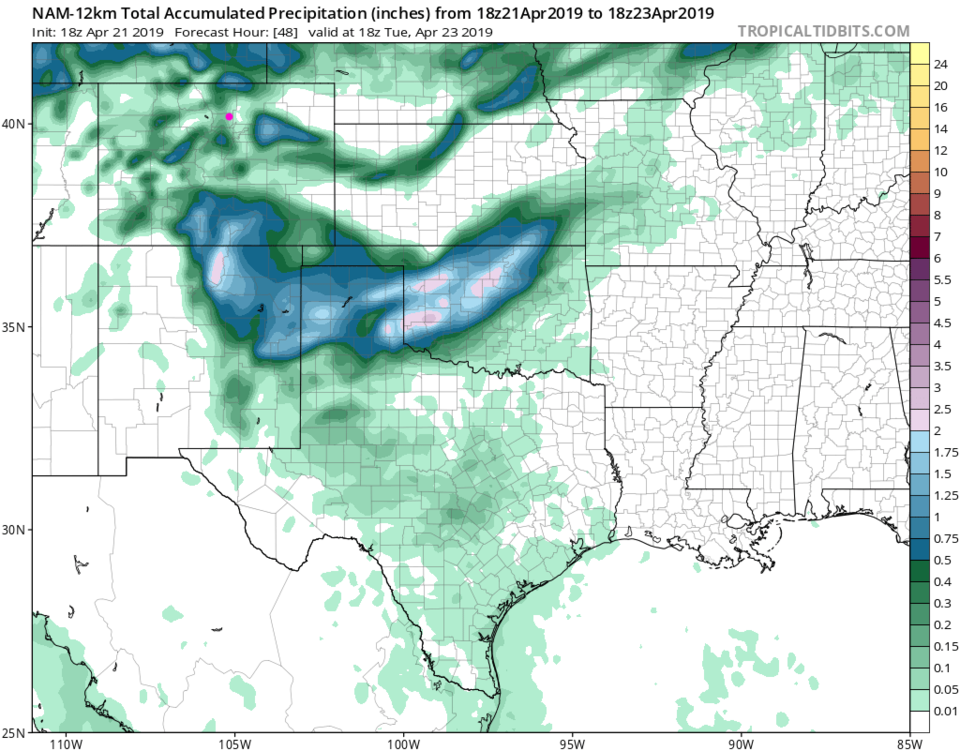
To see how different the models are, the GEM has over 1/2 inch more fall over the next 2 days (Figure 5) while the NAM (Figure 6) gives us about 0.10".

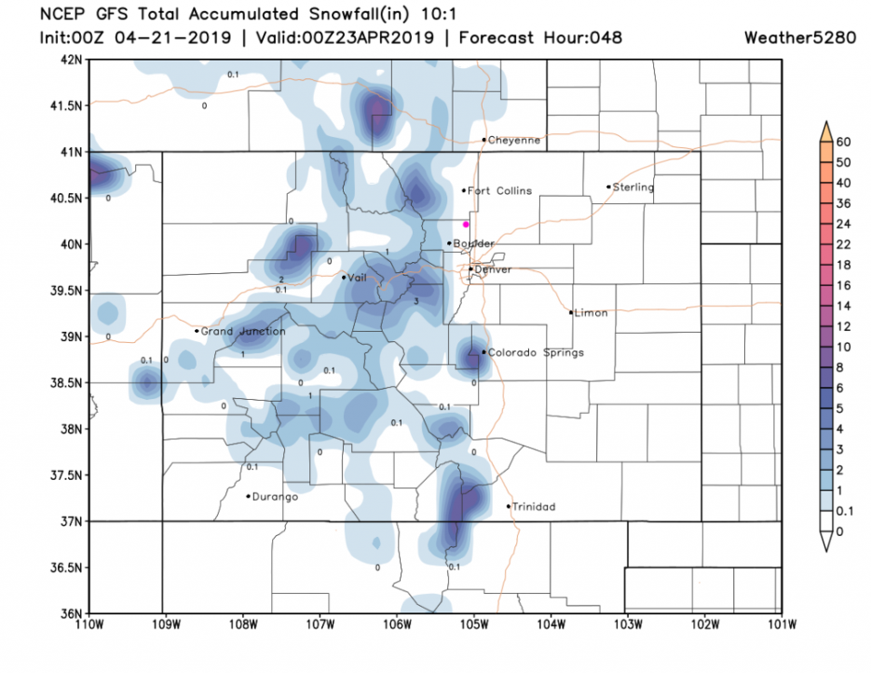
As for snow - there is just a bit in the higher mountains and- maybe- a coating in Boulder and Lyons over the next day (Figure 7).

The Longer Range Forecast:

Figure 2 - again, takes us back to 70F on Tuesday and warms us to 80F by Friday. There are only tiny chances of afternoon showers now and then - mainly Thursday. There is another storm to watch at the end of the weekend (similar to our set up right now!).

Figure 1: The forecast surface map for Monday noon from NCEP.
Figure 2: the graphical forecast for the next 10 days for Longmont, CO from weatherunderground.com
Figure 3: the HRRR precipitation prediction up to 8am Monday from weather5280.com
Figure 4: the forecast accumulated precipitation map from the GFS and weather5280.com for Colorado, through Tuesday night.
Figure 5: the forecast accumulated precipitation map from the GEM and tropicaltidbits.com for Colorado and areas east and south, through the next 2 days.
Figure 6: the forecast accumulated precipitation map from the NAM and tropicaltidbits.com for Colorado and areas east and south, through the next 2 days.
Figure 7: the forecast accumulated snowfall map from the GFS and weather5280.com for Colorado, through Tuesday night.


Current Weather

Cloudy

Cloudy

54°F

UV Index
0 Low
Pressure
29.99 Rising
Visibility
8 miles
Dewpoint
27 °F
Humidity
36%
Wind
SSE 2.7 mph
Gust
5.9 mph
Wind Chill
54 °F

Hourly Forecast

Today
1 AM
48°F
Cloudy
Today
2 AM
46°F
Mostly clear
Today
3 AM
45°F
Mostly clear
Today
4 AM
43°F
Mostly clear
Today
5 AM
41°F
Mostly clear
Today
6 AM
40°F
Mostly sunny
Today
7 AM
42°F
Mostly sunny
Today
8 AM
46°F
Intermittent clouds
Today
9 AM
50°F
Intermittent clouds
Today
10 AM
55°F
Intermittent clouds
Today
11 AM
58°F
Intermittent clouds
Today
12 PM
61°F
Intermittent clouds

7 Day Forecast

Mostly sunny

Tuesday

73 °F

Windy this morning; mostly sunny


Intermittent clouds

Tuesday Night

40 °F

Clearing


Partly sunny w/ t-storms

Wednesday

65 °F

Periods of clouds and sun, becoming breezy with a thunderstorm in the afternoon


Thunderstorms

Wednesday Night

37 °F

A thunderstorm in the evening; otherwise, mostly cloudy


Intermittent clouds

Thursday

64 °F

Windy with intervals of clouds and sun


Mostly cloudy

Thursday Night

36 °F

Mostly cloudy


Partly sunny

Friday

68 °F

Some sun; breezy in the afternoon


Mostly clear

Friday Night

36 °F

Mainly clear


Partly sunny

Saturday

69 °F

Partly sunny


Partly cloudy

Saturday Night

41 °F

Patchy clouds


Sunrise and Sunset

Sunrise
6:00 AM
Sunset
7:55 PM

Based on AccuWeather data