Skip to content

Next Storm/Next Snow Forecast Discussion from the Cherrywood Observatory – April 21, 2019

This content was originally published by the Longmont Observer and is licensed under a Creative Commons license.

The weather in brief:

I've had a request to make these discussions a big shorter - but sometimes I have a lot to say. So I'm going to try a "weather in brief" section up front, then go into more details below in the forecast discussion. If you want it quickly, it'll be up here. If you want all the messy model stuff, it'll be below. Tell me how this works for you in the comments section!

In brief, the storm is shaping up to have less moisture and be stronger up in Wyoming - so much less rain is expected from 2pm Sunday to Tuesday. Maybe only 1/4 th inch. We cool to just a bit below normal for a couple days then warm up again all week.

Forecast Discussion:

The Sunrise Forecast for Easteris now looking as:

6:00am, Partly cloudy skies 50F with no rain. Cloud cover at 40%. Winds from the West or Northwest at 3mph. Pretty nice!

The storm has changed its characteristics over the last couple of days. The may dynamical lift of the system will remain north of our area and there is less moisture expected in the atmosphere (maybe only 0.6 inch of precipitatable water). Rather than an inch or more of water, we may only get a few tenths according to some models.

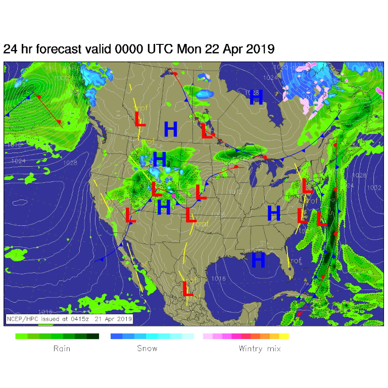
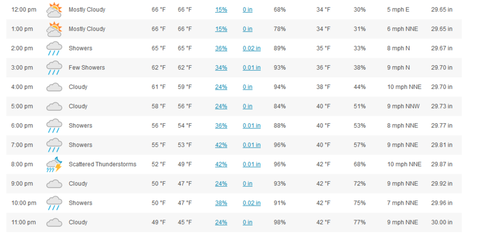
For Sunday afternoon, there is a front draped across the state with rain near and north of the front (Figure 1). The graphical display at weatherunderground.com is broken but their tabulated data shows rain chances holding off until around 2pm, and much more minimal than we've been watching this week (I'm sad - Figure 2).

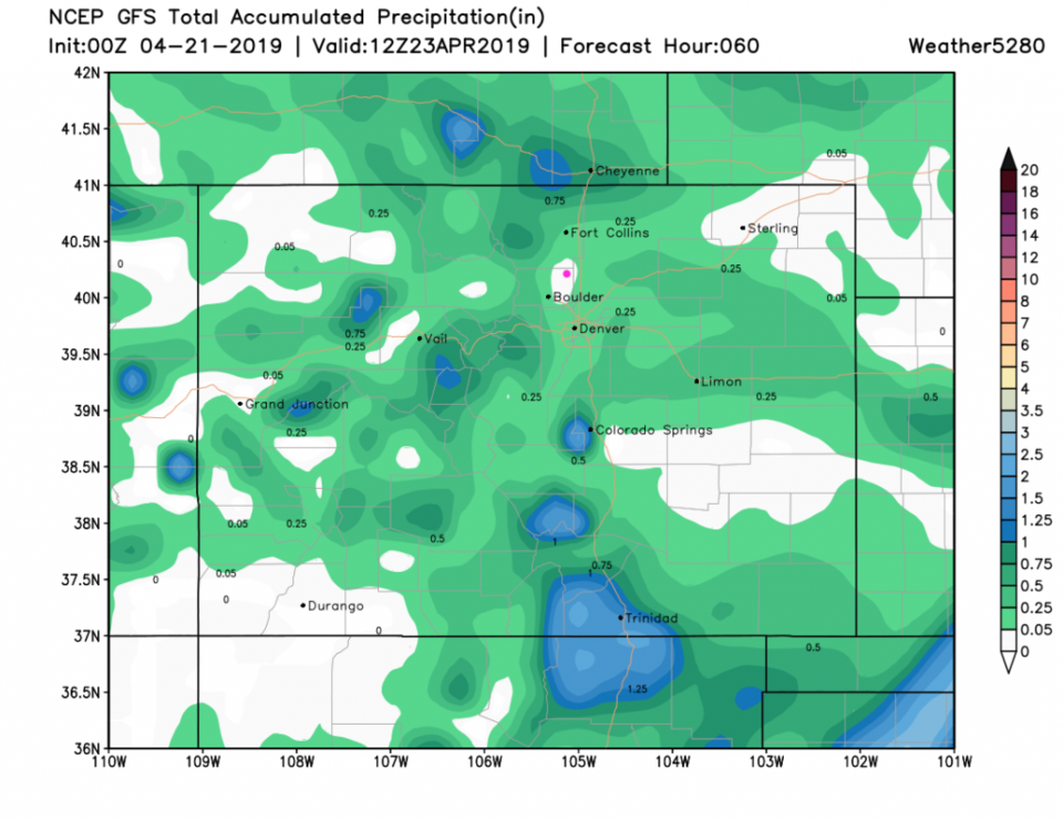
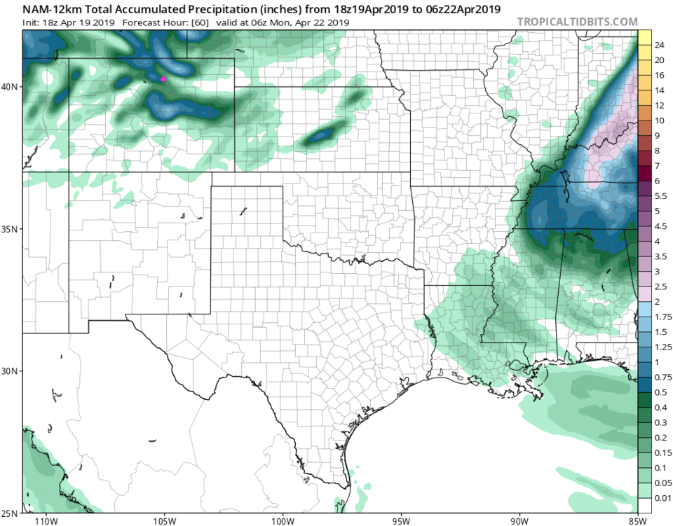
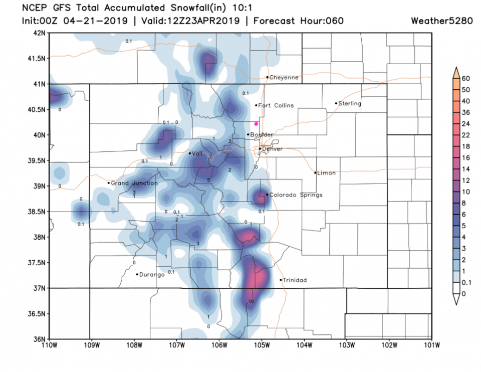
The GFS gives almost NO rain over the next 3 days (Figure 3). The NAM only gives us about 1/3rd inch of rain (Figure 4). Snowfall over the next 3 days is a mere shadow of what we saw just a day ago in the models - up in the mountains and foothills (Figure 5).

The longer range forecast:

We drop to the 50's briefly Monday (but remain above freezing at night) - then warm to the 70's and 80's (by the end of the week). Things stay dry the rest of the week (Figure 6). Happy Easter all!


Figure 1: The forecast surface map for Sunday PM from NCEP.
Figure 2: the tabulated forecast for the next day for Longmont, CO from weatherunderground.com
Figure 3: the forecast accumulated precipitation map from the GFS and weather5280.com for Colorado, through Tuesday night.
Figure 4: the forecast accumulated precipitation map from the NAM and tropicaltidbits.com for Colorado and areas east and south, through the next 3 days.
Figure 5: the forecast accumulated snowfall map from the GFS and weather5280.com for Colorado, through Tuesday night.
Figure 6: the graphical forecast for the next 10 days for Longmont, CO from weatherunderground.com


Current Weather

Light rain

Light rain

41°F

UV Index
1 Low
Pressure
29.92 Steady
Visibility
5 miles
Dewpoint
38 °F
Humidity
91%
Wind
N 3.8 mph
Gust
7.6 mph
Wind Chill
38 °F

Hourly Forecast

Today
4 PM
42°F
Rain
Today
5 PM
42°F
Cloudy
Today
6 PM
42°F
Rain and snow
Today
7 PM
41°F
Rain and snow
Today
8 PM
42°F
Rain
Today
9 PM
42°F
Showers
Today
10 PM
41°F
Rain
Today
11 PM
41°F
Rain
Tomorrow
12 AM
41°F
Rain
Tomorrow
1 AM
40°F
Rain
Tomorrow
2 AM
39°F
Rain
Tomorrow
3 AM
39°F
Rain

7 Day Forecast

Rain and snow

Saturday

42 °F

Chilly with a mix of snow and rain; travel in the foothills and mountains will be slippery due to snow


Rain and snow

Saturday Night

36 °F

Cloudy with rain, mixed with a little snow late; travel in the foothills and mountains will be slippery due to snow


Thunderstorms

Sunday

60 °F

Mostly cloudy and warmer; a thundershower in spots in the afternoon


Partly cloudy w/ t-storms

Sunday Night

37 °F

A thunderstorm in spots in the evening; otherwise, partly cloudy


Partly sunny

Monday

71 °F

Partly sunny, pleasant and warmer


Intermittent clouds

Monday Night

42 °F

Partly cloudy


Mostly sunny

Tuesday

73 °F

Mostly sunny; pleasant in the afternoon


Mostly cloudy

Tuesday Night

40 °F

Mostly cloudy


Intermittent clouds

Wednesday

65 °F

Times of sun and clouds with a passing shower in the afternoon


Rain

Wednesday Night

35 °F

Mainly clear


Sunrise and Sunset

Sunrise
6:04 AM
Sunset
7:52 PM

Based on AccuWeather data