Skip to content

Next Storm/Next Snow Forecast Discussion from the Cherrywood Observatory – April 23, 2019

This content was originally published by the Longmont Observer and is licensed under a Creative Commons license.

In Brief:

After morning mist and clouds, we warm up for almost a week with only a small chance of an afternoon shower now and then. Next week may see a cool down and another rain event.

Forecast Discussion:

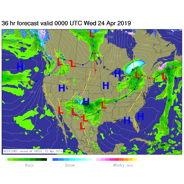
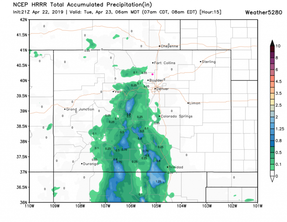
It was cloudy, misty, and foggy in places Monday PM- which will continue through Tuesday AM before dry air moves in from the north shoving the precipitation down to the south. (Figure 1 and Figure 2). There ARE showers nearby in the foothills but not much measurable overnight Monday/Tuesday close to town.

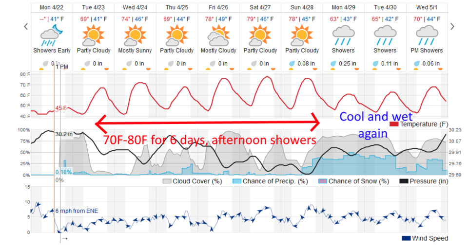
Once the clouds break, mid-morning, we warm to 70°F.

The Longer Range Forecast

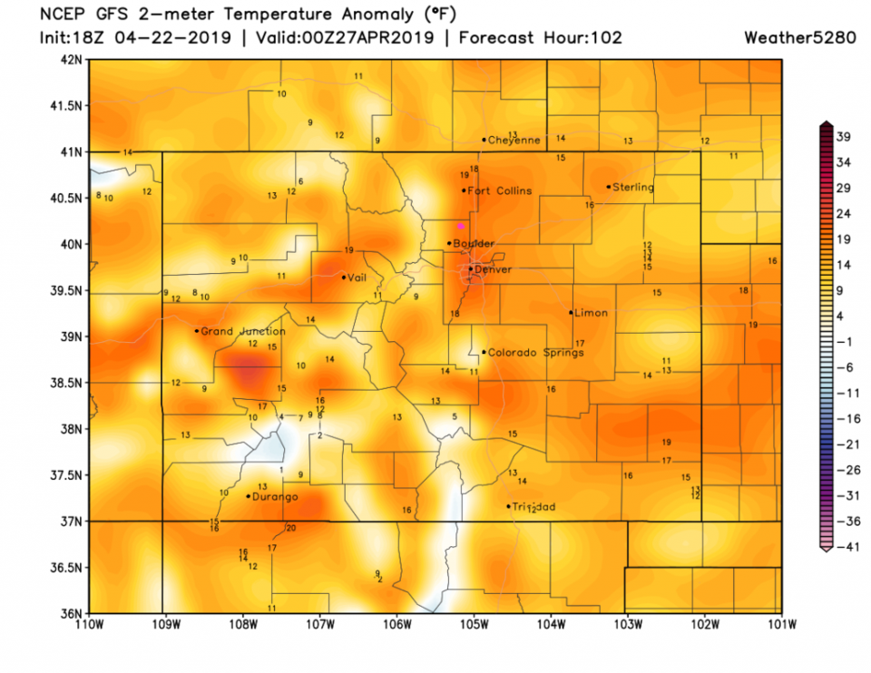
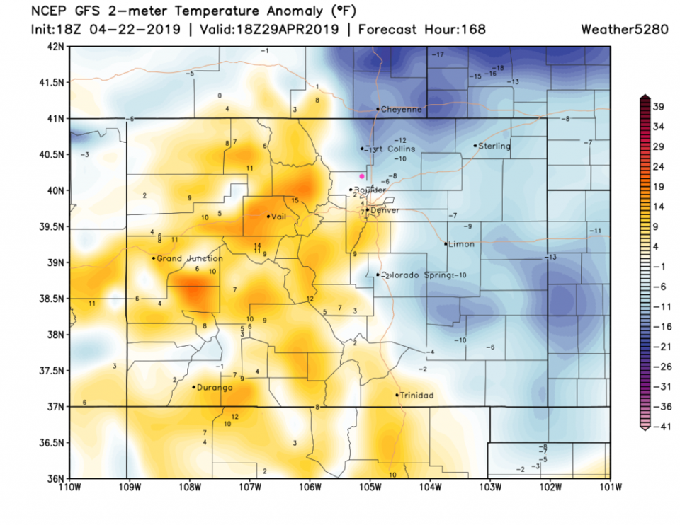
By Saturday (Figure 4 and Figure 2) we are almost 20°F above normal and hovering around 80°F again. The next shot of cool air arrives Monday next week to drop us to about 5°F below normal (but still above freezing over the next 10 days - Figure 5). Rain chances return then too. More later! Enjoy some more spring.

Figure 1: The forecast surface map for Tuesday PM from NCEP.
Figure 2: the HRRR precipitation prediction up to 6 am Tuesday from weather5280.com
Figure 3: the graphical forecast for the next 10 days for Longmont, CO from weatherunderground.com
Figure 4: The forecast temperature departure from normal map from the GFS and weather5280.com for Colorado, Saturday PM.
Figure 5: The forecast temperature departure from normal map from the GFS and weather5280.com for Colorado, Monday noon.


Current Weather

Light rain

Light rain

43°F

UV Index
1 Low
Pressure
29.91 Steady
Visibility
7 miles
Dewpoint
40 °F
Humidity
90%
Wind
N 4 mph
Gust
8 mph
Wind Chill
41 °F

Hourly Forecast

Today
6 PM
42°F
Rain and snow
Today
7 PM
41°F
Rain and snow
Today
8 PM
42°F
Rain
Today
9 PM
42°F
Showers
Today
10 PM
41°F
Rain
Today
11 PM
41°F
Rain
Tomorrow
12 AM
41°F
Rain
Tomorrow
1 AM
40°F
Rain
Tomorrow
2 AM
39°F
Rain
Tomorrow
3 AM
39°F
Rain
Tomorrow
4 AM
38°F
Cloudy
Tomorrow
5 AM
37°F
Cloudy

7 Day Forecast

Rain and snow

Saturday

42 °F

Chilly with a mix of snow and rain; travel in the foothills and mountains will be slippery due to snow


Rain and snow

Saturday Night

37 °F

Cloudy with rain, mixed with a little snow late; travel in the foothills and mountains will be slippery due to snow


Thunderstorms

Sunday

61 °F

Mostly cloudy and warmer; a thundershower in spots in the afternoon


Partly cloudy w/ t-storms

Sunday Night

37 °F

A thunderstorm in spots in the evening; otherwise, partly cloudy


Partly sunny

Monday

71 °F

Partly sunny, pleasant and warmer


Intermittent clouds

Monday Night

42 °F

Partly cloudy


Mostly sunny

Tuesday

73 °F

Mostly sunny and pleasant


Mostly cloudy

Tuesday Night

43 °F

Mostly cloudy


Intermittent clouds

Wednesday

65 °F

Times of sun and clouds with a passing shower in the afternoon


Rain

Wednesday Night

42 °F

Mainly clear


Sunrise and Sunset

Sunrise
6:04 AM
Sunset
7:52 PM

Based on AccuWeather data