This content was originally published by the Longmont Observer and is licensed under a Creative Commons license.
In Brief:
The high that is steering the airflow over the state jogs east today and gives us our best-yet flow of tropical moisture. Severe weather is possible today (Thursday) with hail and high winds being the biggest threat. After today, the high moves back to the west and we return to warm weather and daily/afternoon thunderstorm chances.
9am Update:
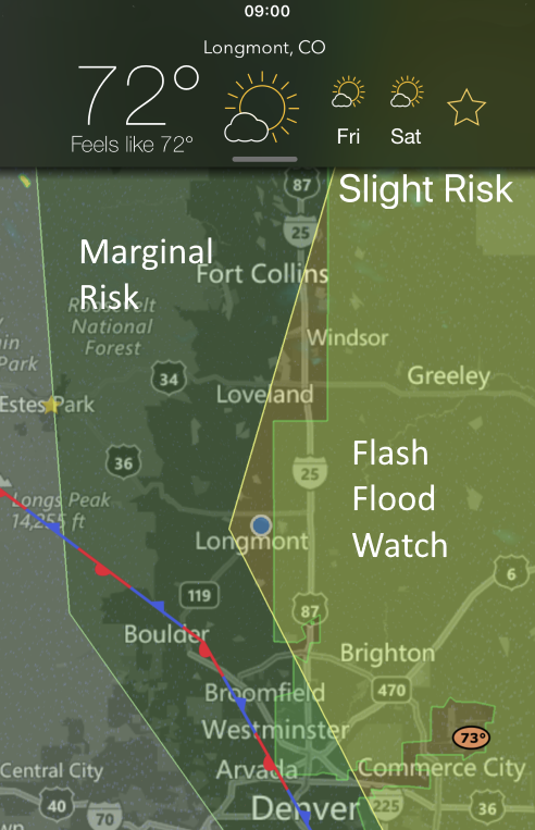
A Slight Risk (2 on a scale of 1-5) is now in place for the I-25 towns and areas eastward. A Marginal Risk (1 out of 5) is still in place for the Front Range foothills (about up to the Divide) . There is also a Flash Flood watch (conditions are right for locally flooding rains under heavier storms later today - this is not a warning, which means flooding is imminent or occurring) for the region from roughly around County Line Rt. 1 and areas eastward. Precipitatable water is deep (0.7 inch expected to approach 1 inch around Longmont later today) and the incoming shortwave is pretty strong for this time of year.
Storms should begin to form around 11am in the foothills and begin to impact the I-25 corridor around 1pm and continue until about 9pm. Keep an eye on your weather apps (my favorite on IOS are My Radar, RadarScope, Storm Shield, Dark Sky, RainAware currently).
End 9am Update.
Forecast Discussion:
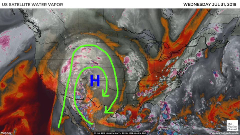
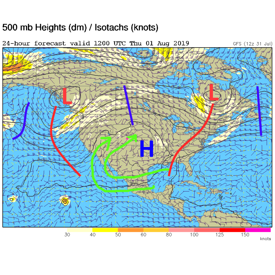
The high on Wednesday was entering the Oklahoma and Texas panhandle with a very obvious moisture flow anti-cycling around it (Figure 1, bright green arrows). The GFS jogs this center over to central Oklahoma as a short wave moves in (the wiggle in the isoheight line at the tip of the left most green arrow - Figure 2). We'll have cooler and very moist surface winds coming in from the east (upslope!) and moist air in the mid levels of the atmosphere flowing in from the southwest. With healthy daytime heating, severe weather is possible again.
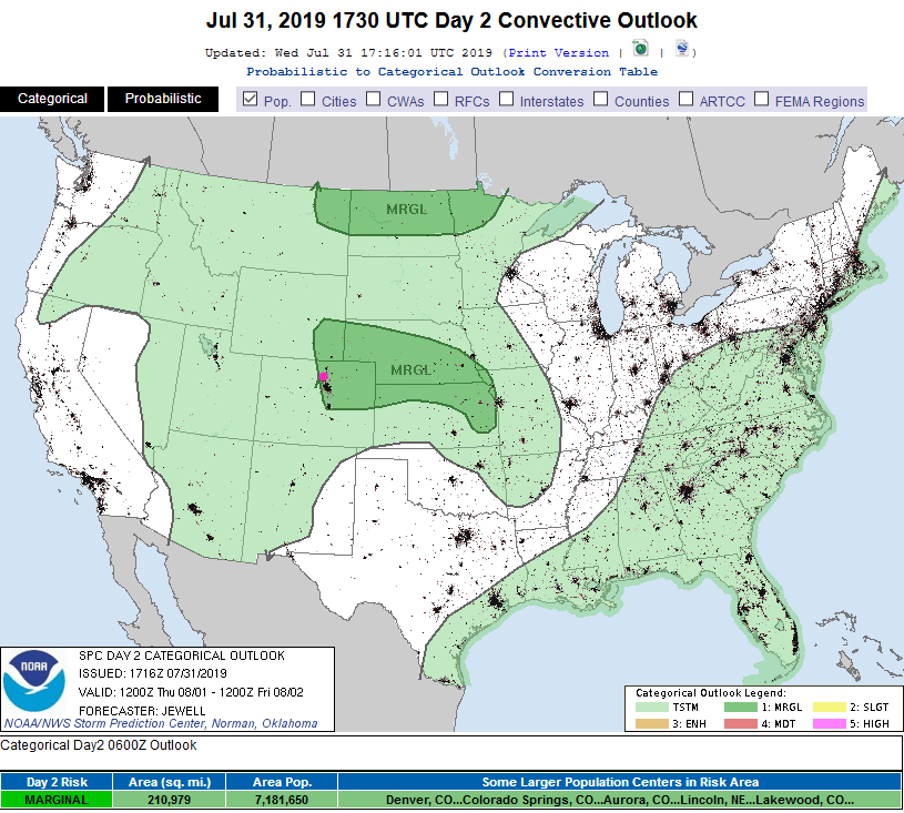
The SPC has painted the northeast corner of Colorado with a Marginal Risk of severe weather - for hail and high winds - Thursday (Figure 3).
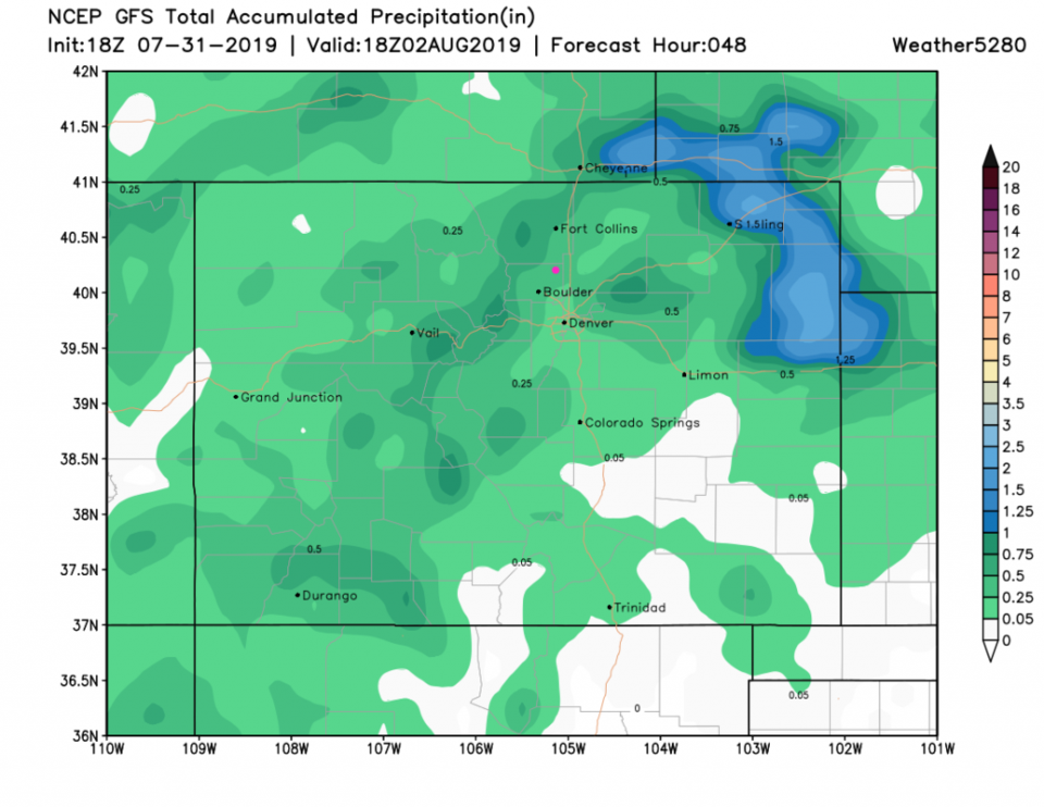
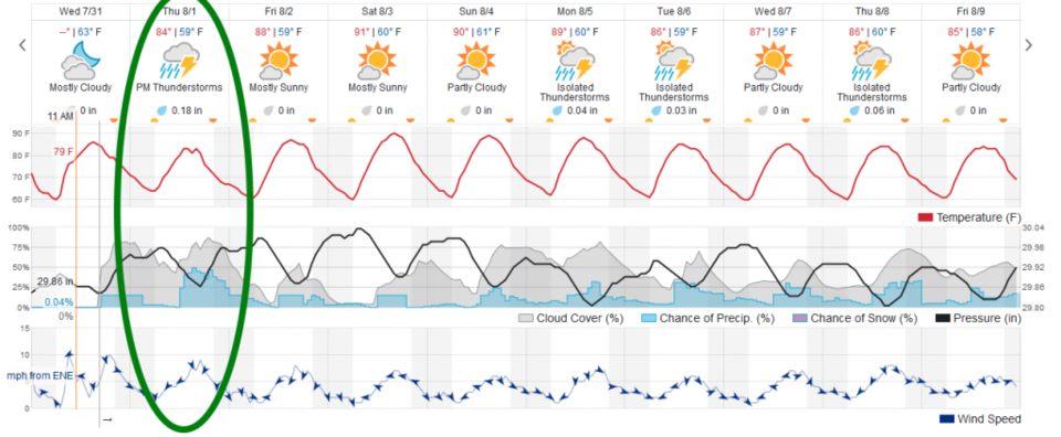
The GFS givs us 0.25-0.50 inch of rain (though thunderstorms can hit some areas with 1+ inch of water and miss other areas entirely - Figure 4). The weatherunderground.com model gives us 0.18 inch of water.
The Longer Range Forecast:
After this, the high wanders back to the Four Corners area and we get less moisture, but enough will be sitting around for daily afternoon storms. We warm a bit from Thursday's low 80F temperature to hover around 90F for the next week.
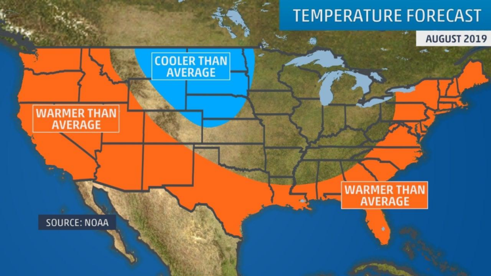
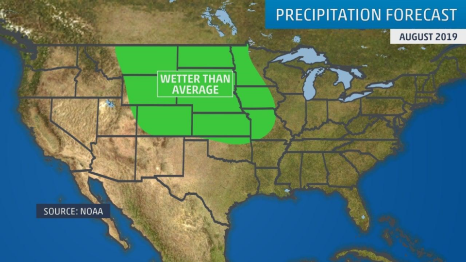
With August beginning today - we can check on what the weather.com folks are thinking about the new month. Figure 6 is the temperature trend - they give us normal to maybe a bit below normal temperatures for the month as a whole. Figure 7 shows them expecting above normal precipitation for August. We'll see!