Skip to content

3pm Wed. Update: Next Storm/Next Snow Forecast Discussion from the Cherrywood Observatory – August 14-15, 2019

This content was originally published by the Longmont Observer and is licensed under a Creative Commons license.

In Brief:

After a possible round of strong later night storms Tuesday PM, we'll have warm to hot weather and afternoon storms most days this week. Severe weather chances are just to our east and may get bumped any day back to include I-25 folks. Keep aware!

3pm Update:

The NWS and high resolution models were correct and the outflow from the storms, that formed to the distant east earlier in the day Tuesday, hit the Front Range late in the evening and triggered hail producing storms. My rain gauge picked up under 1/10th of an inch of rain.

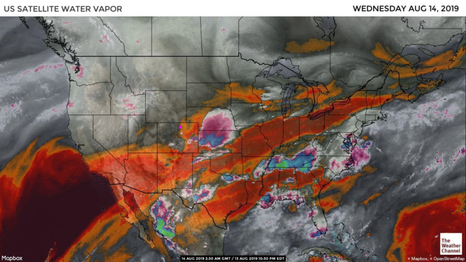
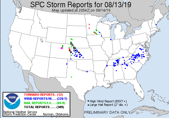
There were hail, tornado, and high wind reports in Colorado and just over the line into Kansas yesterday. Longmont is the big pink dot (Figure 1 update).

A similar situation is occurring again today (Wednesday) but the outflow boundary headed for us this evening is not expected to be able to trigger activity this time (due to moisture levels and the vertical temperature structure of the atmosphere).

Figure 1 update: the SPC storm reports up to 7am Wednesday.

End 3pm Update.

Forecast Discussion:

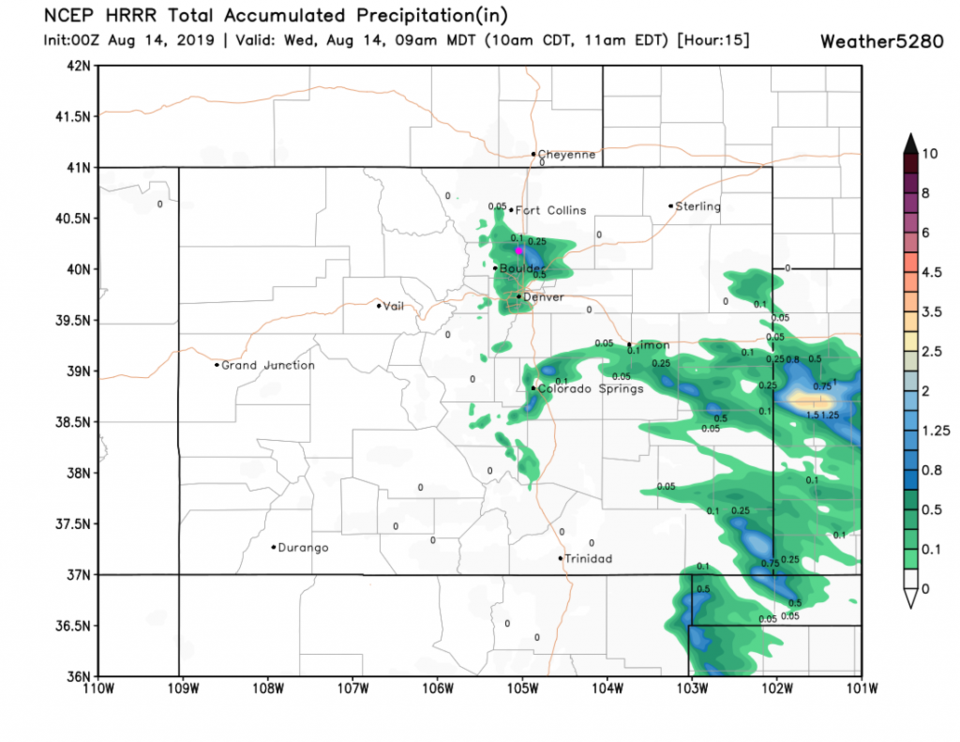
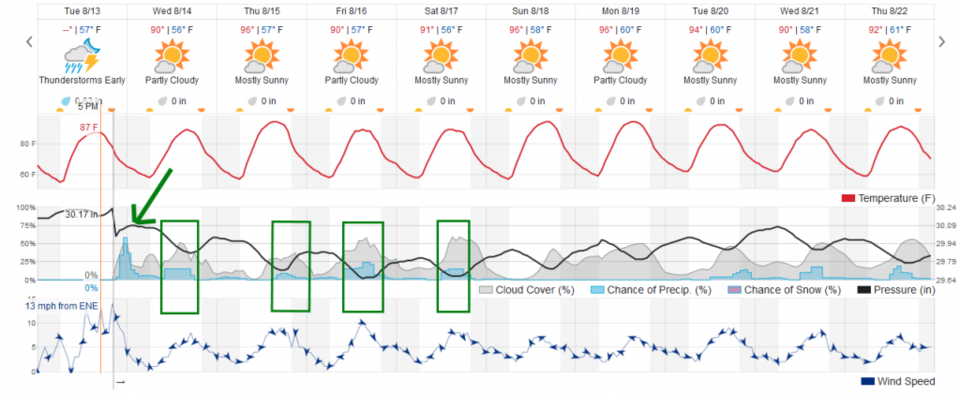
There was some rich, shallow, moisture east of a dryline that formed east of Longmont Tuesday. This situation will keep repeating each day for the next few days (Figure 1). The High Resolution Rapid Refresh model (HRRR) and others are predicting some strong storms to form - yet - Tuesday night. The HRRR (Figure 2) has 2/3rds of an inch hit the town tonight and the weatherunderground model is very similar (green arrow in Figure 3). We'll see, but the NWS is expecting it too.

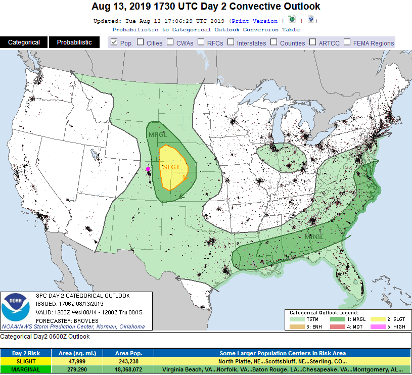
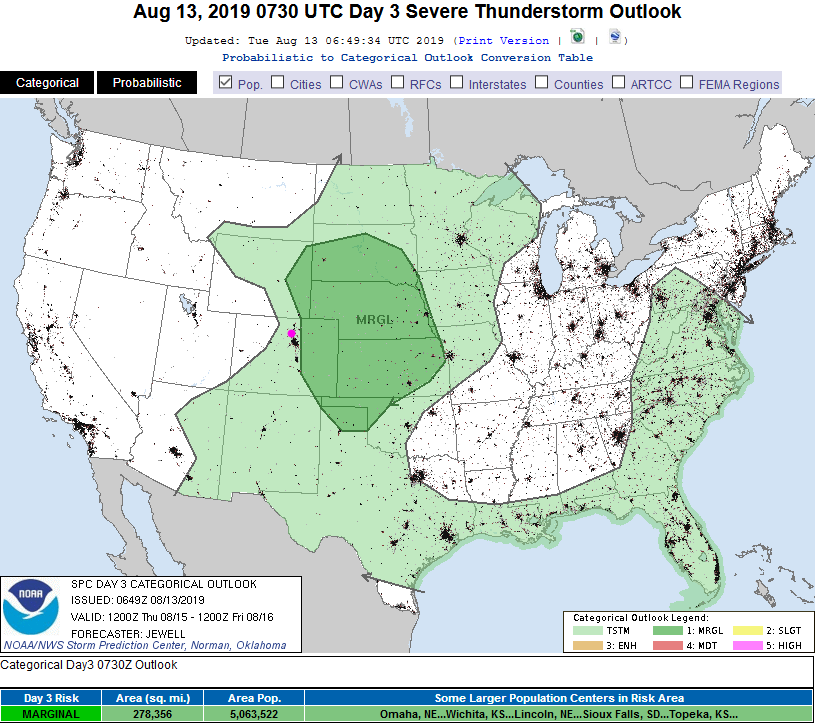
For Wednesday, we have a repeat that may be not as severe for the state (there was record breaking hail and a number of tornadoes out on the eastern Plains Tuesday). The severe chances are close - a Marginal Risk is maybe 50 miles to the east (Figure 4).

The Longer Range Forecast:

We see 90'sF continue, severe storms nearby (Thursday's Marginal Risk to our east is seen in Figure 5). The fine details will be better seen a day or two out as the week goes on.

Figure 1 update: the water vapor satellite image (browns/reds are dry air, whites and light grey is moist air, purple/blue is ice and high cloud tops). From the the Weather Channel from Tuesday PM.
Figure 2: The HRRR model 15 hour precipitation forecast up to 9am Wednesday from weather5280.com
Figure 3: the graphical forecast for the next 10 days for Longmont, CO from weatherunderground.com
Figure 4: The severe storm weather forecast for the U.S. from the Storm Predication Center in Norman, OK. Made Tuesday for Wednesday.
Figure 5: The severe storm weather forecast for the U.S. from the Storm Predication Center in Norman, OK. Made Tuesday for Thursday.

Current Weather

Cloudy

Cloudy

56°F

UV Index
0 Low
Pressure
29.66 Rising
Visibility
8 miles
Dewpoint
42 °F
Humidity
58%
Wind
NNW 4.5 mph
Gust
12 mph
Wind Chill
56 °F

Hourly Forecast

Today
10 PM
54°F
Cloudy
Today
11 PM
54°F
Cloudy
Tomorrow
12 AM
53°F
Cloudy
Tomorrow
1 AM
52°F
Cloudy
Tomorrow
2 AM
51°F
Cloudy
Tomorrow
3 AM
51°F
Cloudy
Tomorrow
4 AM
50°F
Cloudy
Tomorrow
5 AM
51°F
Cloudy
Tomorrow
6 AM
51°F
Cloudy
Tomorrow
7 AM
52°F
Cloudy
Tomorrow
8 AM
56°F
Cloudy
Tomorrow
9 AM
59°F
Cloudy

7 Day Forecast

Mostly cloudy w/ showers

Thursday

72 °F

Turning cloudy, warm; an afternoon shower or two


Thunderstorms

Thursday Night

50 °F

A thunderstorm in parts of the area this evening; otherwise, considerable cloudiness and mild


Thunderstorms

Friday

70 °F

Mostly cloudy with a couple of thundershowers


Thunderstorms

Friday Night

43 °F

Cloudy with a couple of thundershowers


Rain

Saturday

46 °F

Chilly with periods of rain and a thunderstorm


Rain and snow

Saturday Night

39 °F

Cloudy with rain, mixed with a little snow late


Mostly cloudy

Sunday

59 °F

Mostly cloudy and warmer; a stray afternoon thundershower


Partly cloudy

Sunday Night

36 °F

Partly cloudy


Partly sunny

Monday

71 °F

Partly sunny, pleasant and warmer


Partly cloudy

Monday Night

42 °F

Partly cloudy


Sunrise and Sunset

Sunrise
6:07 AM
Sunset
7:50 PM

Based on AccuWeather data