Skip to content

10am Update: Next Storm/Next Snow Forecast Discussion from the Cherrywood Observatory – August 2-3, 2019

This content was originally published by the Longmont Observer and is licensed under a Creative Commons license.

In Brief:

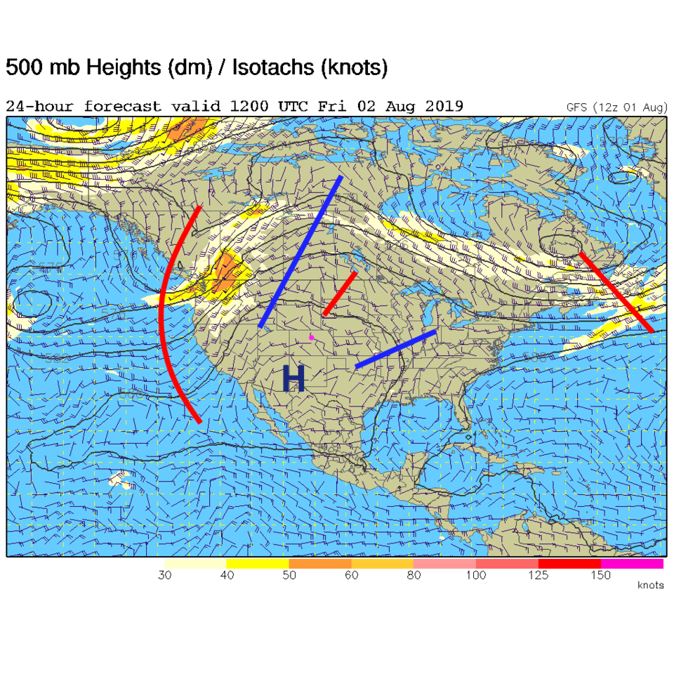
After rain dumped on a few spots in Colorado Thursday PM, the upper level high reforms over the southwestern U.S. Moisture will still flow into the ridge, but at a lesser rate. Low level winds will return to a northwesterly direction drying things out a bit. We hover around the upper 80'sF and lower 90'sF until a (hinted) return of more moisture next week.

10am Update:

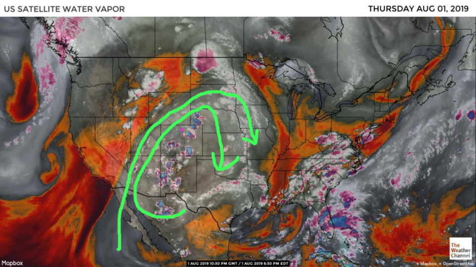
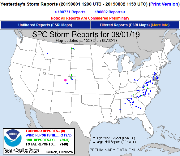
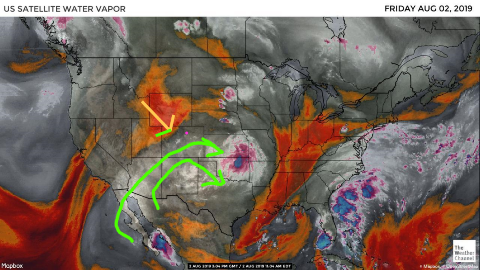
The severe weather predictions yesterday may have been a bit over-done - persistent clouds limited heating needed to push the plentiful moisture up into stronger storms. Still, there were some high wind and hail reports in NE Colorado (Figure 1 update). There is still some deeper moisture (almost 1 inch of precipitatable water) - but the drier air is beginning to flow in from the northwest (orange arrow in Figure 2 update).

Figure 1 update: storm reports to the SPC for Thursday 8/1 nationwide.
Figure 2 update: the water vapor satellite image (browns/reds are dry air, whites and light grey is moist air, purple/blue is ice and high cloud tops). From the the Weather Channel from Thursday.

End 10am Update.

Forecast Discussion:

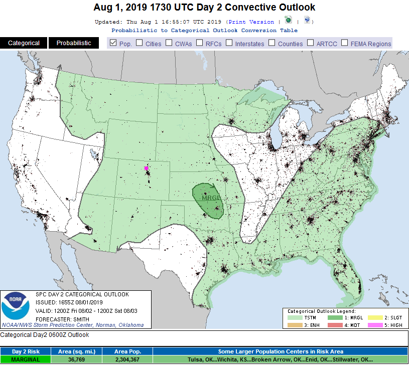
There was 'some' excitement (thunderstorm-wise) across the state on Thursday (I'll update with interesting storm reports Friday). As the upper level trough of Thursday passes, the high center will reform over the desert Southwest (Figure 2). Moisture will still be fairly abundant for the next few days (Figure 1). For Friday, the severe storm chances reside out in Kansas and Oklahoma, far to our east (Figure 3).

The Longer Range Forecast:

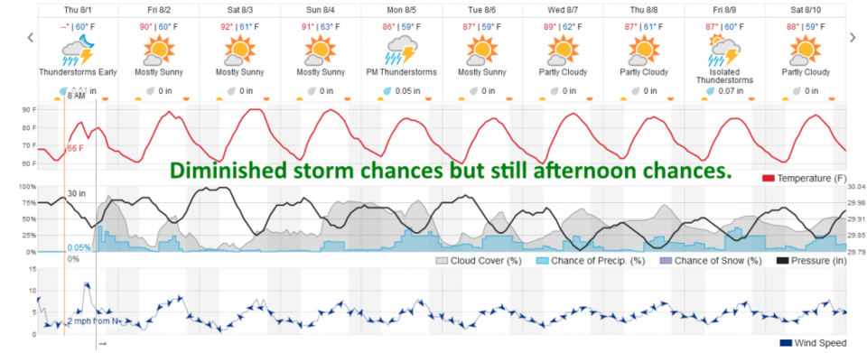
The high will jog towards our state Saturday tamping down the storms some more and warming us to the lower 90'sF - then moisture returns, temperatures drop a few degrees, and afternoon storms return (Figure 4).

Figure 1: the water vapor satellite image (browns/reds are dry air, whites and light grey is moist air, purple/blue is ice and high cloud tops). From the the Weather Channel from Thursday.
Figure 2: The 500mb forecast upper air analysis for Friday AM. Pink dot is Longmont. Red lines are troughs, blue lines are ridges.
Figure 3: The severe storm weather forecast for the U.S. from the Storm Predication Center in Norman, OK. Made Thursday for Friday.
Figure 4: the graphical forecast for the next 10 days for Longmont, CO from weatherunderground.com

Current Weather

Cloudy

Cloudy

62°F

UV Index
2 Low
Pressure
29.63 Falling
Visibility
8 miles
Dewpoint
29 °F
Humidity
29%
Wind
WSW 10.3 mph
Gust
22.8 mph
Wind Chill
62 °F

Hourly Forecast

Today
3 PM
62°F
Showers
Today
4 PM
60°F
Mostly cloudy
Today
5 PM
58°F
Intermittent clouds
Today
6 PM
56°F
Intermittent clouds
Today
7 PM
54°F
Intermittent clouds
Today
8 PM
51°F
Intermittent clouds
Today
9 PM
48°F
Partly cloudy
Today
10 PM
45°F
Partly cloudy
Today
11 PM
43°F
Partly cloudy
Tomorrow
12 AM
42°F
Mostly clear
Tomorrow
1 AM
40°F
Mostly clear
Tomorrow
2 AM
39°F
Mostly clear

7 Day Forecast

Partly sunny w/ showers

Tuesday

62 °F

Times of clouds and sun with a couple of brief showers beginning at midday; windy


Partly cloudy

Tuesday Night

34 °F

Partly cloudy and colder; there can be frost in the normally colder spots


Intermittent clouds

Wednesday

59 °F

Cool with times of clouds and sun


Mostly cloudy w/ showers

Wednesday Night

37 °F

Increasing clouds with a shower in spots late


Partly sunny w/ showers

Thursday

56 °F

Times of clouds and sun with a couple of showers; cool


Partly cloudy

Thursday Night

40 °F

Partly cloudy


Mostly cloudy

Friday

63 °F

Mostly cloudy and warmer


Clear

Friday Night

40 °F

Clear


Mostly sunny

Saturday

74 °F

Mostly sunny, pleasant and warmer


Mostly clear

Saturday Night

43 °F

Mainly clear


Sunrise and Sunset

Sunrise
5:52 AM
Sunset
8:02 PM

Based on AccuWeather data