Skip to content

Thur 8/29 Update: Next Storm/Next Snow Forecast Discussion from the Cherrywood Observatory – August 27-29, 2019

This content was originally published by the Longmont Observer and is licensed under a Creative Commons license.

In Brief:

We remain cool and dry Tuesday, we get hot but dry Wednesday/Thursday. Moisture returns and cools us a bit Friday/Saturday when afternoon storms return, then we are hot and dry later in the weekend. It looks like Fall is trying to start its engine.

11am Update Thur 8/29:

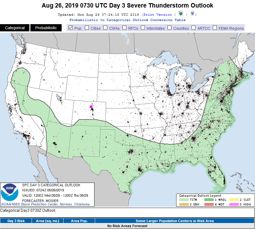
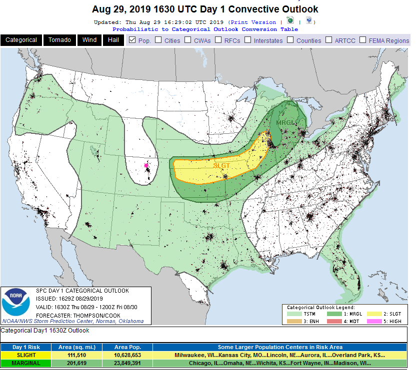
The return of moisture will be slow after the frontal passage (around 3-4pm today, still). With dry air in place and down slope heating, we should sneak up to the lower 90'sF today before that front cools things just a bit. The SPC has removed our chance of convection today (Figure 2 update). No rain for you!

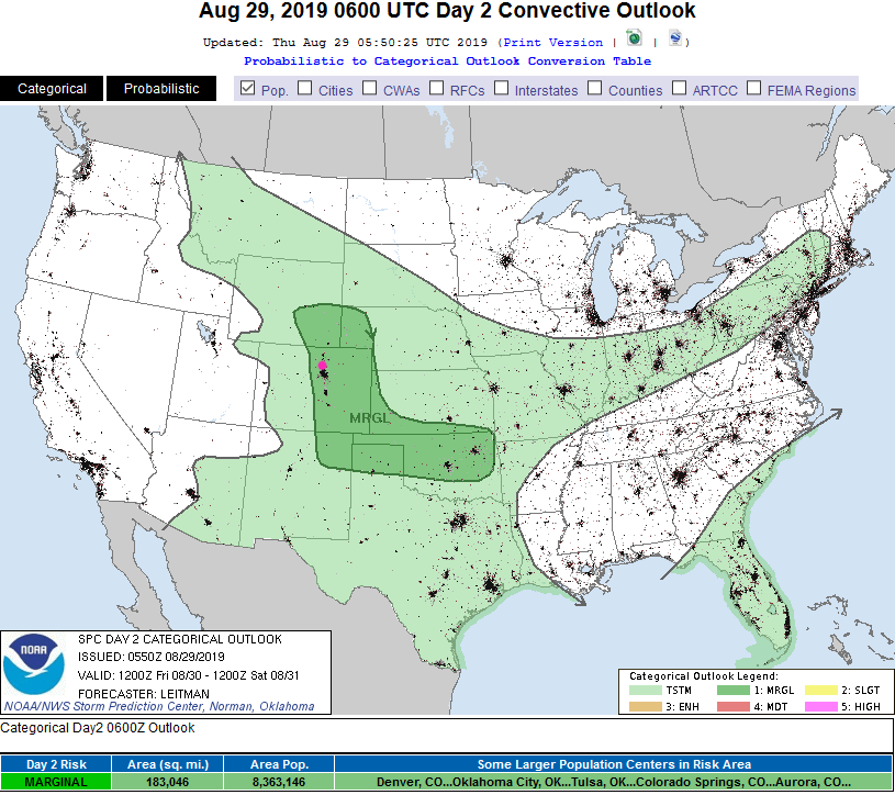
We do have a marginal risk of severe weather tomorrow (Friday - Figure 3 update). The main risk looks to be large hail in a few storms near I-25.

Figure 2 update: The severe storm weather forecast for the U.S. from the Storm Predication Center in Norman, OK. Made Thursday for Thursday.
Figure 3 update: The severe storm weather forecast for the U.S. from the Storm Predication Center in Norman, OK. Made Thursday for Friday.

End 11am Update Thur 8/29.

3pm Update Wed 8/28:

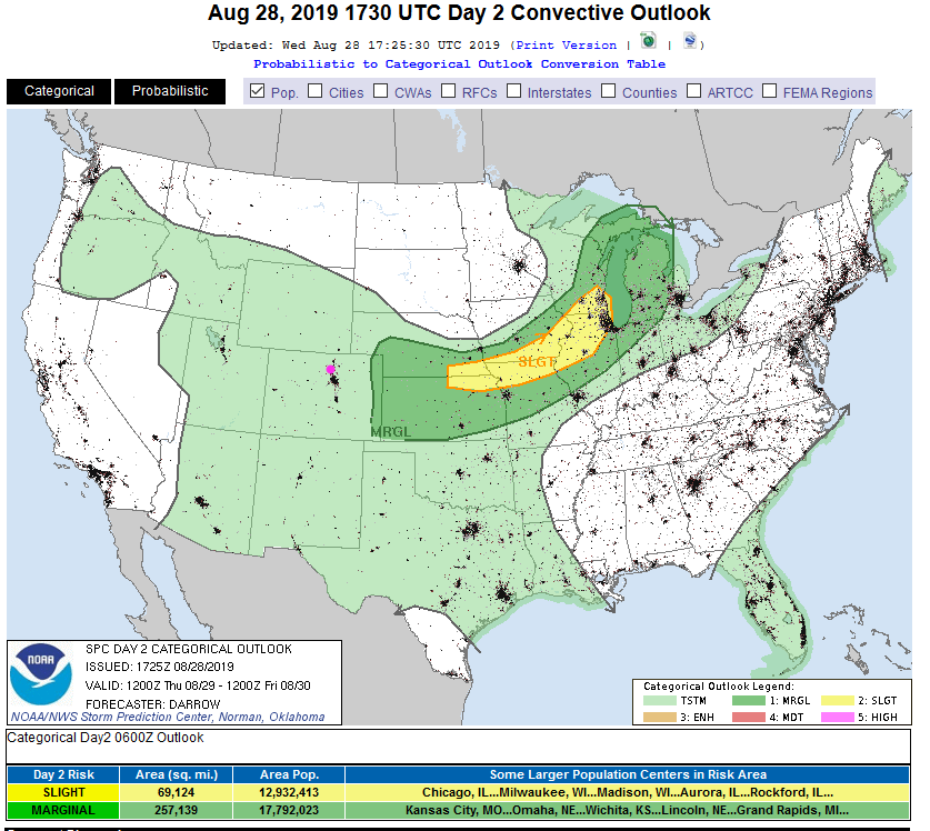
The forecast is on track with dry hot weather continuing Wednesday. We start out warm on Thursday, but a cold front will pass around 3-4pm keeping us from the 90'sF. There won't be severe weather, but there is a chance of storms (garden variety - Figure 1 update) returning this afternoon/evening. We cool about 10 degrees over Tuesday/Wednesday.

Figure 1 update: The severe storm weather forecast for the U.S. from the Storm Predication Center in Norman, OK. Made Wednesday for Thursday.

End 3pm Update.

Forecast Discussion:

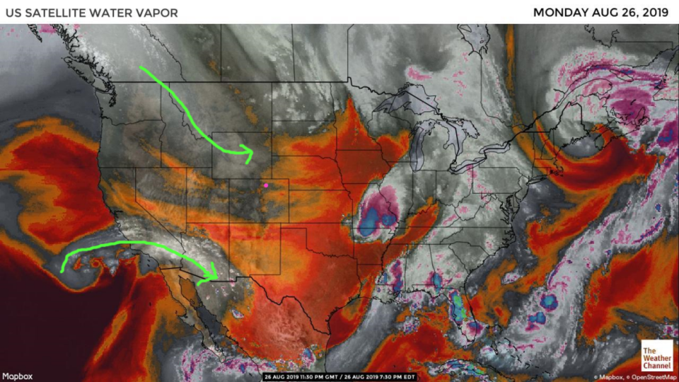
A cool front cut off the heat on Monday. This comfortable dryness will continue today (Tuesday). The dry air with little moisture anywhere near the state is visible in oranges and reds on Figure 1. We won't see any rain in the mountains or nearby plains today or Wednesday.

The Longer Range Forecast:

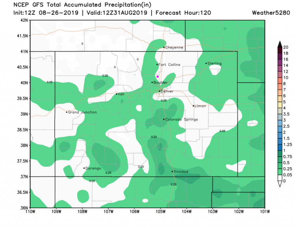
The SPC convection map is blank for northern Colorado over the next 3 days (day 3 is shown in Figure 2). The GFS 5 day precipitation map is equally unimpressive (Figure 3).

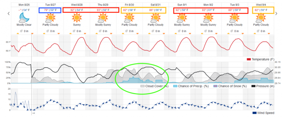
I put blocks around the temperatures with blue being quite a bit below average, red being quite a bit above average, and orange being close to average high temperatures (Figure 4). The only time we are swinging to extremes will be Friday/Saturday when some tropical moisture returns with afternoon storms again.

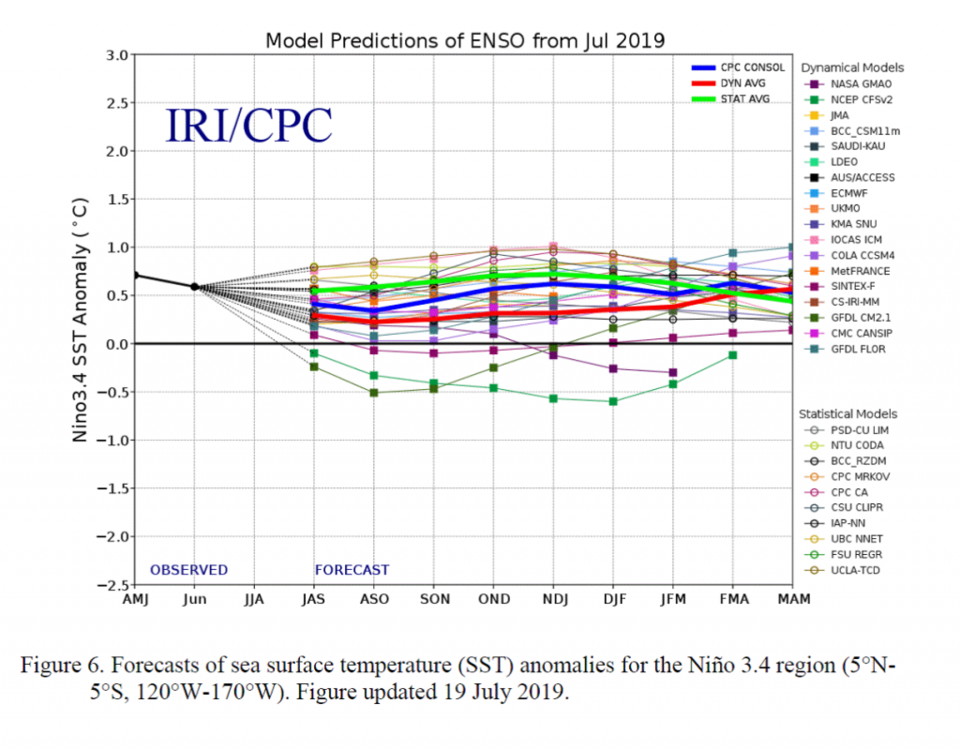
Looking WAY out into the future, the ENSO (El Nino Southern Oscillation) predictions from many models into next Spring calls for near neutral to slightly El Nino skewed Pacific ocean conditions. This means Colorado will experience fairly normal seasonal weather. We'll watch the details as the months pass!

Figure 1: the water vapor satellite image (browns/reds are dry air, whites and light grey is moist air, purple/blue is ice and high cloud tops). From the the Weather Channel from Monday evening.
Figure 2: The severe storm weather forecast for the U.S. from the Storm Predication Center in Norman, OK. Made Monday for Wednesday.
Figure 3 the forecast accumulated precipitation map from the GFS and weather5280.com for Colorado, for the next 5 days.
Figure 4: the graphical forecast for the next 10 days for Longmont, CO from weatherunderground.com
Figure 5: The ENSO indices forecast from various models through March/April/May next year (MAM). From the IRI/CPC and NWS.

Current Weather

Clear

Clear

43°F

UV Index
0 Low
Pressure
29.86 Falling
Visibility
8 miles
Dewpoint
35 °F
Humidity
71%
Wind
NW 2.2 mph
Gust
5.1 mph
Wind Chill
43 °F

Hourly Forecast

Today
4 AM
42°F
Mostly clear
Today
5 AM
40°F
Mostly clear
Today
6 AM
39°F
Mostly sunny
Today
7 AM
42°F
Mostly sunny
Today
8 AM
47°F
Partly sunny
Today
9 AM
52°F
Partly sunny
Today
10 AM
57°F
Intermittent clouds
Today
11 AM
62°F
Mostly cloudy
Today
12 PM
65°F
Cloudy
Today
1 PM
69°F
Cloudy
Today
2 PM
73°F
Cloudy
Today
3 PM
75°F
Cloudy

7 Day Forecast

Intermittent clouds

Saturday

64 °F

Cooler with clouds giving way to some sun


Mostly clear

Saturday Night

39 °F

Clear to partly cloudy


Mostly cloudy

Sunday

77 °F

Rather cloudy and warmer; breezy this afternoon


Mostly cloudy

Sunday Night

48 °F

Cloudy most of the time


Windy

Monday

57 °F

Winds gusting past 40 mph; cloudy and cooler


Intermittent clouds

Monday Night

43 °F

Partly cloudy


Intermittent clouds

Tuesday

59 °F

Windy and cool with times of clouds and sun


Partly cloudy

Tuesday Night

32 °F

Partly cloudy


Intermittent clouds

Wednesday

60 °F

Times of clouds and sun


Intermittent clouds

Wednesday Night

35 °F

Partly cloudy


Sunrise and Sunset

Sunrise
5:55 AM
Sunset
7:59 PM

Based on AccuWeather data