Skip to content

Next Storm/Next Snow Forecast Discussion from the Cherrywood Observatory – August 30-31, 2019

This content was originally published by the Longmont Observer and is licensed under a Creative Commons license.

In Brief:

A cold front arrived Thursday and will hang around for a day and a half. It will allow some moisture to return and may trigger severe weather (a Marginal Risk for Friday) with large hail. For Labor Day weekend, the front leaves and we bake again in the 90'sF Saturday-Monday. Go take advantage of that pool!

Forecast Discussion:

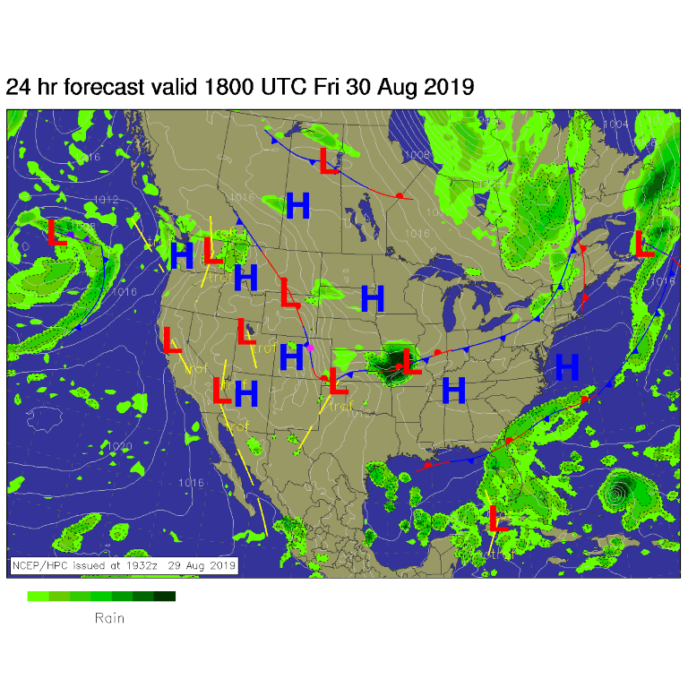
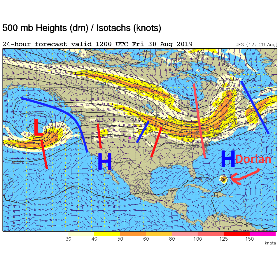
The cold front that arrived Thursday afternoon is draped down the Front Range foothills but the air in place is still very dry (Figure 1). This will get a bit of a reinforcement Friday with a bit more moisture returning. A short wave ripple in the upper level flow (Figure 2) will pass Friday increasing storm chances late morning through the evening (Figure 3).

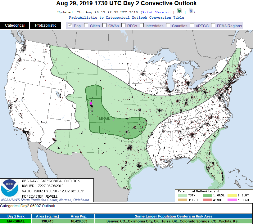
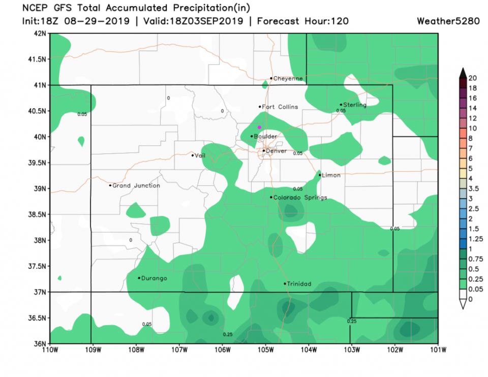
The SPC has issued a Marginal Risk (1 on a scale of 1-5) for the eastern half of Colorado for Friday. Super cellular storms with large hail will be the main threat (Figure 4). Still, looking at the precipitation for the next 5 days, not much is expected to fall over a large region according to the GFS (Figure 5). Most people won't get wet.

The Longer Range Forecast:

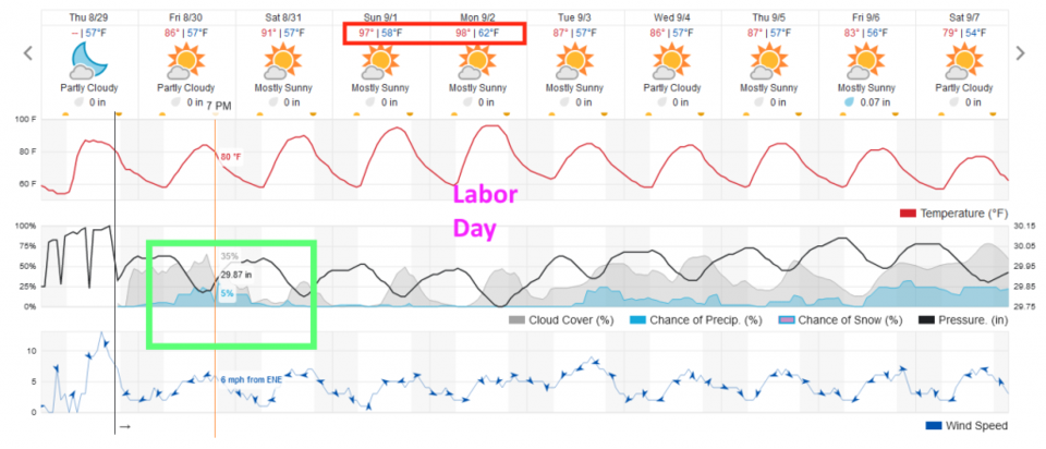
Our regularly scheduled summer returns on Saturday and things dry out for the long weekend (Figure 4). We might see some moisture return and temperatures go back to normal next week with a hint of a big cold front at the end of next week (that is a LONG way out though, so don't get too excited).

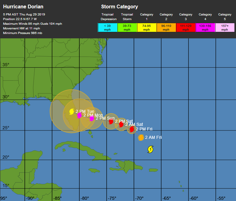
What you can get excited about is Hurricane Dorian that is approaching the Bahamas and Florida for the weekend and start of next week (Figure 6). I'll watch this closely (I like Walt Disney World and Universal Studios - so I hope they fare well ). This might make it to category 4 out of 5. It will be a very significant storm. It might also make it into the Gulf of Mexico and endanger the Gulf coast from Louisiana to Florida again.

The Month End Glimpse into September:

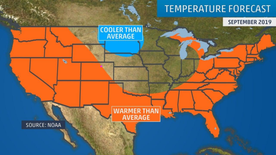
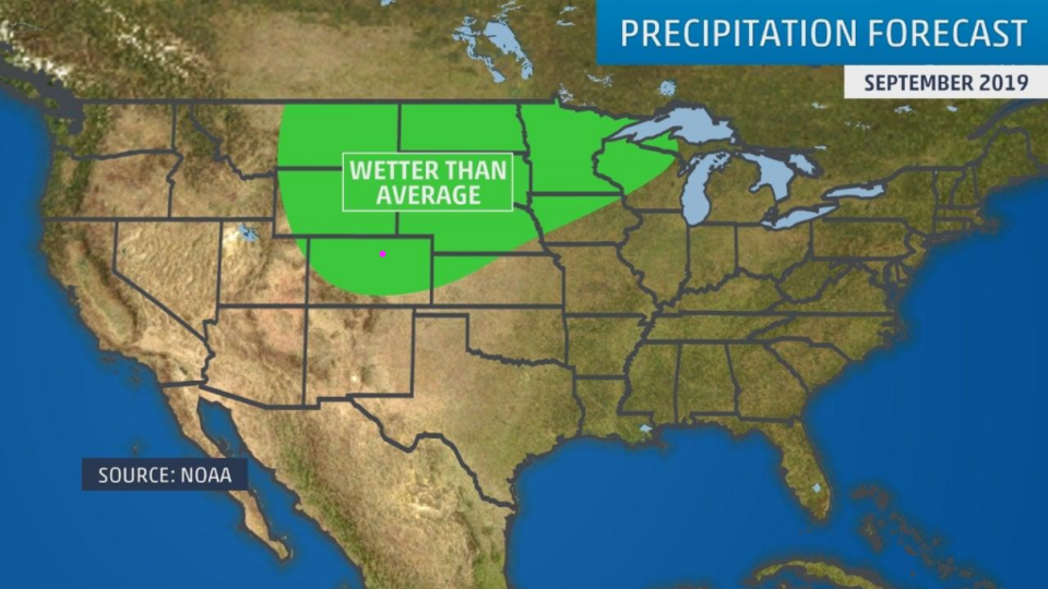
The climate models are trying to figure out the mean pressure patterns for September. If this output from the weather channel is correct, we'll be near normal to a bit above normal for the month in temperatures (Figure 7). Precipitation is expected to be above normal for the month (Figure 8) - but what's new looking back at this last year? I like it.

Figure 1: The forecast surface map for Friday midday from NCEP.
Figure 2: The 500mb forecast upper air analysis for Friday AM. Pink dot is Longmont. Red lines are troughs, blue lines are ridges.
Figure 3: the graphical forecast for the next 10 days for Longmont, CO from weatherunderground.com
Figure 4: The severe storm weather forecast for the U.S. from the Storm Predication Center in Norman, OK. Made Thursday for Friday.
Figure 5: the forecast accumulated precipitation map from the GFS and weather5280.com for Colorado, for the next 5 days.
Figure 6: The hurricane Dorian 5 day forecast map from the NHC and weatherunderground.com
Figure 7: The September temperature outlook for the U.S. from weather.com
Figure 8: The September precipitation outlook for the U.S. from weather.com

Current Weather

Light rain

Light rain

41°F

UV Index
2 Low
Pressure
29.91 Steady
Visibility
4 miles
Dewpoint
38 °F
Humidity
88%
Wind
N 4 mph
Gust
9.5 mph
Wind Chill
38 °F

Hourly Forecast

Today
1 PM
42°F
Rain
Today
2 PM
42°F
Cloudy
Today
3 PM
42°F
Rain
Today
4 PM
42°F
Cloudy
Today
5 PM
42°F
Cloudy
Today
6 PM
42°F
Rain and snow
Today
7 PM
41°F
Rain and snow
Today
8 PM
41°F
Rain
Today
9 PM
41°F
Cloudy
Today
10 PM
40°F
Rain
Today
11 PM
40°F
Rain
Tomorrow
12 AM
40°F
Rain

7 Day Forecast

Rain and snow

Saturday

42 °F

Chilly with a mix of snow and rain; travel in the foothills and mountains will be slippery due to snow


Rain and snow

Saturday Night

36 °F

Cloudy with rain, mixed with a little snow late; travel in the foothills and mountains will be slippery due to snow


Thunderstorms

Sunday

60 °F

Mostly cloudy and warmer; a thundershower in spots in the afternoon


Partly cloudy w/ t-storms

Sunday Night

37 °F

A thunderstorm in spots in the evening; otherwise, partly cloudy


Partly sunny

Monday

71 °F

Partly sunny, pleasant and warmer


Intermittent clouds

Monday Night

42 °F

Partly cloudy


Mostly sunny

Tuesday

73 °F

Mostly sunny; pleasant in the afternoon


Mostly cloudy

Tuesday Night

40 °F

Mostly cloudy


Intermittent clouds

Wednesday

65 °F

Times of sun and clouds with a passing shower in the afternoon


Rain

Wednesday Night

35 °F

Mainly clear


Sunrise and Sunset

Sunrise
6:04 AM
Sunset
7:52 PM

Based on AccuWeather data