Skip to content

1 am update: Next Storm/Next Snow Forecast Discussion from the Cherrywood Observatory – August 4-6, 2019

This content was originally published by the Longmont Observer and is licensed under a Creative Commons license.

In Brief:

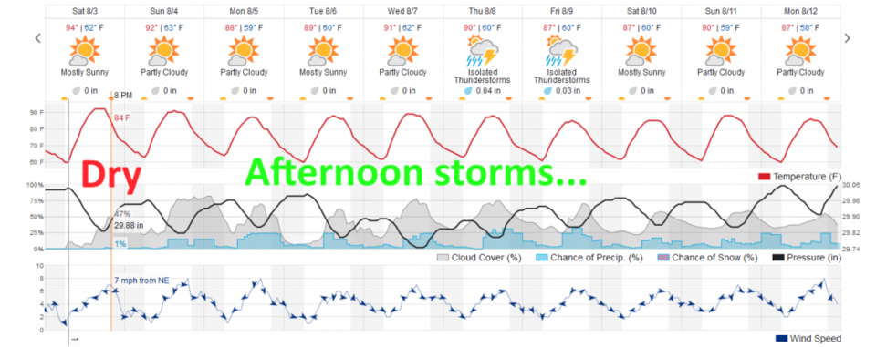
Upper atmospheric high pressure and dry air keeps things quiet on Saturday. Moisture in place and a shifting of the high center allows for afternoon storms and seasonable high temperatures for many days to come.

1am update 8/6:

A bunch of work and home stuff crowded out the forecast discussion today (8//6) but the story is pretty simple. The high that either blocks the moisture and convection or pumps it into the state is in a no-so-great location for storms Tuesday and (somewhat) on into Wednesday. After that it does drift to the southeast of Colorado again. Moisture will return Thursday-Saturday (at least) and short waves will be able to interact with this moisture to really kick off some better thunderstorm coverage Thursday +. More later!

End 1am udpate.

Forecast Discussion:

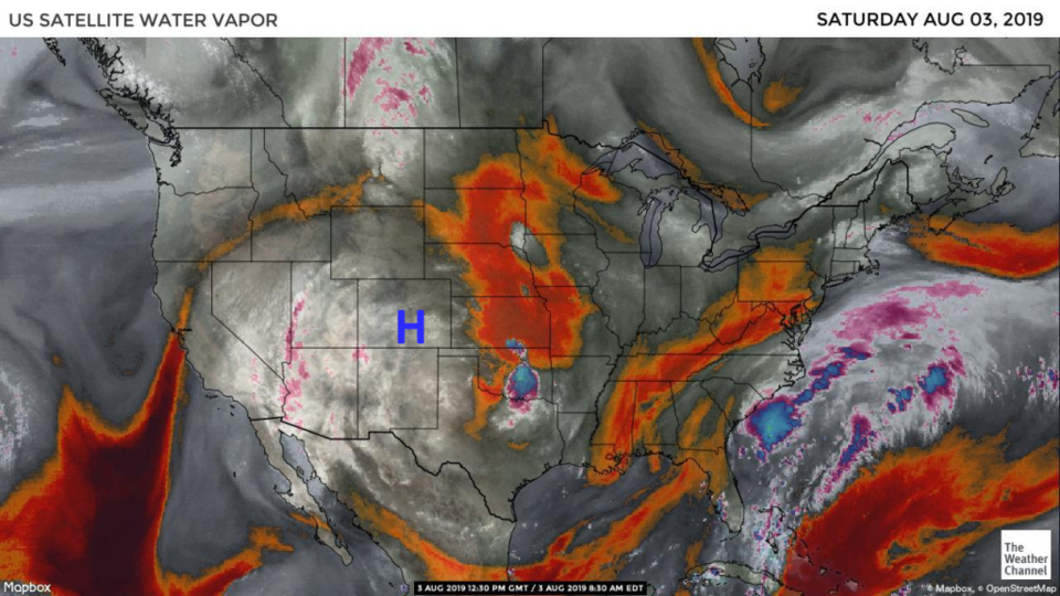
There is quite a big blob of tropical moisture over the southwest U.S., (Figure 1) but the high has wobbled over Colorado Saturday which will keep things quiet except for a few isolated thunderstorms up in the mountains and on the Palmer Divide (Figure 2). For Sunday, the high center drifts to Arizona which will allow some afternoon storms to form and drift east off the mountains.

The Longer Range Forecast:

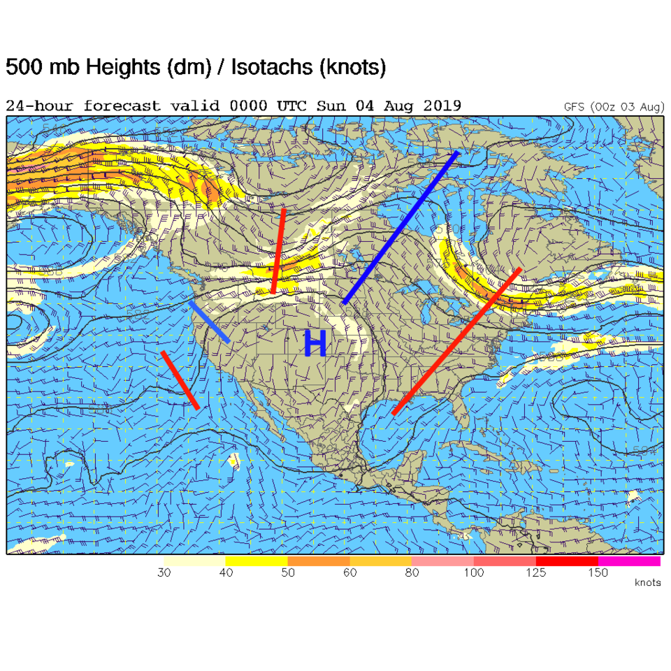
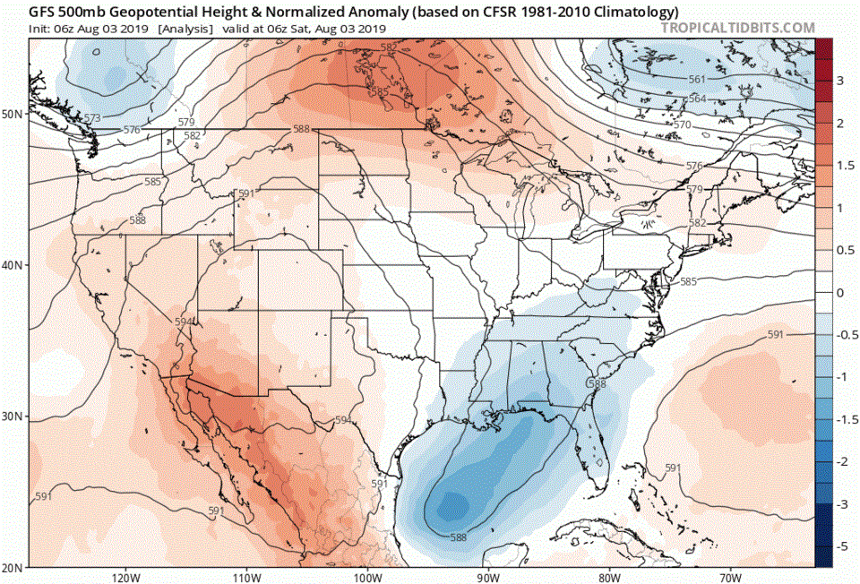
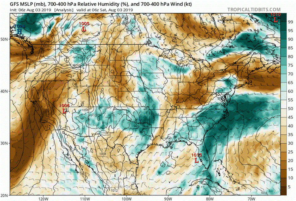
Little changes in the longer range - you can watch the animation of the 500mb pattern and the closed set of circles that is the high (like a mountain with lines of equal elevation) drift this way and that around the southwestern U.S. over the next 5 days (Figure 3). The upper atmospheric relative humidity gives an indication of the moisture flow around this high - the animation in Figure 4 shows blobs of moisture getting pulled into the circulation. Because of this, we'll see varying amounts of afternoon convection over the next 10 days with peak activity occurring when the high is more distant or to the southeast of us, and when the higher moisture values are in place at the time of maximum daytime heating (Figure 5).

Figure 1: the water vapor satellite image (browns/reds are dry air, whites and light grey is moist air, purple/blue is ice and high cloud tops). From the the Weather Channel from Satruday.
Figure 2: The 500mb forecast upper air analysis for Friday AM. Pink dot is Longmont. Red lines are troughs, blue lines are ridges.
Figure 3: Animation of the GFS 500mb pattern and anomaly for the next 5 days from tropicaltidbits.com
Figure 4: Animation of the GFS upper air moisture representation for the next 5 days from tropicaltidbits.com
Figure 5: the graphical forecast for the next 10 days for Longmont, CO from weatherunderground.com

Current Weather

Cloudy

Cloudy

59°F

UV Index
1 Low
Pressure
29.8 Steady
Visibility
8 miles
Dewpoint
39 °F
Humidity
47%
Wind
NNW 7.7 mph
Gust
16.3 mph
Wind Chill
59 °F

Hourly Forecast

Today
4 PM
62°F
Cloudy
Today
5 PM
60°F
Intermittent clouds
Today
6 PM
57°F
Mostly cloudy w/ t-storms
Today
7 PM
55°F
Intermittent clouds
Today
8 PM
53°F
Thunderstorms
Today
9 PM
51°F
Cloudy
Today
10 PM
49°F
Cloudy
Today
11 PM
47°F
Cloudy
Tomorrow
12 AM
46°F
Cloudy
Tomorrow
1 AM
45°F
Cloudy
Tomorrow
2 AM
44°F
Mostly cloudy
Tomorrow
3 AM
43°F
Mostly cloudy

7 Day Forecast

Partly sunny w/ t-storms

Wednesday

68 °F

Times of sun and clouds; a shower in spots this morning followed by a couple of thunderstorms this afternoon


Thunderstorms

Wednesday Night

35 °F

A thunderstorm this evening; otherwise, mostly cloudy


Intermittent clouds

Thursday

63 °F

A blend of sun and clouds


Mostly cloudy

Thursday Night

39 °F

Mostly cloudy


Partly sunny

Friday

64 °F

Some sun; breezy in the afternoon


Partly cloudy

Friday Night

36 °F

Partly cloudy


Partly sunny

Saturday

66 °F

Partial sunshine


Mostly clear

Saturday Night

41 °F

Clear to partly cloudy


Mostly cloudy

Sunday

78 °F

Rather cloudy and warmer; breezy in the afternoon


Mostly cloudy

Sunday Night

43 °F

Rather cloudy


Sunrise and Sunset

Sunrise
5:59 AM
Sunset
7:56 PM

Based on AccuWeather data