Skip to content

Next Storm/Next Snow Forecast Discussion from the Cherrywood Observatory – August 7, 2019

This content was originally published by the Longmont Observer and is licensed under a Creative Commons license.

In Brief:

It has been pretty quiet for a few days - just a few isolated cells were able to fire each day (but if you were under them, you knew it!). Most Front Range residents did not see measurable precipitation. The high pressure center that is running the show will jog to the distant southeast and open up tropical flow across Colorado again. Short waves coming from a trough on the west coast will also be able to aid in kicking off more organized storms. This wetter afternoon thunderstorm pattern will fade out early next week as the high becomes a big ridge across the southern U.S.

Forecast Discussion:

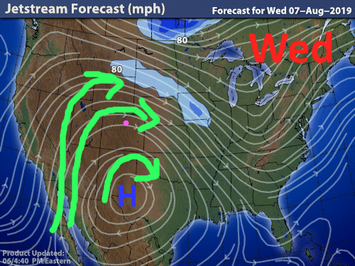
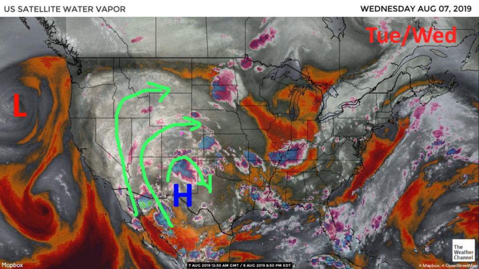
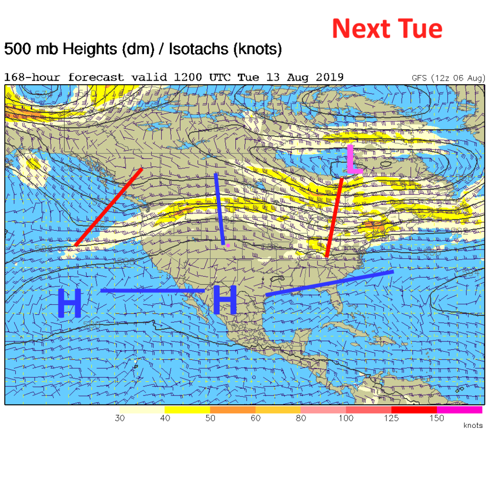
Figure 1 is a new-ish map that shows, not rigorous heights of the 500mb pressure level, but the flow of air in the upper atmosphere. The high near El Paso, TX is plain to see as is the flow northward on the western side of this persistent pressure system. The moisture (white and grey colors (+ pinks)) is flowing up into the Western U.S (Figure 2). The moisture over Colorado has been drifting around the deserts to our southwest for a couple of days (it has been 'recycled so to speak).

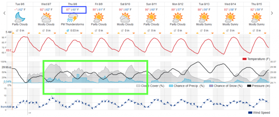
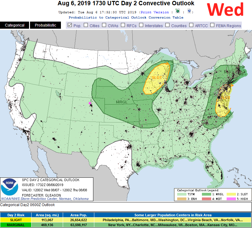
We'll still see very warm weather today (Wednesday - Figure 4) and only a marginal increase in afternoon storms. The chance of severe weather will remain over the northeast corner of Colorado (Figure 5). It isn't too far away.

The longer range forecast:

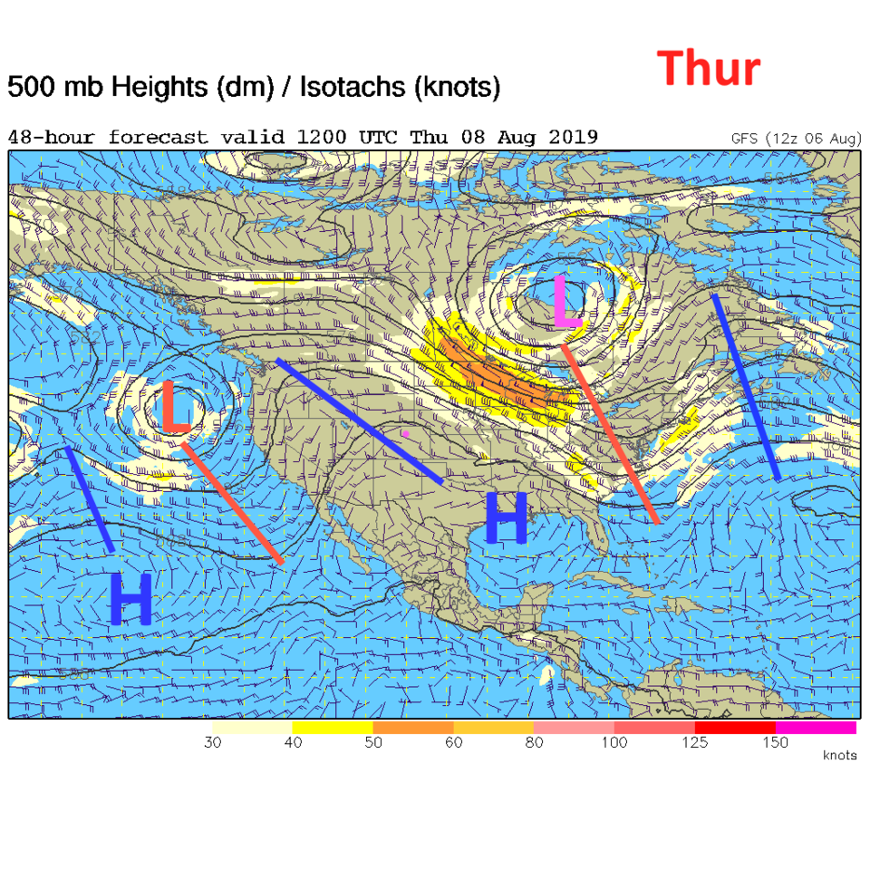
By Thursday, the high center is located over Louisiana and there is better (but still not at record levels of) direct moisture flow from the Gulf of Mexico (Figure 3). Thursday will see our best chance of rainfall with weatherunerground models giving us less than 1/10th of an inch (unless we get a lucky direct hit - figure 4).

By Friday the high begins to inch back as a ridge builds back into Colorado (Figure 6). At the start of next week, there is a ridge to the south and overhead. That "recycled" moisture will still be around to create some afternoon storms, but nothing to write a book about.

Figure 1: stream line map (wind flow lines) from the weatherchannel for early Wednesday.
Figure 2: the water vapor satellite image (browns/reds are dry air, whites and light grey is moist air, purple/blue is ice and high cloud tops). From the the Weather Channel from Tuesday.
Figure 3: The 500mb forecast upper air analysis for Thursday AM. Pink dot is Longmont. Red lines are troughs, blue lines are ridges.
Figure 4: the graphical forecast for the next 10 days for Longmont, CO from weatherunderground.com
Figure 5: The severe storm weather forecast for the U.S. from the Storm Predication Center in Norman, OK. Made Tuesday for Wednesday.
Figure 6: The 500mb forecast upper air analysis for Friday AM. Pink dot is Longmont. Red lines are troughs, blue lines are ridges.
Figure 7: The 500mb forecast upper air analysis for next Tuesday AM. Pink dot is Longmont. Red lines are troughs, blue lines are ridges.

Current Weather

Light rain

Light rain

41°F

UV Index
1 Low
Pressure
29.92 Steady
Visibility
3 miles
Dewpoint
39 °F
Humidity
93%
Wind
NNE 4.5 mph
Gust
8.8 mph
Wind Chill
38 °F

Hourly Forecast

Today
3 PM
42°F
Rain
Today
4 PM
42°F
Cloudy
Today
5 PM
42°F
Cloudy
Today
6 PM
42°F
Rain and snow
Today
7 PM
41°F
Rain and snow
Today
8 PM
41°F
Rain
Today
9 PM
41°F
Cloudy
Today
10 PM
40°F
Rain
Today
11 PM
40°F
Rain
Tomorrow
12 AM
40°F
Rain
Tomorrow
1 AM
39°F
Rain
Tomorrow
2 AM
39°F
Rain

7 Day Forecast

Rain and snow

Saturday

42 °F

Chilly with a mix of snow and rain; travel in the foothills and mountains will be slippery due to snow


Rain and snow

Saturday Night

36 °F

Cloudy with rain, mixed with a little snow late; travel in the foothills and mountains will be slippery due to snow


Thunderstorms

Sunday

60 °F

Mostly cloudy and warmer; a thundershower in spots in the afternoon


Partly cloudy w/ t-storms

Sunday Night

37 °F

A thunderstorm in spots in the evening; otherwise, partly cloudy


Partly sunny

Monday

71 °F

Partly sunny, pleasant and warmer


Intermittent clouds

Monday Night

42 °F

Partly cloudy


Mostly sunny

Tuesday

73 °F

Mostly sunny; pleasant in the afternoon


Mostly cloudy

Tuesday Night

40 °F

Mostly cloudy


Intermittent clouds

Wednesday

65 °F

Times of sun and clouds with a passing shower in the afternoon


Rain

Wednesday Night

35 °F

Mainly clear


Sunrise and Sunset

Sunrise
6:04 AM
Sunset
7:52 PM

Based on AccuWeather data