This content was originally published by the Longmont Observer and is licensed under a Creative Commons license.
In Brief:
The next 10 days will see slightly cooler weather than normal and (at this point) a minor chance of rain/snow early Thursday morning. Quiet weather is back for a slow melt.
Forecast Discussion:
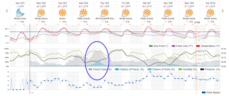
I'm still unpacking from the Great American Road Trip, so this will be brief today (and there isn't much to discuss). A ridge will pass the state over the next couple of days and warm us back to near normal. Normal high temperatures this time of year are about 49F and normal low temperatures are near 19F. That is close to what is forecasted for the next week - plus. (Figure 1).
The Longer Range Forecast:
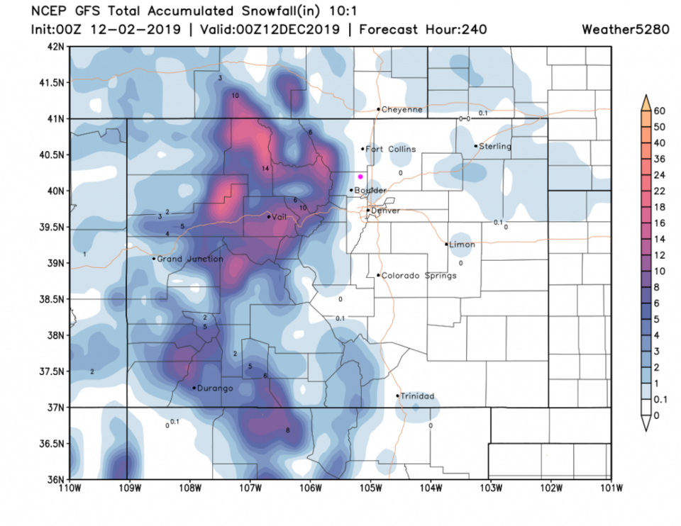
There is a small chance of rain/snow that we will need to watch (since these can become big time stories as the date approaches) for early Thursday morning (Figure 1). Still, the GFS's take on snow for the next 10 days over Colorado dumps all of it on the mountains west of us. Longmont has a chance of a dusting, but right now not much is expected. If you have a north facing driveway (like I do) - good luck getting it to melt.