Skip to content

Next Storm/Next Snow Forecast Discussion from the Cherrywood Observatory – December 22, 2018

This content was originally published by the Longmont Observer and is licensed under a Creative Commons license.

Forecast Discussion:

Closer the front comes... step by step...

With the storm moving in Friday night - I'll post this early so you have a heads-up.

There will be a low forming down in the SE corner of the state that will create some up-slope flow from about 4am to 3pm on Saturday. We seem to be well placed for a coating of snow; maybe up to a local inch of snow in spots. Hurray!

Will it last until Christmas morning?

Figure 1: The forecast surface map for Saturday PM. From NCEP.

The longer range forecast:

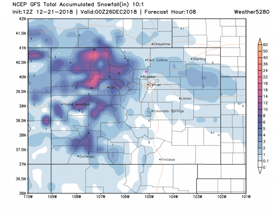
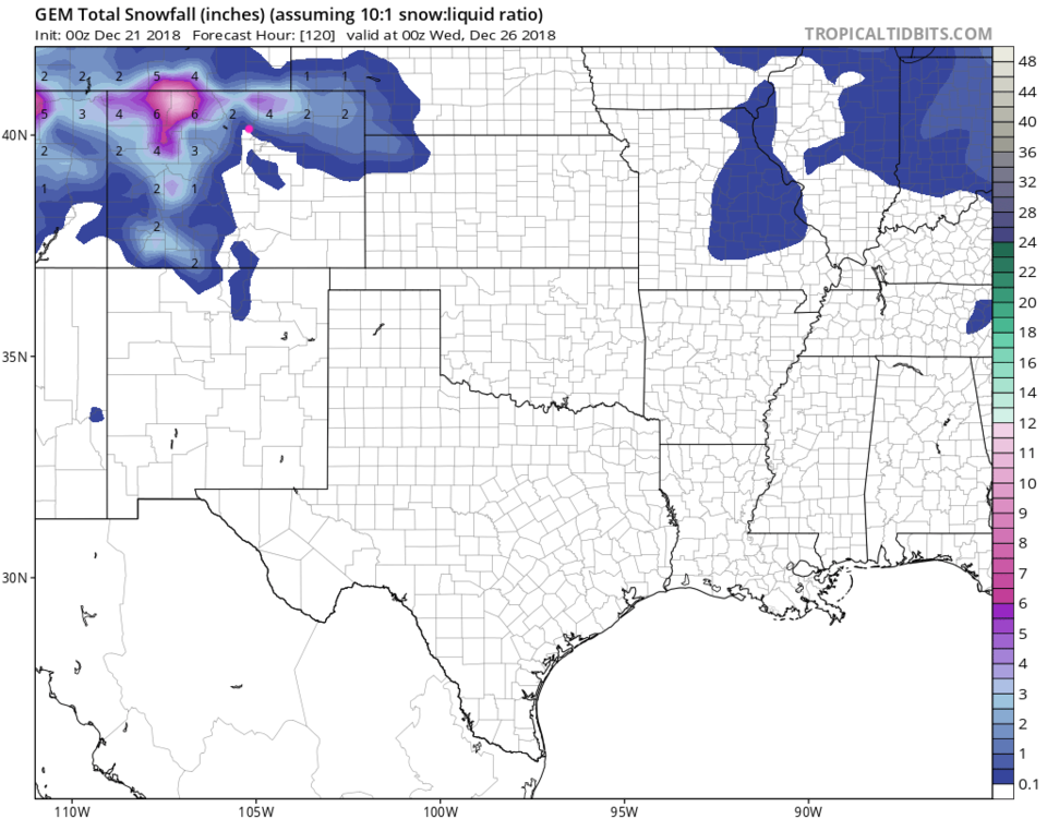
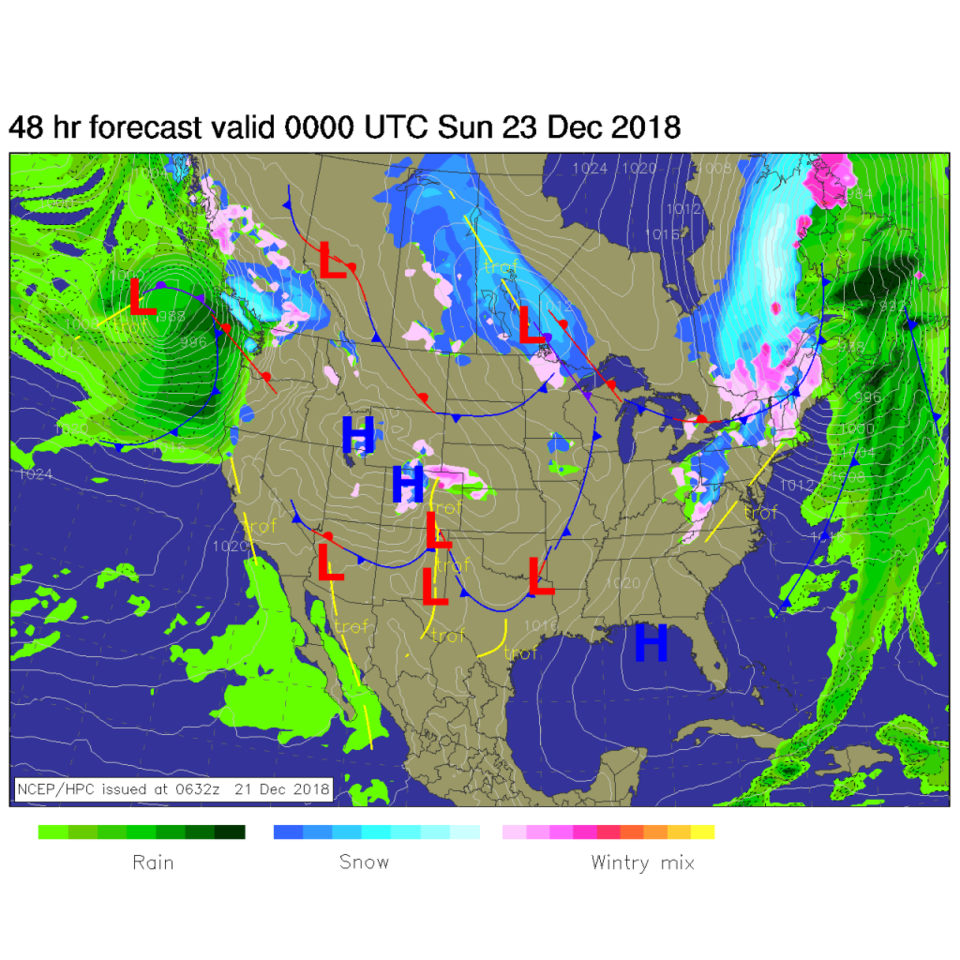
The GFS is giving us 1/10th to 1 inch of snow Saturday (as shown above) and that is all that is going to fall by Christmas afternoon (Figure 2). The GEM puts us in the 1/2" area by Christmas afternoon (Figure 3).

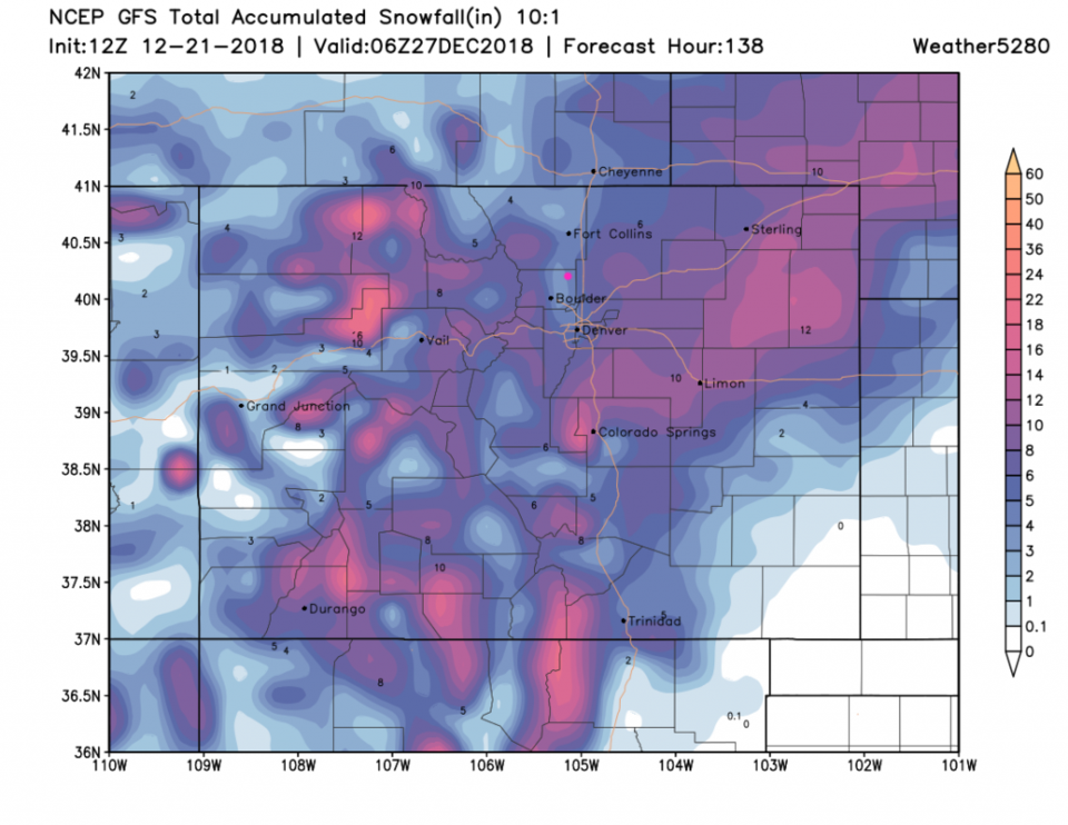
After Christmas, more snow is on the way.  As is colder air.  Over the next 5 days (going up to a day after Christmas) we are given 2-3 inches of snow  by the GFS (Figure 4).

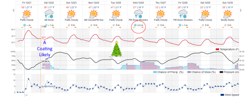
Figure 5 is the overview of the next 10 days:

The precipitation Saturday is will last about 10-12 hours then things warm to the mid 40's for Christmas Eve Eve and Christmas Eve - and lower 40'sF Christmas Day. The precipitation won't start again until after about 9pm on Christmas Day and will continue on and off to the weekend.  The initial push on Wednesday is a hefty 3-5 inches according to the Weatherunderground.com model.  As always, more later!

Figure 2: The forecast accumulated snow map from the GFS and weather5280.com for Colorado, through Christmas Day night.

Figure 3: The forecast accumulated snow map from the GEM and tropicaltidbits.com for Colorado, through Christmas Day night.

Figure 4: The forecast accumulated snow map from the GFS and weather5280.com for Colorado, through the next 5 days.

Figure 5: the graphical forecast for the next 10 days forecast for Longmont, CO from weatherunderground.com

Current Weather

Cloudy

Cloudy

43°F

UV Index
1 Low
Pressure
30.22 Steady
Visibility
8 miles
Dewpoint
32 °F
Humidity
66%
Wind
SE 2.9 mph
Gust
6.2 mph
Wind Chill
42 °F

Hourly Forecast

Today
9 AM
43°F
Intermittent clouds
Today
10 AM
48°F
Mostly sunny
Today
11 AM
51°F
Mostly sunny
Today
12 PM
54°F
Mostly sunny
Today
1 PM
58°F
Mostly sunny
Today
2 PM
61°F
Partly sunny
Today
3 PM
63°F
Partly sunny
Today
4 PM
65°F
Intermittent clouds
Today
5 PM
66°F
Intermittent clouds
Today
6 PM
65°F
Intermittent clouds
Today
7 PM
63°F
Intermittent clouds
Today
8 PM
60°F
Mostly clear

7 Day Forecast

Partly sunny

Saturday

66 °F

Not as warm with partial sunshine


Mostly clear

Saturday Night

39 °F

Clear to partly cloudy


Mostly cloudy

Sunday

77 °F

Mostly cloudy and warmer; breezy in the afternoon


Mostly cloudy

Sunday Night

45 °F

Rather cloudy; breezy late


Windy

Monday

60 °F

Very windy; cloudy and cooler


Intermittent clouds

Monday Night

43 °F

Partly cloudy


Intermittent clouds

Tuesday

62 °F

Times of clouds and sun; windy in the afternoon


Partly cloudy

Tuesday Night

36 °F

Partly cloudy


Intermittent clouds

Wednesday

60 °F

Times of clouds and sun


Intermittent clouds

Wednesday Night

35 °F

Partly cloudy


Sunrise and Sunset

Sunrise
5:55 AM
Sunset
7:59 PM

Based on AccuWeather data