Skip to content

Next Storm/Next Snow Forecast Discussion from the Cherrywood Observatory – December 24, 2018

This content was originally published by the Longmont Observer and is licensed under a Creative Commons license.

Forecast Discussion:

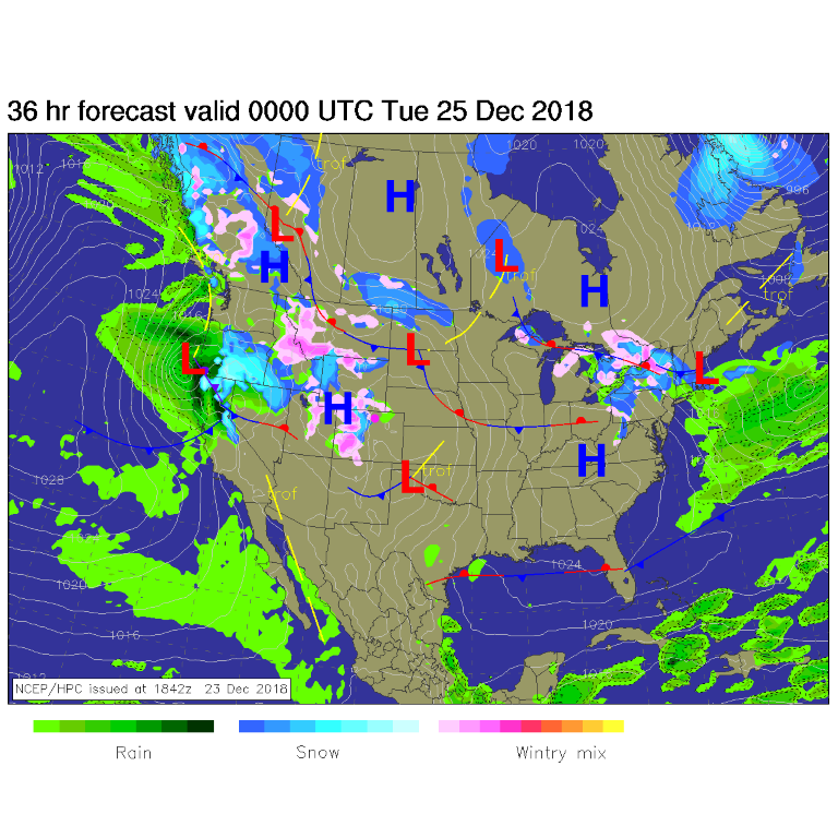
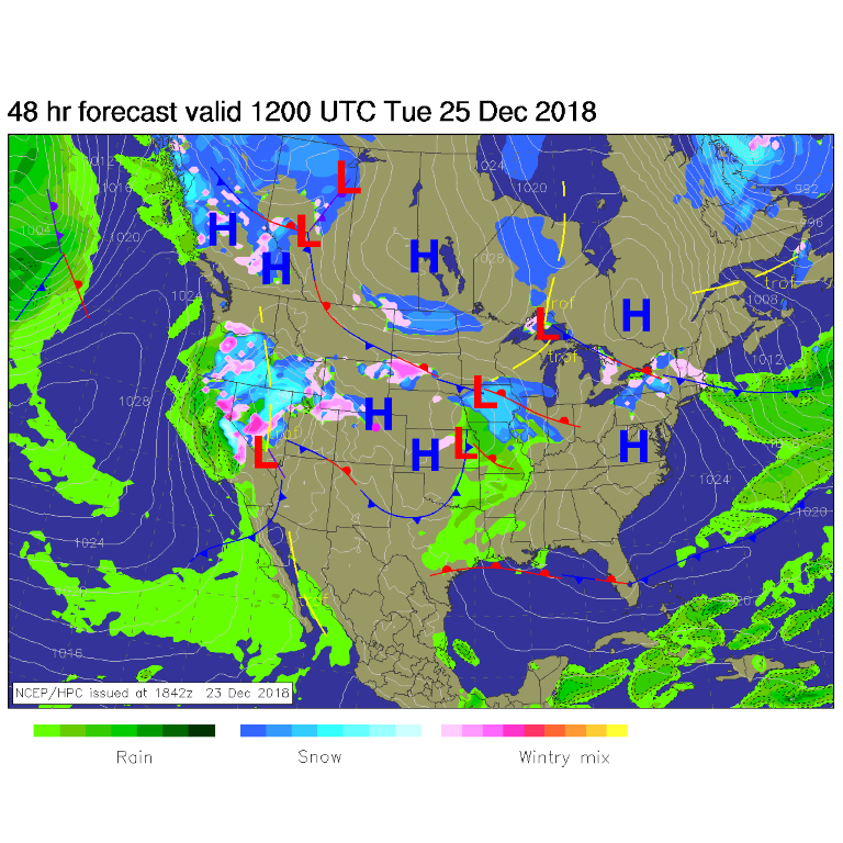
Snow continues on the western slopes of Colorado as moisture streams across the West, but Longmont remains dry and a bit above average in temperature (Figure 1).  For Monday evening (Figure 2) the western slopes precipitation picks up more as California and other western states get soaked.

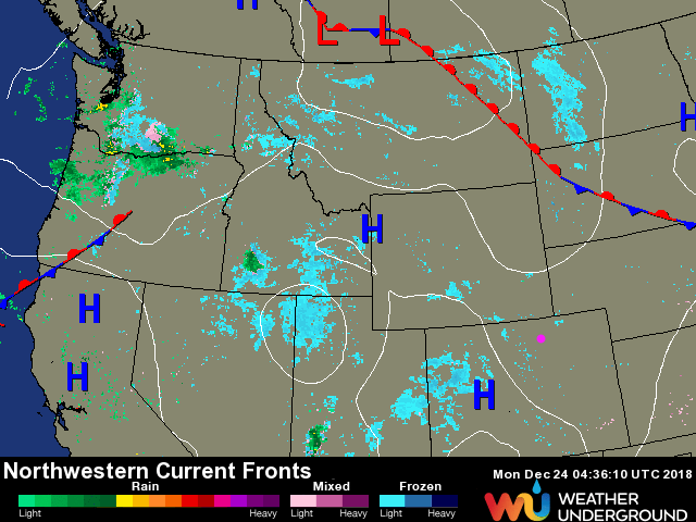
For Christmas morning, northwest Colorado keeps getting new snow showers, but nothing is likely to leak over the Rockies and make it to I-25 communities (Figure 3).

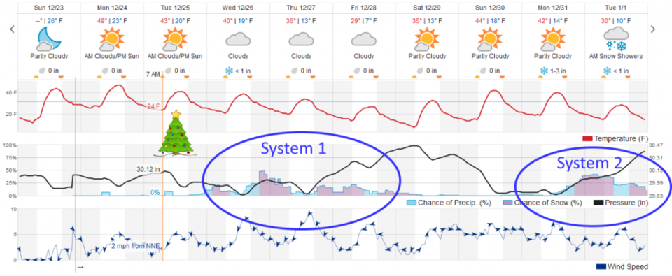
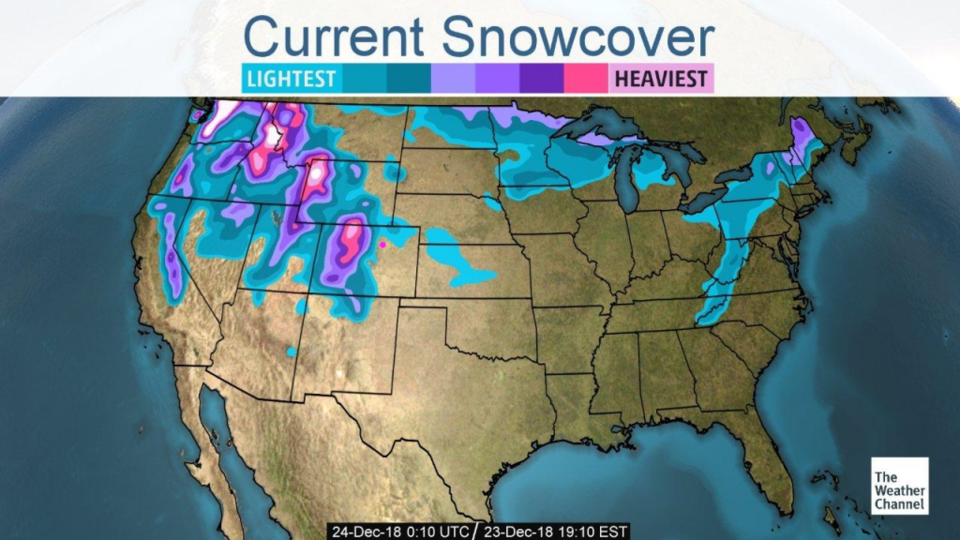
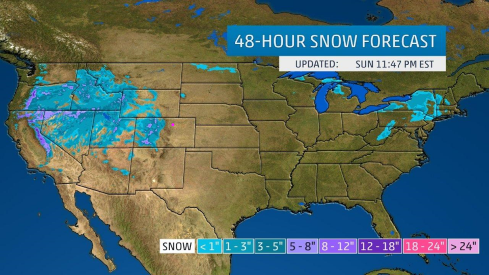
Figure 4 shows the actual snow cover as of Sunday PM (Christmas Eve Eve). Over the next 48 hours, through Christmas night (Figure5), Longmont is unlikely to see anything more than a flurry Christmas morning if we are very very lucky (Figure 8).

Figure 1: The current surface map and radar image from Sunday PM.

Figure 2: The forecast surface map for Monday PM. From NCEP.

Figure 3: The forecast surface map for Christmas morning. From NCEP.

Figure 4: Current snow cover as of Sunday PM from the Weather Channel.

Figure 5: Current snow 48 hour snowfall forecast from the Weather Channel.

The longer range forecast:

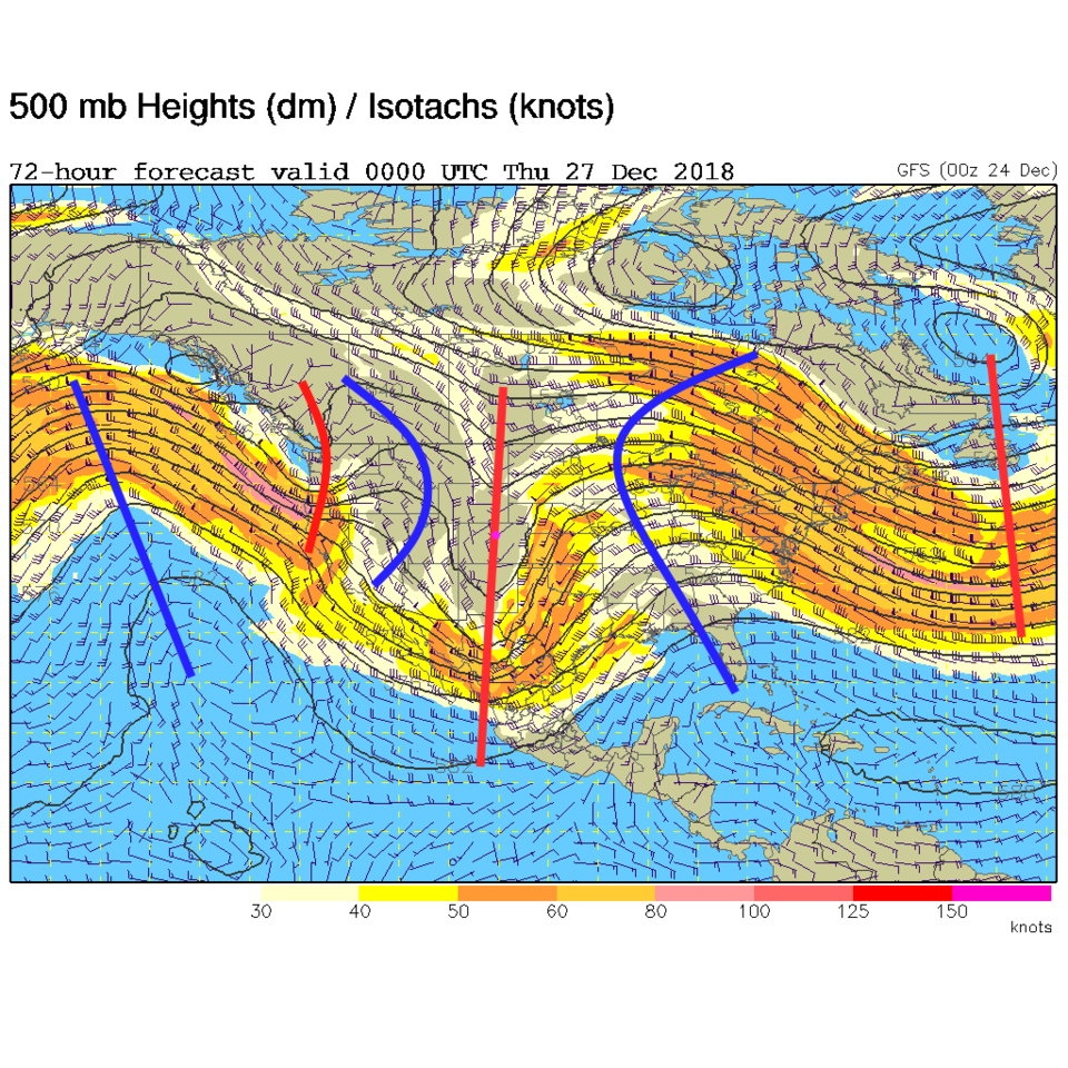
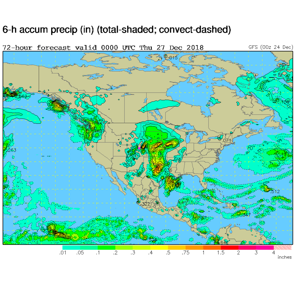
AFTER Christmas, things really get hopping in a winter-like way. A powerful trough moves in with another on its heels (Figure 6). The GFS paints a large shield of precipitation from Canada to Mexico with lots of activity over our state (but a bit of a hole over Longmont - Figure 7).

The overall picture (Figure 8) shows two periods of storminess after Christmas over the next 10 days.  Temperatures settle down into the 30'sF then 20'sF for highs at the end of the week and recover just a bit next weekend.  Overall, it is going to be a lot colder and we will have many more chances of snow - coatings to measurable amounts - maybe.

Figure 6: The 500mb forecast upper air analysis for Wednesday evening. Pink dot is Longmont. Red lines are troughs, blue lines are ridges.

Figure 7: The surface forecast for Wednesday evening. Pink dot is Longmont. Red lines are troughs, blue lines are ridges.

Figure 8: the graphical forecast for the next 10 days forecast for Longmont, CO from weatherunderground.com

Current Weather

Cloudy

Cloudy

39°F

UV Index
0 Low
Pressure
29.96 Steady
Visibility
7 miles
Dewpoint
38 °F
Humidity
95%
Wind
N 2.2 mph
Gust
4.3 mph
Wind Chill
39 °F

Hourly Forecast

Tomorrow
12 AM
41°F
Rain
Tomorrow
1 AM
40°F
Rain
Tomorrow
2 AM
39°F
Rain
Tomorrow
3 AM
39°F
Rain
Tomorrow
4 AM
38°F
Cloudy
Tomorrow
5 AM
37°F
Cloudy
Tomorrow
6 AM
37°F
Cloudy
Tomorrow
7 AM
38°F
Cloudy
Tomorrow
8 AM
40°F
Cloudy
Tomorrow
9 AM
44°F
Cloudy
Tomorrow
10 AM
47°F
Mostly cloudy
Tomorrow
11 AM
50°F
Mostly cloudy

7 Day Forecast

Rain and snow

Saturday

43 °F

Chilly with a mix of snow and rain; travel in the foothills and mountains will be slippery due to snow


Rain and snow

Saturday Night

37 °F

Cloudy with rain, mixed with a little snow late; travel in the foothills and mountains will be slippery due to snow


Thunderstorms

Sunday

61 °F

Mostly cloudy and warmer; a thundershower in spots in the afternoon


Partly cloudy w/ t-storms

Sunday Night

37 °F

A thunderstorm in spots in the evening; otherwise, partly cloudy


Partly sunny

Monday

71 °F

Partly sunny, pleasant and warmer


Intermittent clouds

Monday Night

42 °F

Partly cloudy


Mostly sunny

Tuesday

73 °F

Mostly sunny and pleasant


Mostly cloudy

Tuesday Night

43 °F

Mostly cloudy


Intermittent clouds

Wednesday

65 °F

Times of sun and clouds with a passing shower in the afternoon


Rain

Wednesday Night

42 °F

Mainly clear


Sunrise and Sunset

Sunrise
6:04 AM
Sunset
7:52 PM

Based on AccuWeather data