This content was originally published by the Longmont Observer and is licensed under a Creative Commons license.
In Brief:
After a rough weekend, we re-enter quietness. We are below normal for Monday then back to normal temperatures Tuesday. There will be ongoing shots of snow for the mountains, but our next eastern plains snow chances hold off until next weekend.
Forecast Discussion:
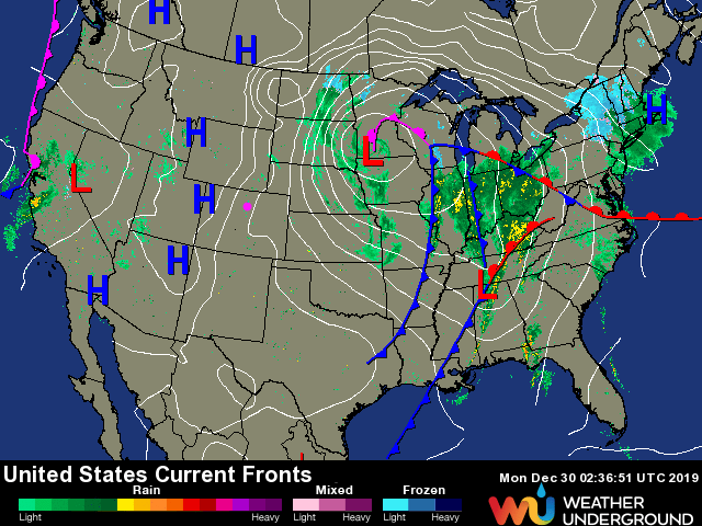
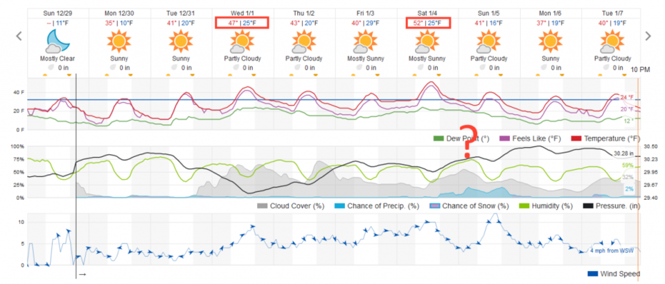
Only another trace of snow was seen Saturday across Longmont (so I didn't put the CoCoRaHS map up). Some melting began today under building high pressure (Figure 1). Monday is still chilly but the sun will melt things a bit better than it did on Sunday (Figure 2).
The Longer Range Forecast:
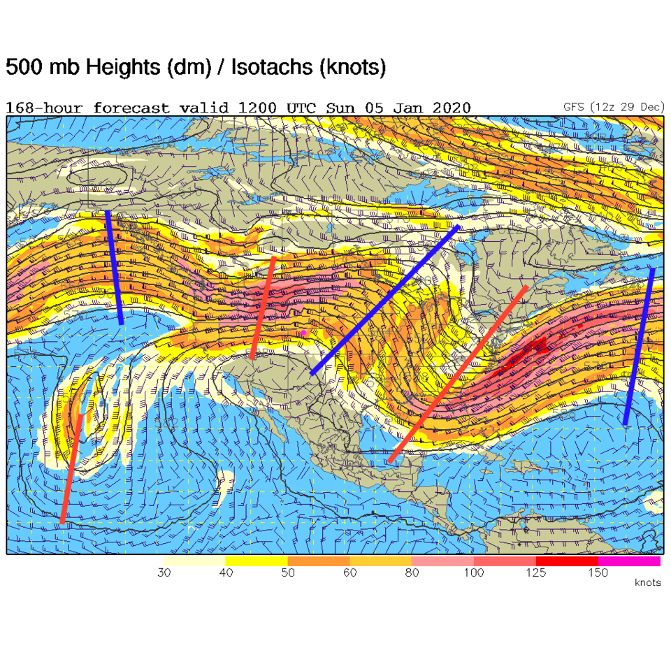
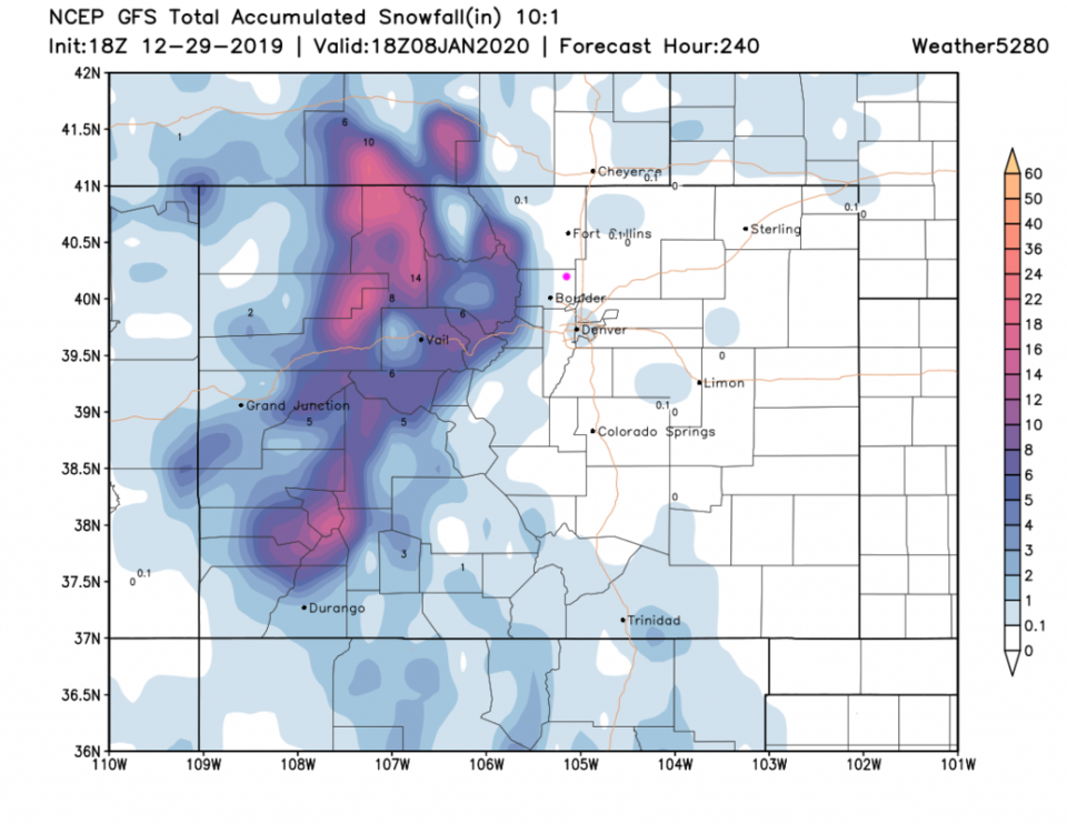
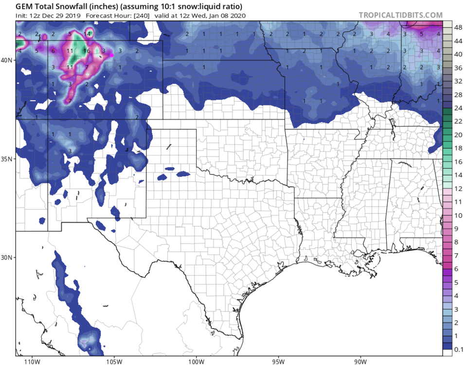
The west is dominated by a ridge for most of the week keeping us dry. A trough flattens the ridge out next weekend (Figure 3) that will fuel our next (not so great - as it looks now) chance for snow - mainly on Sunday (Figure 2). Over the next 10 days, the GFS shows no significant snow in town (Figure 4). The GEM, on the other hand, does see a much stronger storm next weekend with up to 4-5 inches of new snow on the way (Figure 5). This means we have a fun model-battle to watch all week.
New Years Eve midnight forecast:
expect temperatures around 21F at midnight New Years Eve into the New year with partly cloudy skies and light west winds.