This content was originally published by the Longmont Observer and is licensed under a Creative Commons license.
Forecast Discussion:
Update 8:30am:
It looks like it is safe to forecast an additional inch or *maybe* two for most locations around Longmont. The NWS has issued a winter weather advisory through this afternoon:
...WINTER WEATHER ADVISORY REMAINS IN EFFECT UNTIL 5 PM MST THISAFTERNOON...
* WHAT...Snow expected. Total snow accumulations of 2 to 4 inches
expected, with up to 7 inches in the foothills.
* WHERE...The Southern Front Range Foothills, The Northern Front
Range Foothills, and the Denver area.
* WHEN...Until 5 PM MST this afternoon.
* ADDITIONAL DETAILS...Plan on slippery road conditions. The
hazardous conditions could impact the morning commute.
PRECAUTIONARY/PREPAREDNESS ACTIONS...
A Winter Weather Advisory for snow means periods of snow will
cause travel difficulties. Expect snow covered roads and limited
visibilities, and use caution while driving.
The latest road conditions for the state you are calling from can
be obtained by calling 5 1 1.
End 8:30am Update.
With dangerous cold coming before Monday morning, I'll post this early. That will also make the HRRR more timely (see below).
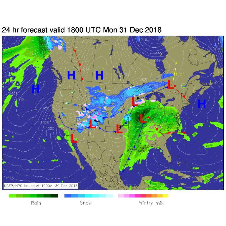
The first front is through the area Sunday evening... the arctic front is expected to roar down the Front Range between midnight and 3am Monday morning. Strong winds and bitter cold air will create some of the lowest wind chills we've seen in a long time (Figure 1).
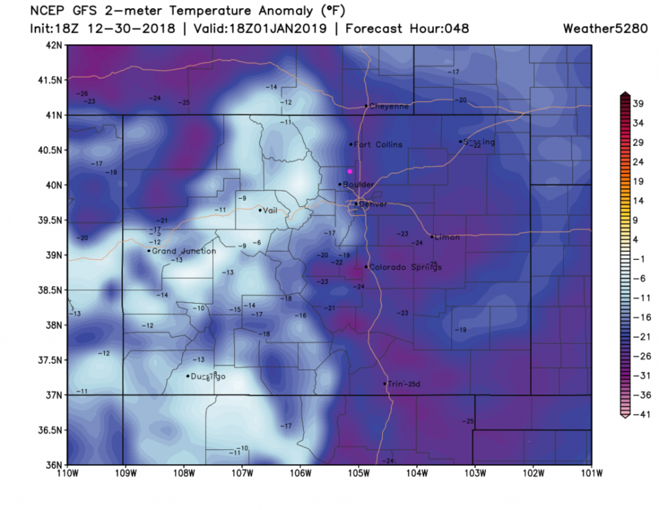
Temperatures Tuesday midday (New Years Day) will be some 23 to 28 F below normal. Amazing cold (Figure 2). You can see how dense/shallow that super cold air is - the mountains are not as far below normal as the Plains.
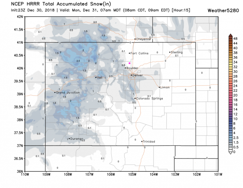
Snowfall just through Monday morning should only be in the trace/coating amounts. Snow will continue through the rest of the day on Monday (Figure 3).
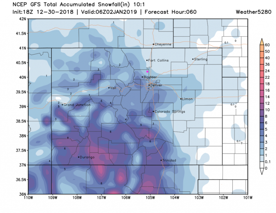
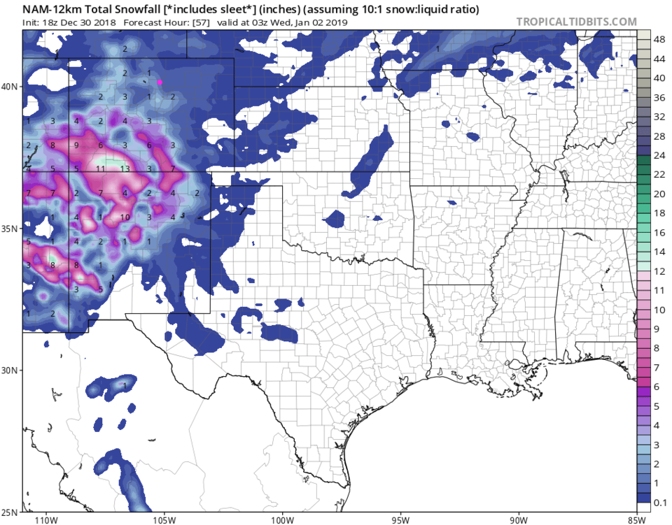
The GFS's take on snow through New Years should be about 1-2 inches in depth (Figure 4). The NAM (Figure 5) is very similar, about 1 to 2 inches.
Bundle up and be prepared for a tough/tremendously cold/slippery 48 hours.
The longer range forecast:
We warm up rapidly; approaching 60F by the end of the week. There is another system for Sunday night Monday that is very similar in timing, but not as cold, one week out.


