This content was originally published by the Longmont Observer and is licensed under a Creative Commons license.
In Brief:
Another (deep southwest) storm will effect Colorado Thursday, but don't look for much snow from it in town. We get pretty warm for the weekend (relatively speaking) and sink into the ice box for most of next week.
Forecast Discussion:
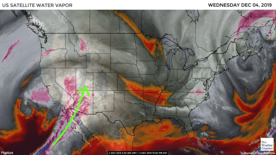
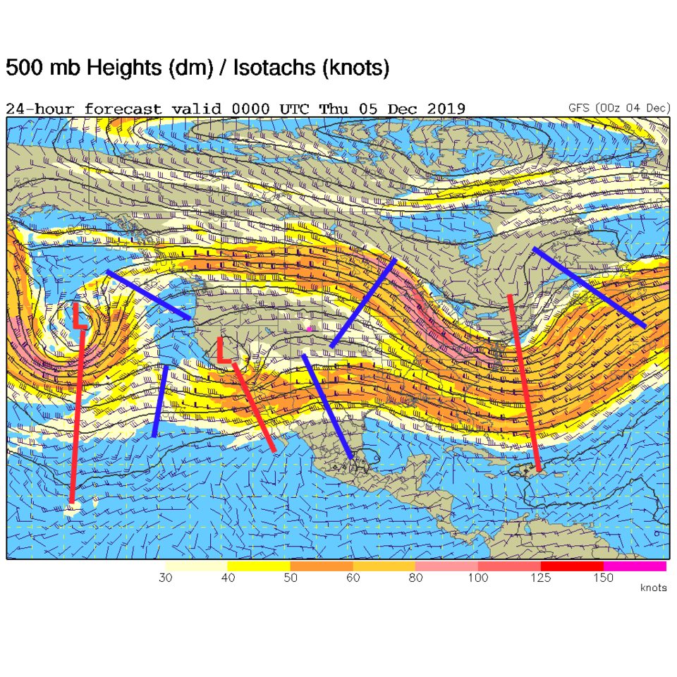
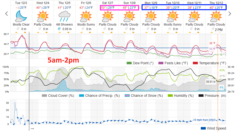
Moisture is getting pumped up into the desert southwest (again) but not as strongly as we saw in our last storm (Figure 1). The approaching trough is not as significant either and will remain fairly far south as it passes the state (the L and red trough line over California and south in Figure 2). Down slope winds warmed us to surprising levels - lower 60'sF- and gave everyone a boost towards snow melt/removal on Tuesday. It doesn't look as warm leading up to the Thursday morning to midday storm (Figure 3).
The Longer Range Discussion:
The weatherunderground model gives us snow chances as temperatures rise from around 28F to near 40F (Figure 3). This won't help the snow stick. This model even paints the significant accumulation of precipitation as rain, not reaching 1/10th inch.
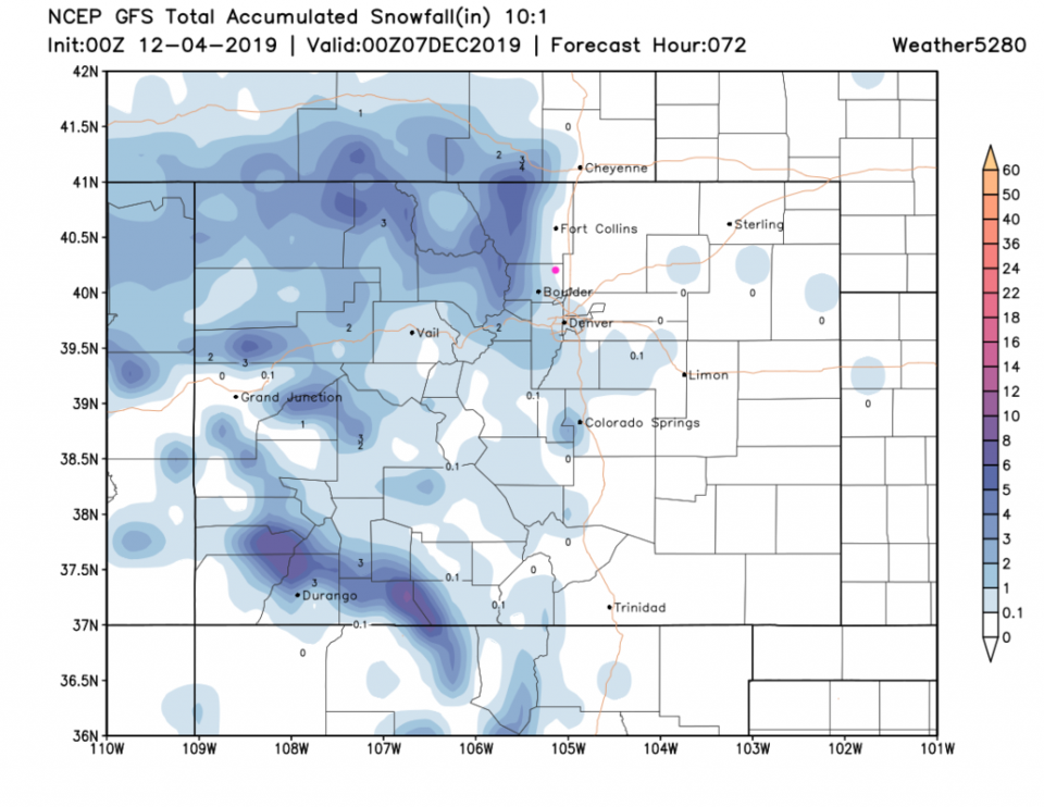
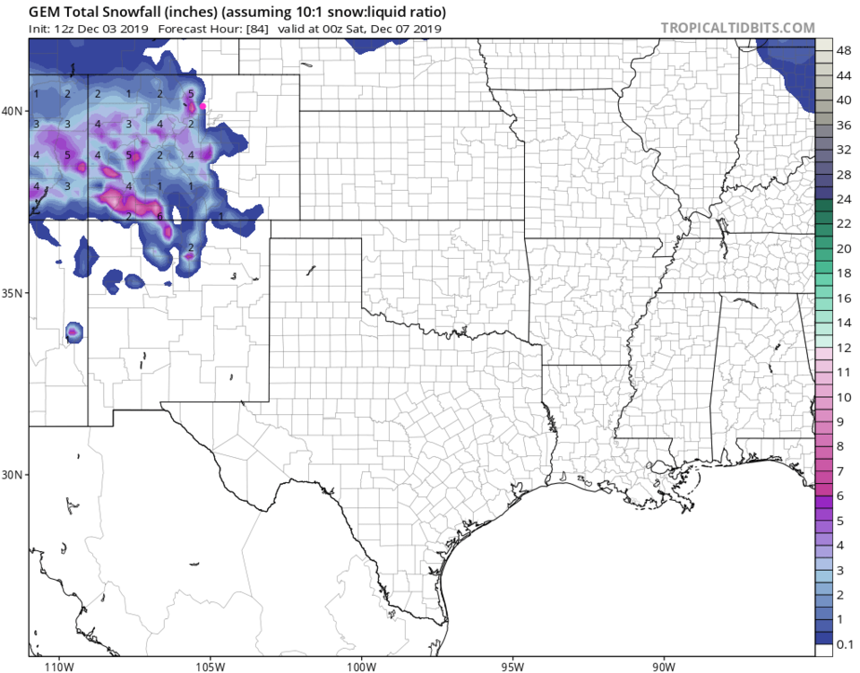
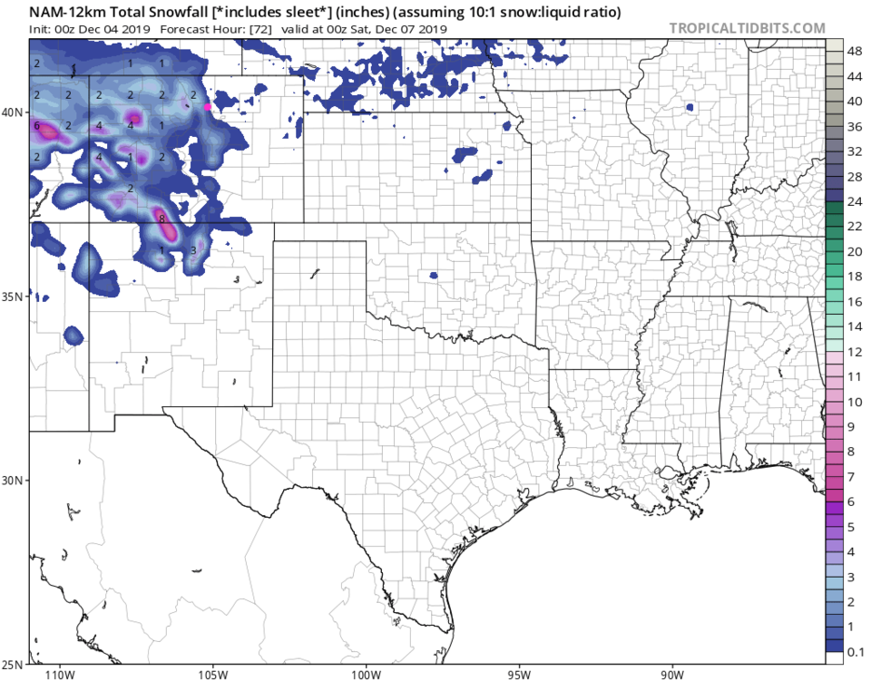
The GFS gives the southwest mountains (through Friday night- Figure 4) and the northern mountains a nice coating of snow, but its eastward extent ends near or in Longmont. No real snow will hit the Plains this time. The GEM also puts us right on the line too, between snow and no-snow (Figure 5). Finally, the NAM does give us a coating to maybe an inch, but the no-snow zone is very close to the east.
We warm up nicely and dry out for the weekend (no problems getting to and from Christmas parties). But get really cold overall next week as a trough moves in and stays a while in the West (Figure 3).