This content was originally published by the Longmont Observer and is licensed under a Creative Commons license.
Forecast Discussion:
I'm working on getting the inside decorations up now, so I'll use this quiet weather period to go 'lite' on the posting. Eventually we'll have so much weather I won't be able to fit it all here. Just not this week.
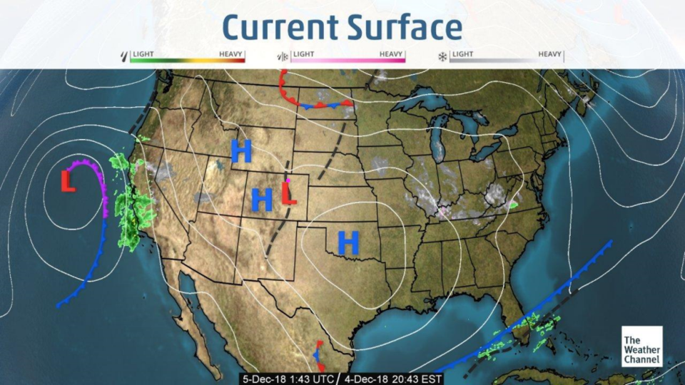
The weather map, minus a weak lee trough (black dashed line in Colorado), is still quiet. The next system is occluding (purple front) out on the West coast. It next heads past us to the south (Figure 1) over the next 48 hours.
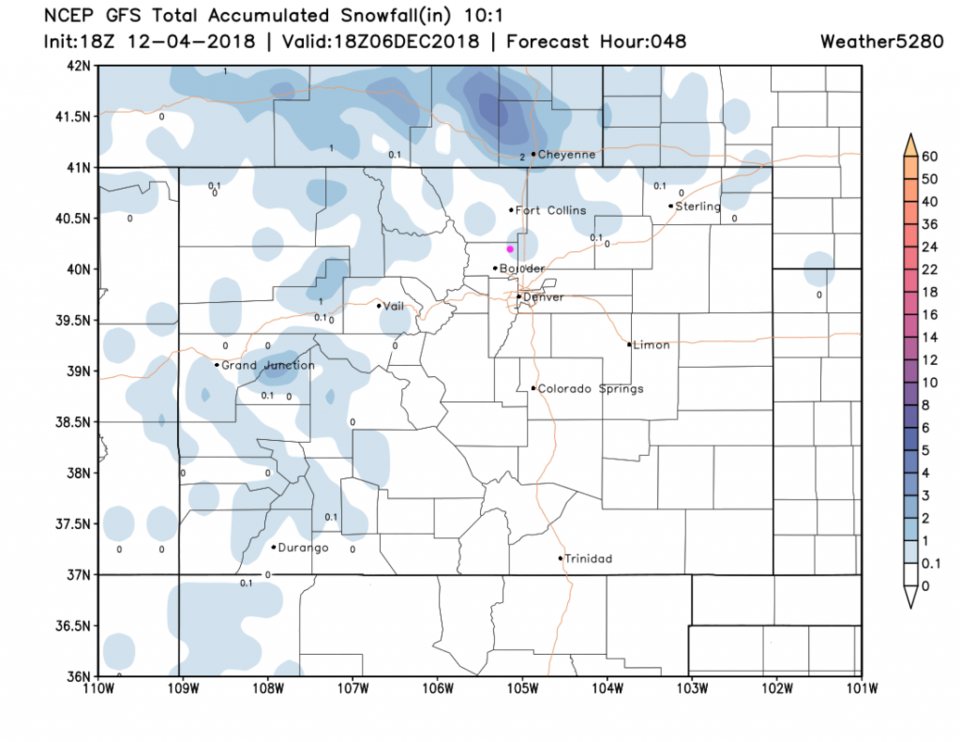
The snowfall over the next 48 hours really really meager across Colorado (Figure 2). We may see a dusting to a coating again tonight through Thursday AM.
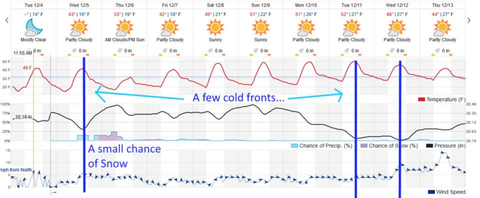
Forecast Discussion:
We have the current cold front pass mid-afternoon today followed by about 12 hours of elevated light snow chances. This does put us at near freezing for a day and a half. The next warm up continues until a double (dry, it seems) cold front hit comes Tuesday and Wednesday next week (Figure 3).
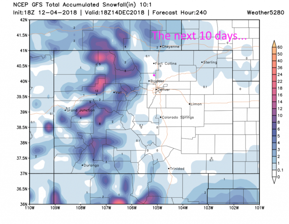
Even over the next 10 days (Figure 4) Longmont does not expect (from the GFS) to see any more snow than it gets over the next day or so. The mountains will see more snow with the systems next week at least. That is important for long term water supplies and ski resort happiness. Crazy way to run a late-Fall.