Skip to content
Join our Newsletter

Update 12/8 8am: Next Storm/Next Snow Forecast Discussion from the Cherrywood Observatory – December 8-9, 2019

This content was originally published by the Longmont Observer and is licensed under a Creative Commons license.

In Brief:

We have a cool down from a mild Saturday (that might not be as warm as expected if the high clouds stay in place and keep the cold air at the surface from mixing out) on to a chilly Monday. A storm system arrives Sunday into Monday putting fresh snow down in the mountains, but little moisture and warm temperatures (again) will keep us snow-less and possibly dry. Next week looks seasonably normal with no storms on the horizon.

12/8 8am Update:

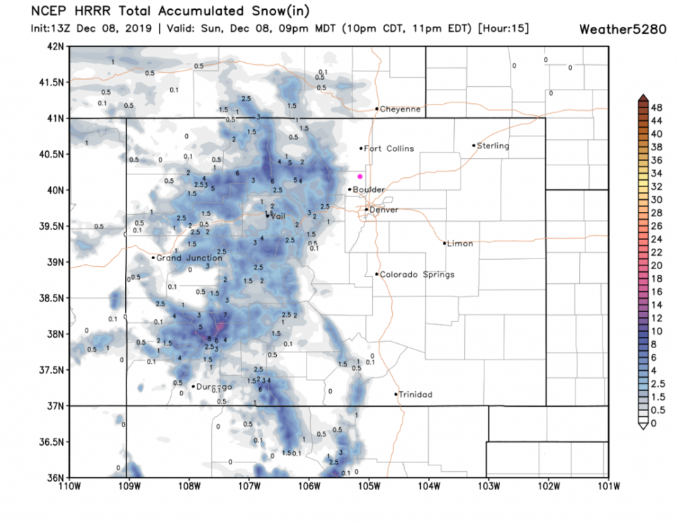
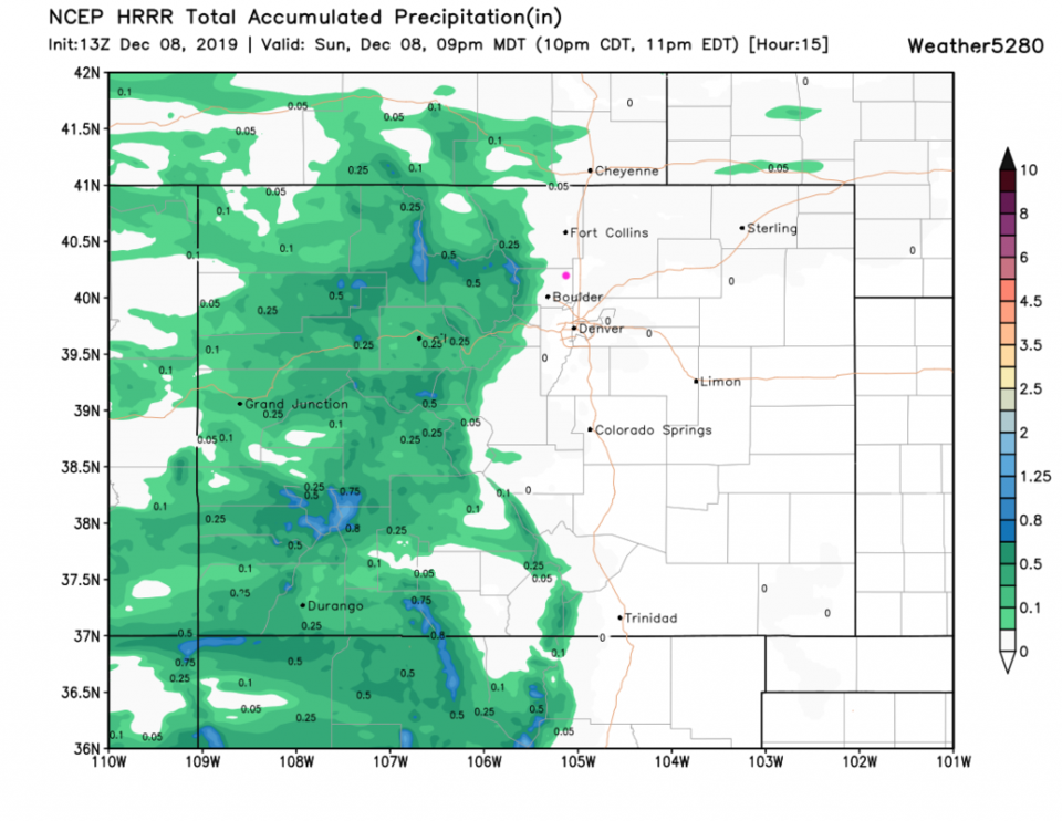
This is just a quick check-in Sunday AM looking at the snow accumulation up to 9pm tonight according to the HRRR map (Figure 1 update) and total precipitation (rainfall too - Figure 2 update) for that same time period. Right now it doesn't look like much will fall -at all- in Longmont. There is a slightly better chance of snow showers between 5am and 11am Monday, but the GFS doesn't show anything falling in town (just up in the nearby mountains).

Figure 1 update: The forecast snowfall for the next 15 hours from the HRRR and weather5280com for Colorado (up to 9pm Sunday) made Sunday at 6am.
Figure 2 update: The forecast precipitation for the next 15 hours from the HRRR and weather5280com for Colorado (up to 9pm Sunday) made Sunday at 6am.

End 12/8 8am Update.

Forecast Discussion:

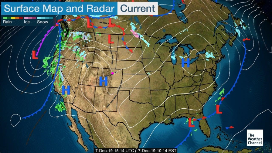
High pressure at the surface and aloft is sitting over Colorado today (Figure 1). The only problem keeping us from an almost hot day (65F) is the thickness of the high clouds. If they remain in place through much of the morning and afternoon, the thin layer of cold air (inversion) near the surface won't destabilize enough to mix out and let us warm up fully. It will still be nice and the slow melt will continue.

The Longer Range Forecast:

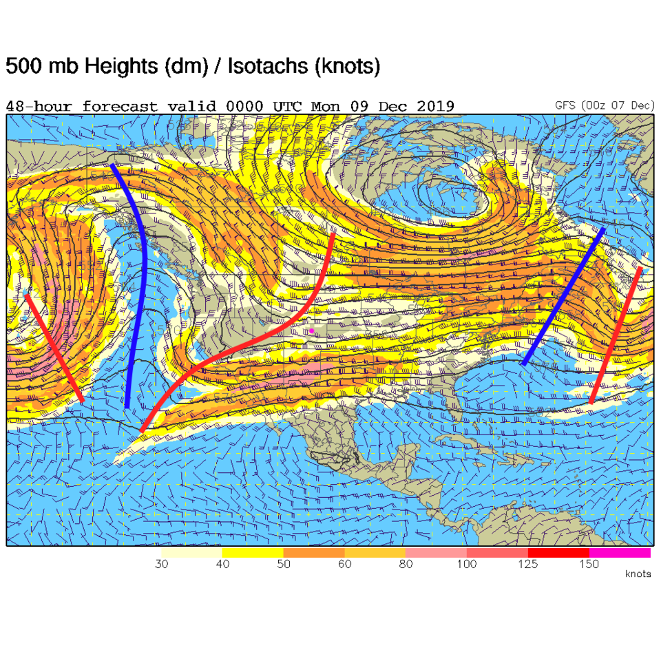
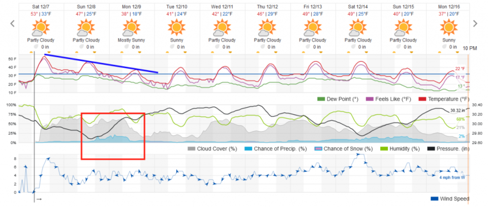
We will see a slight downhill slide in temperatures from today to Monday (Figure 3) with a small chance of precipitation Sunday PM to Monday AM. This cooling and slight shower chance will be created by a weak trough sliding by (Figure 2).

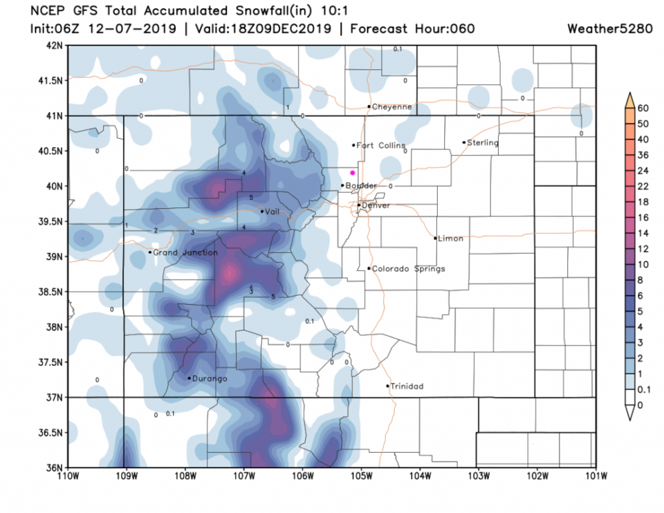
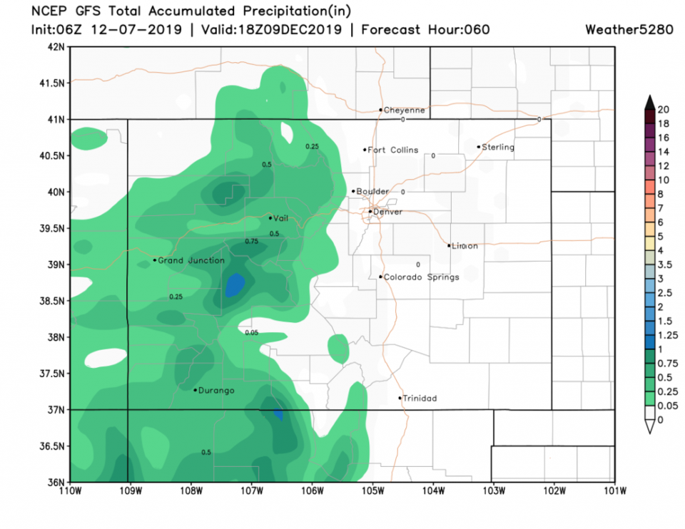
For this storm, the mountains get a foot plus in the higher elevations but Longmont sees no snow (the GFS Figure 4). Even rainfall probably won't make it to 0.05" level (Figure 5).

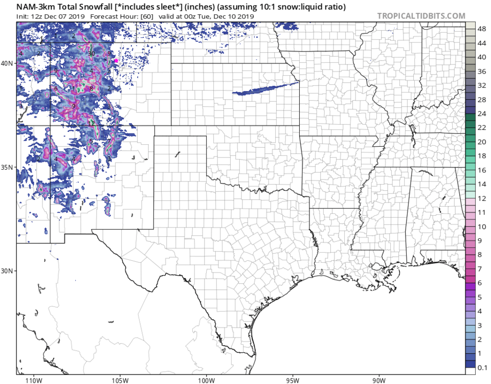
The NAM agrees keeping snow to the foothills to our west (Figure 6).
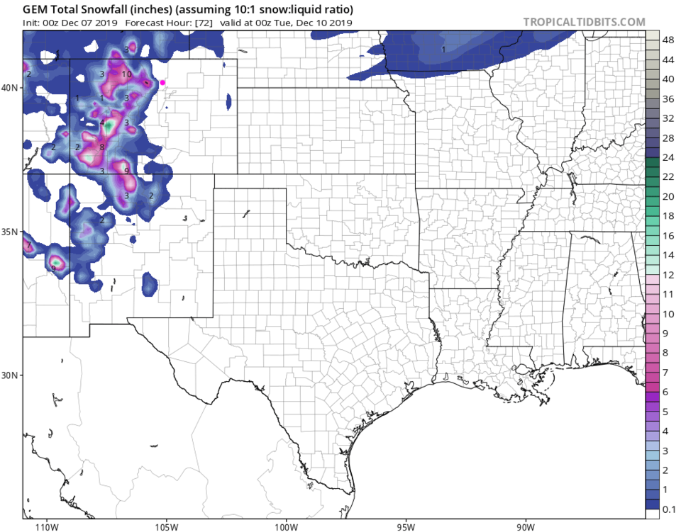
The GEM says the same (Figure 7).

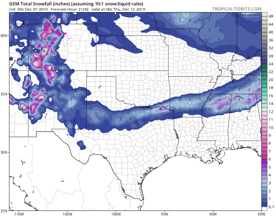
An interesting footnote: Figure 8 shows a deep south storm moving up across New Mexico and Texas (and beyond) mid-week. If you have friends in the DFW area, they might slip and slide going to work Wednesday.

Figure 1: the current surface analysis map from Saturday AM and the weather channel.
Figure 2: The 500mb forecast upper air analysis for Sunday night. Pink dot is Longmont. Red lines are troughs, blue lines are ridges.
Figure 3: the graphical forecast for the next 10 days for Longmont, CO from weatherunderground.com
Figure 4: 10:1 (snow to liquid) snowfall totals through through Monday noon from the GFS and weather5280com for Colorado made Saturday morning.
Figure 4: precipitation totals through through Monday noon from the GFS and weather5280com for Colorado made Saturday morning.
Figure 6: 10:1 (snow to liquid) snowfall totals through Saturday noon from the NAM and tropicaltidbits. com for Colorado made Saturday AM.
Figure 7: 10:1 (snow to liquid) snowfall totals through Saturday noon from the GEM and tropicaltidbits. com for Colorado made Saturday AM.
Figure 8: 10:1 (snow to liquid) snowfall totals through Thursday early morning/midnight from the GEM and tropicaltidbits. com for Colorado made Saturday AM.

Current Weather

Cloudy

Cloudy

71°F

UV Index
4 Moderate
Pressure
30.21 Falling
Visibility
6 miles
Dewpoint
60 °F
Humidity
67%
Wind
NE 1.7 mph
Gust
3.8 mph
Wind Chill
71 °F

Hourly Forecast

Today
12 PM
73°F
Mostly cloudy
Today
1 PM
76°F
Mostly cloudy
Today
2 PM
78°F
Mostly cloudy
Today
3 PM
80°F
Mostly cloudy
Today
4 PM
82°F
Mostly cloudy
Today
5 PM
84°F
Intermittent clouds
Today
6 PM
82°F
Intermittent clouds
Today
7 PM
79°F
Intermittent clouds
Today
8 PM
77°F
Intermittent clouds
Today
9 PM
73°F
Partly cloudy
Today
10 PM
69°F
Partly cloudy
Today
11 PM
65°F
Intermittent clouds

7 Day Forecast

Mostly cloudy

Saturday

84 °F

Clouds and breaks of sun; smoke from area fires will lead to poor air quality


Partly cloudy

Saturday Night

58 °F

Partly cloudy


Partly sunny w/ showers

Sunday

94 °F

Partly sunny with a passing shower in the afternoon


Partly cloudy

Sunday Night

61 °F

Partly cloudy


Mostly cloudy

Monday

91 °F

Considerable cloudiness


Mostly clear

Monday Night

60 °F

Clear to partly cloudy


Intermittent clouds

Tuesday

92 °F

Sun through high clouds


Partly cloudy

Tuesday Night

58 °F

Partly cloudy


Intermittent clouds

Wednesday

84 °F

Not as warm with times of clouds and sun; a thunderstorm in spots in the afternoon


Intermittent clouds

Wednesday Night

58 °F

An evening thunderstorm; otherwise, partly cloudy


Sunrise and Sunset

Sunrise
5:41 AM
Sunset
8:30 PM

Based on AccuWeather data